|
 |
 |
||
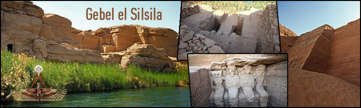
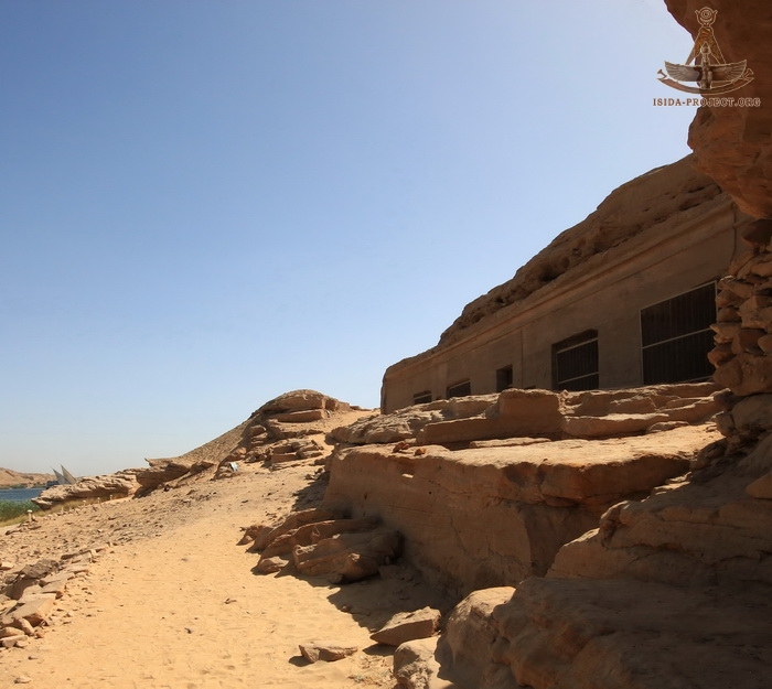
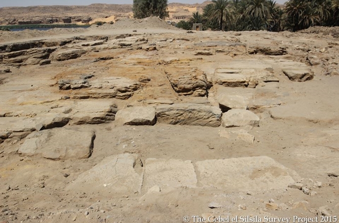
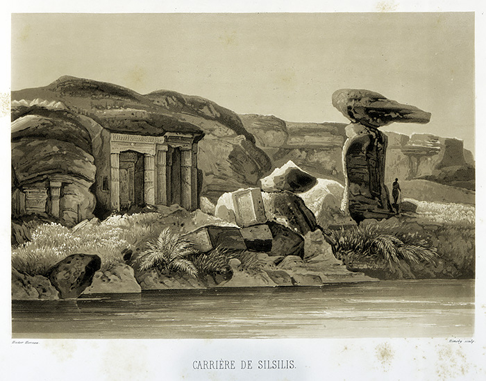
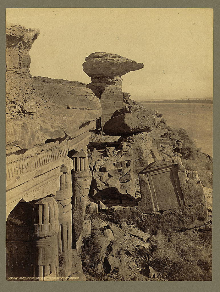
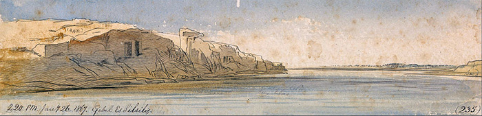
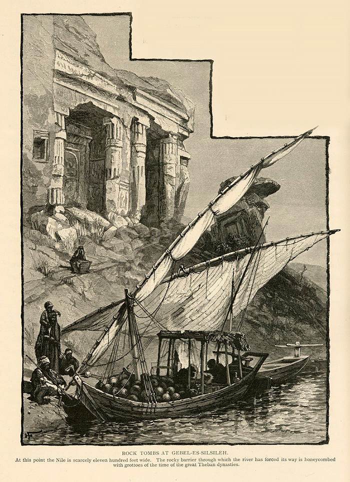
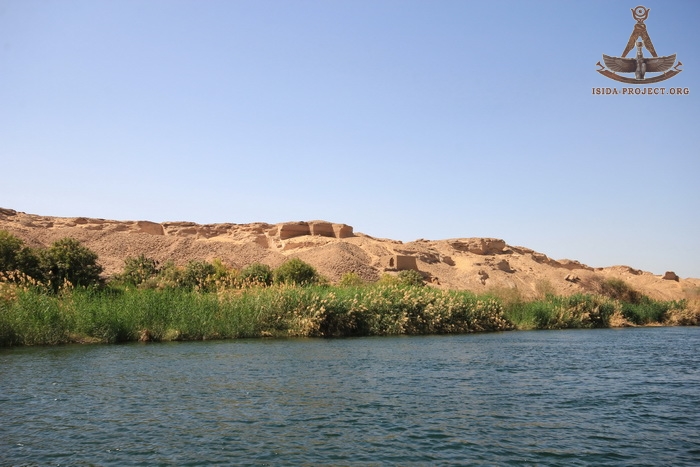
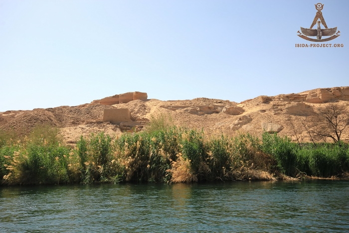
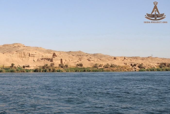
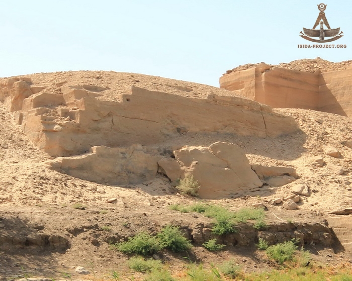
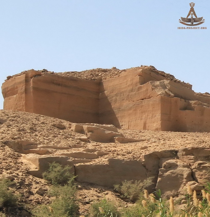
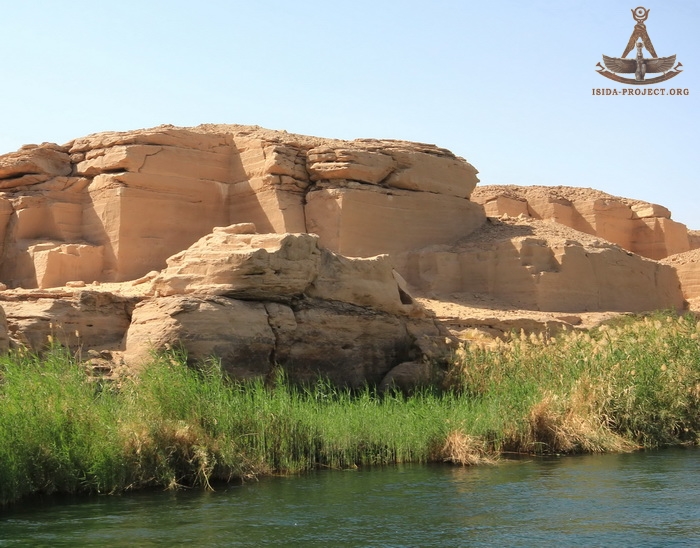
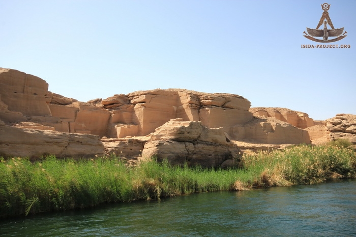
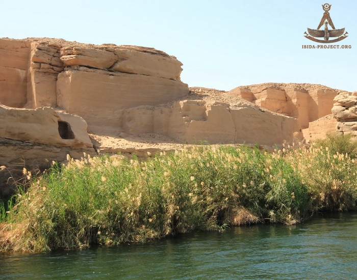
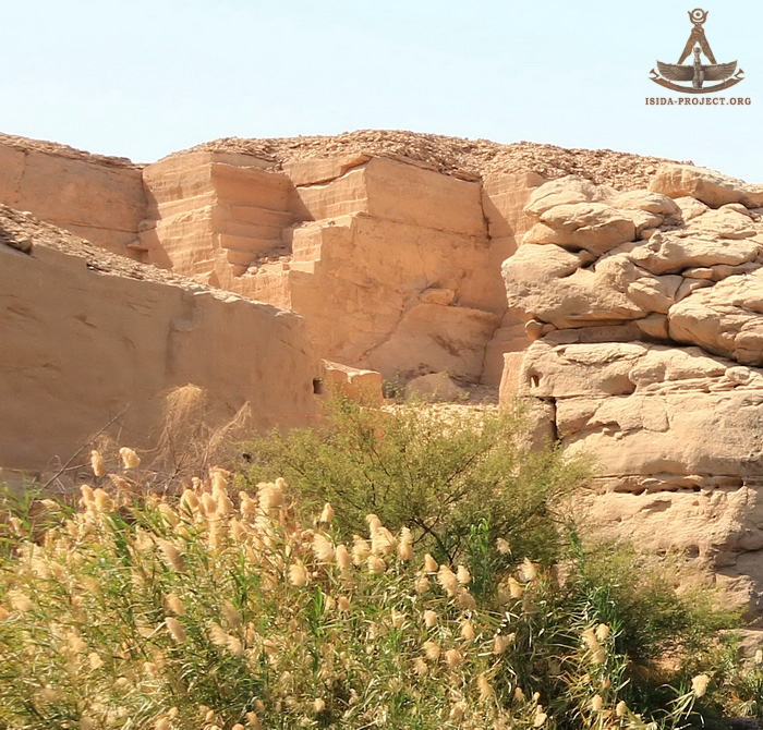
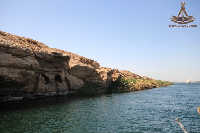
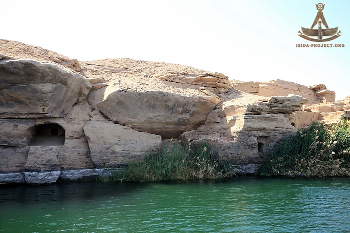
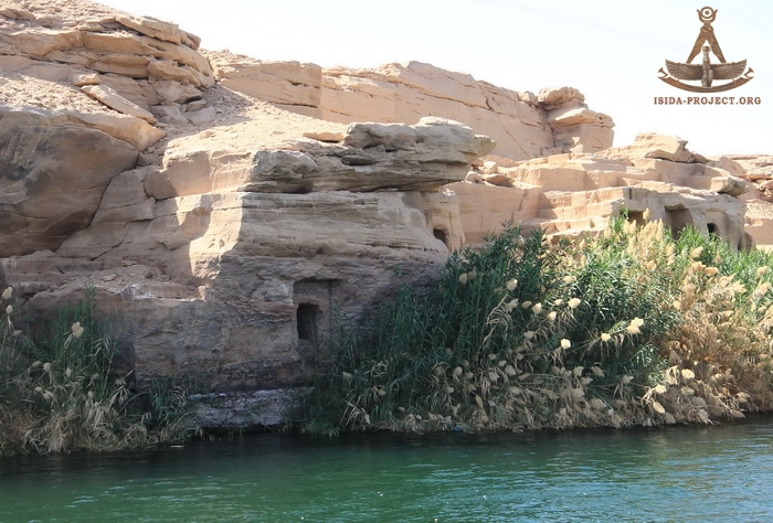
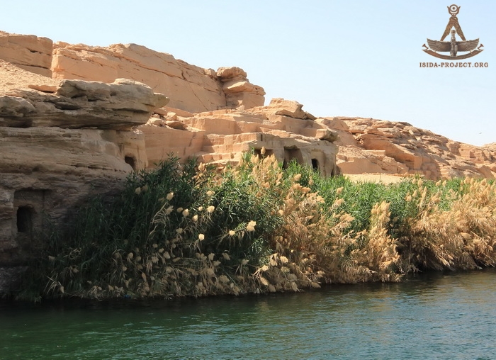
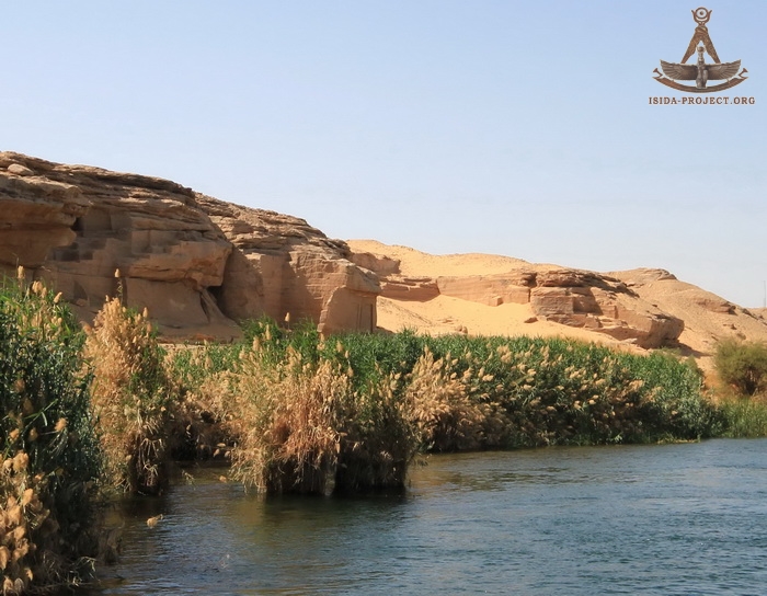
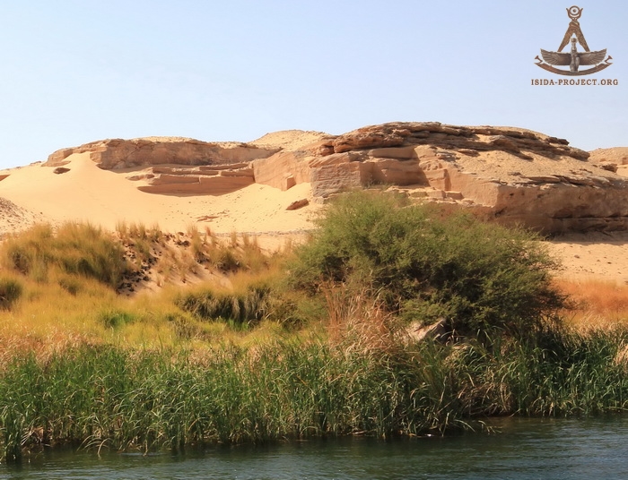
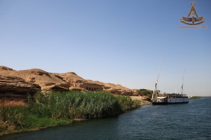
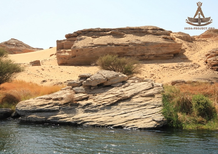
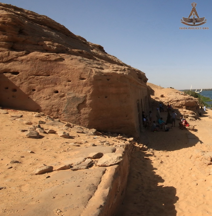
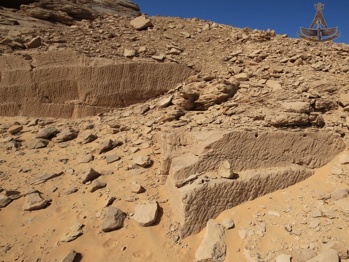
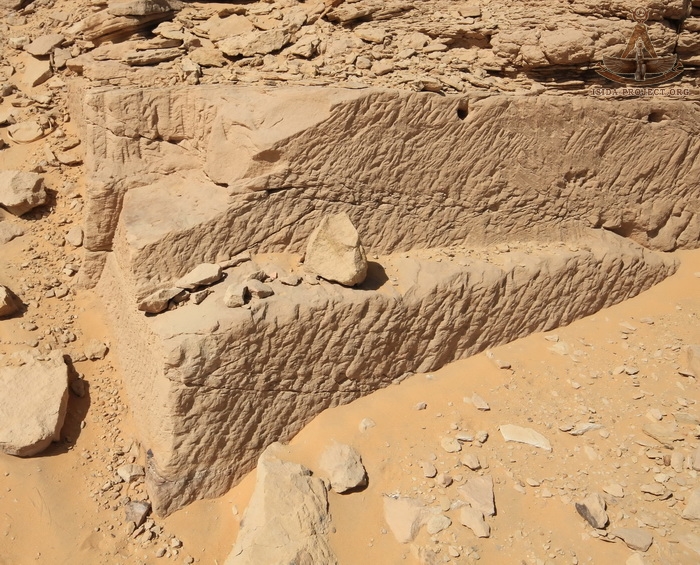
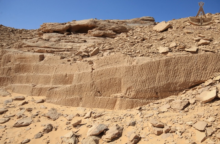
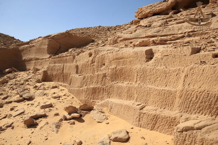
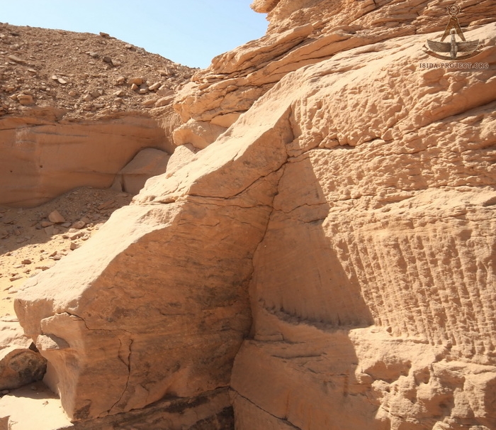
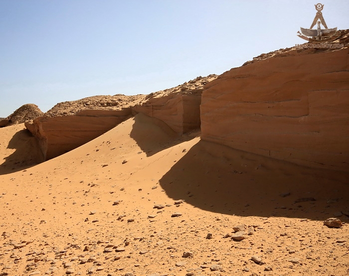
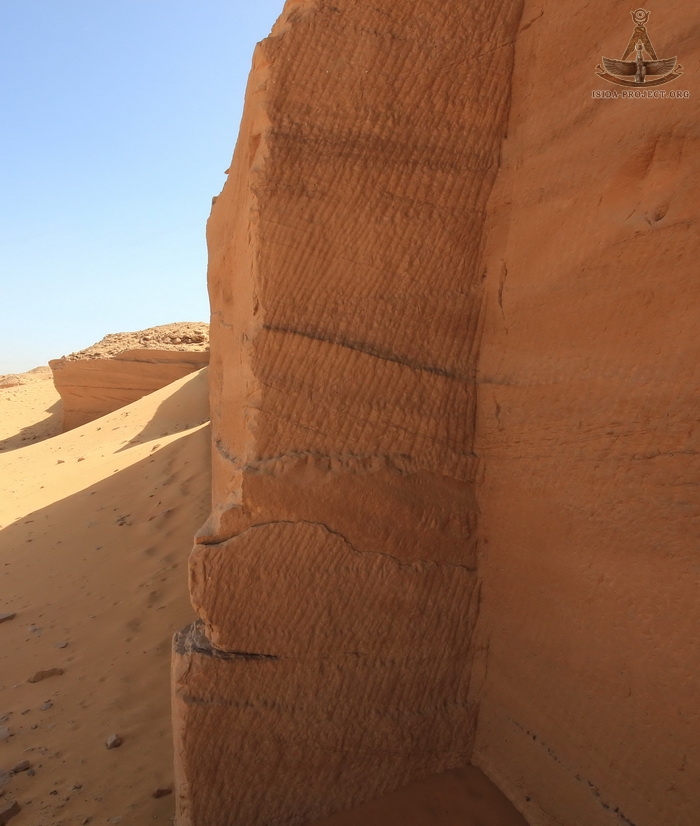
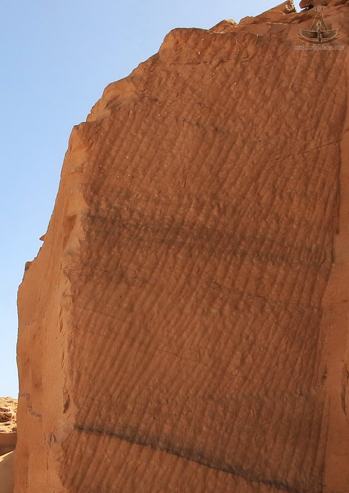
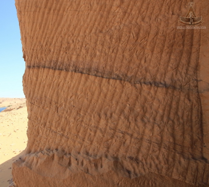
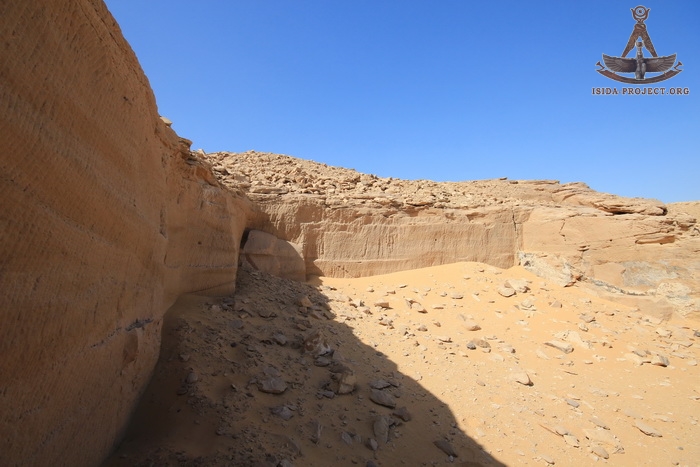
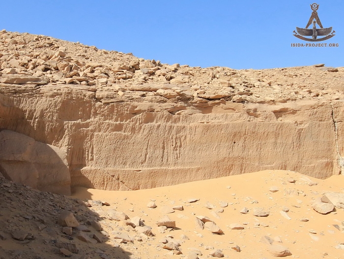
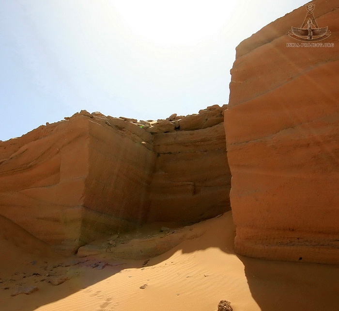
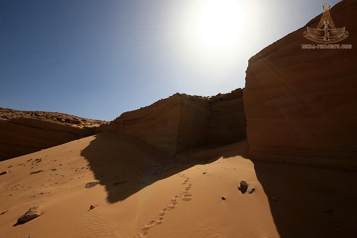
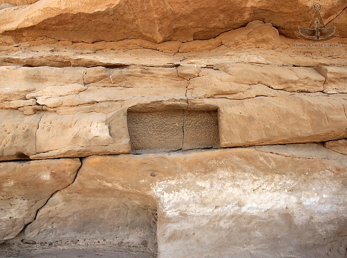
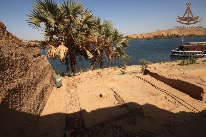
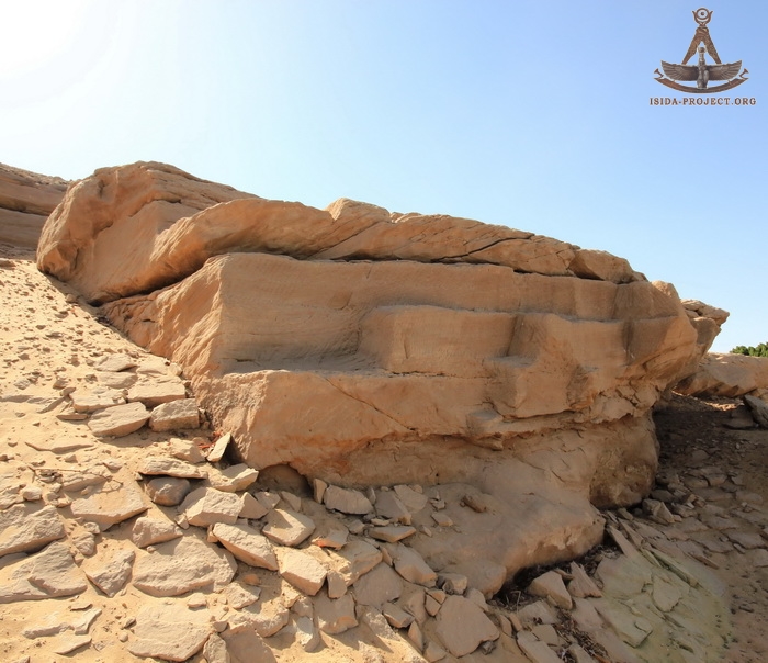
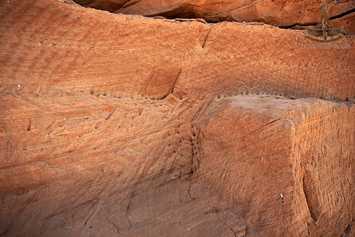
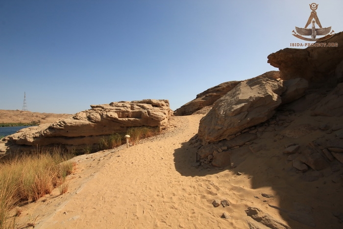
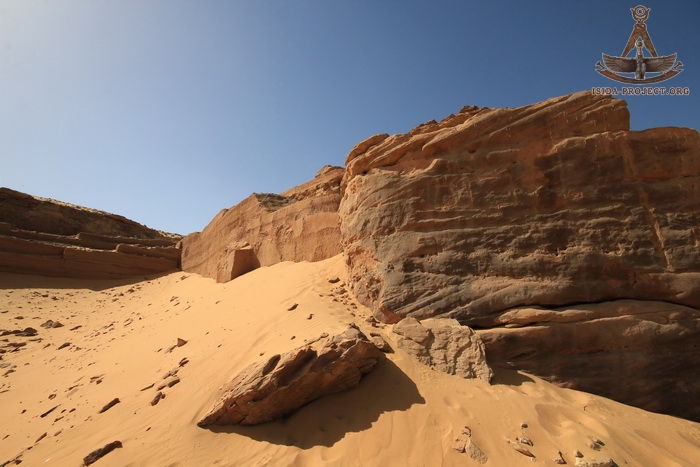
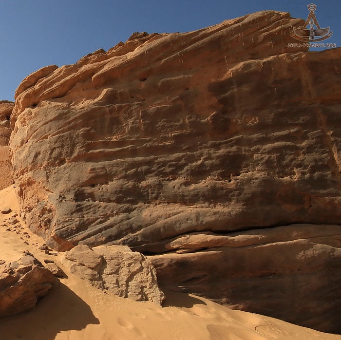
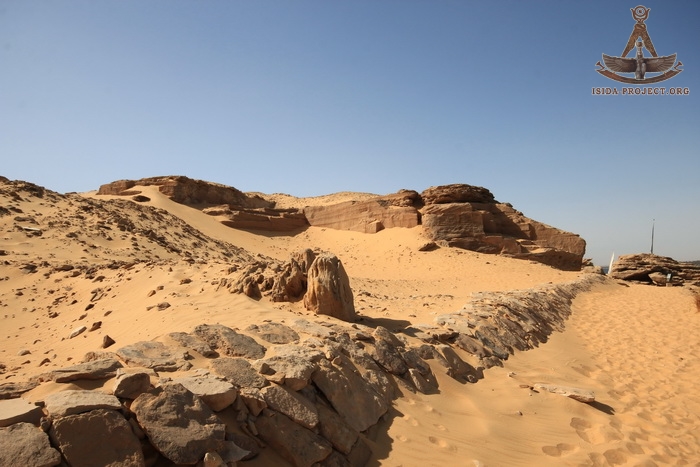
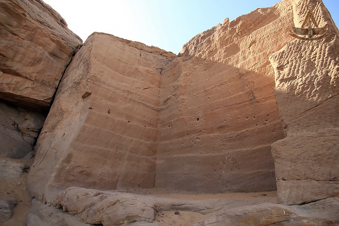
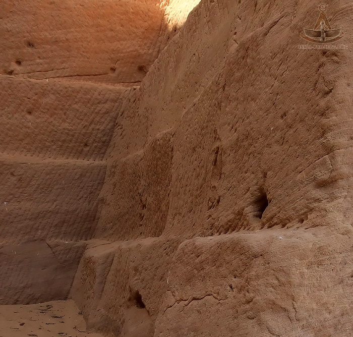
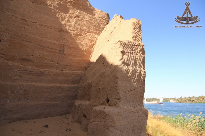
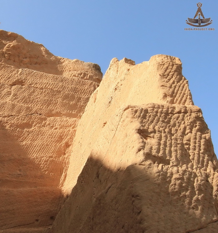
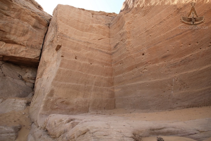
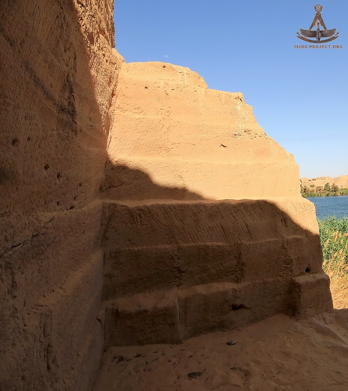
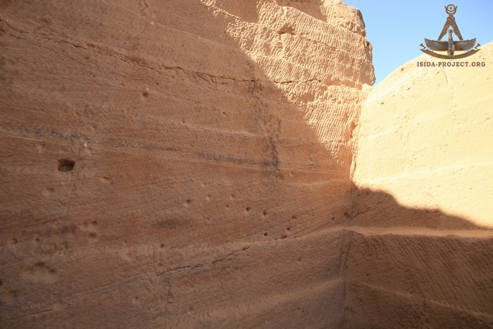
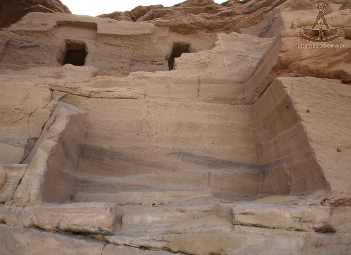
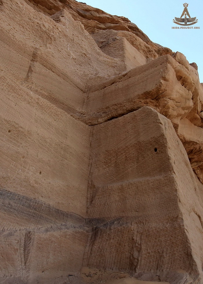
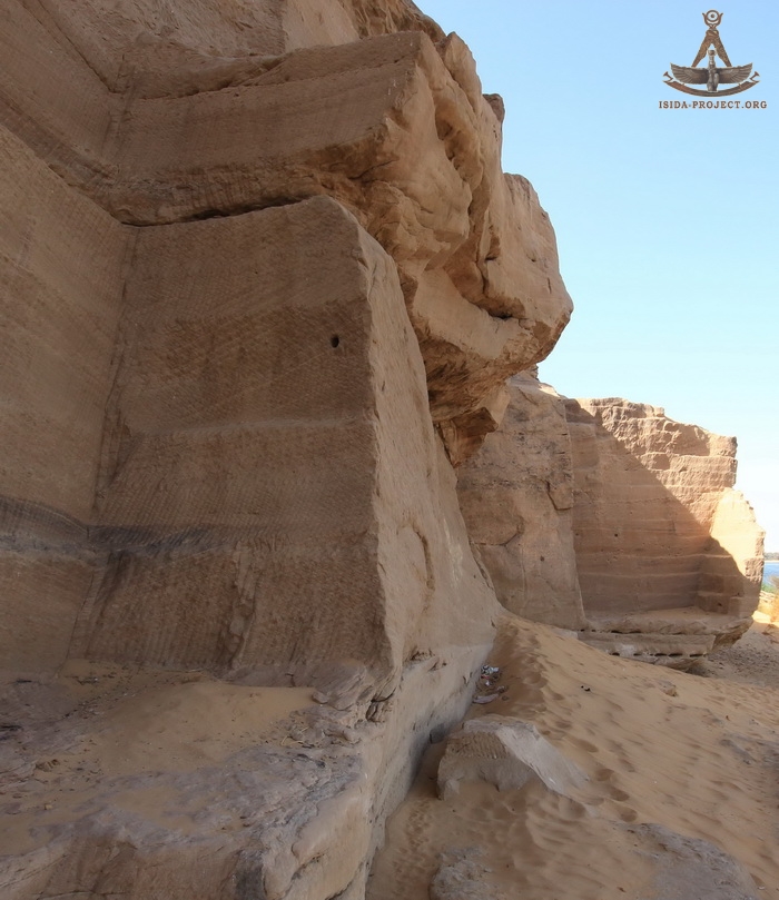
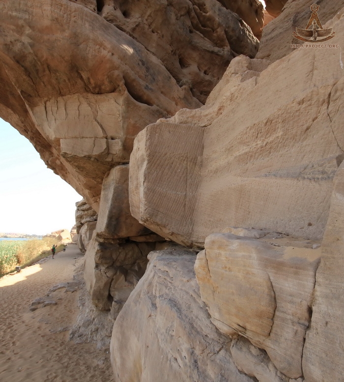
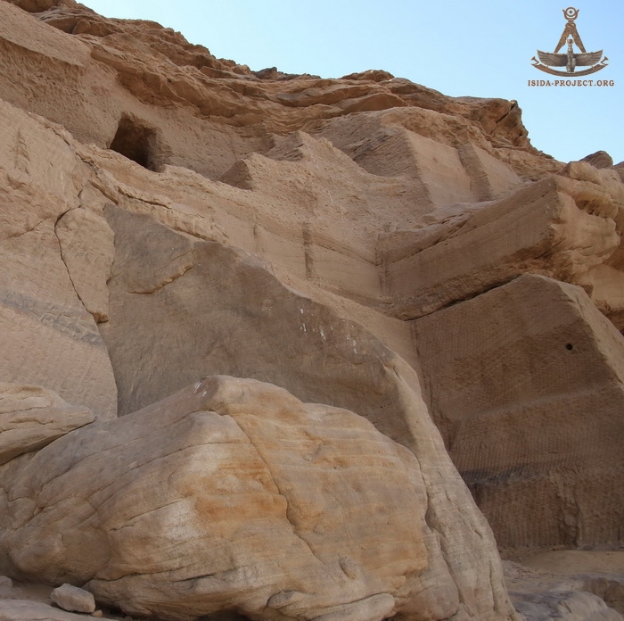
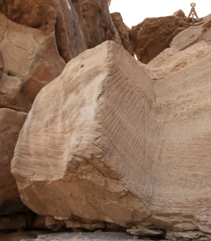
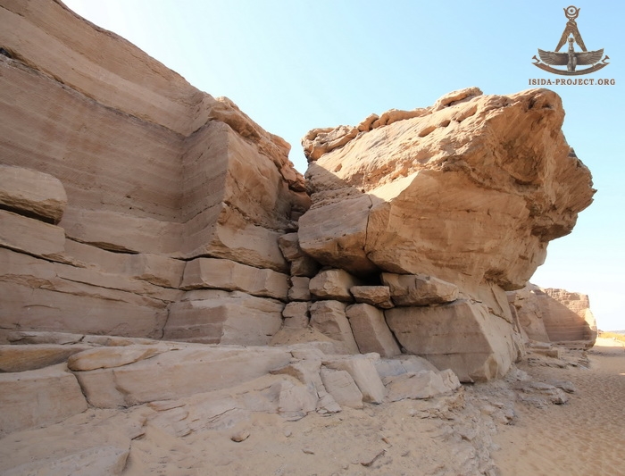
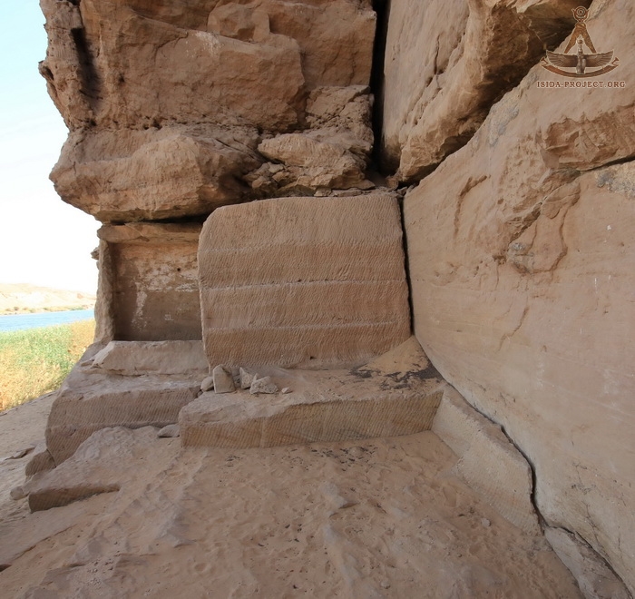
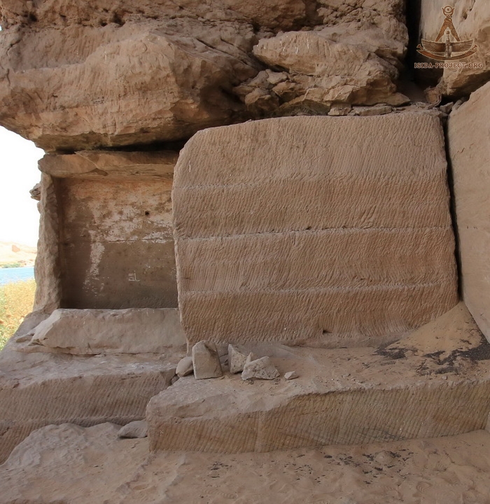
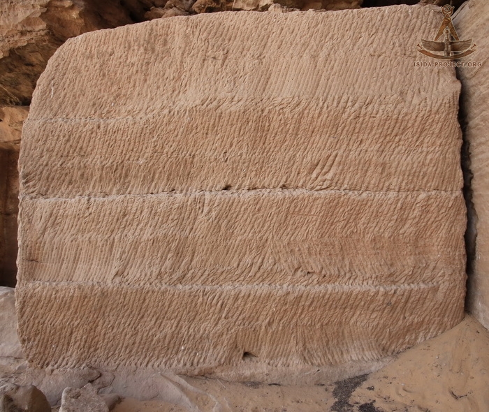
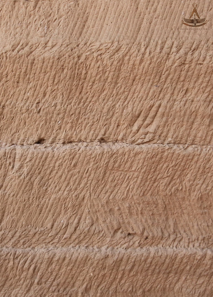
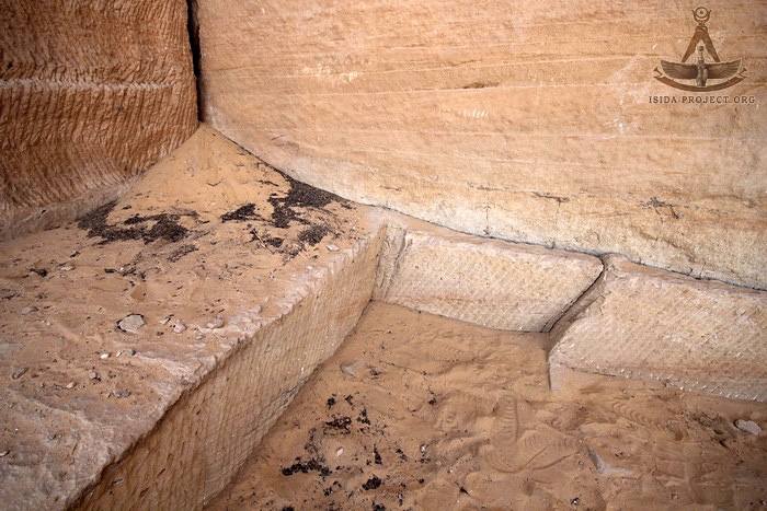
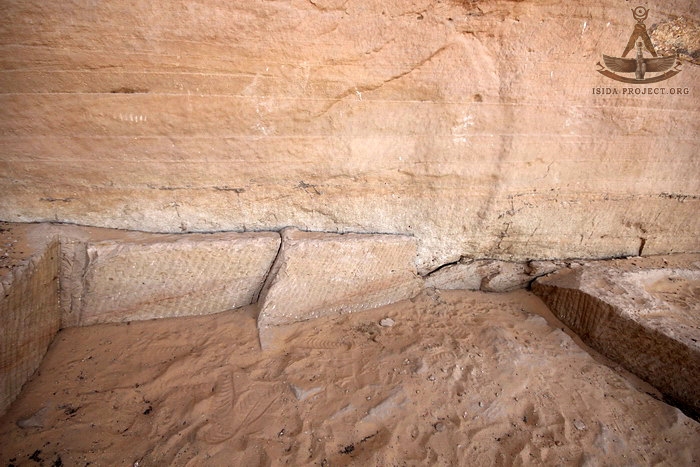
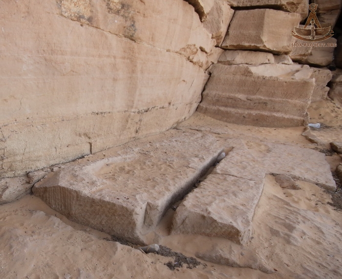
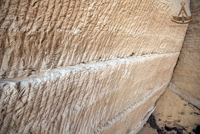
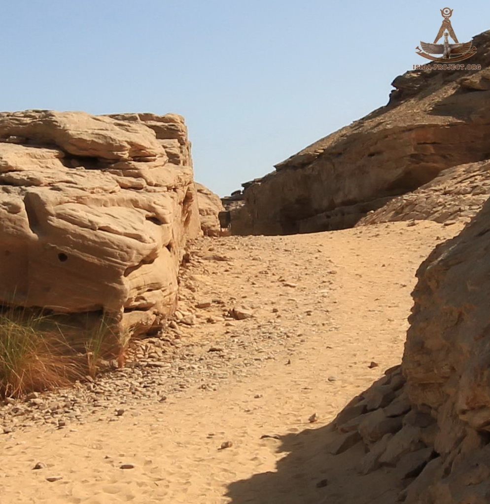
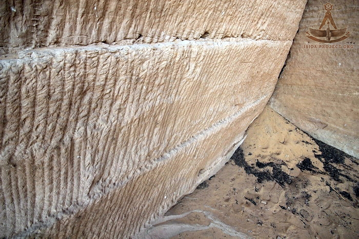
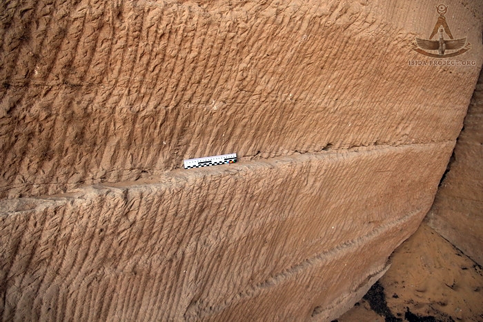
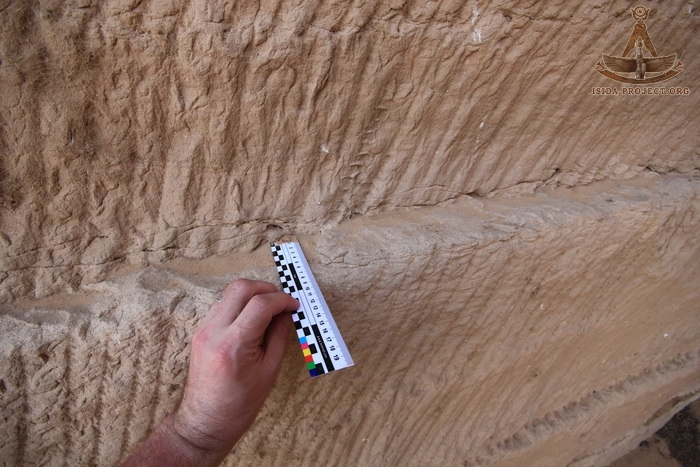
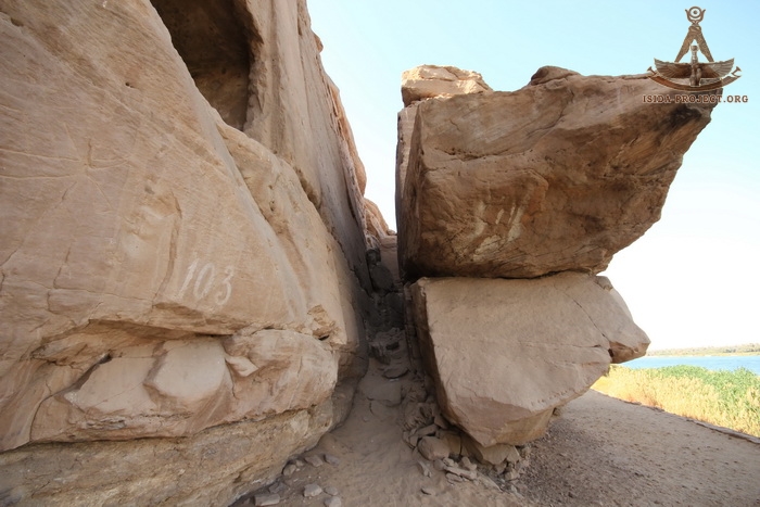
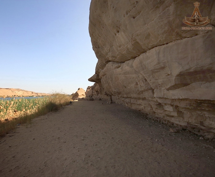
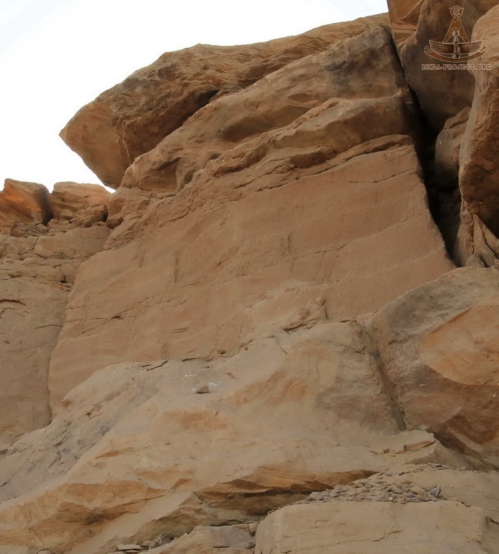
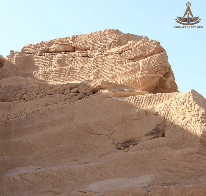
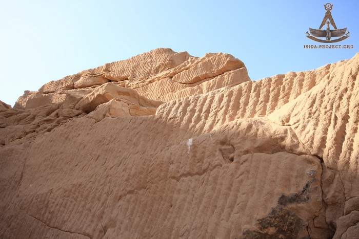
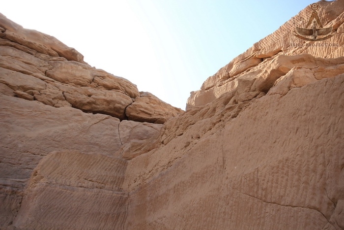
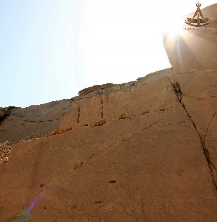
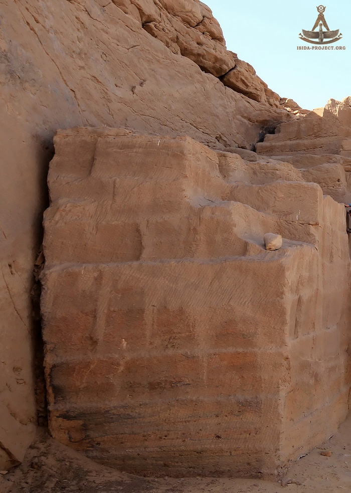
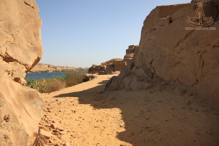
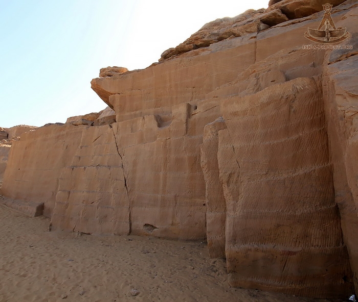
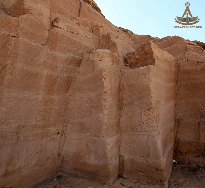
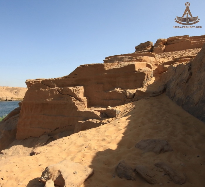
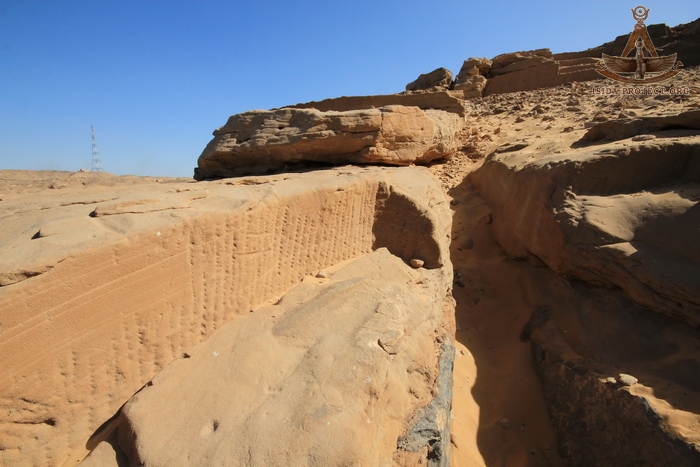
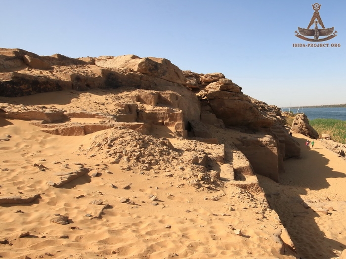
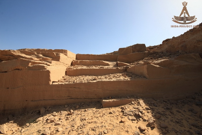
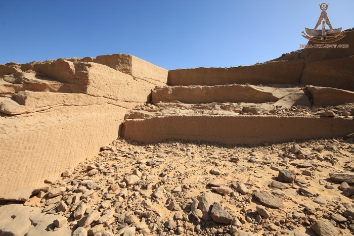
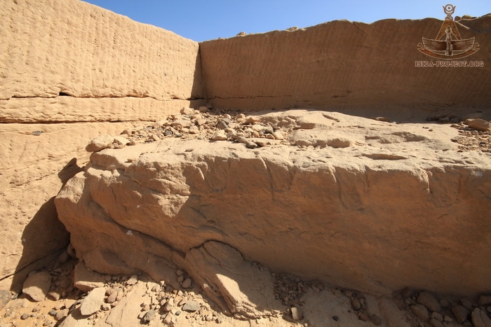
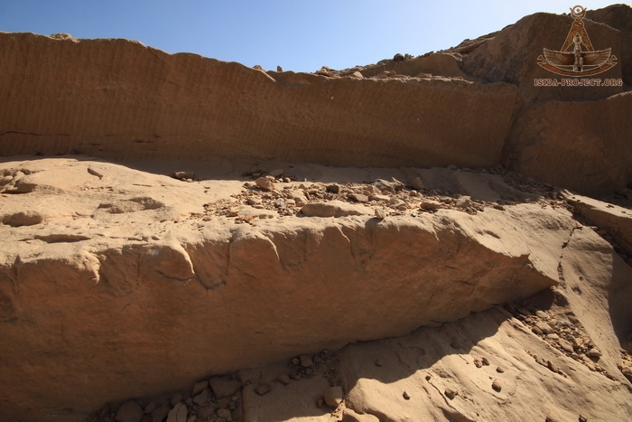
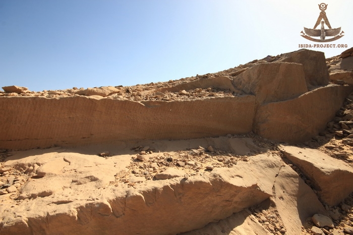
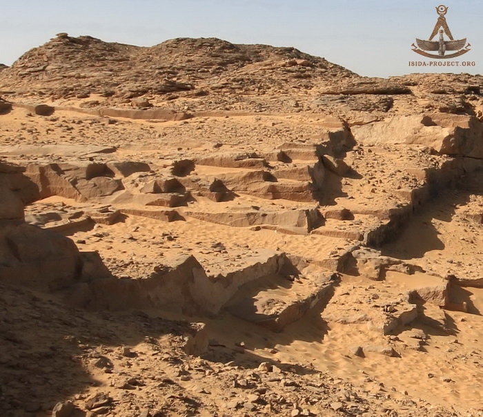
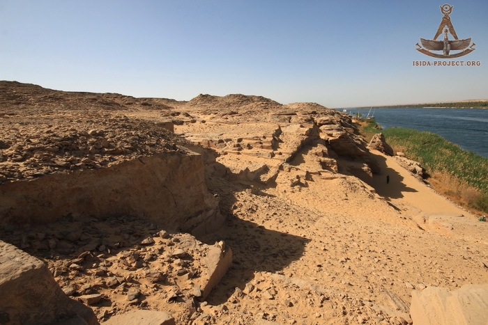
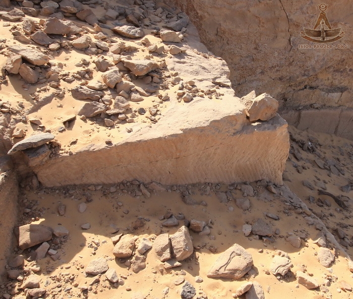
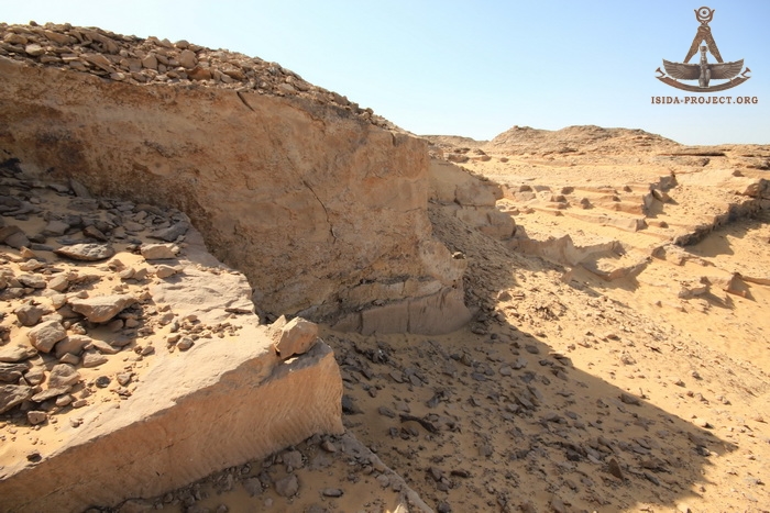
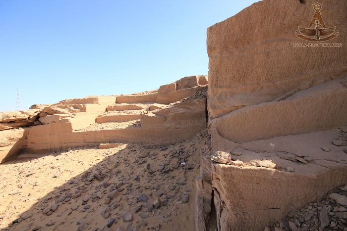
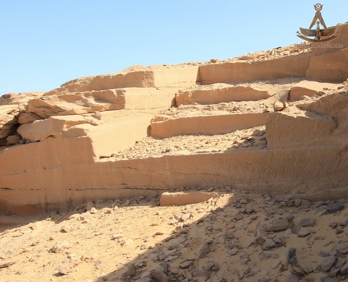
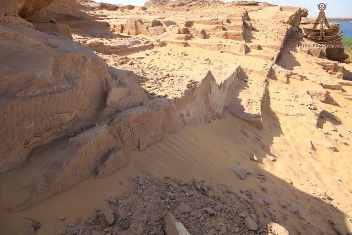
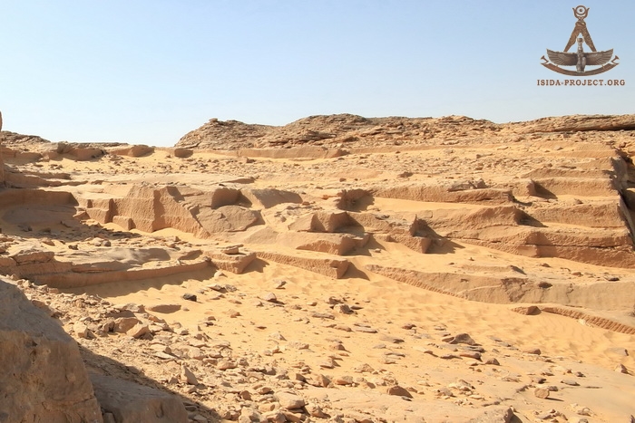
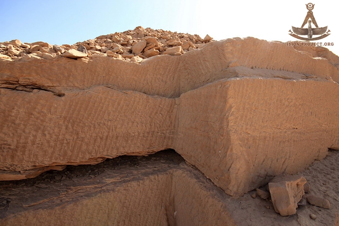
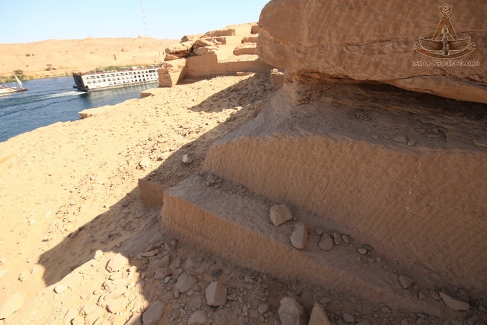
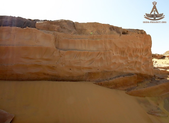
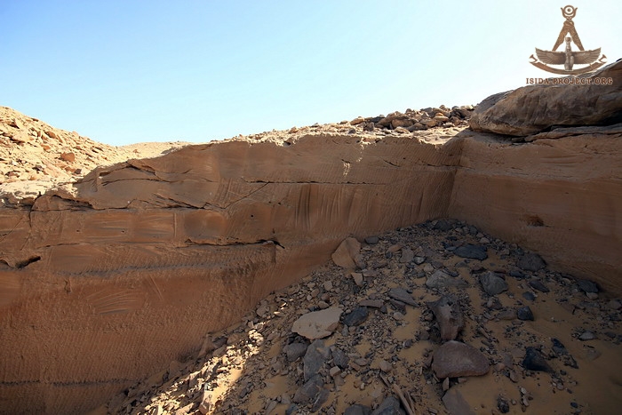
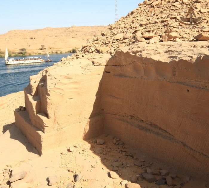
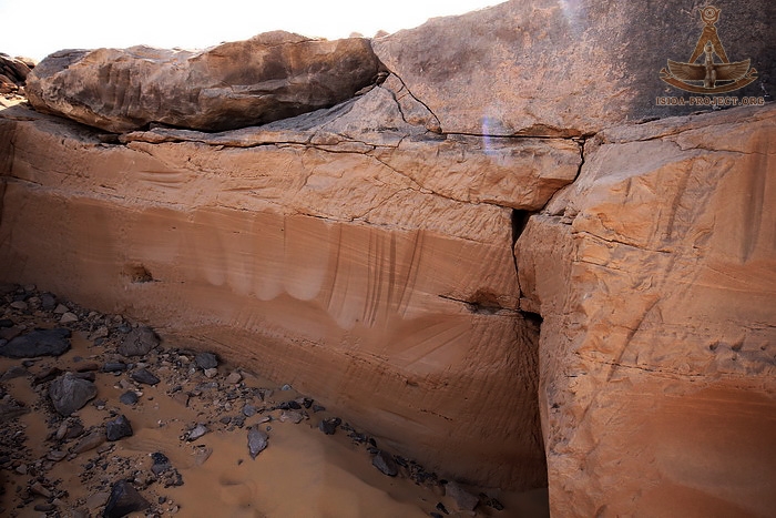
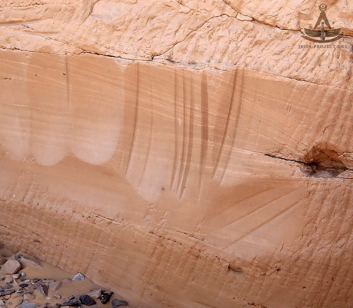
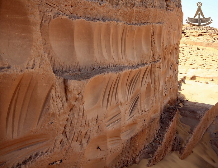
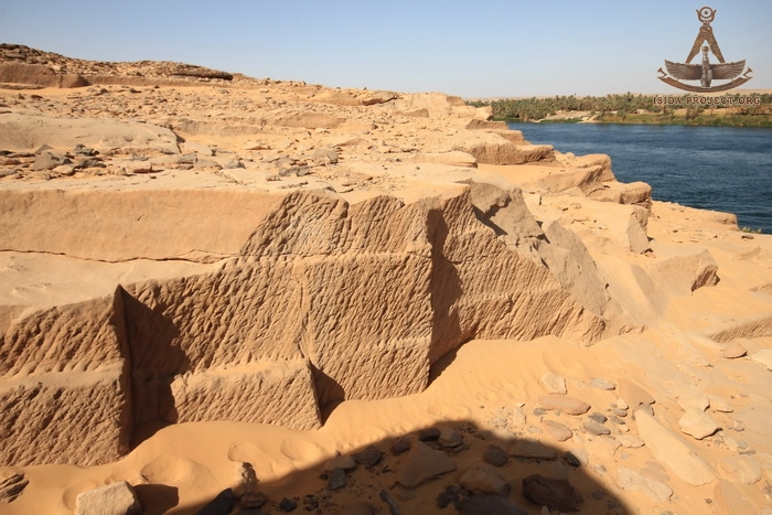
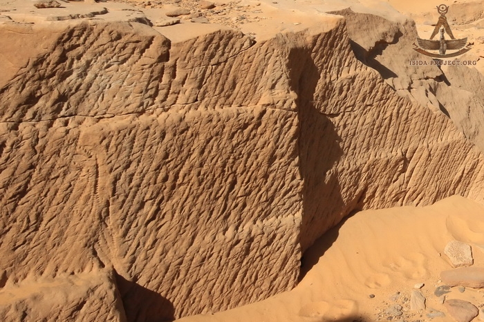
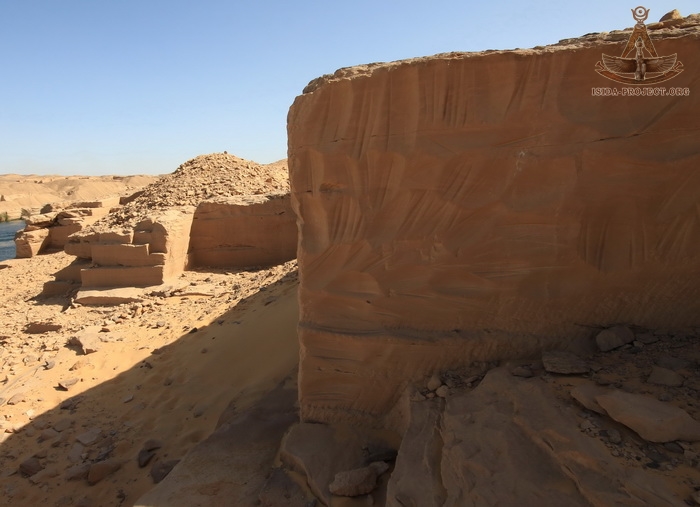
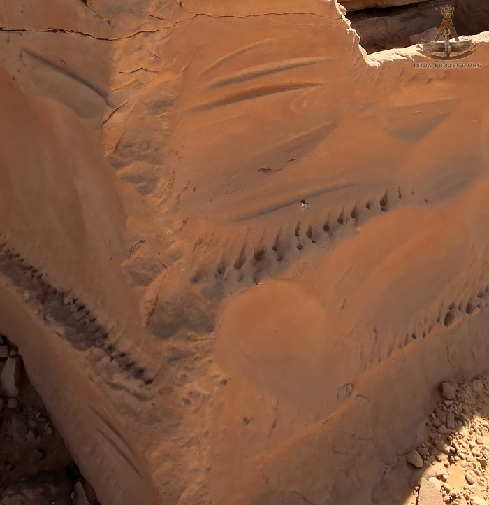
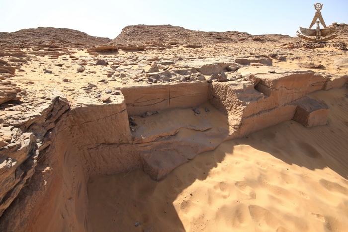
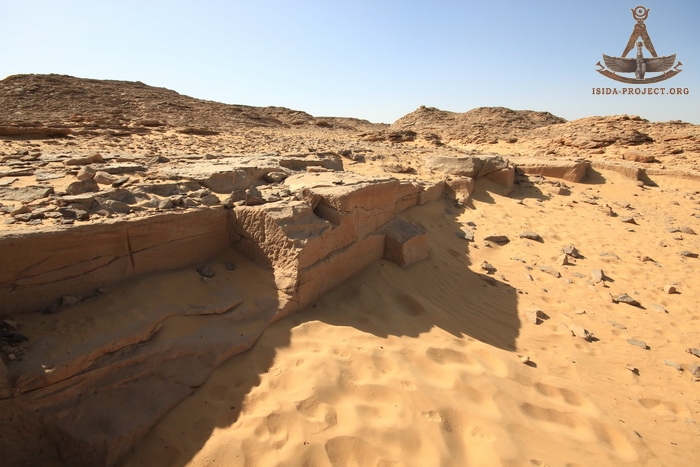
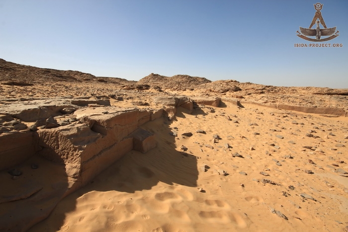
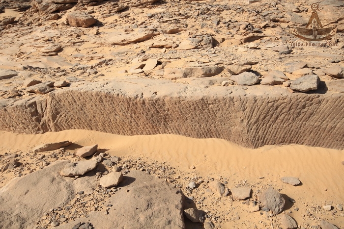
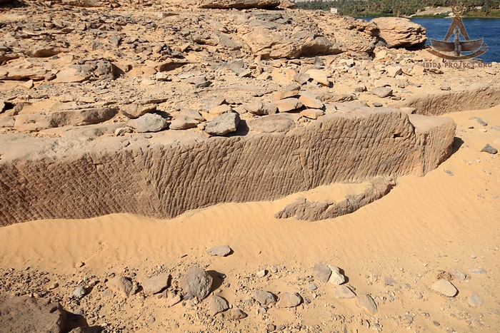
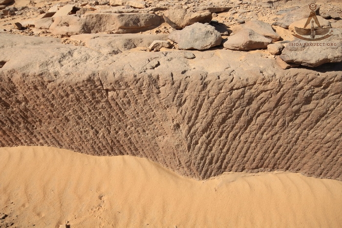
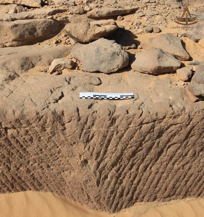
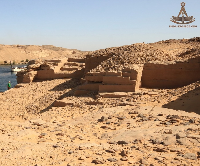
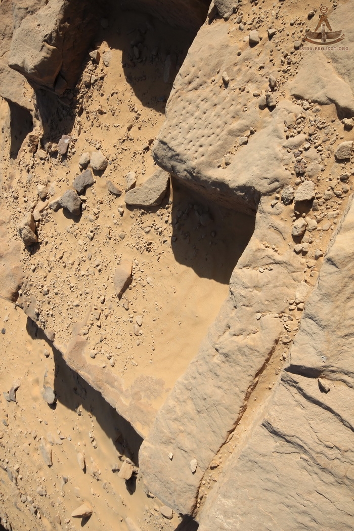
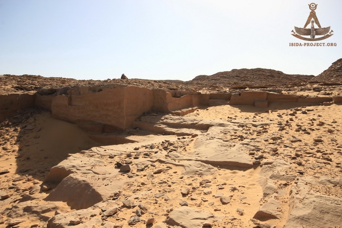
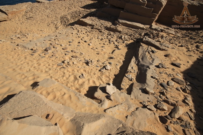
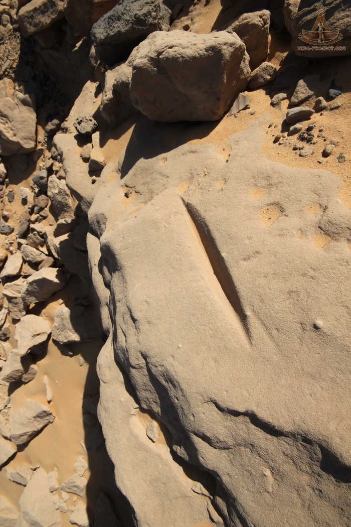
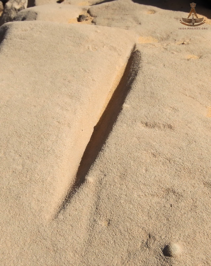
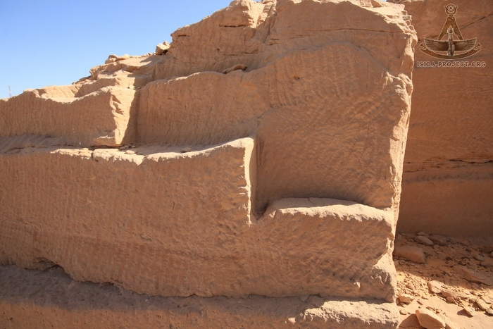
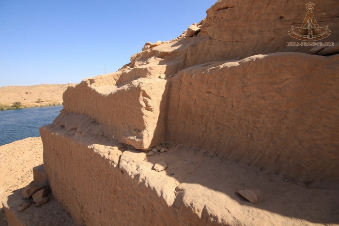
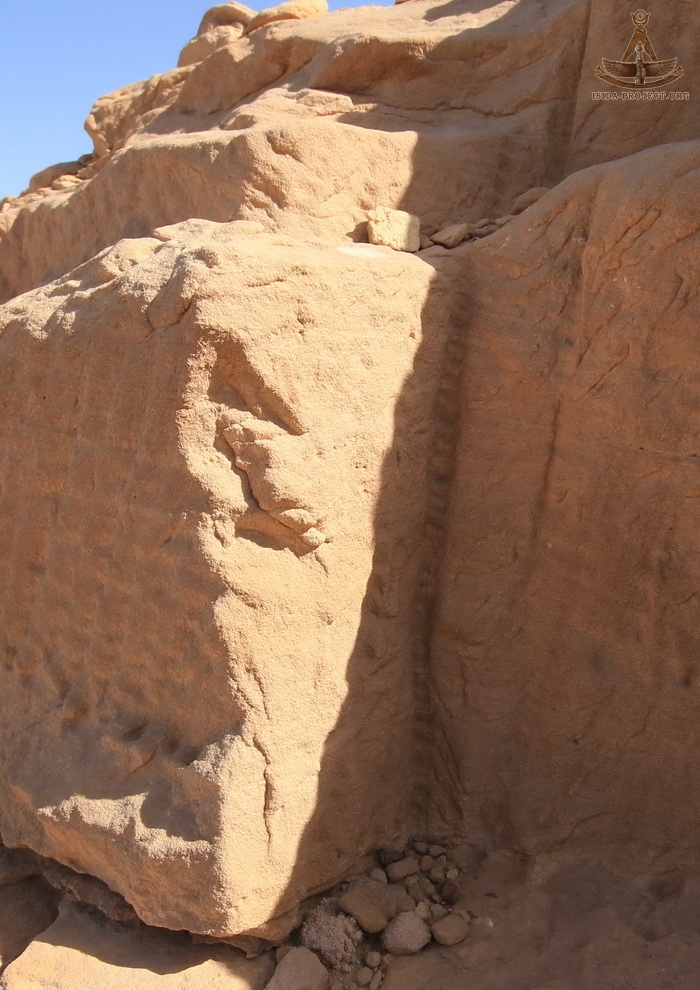
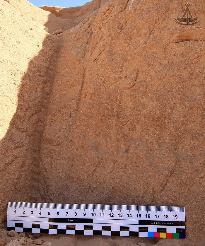
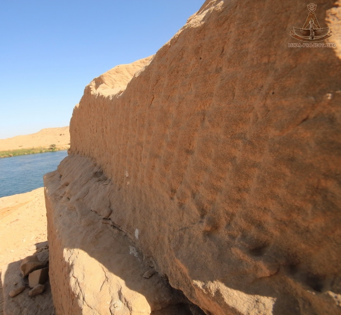
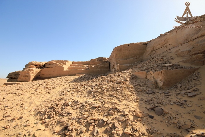
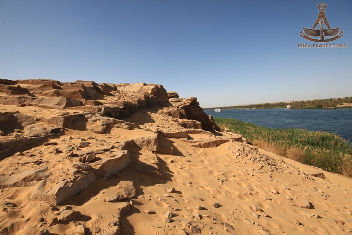
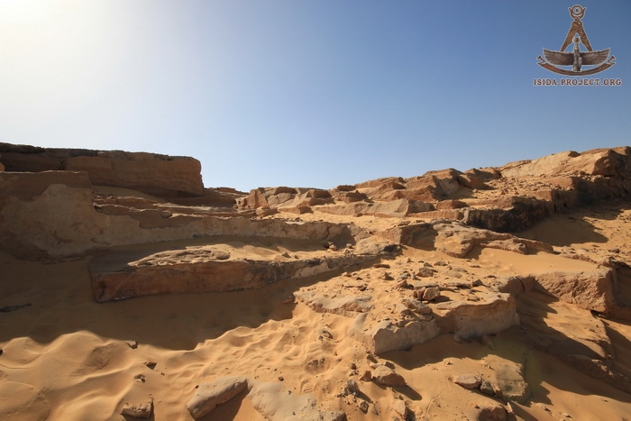
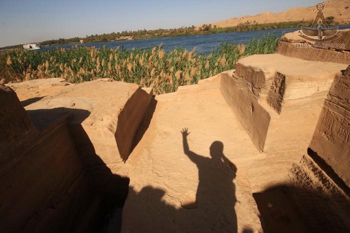
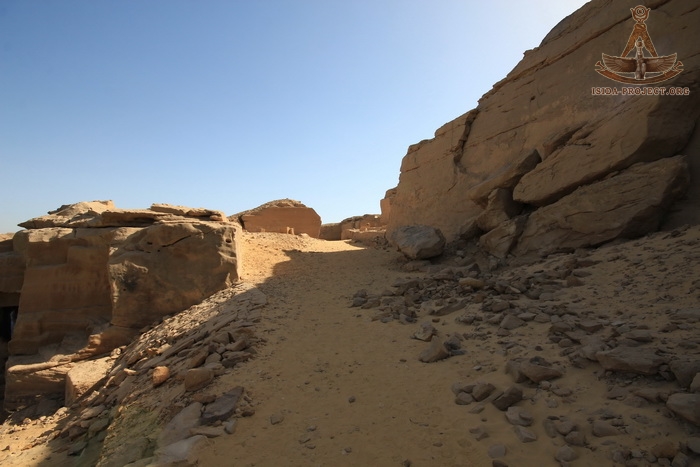
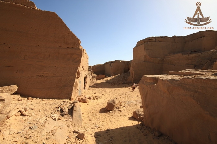
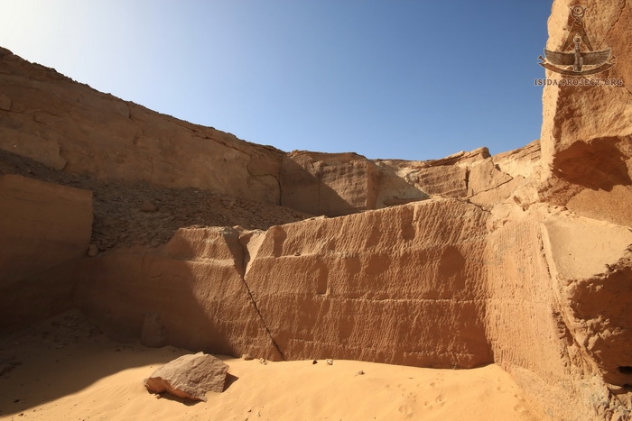
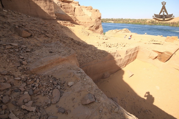
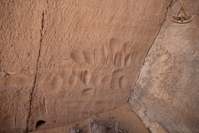
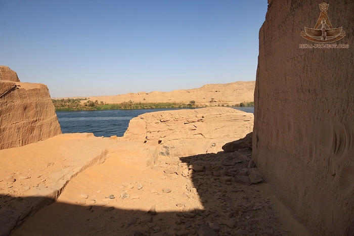
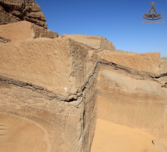
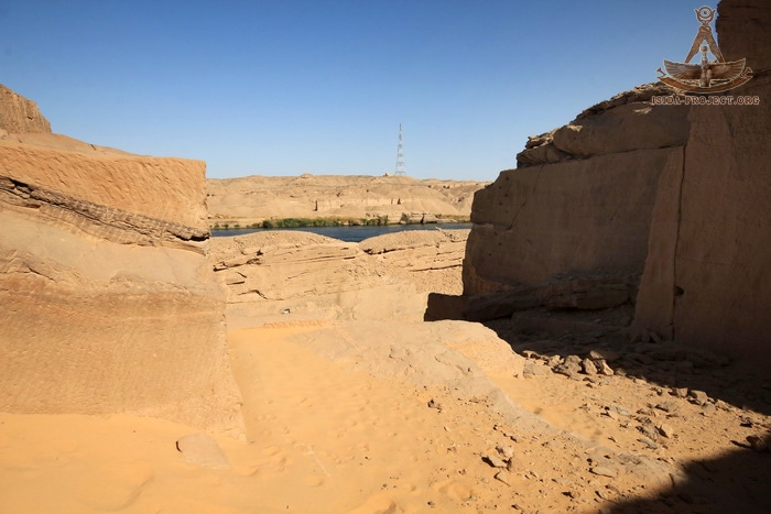
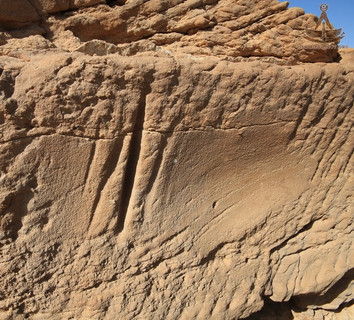
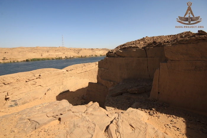
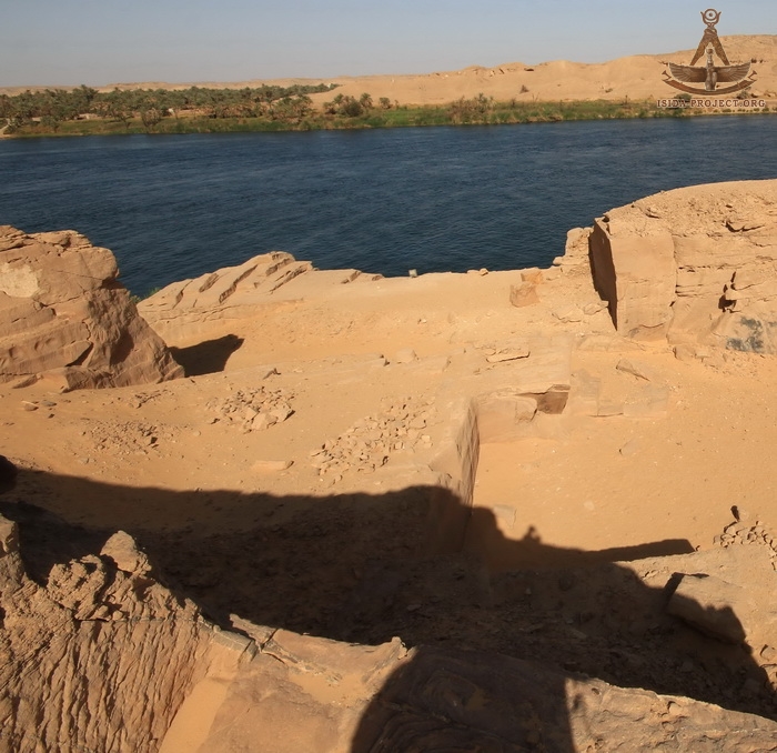
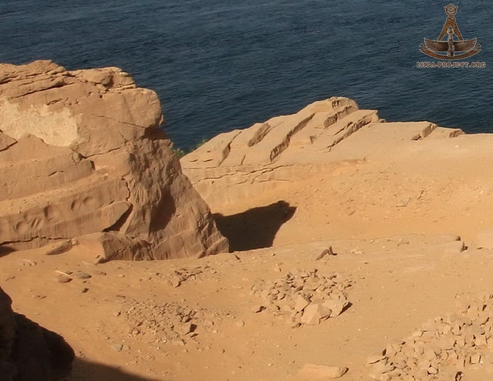
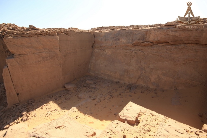
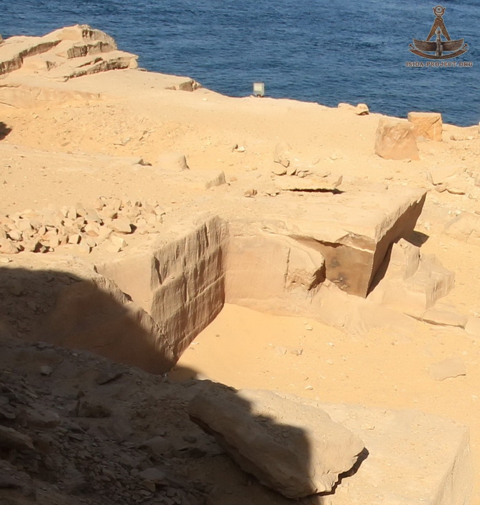
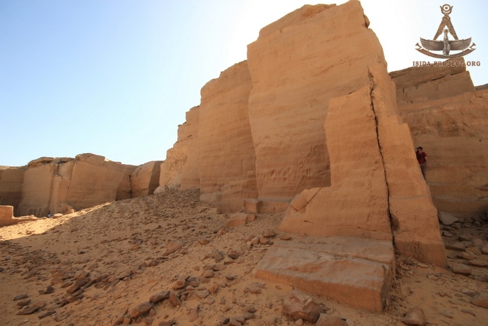
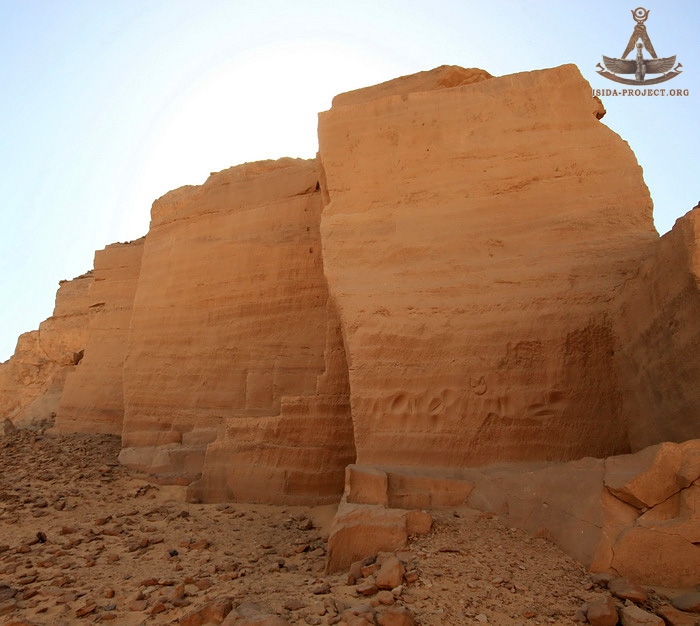
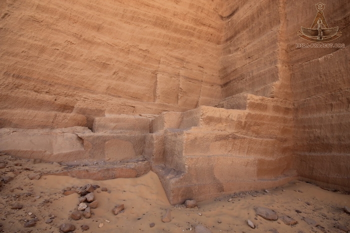
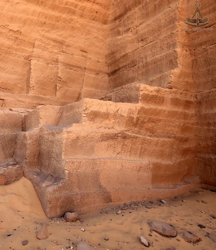
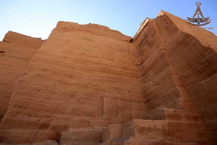
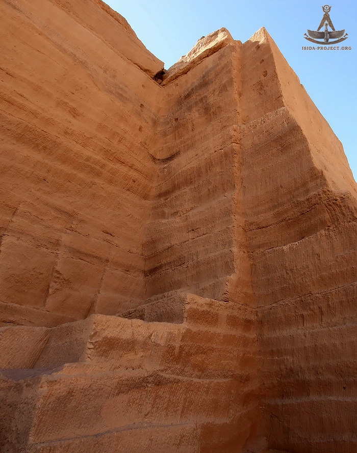
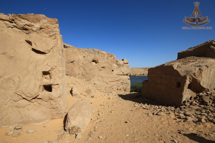
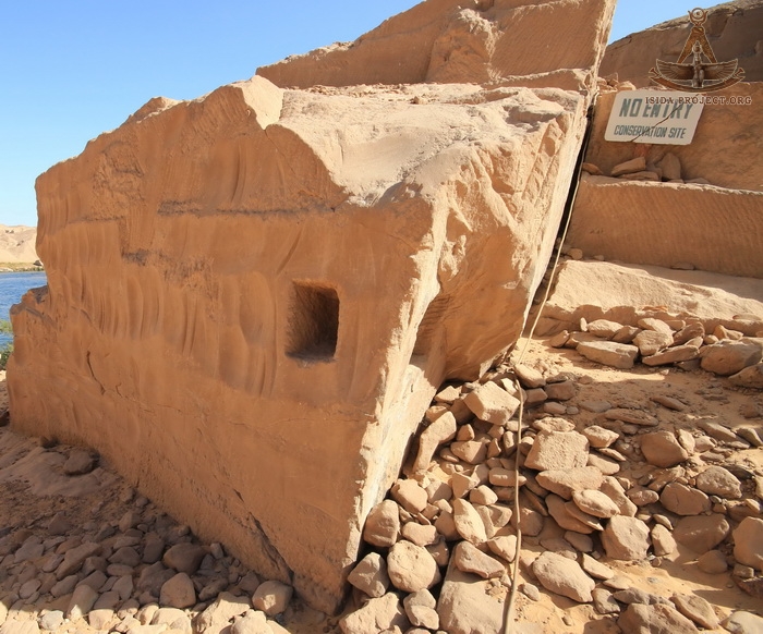
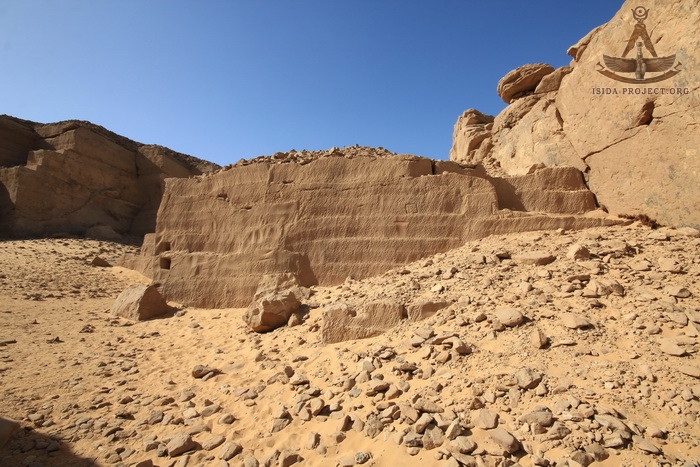
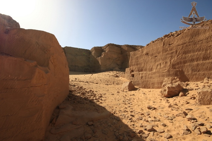
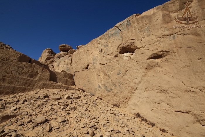
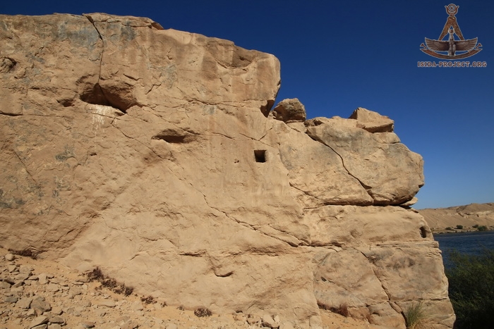
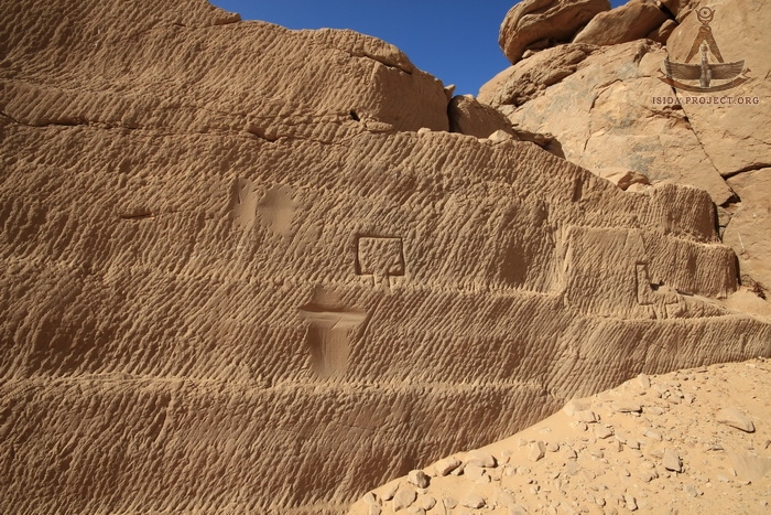
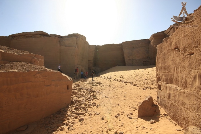
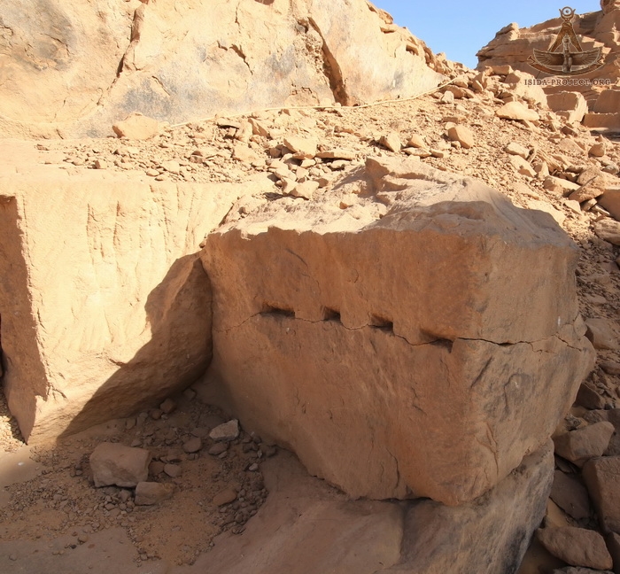
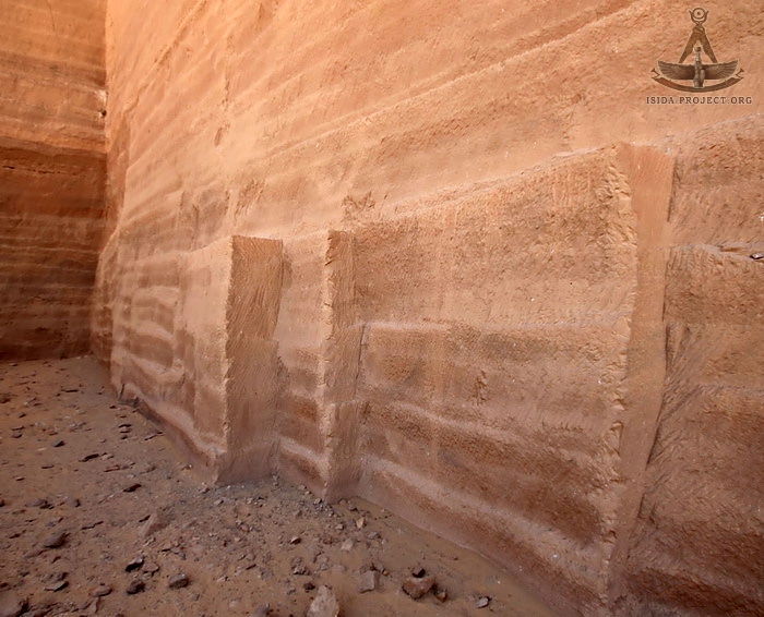
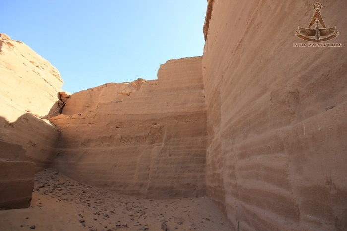
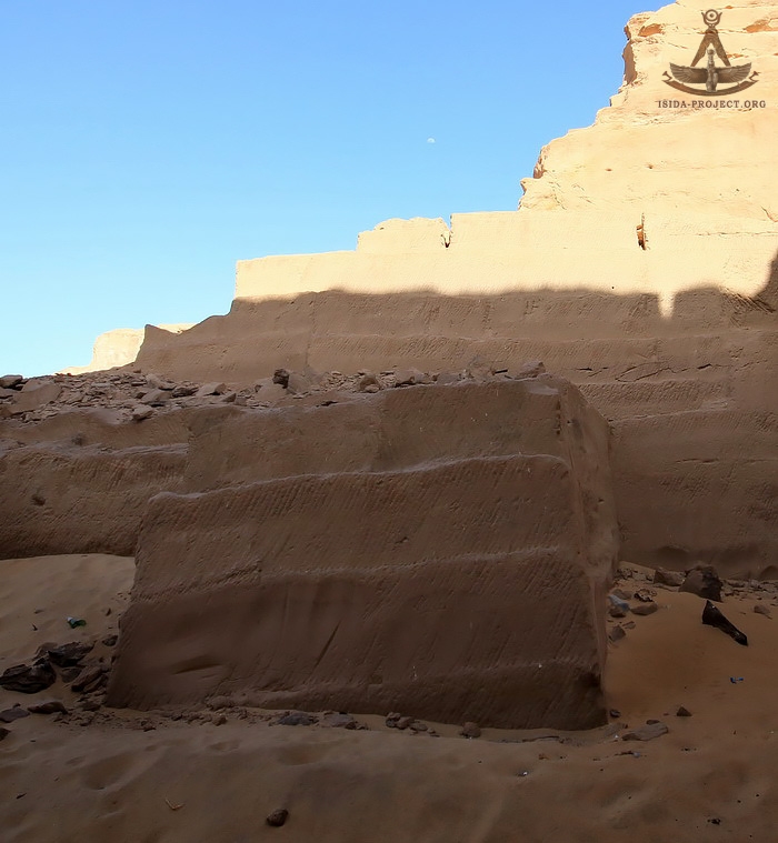
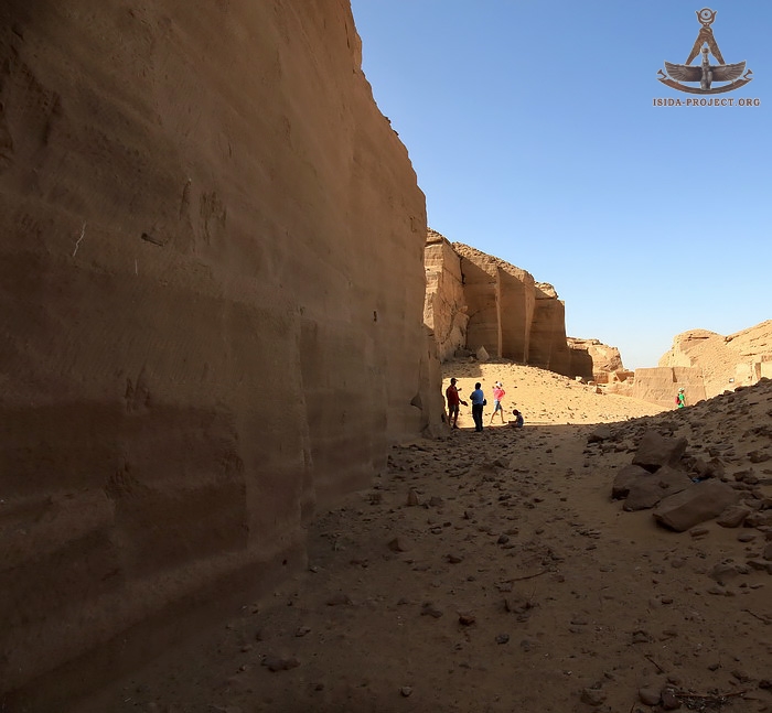
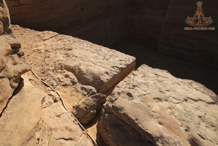
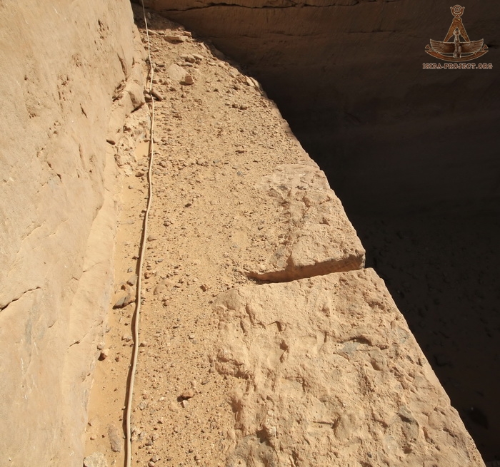
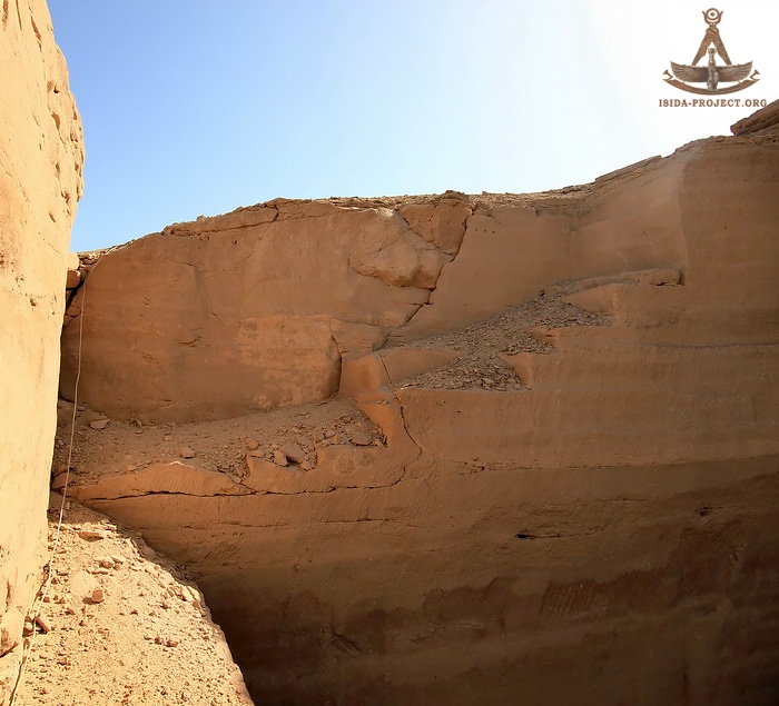
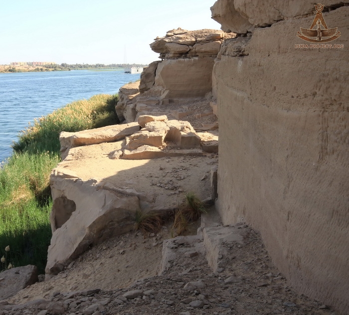
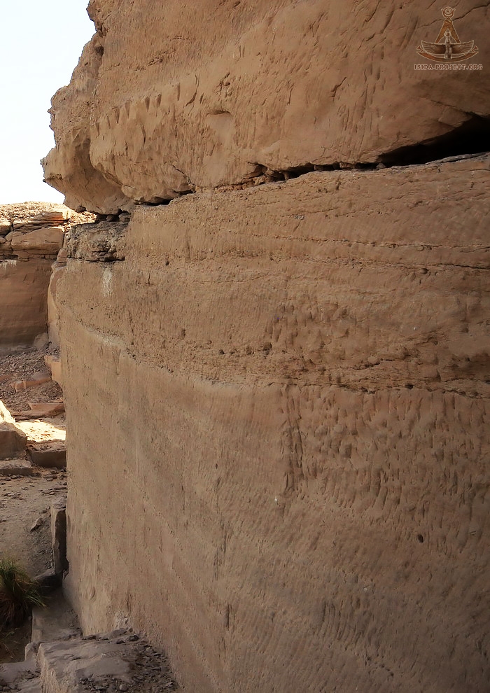
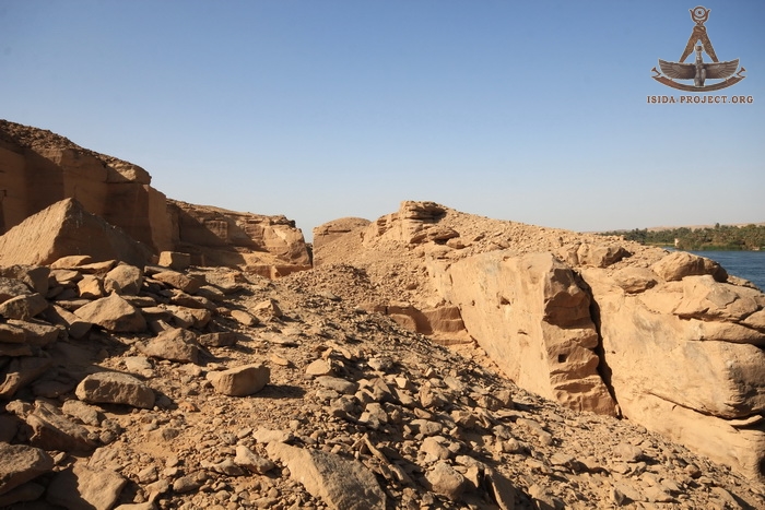
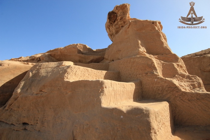
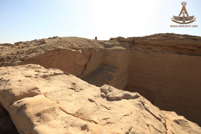
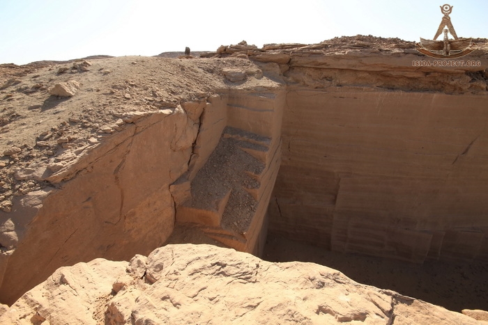
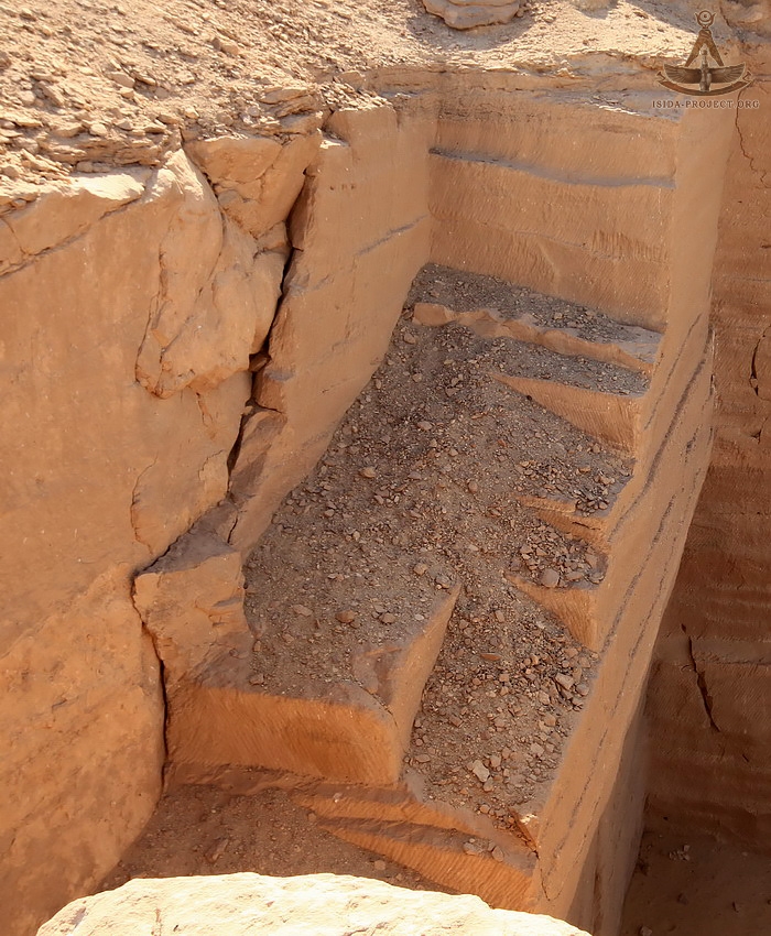
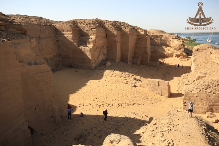
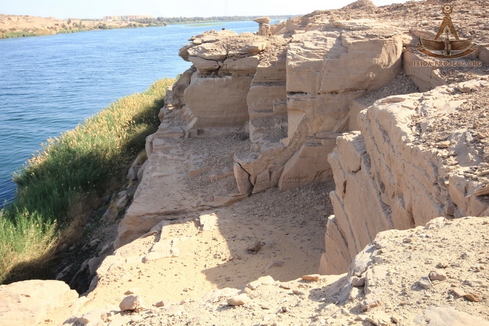
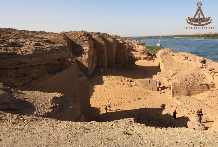
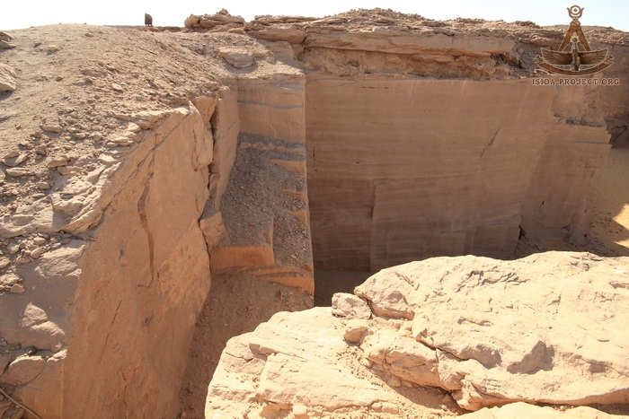
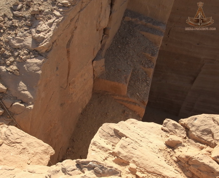
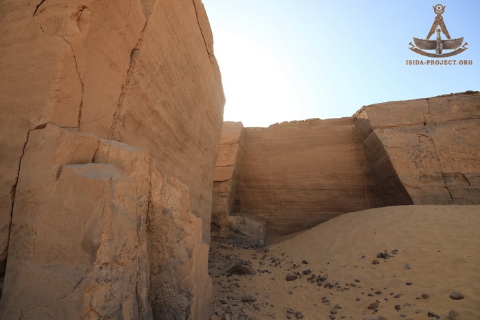
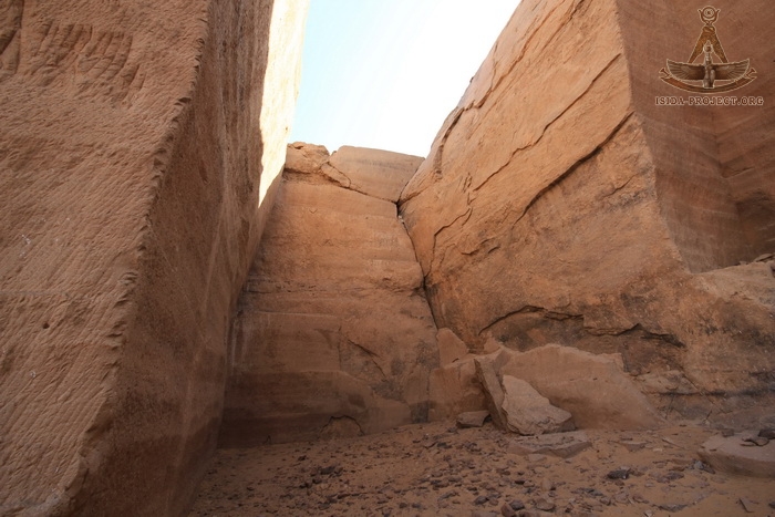
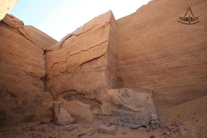
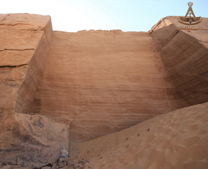
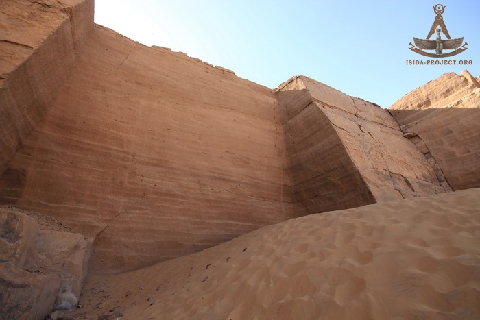
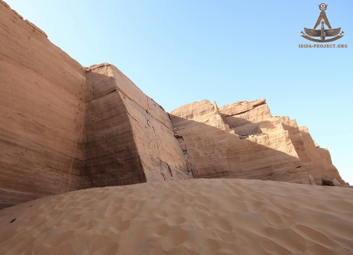
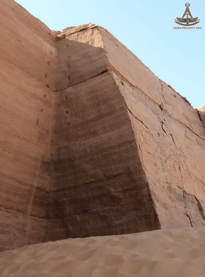
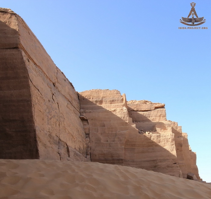
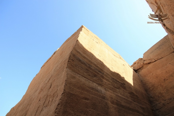
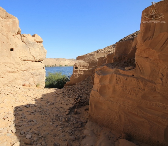
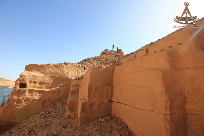
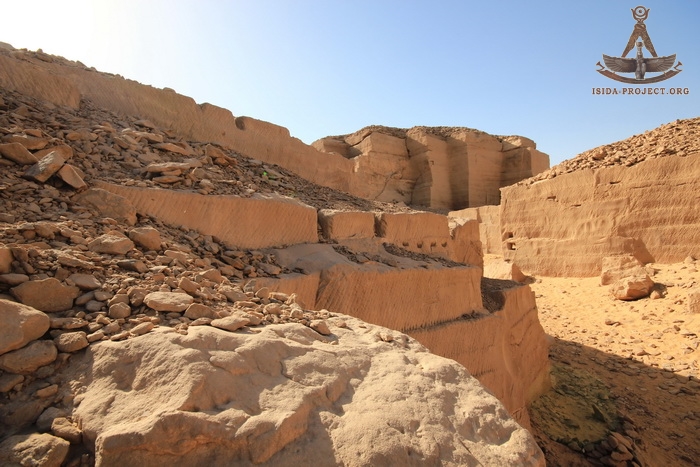
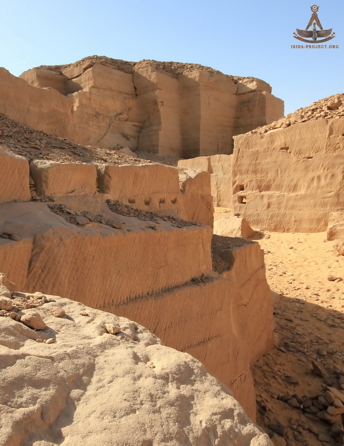
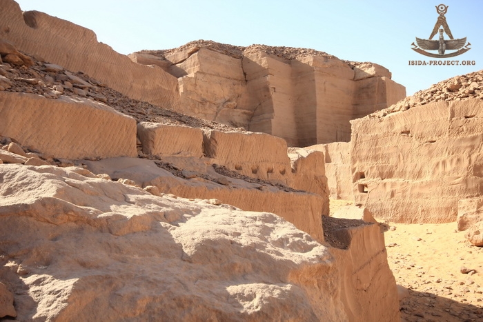
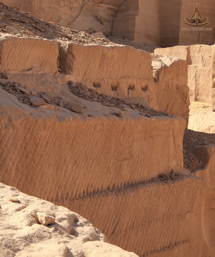
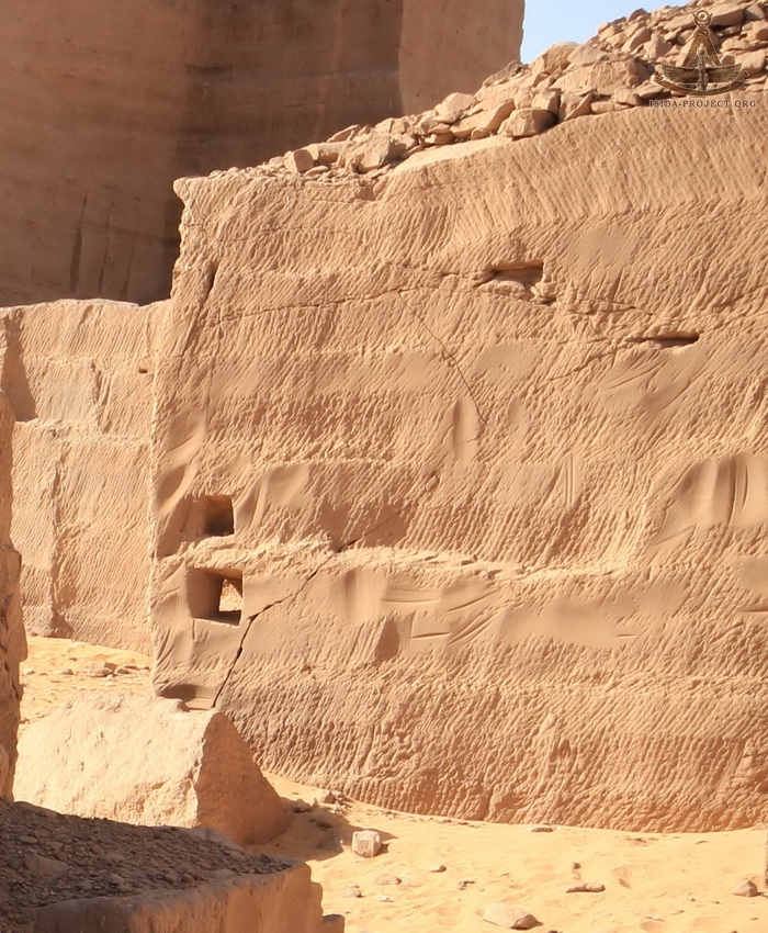
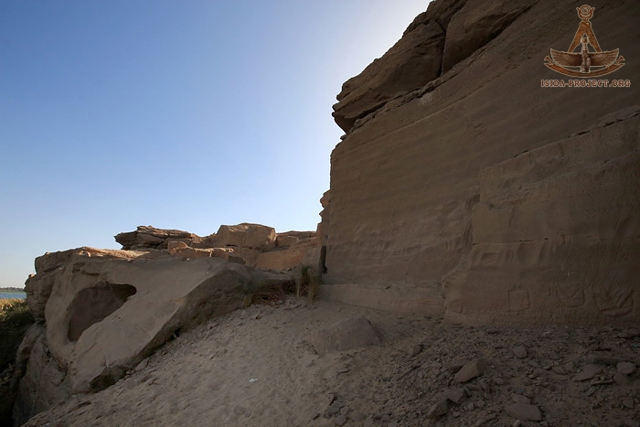
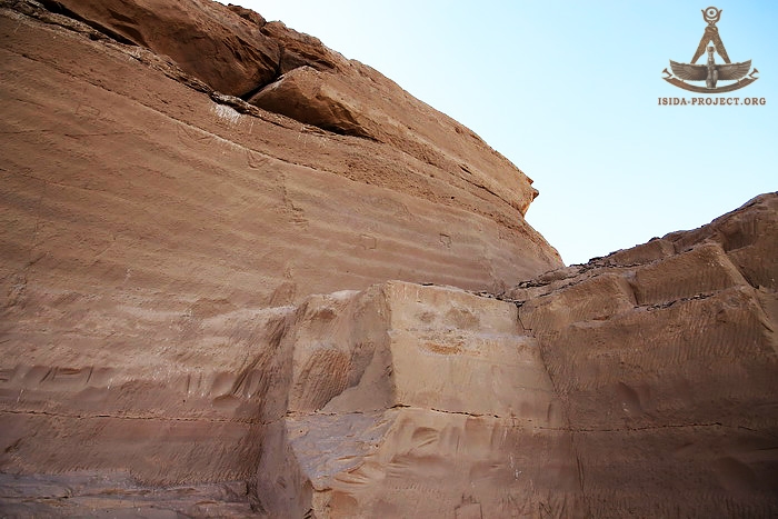
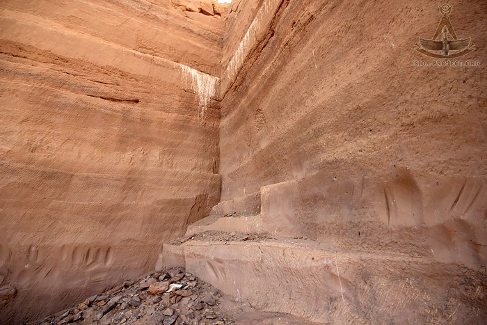
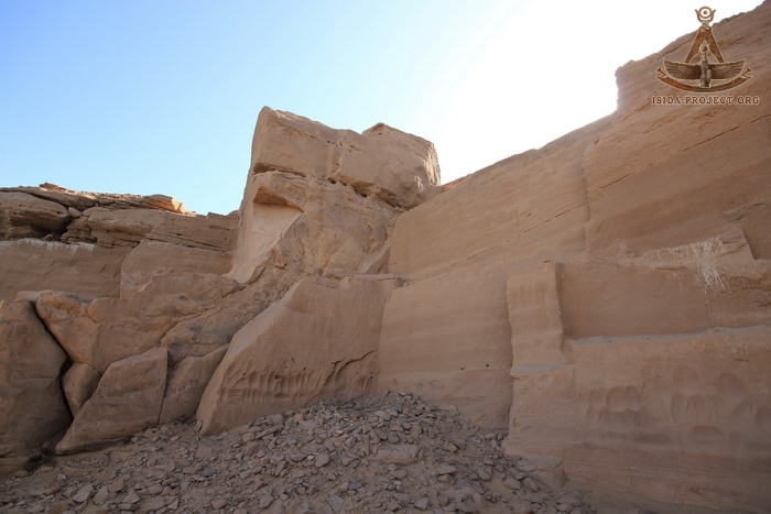
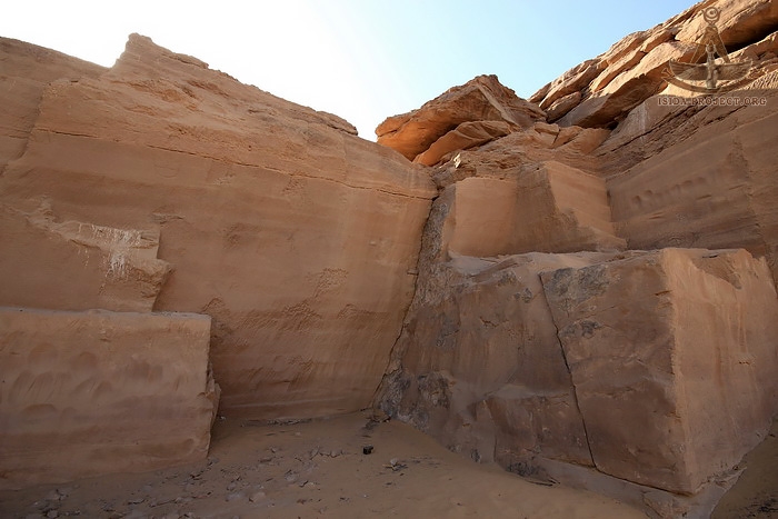
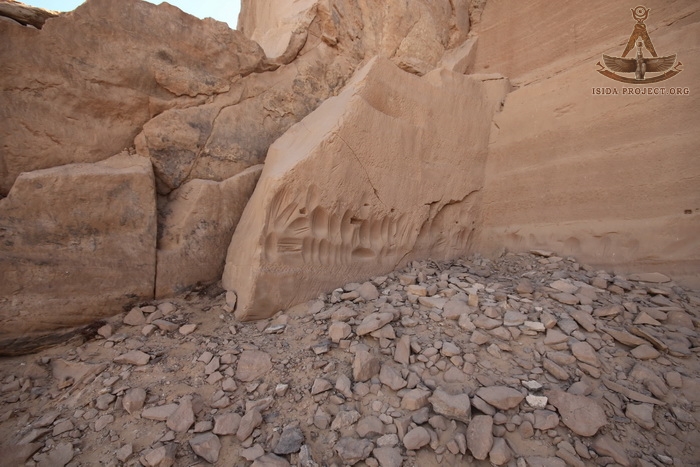
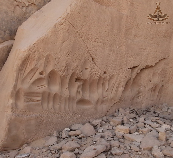
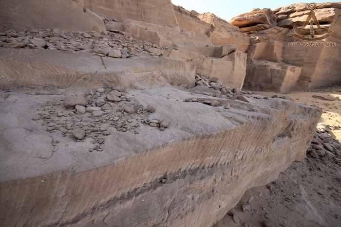
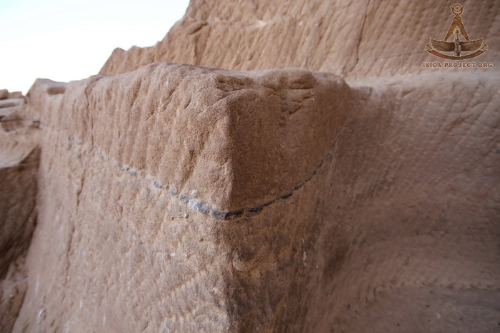
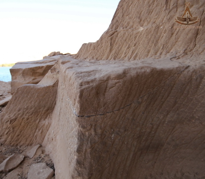
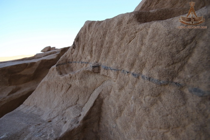
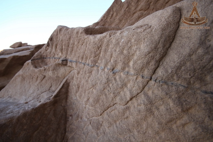
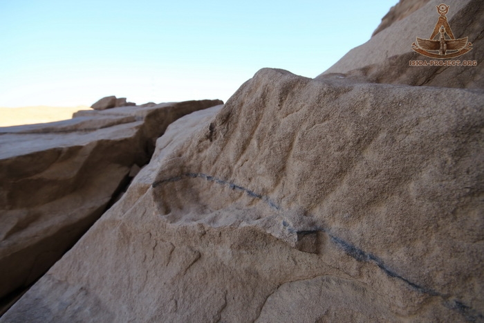
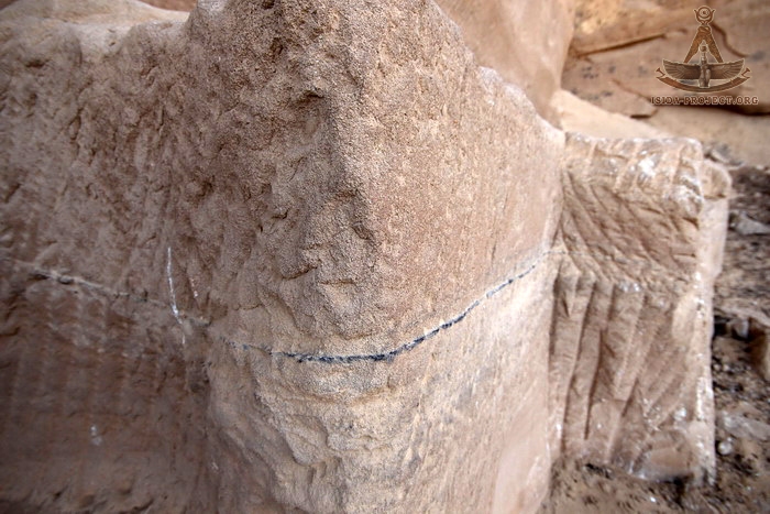
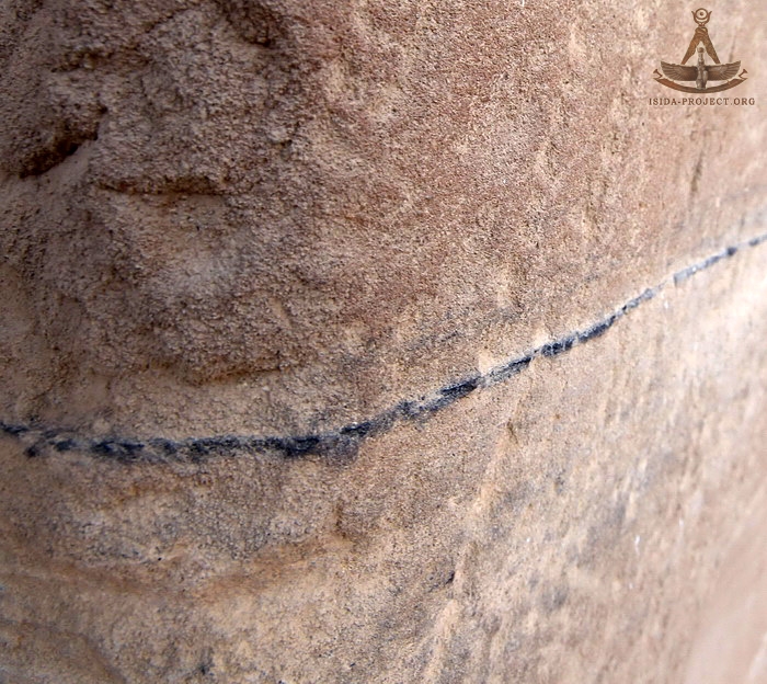
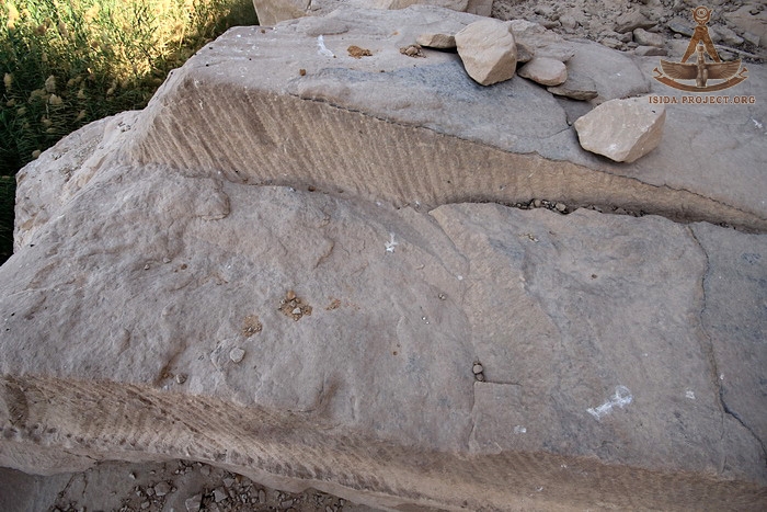
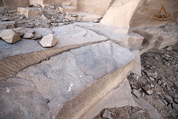
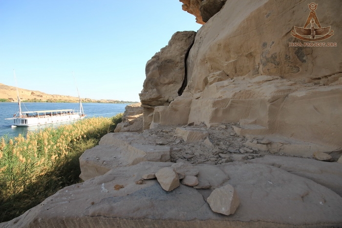
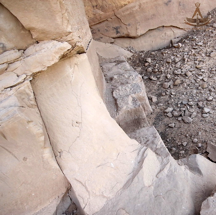
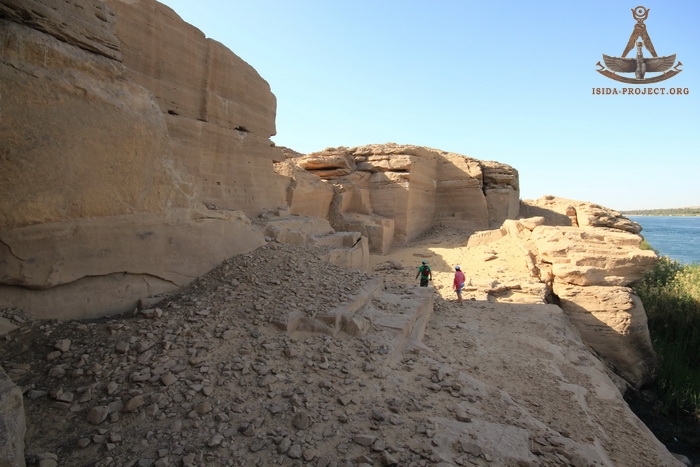
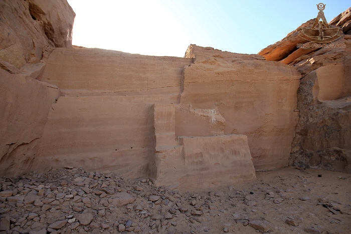
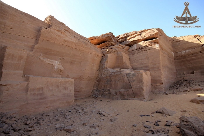
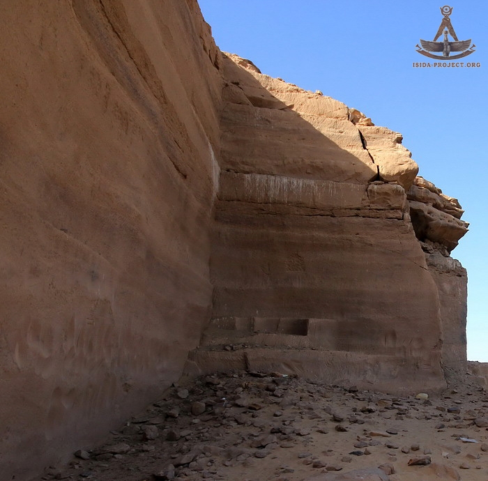
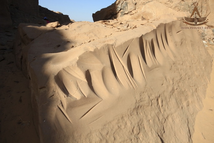
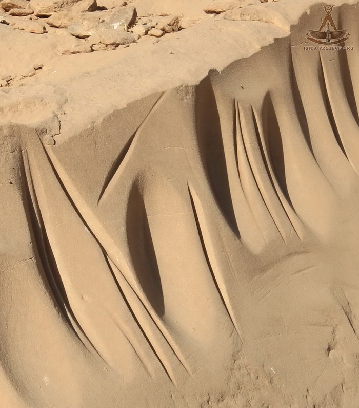
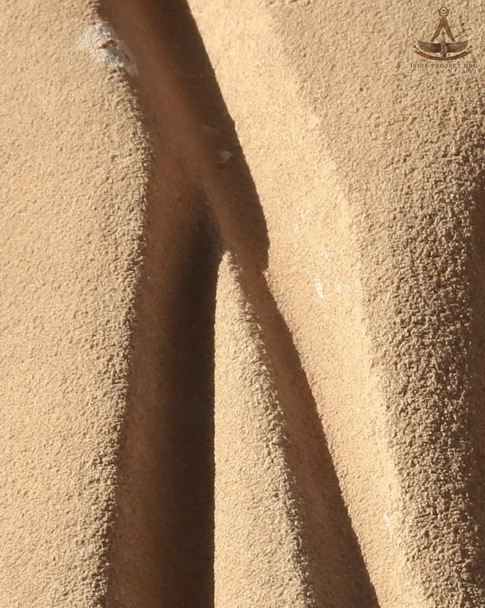
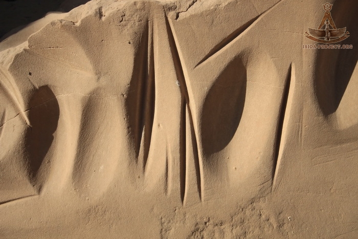
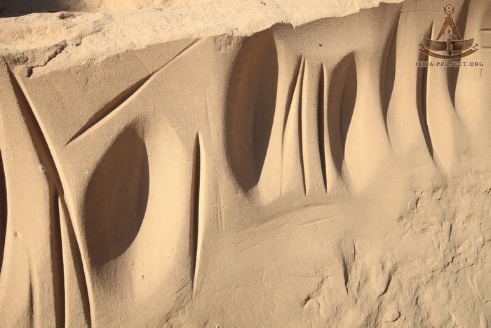
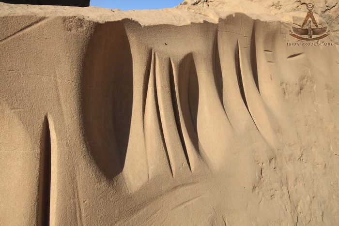
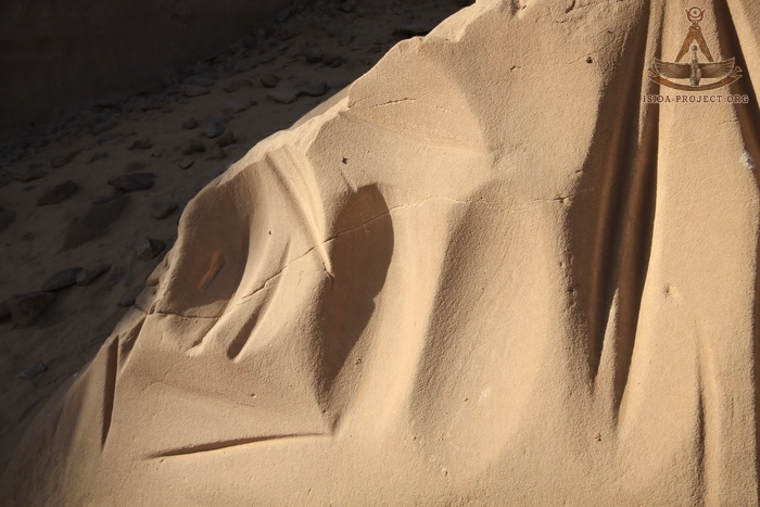
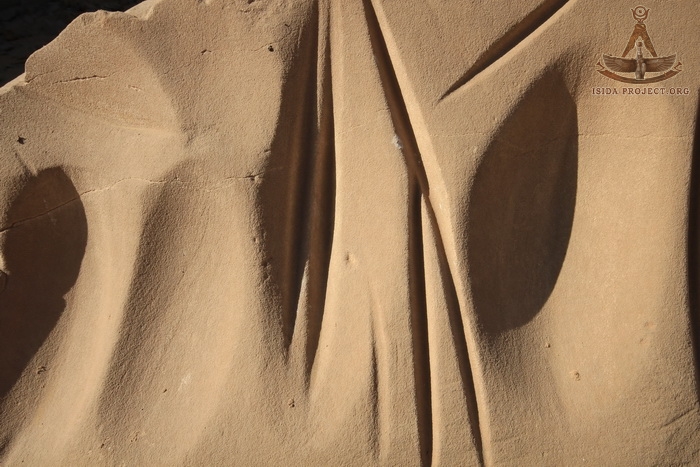
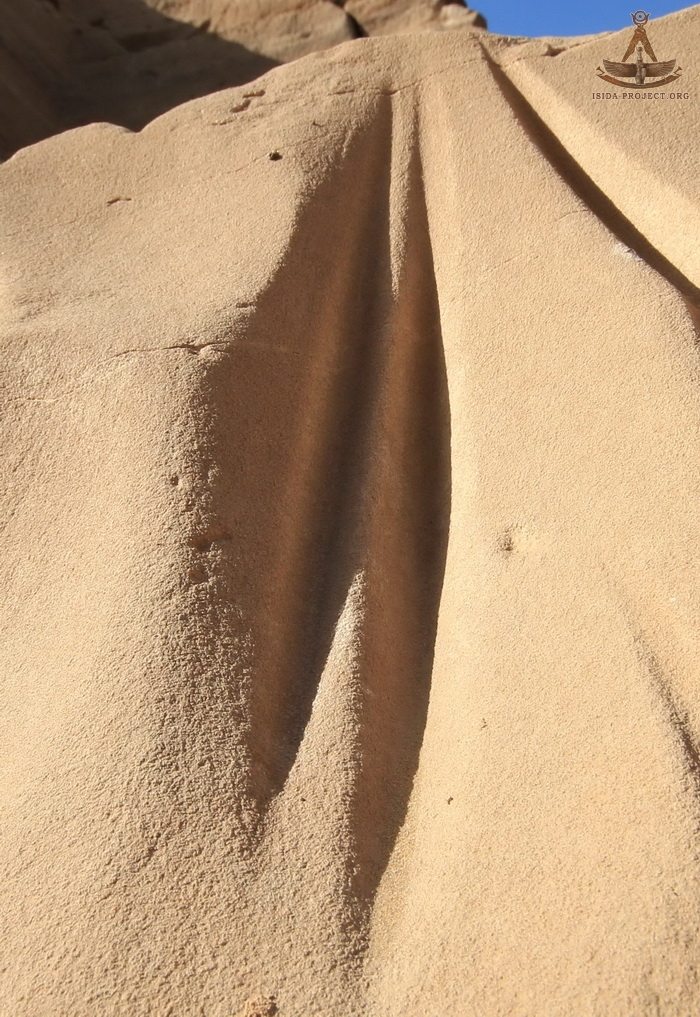
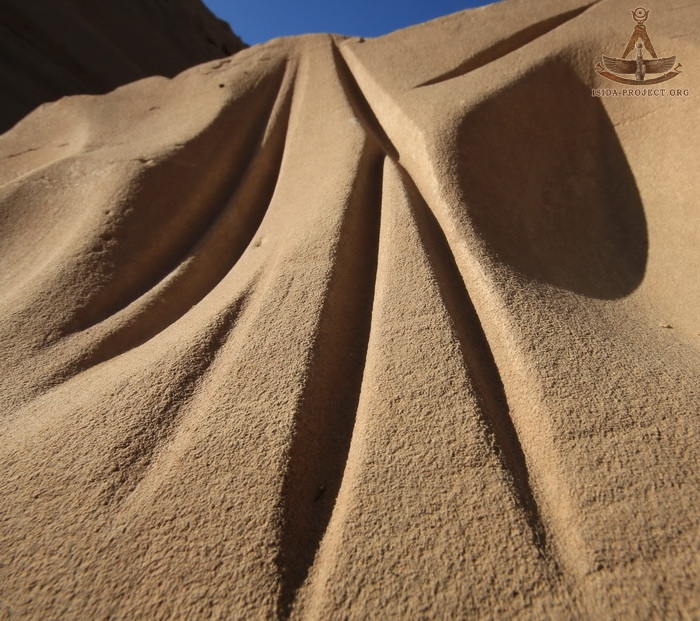
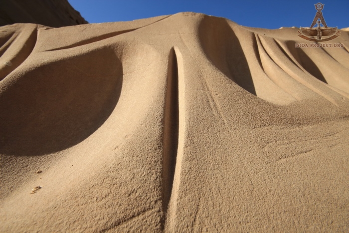
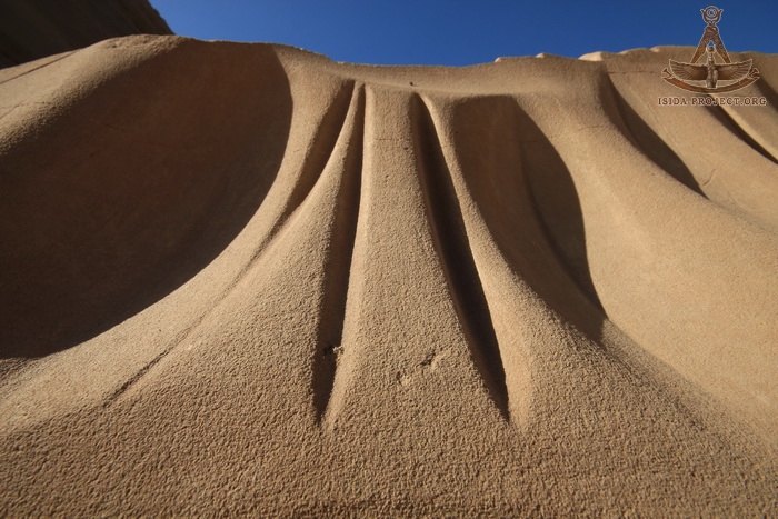
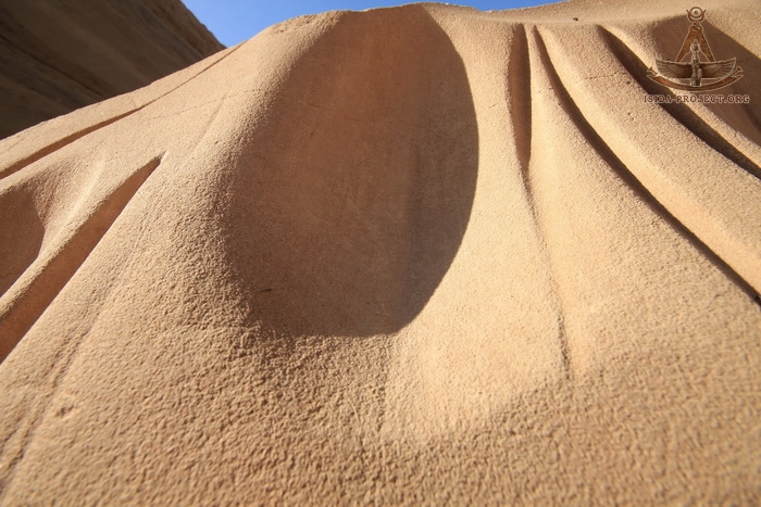
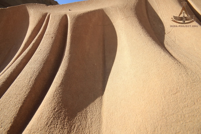
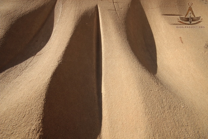
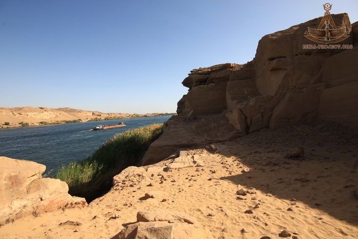
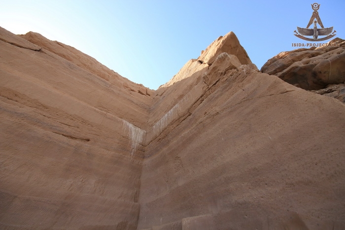
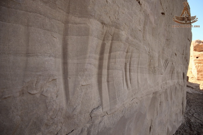
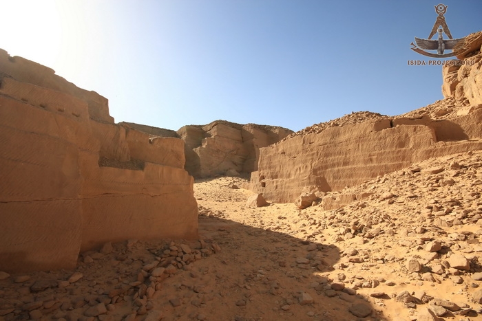
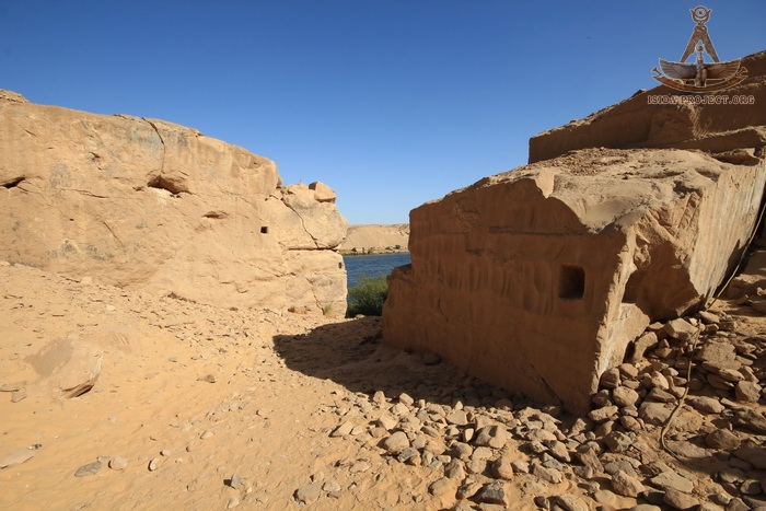
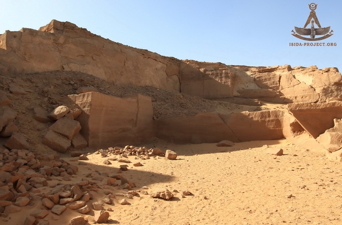
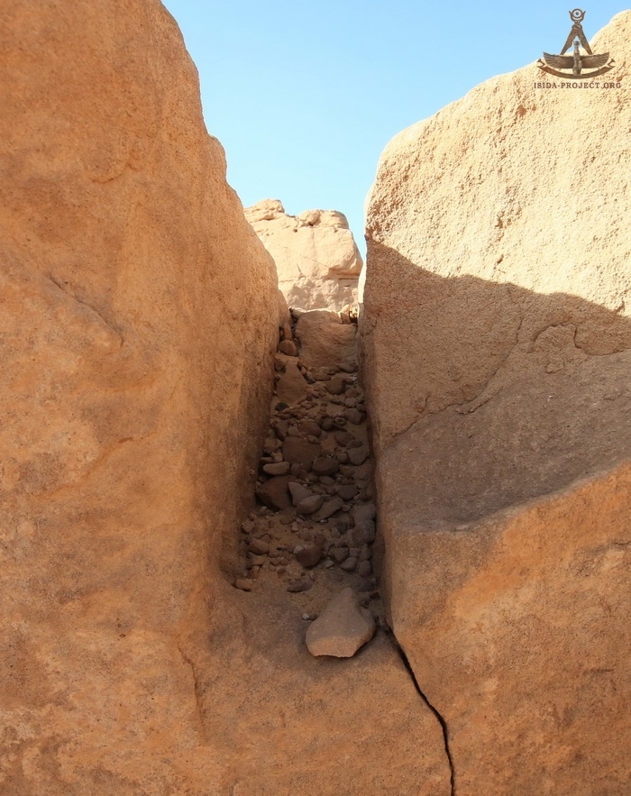
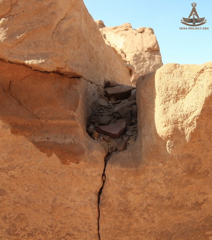
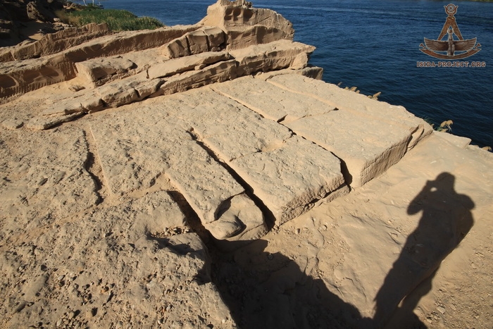
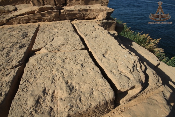
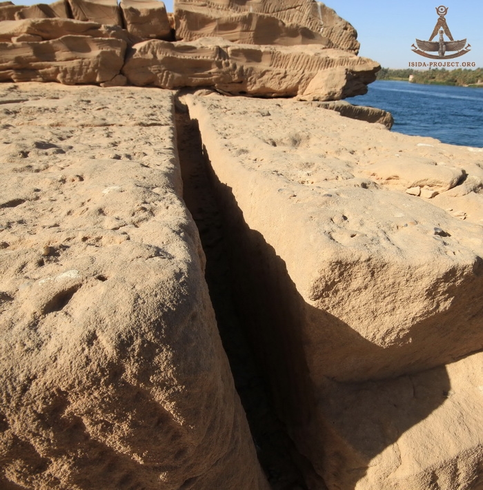
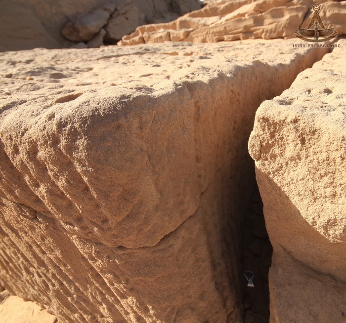
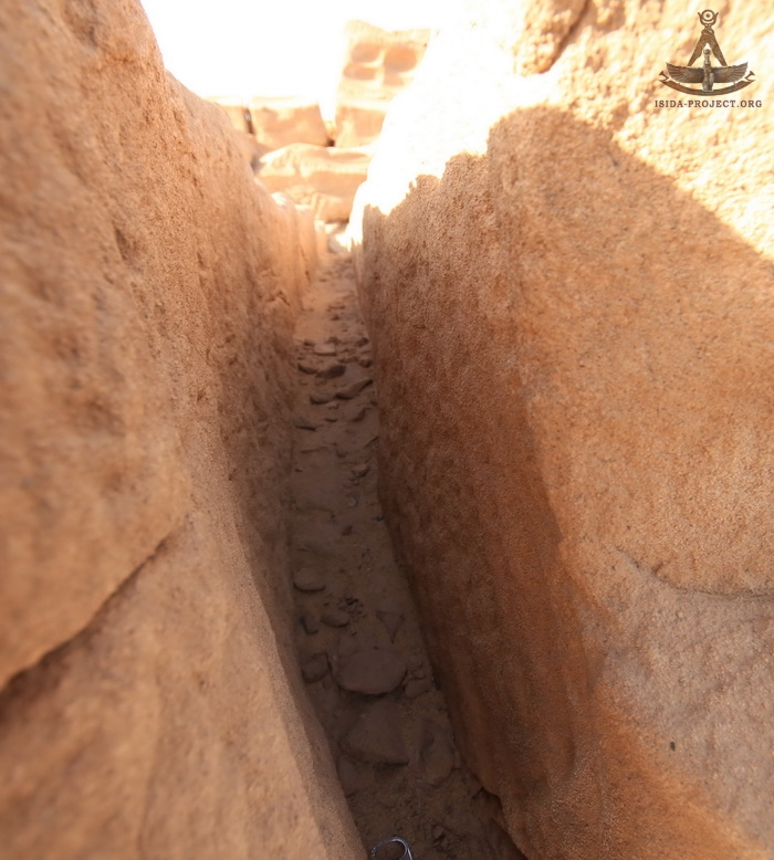
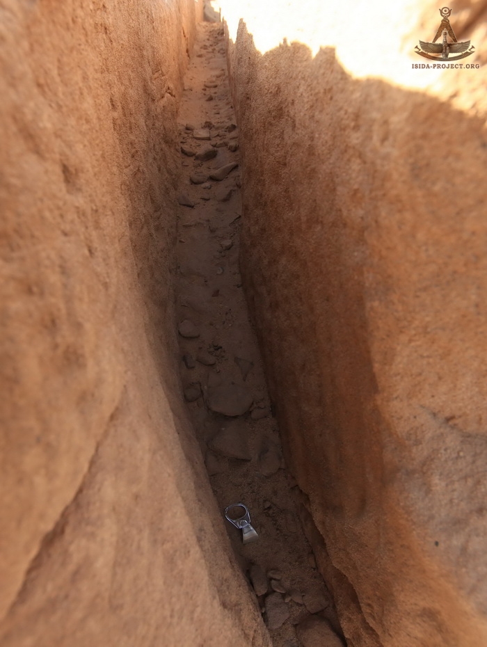
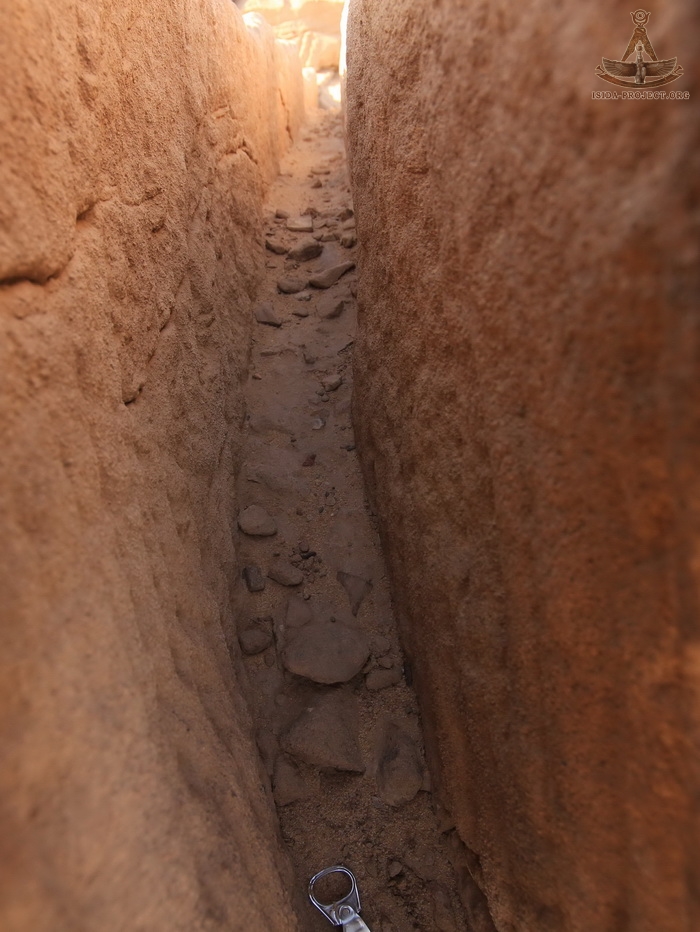
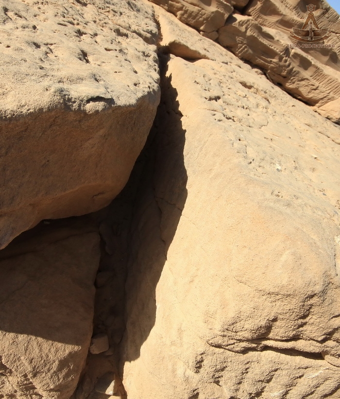
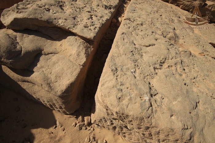
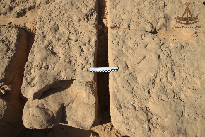
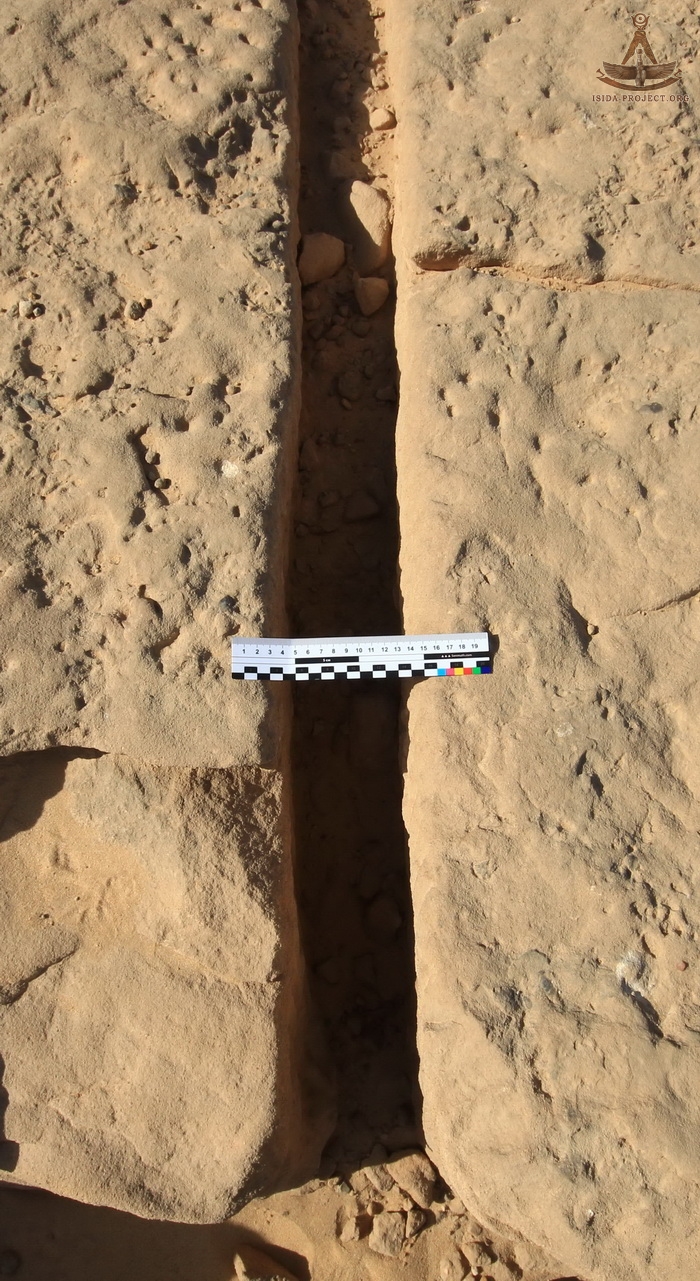
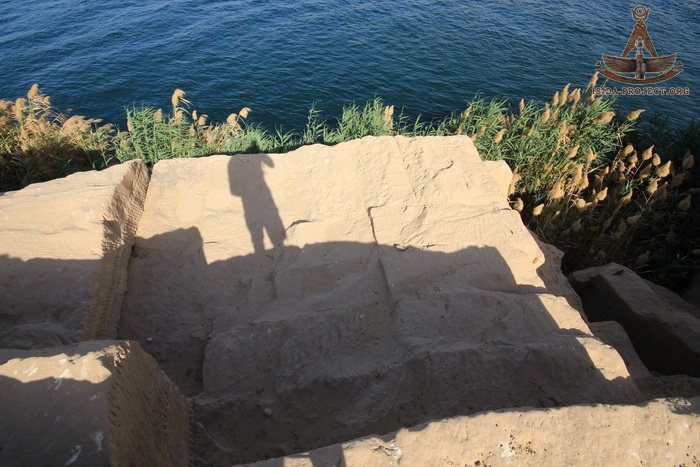
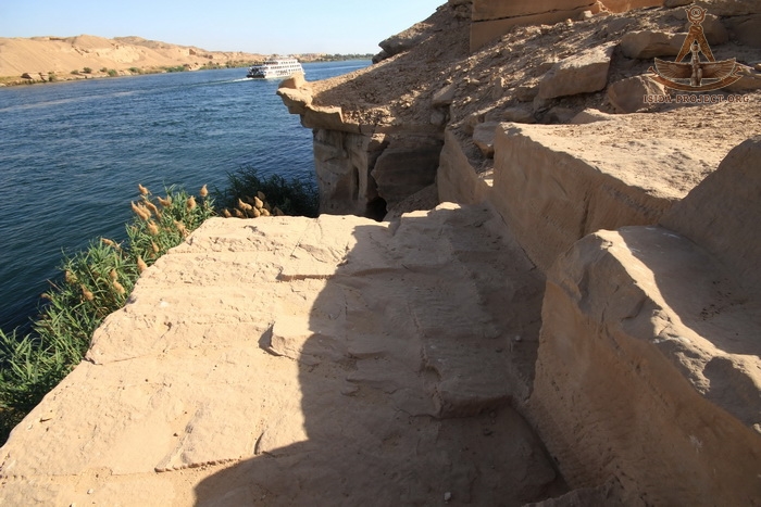
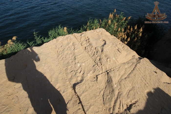
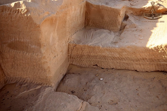
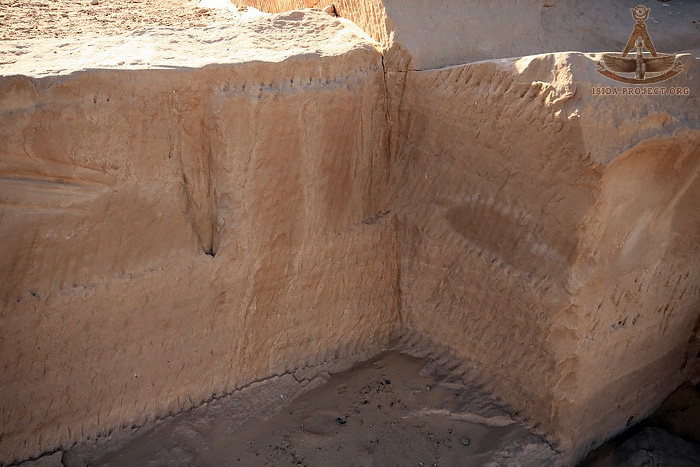
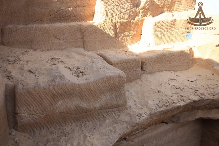
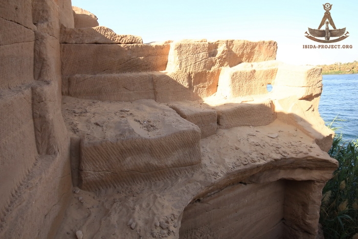
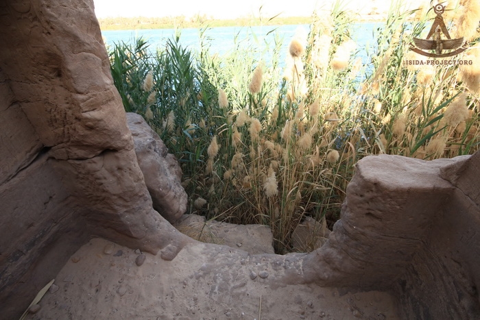
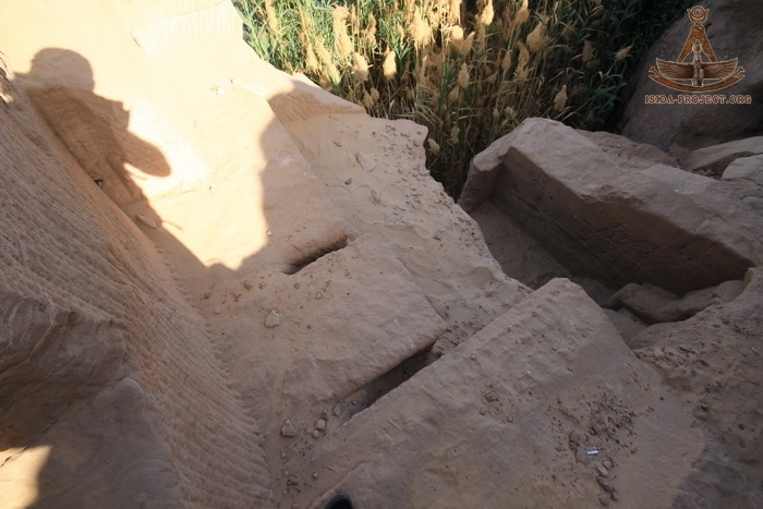
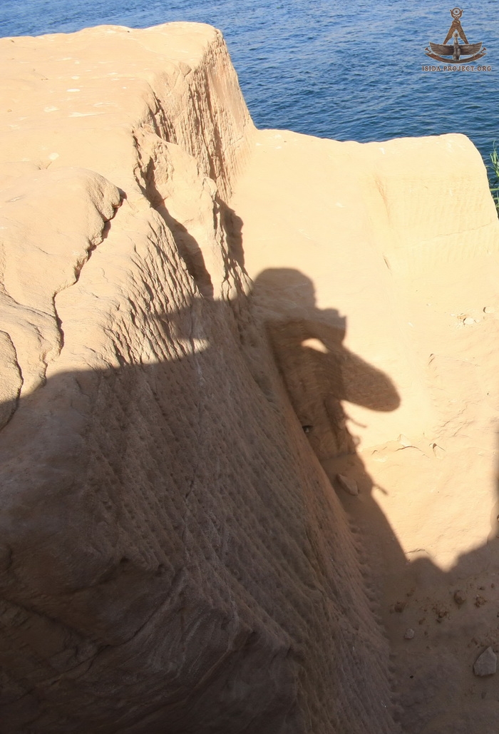
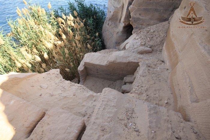
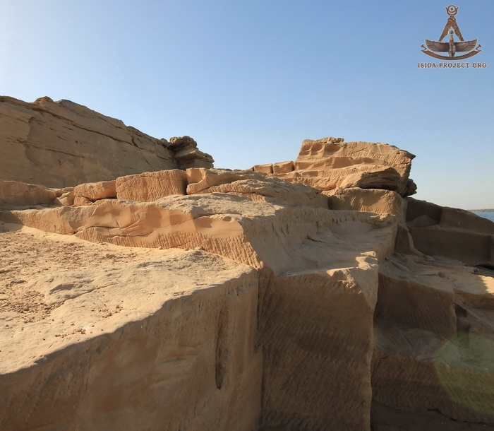
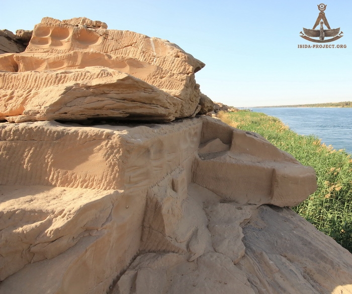
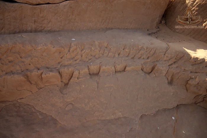
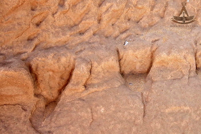
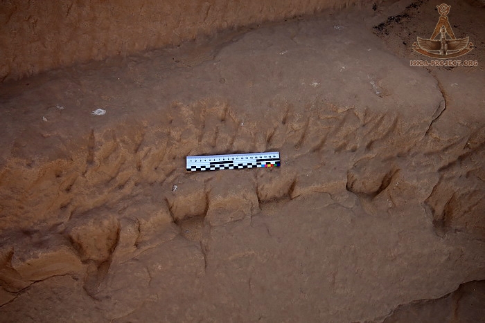
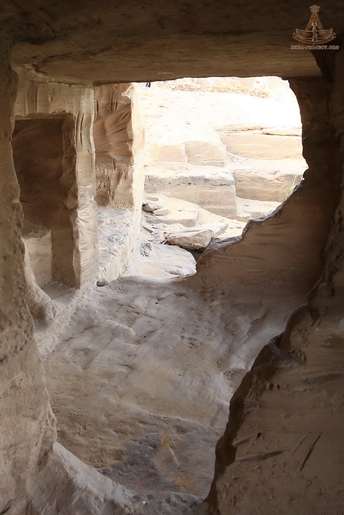
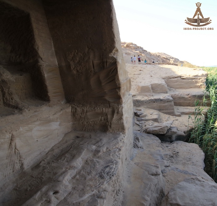
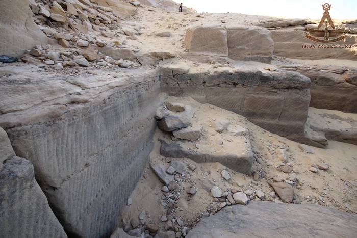
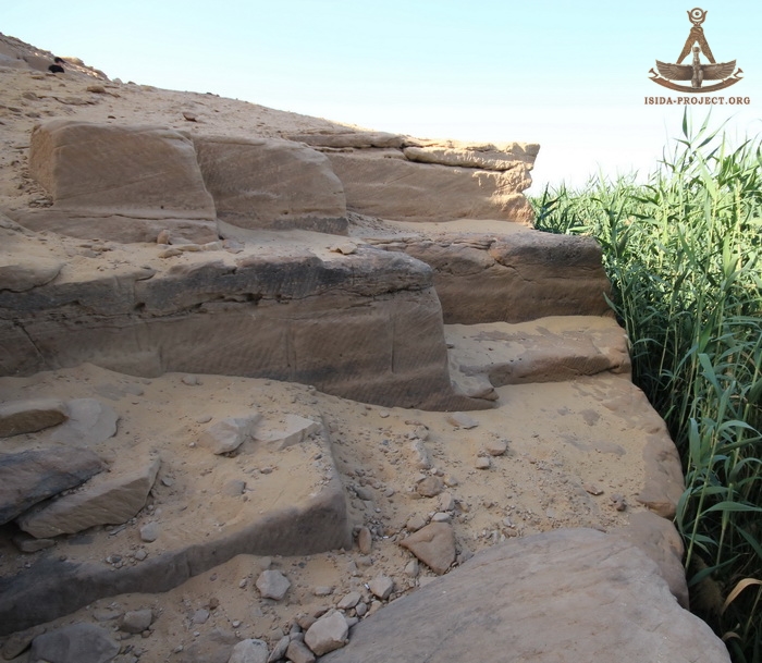
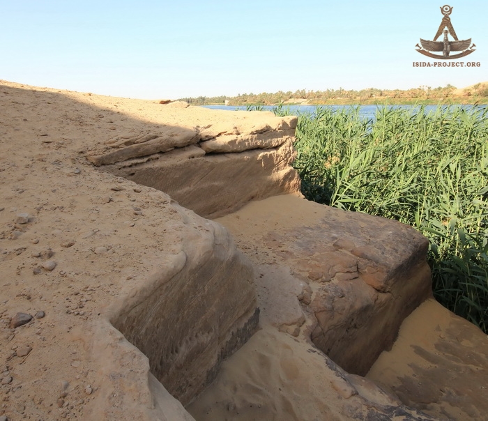
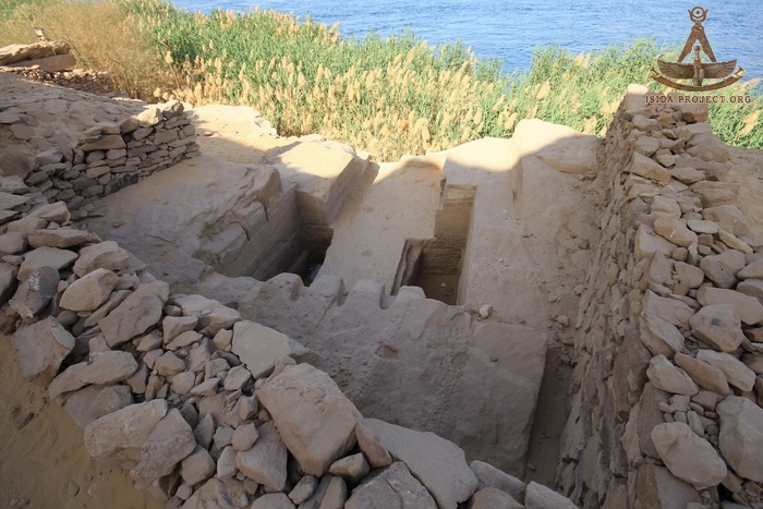
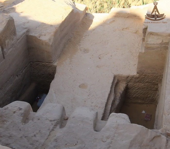
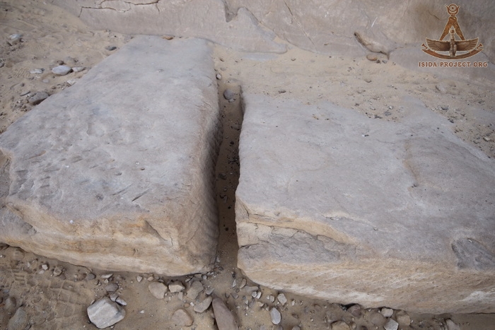
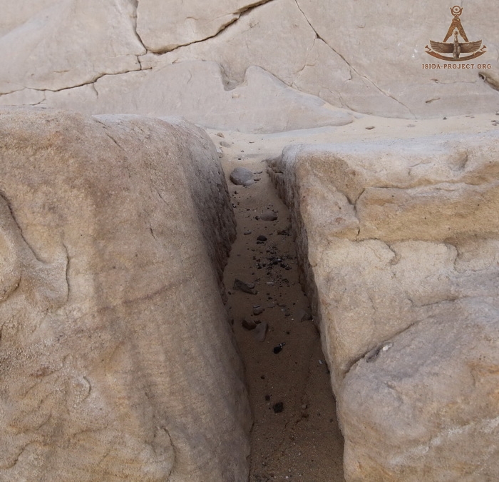
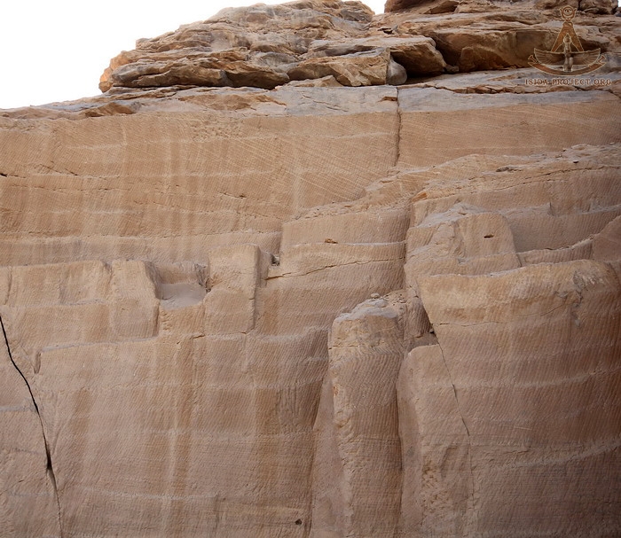
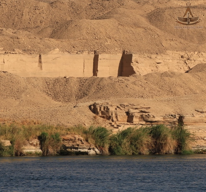
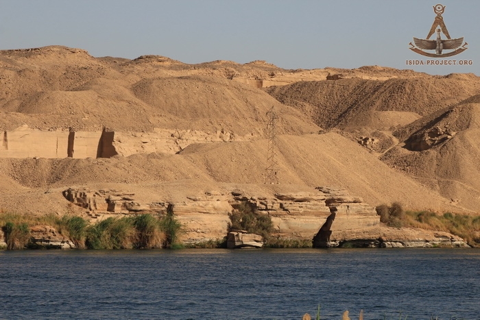
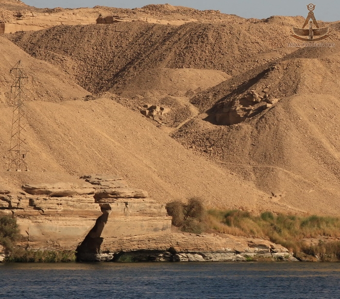
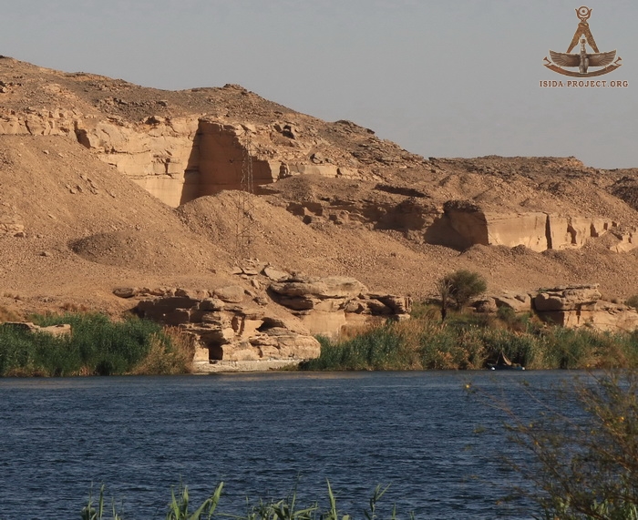
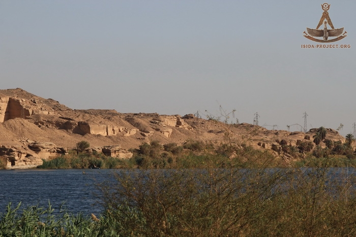
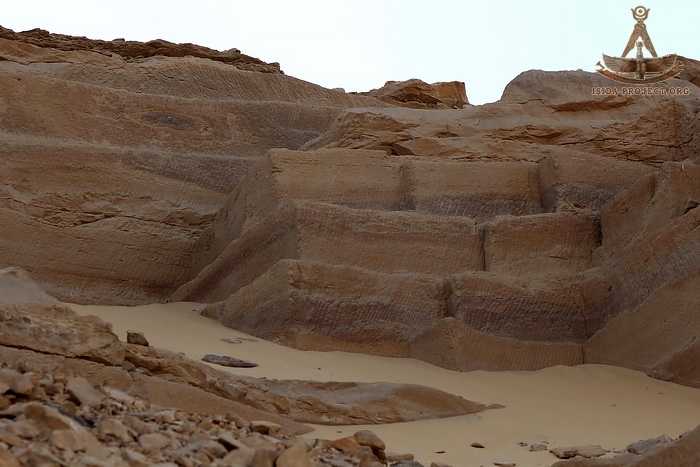
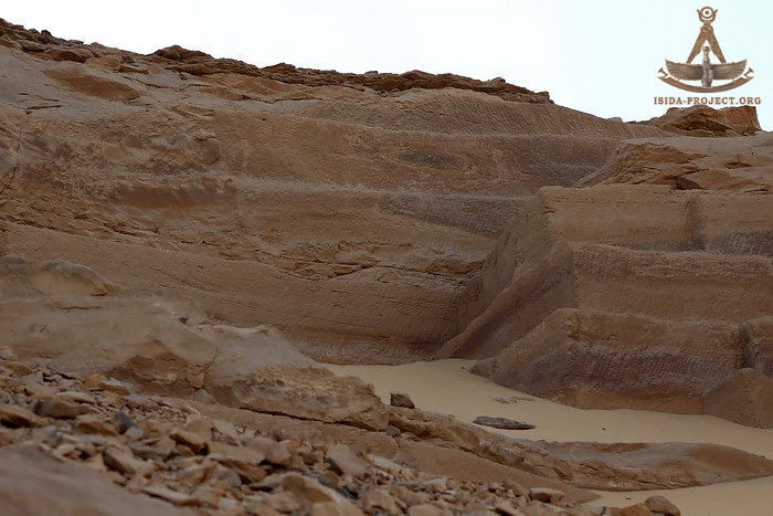
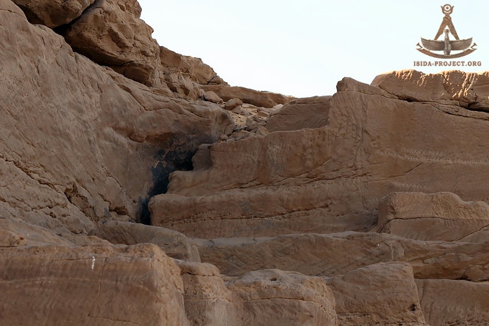
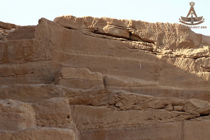
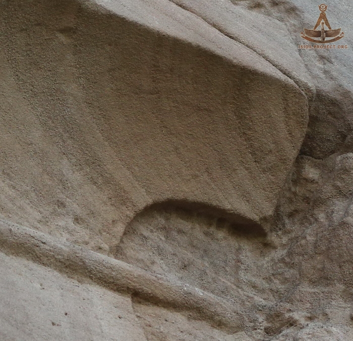
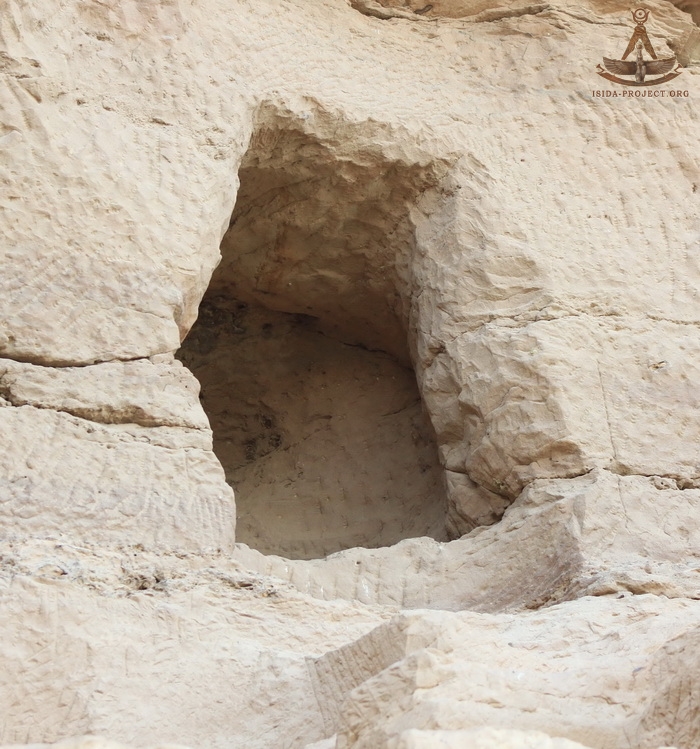
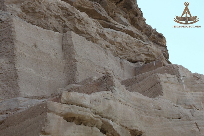
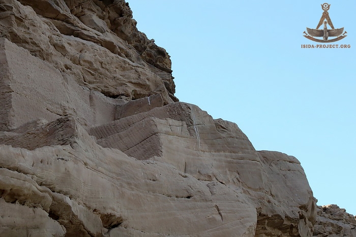
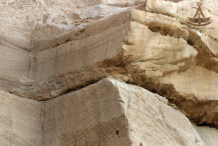
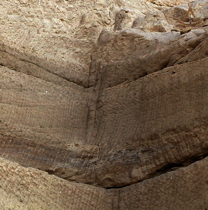
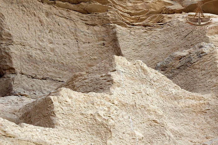
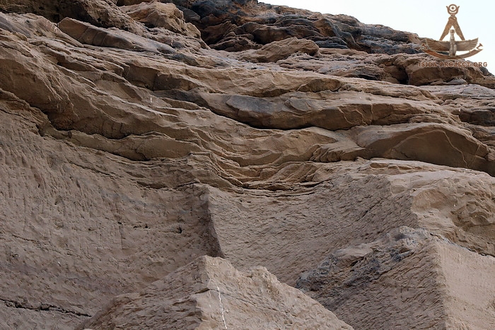
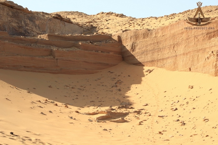
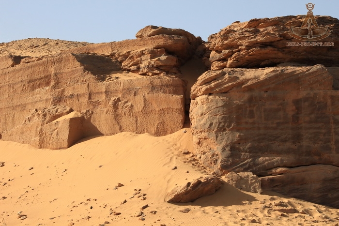
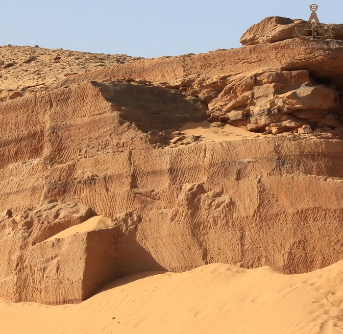
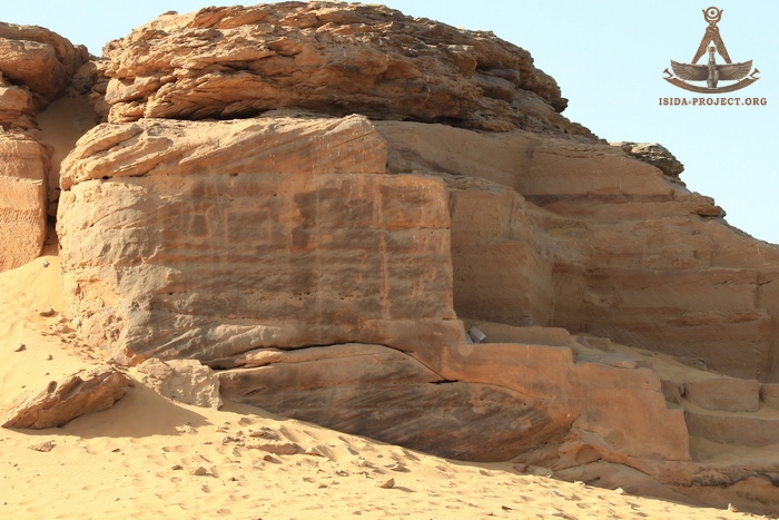
- ASWAN - Gebel-el-Silsila. This is the name of a rocky canyon, located between Kom Ombo and Edfu, through which the Nile carries its waters, and where the high rocks are passing along the very edge of the water surface, forming both banks of the Nile and covering the area about 20 square kilometers. Here the ancient Egyptian stone quarry is located, where the ancient builders mined a sandstone.
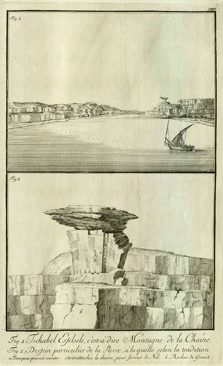
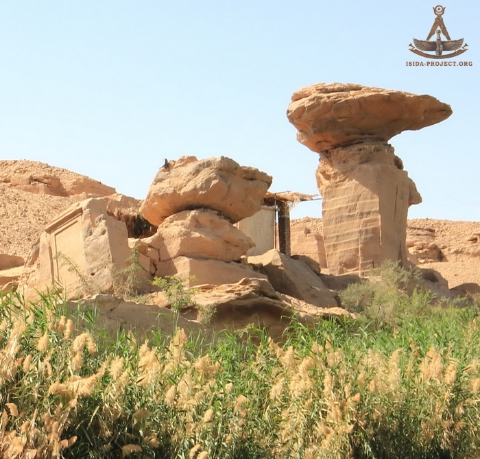
The name of Gabel-el-Silsila has its own ancient history. In ancient times the Nile overcame a number of thresholds dangerous for navigation in this area. It appeared a big problrm for sailing between the regions of Elephantine and Edfu. In the Pharaonic times, this area was known as Khennui, that meant "the place of rowing." There is a high cliff in the West Bankof the river, called "The Capstan". According to a local legend, it was the place, where a certain "great chain" was tossed from the east to the west bank of the Nile ("Silsila" in Arabic). This legend was reflected in the picture of Danish naval captain and explorer Frederick Louis Norden in his work "Voyage d'Egypte et de Nubie " published in 1780.
English Egyptologist Arthur Weigall in his book "Antiquities of Egypt" argues that the word "Silsileh" is a distorted Roman writing of the original Egyptian name for the city of Khol-Khol, which means a barrier or frontier. "The town of Khennui was sometimes known to the later Egyptians as Khol-Khol, which means a barrier or frontier ; and the Romans, who placed a garrison here in later times, corrupted the word into Sil-sil, or Silsili. The mediaeval Arabs incorrectly identified the name with Silsileh, the Arabic word for "'chain." Arthur Weigall
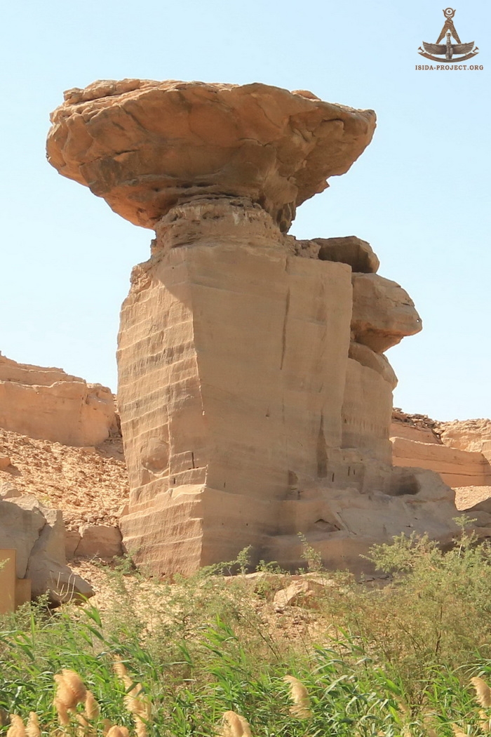
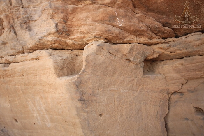
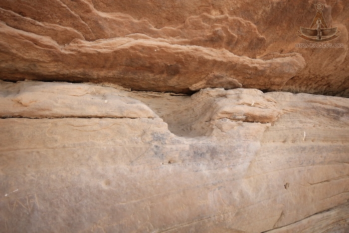
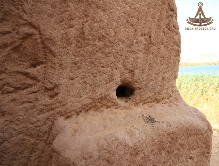
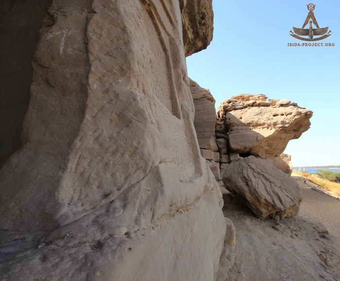
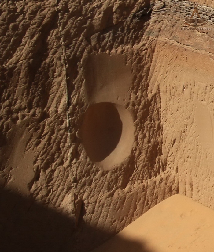
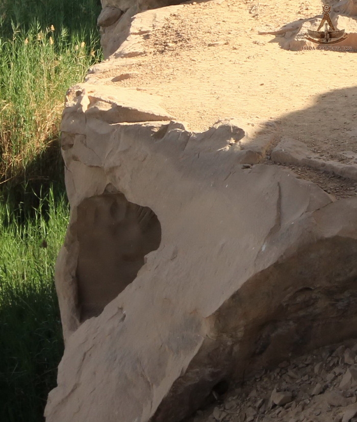
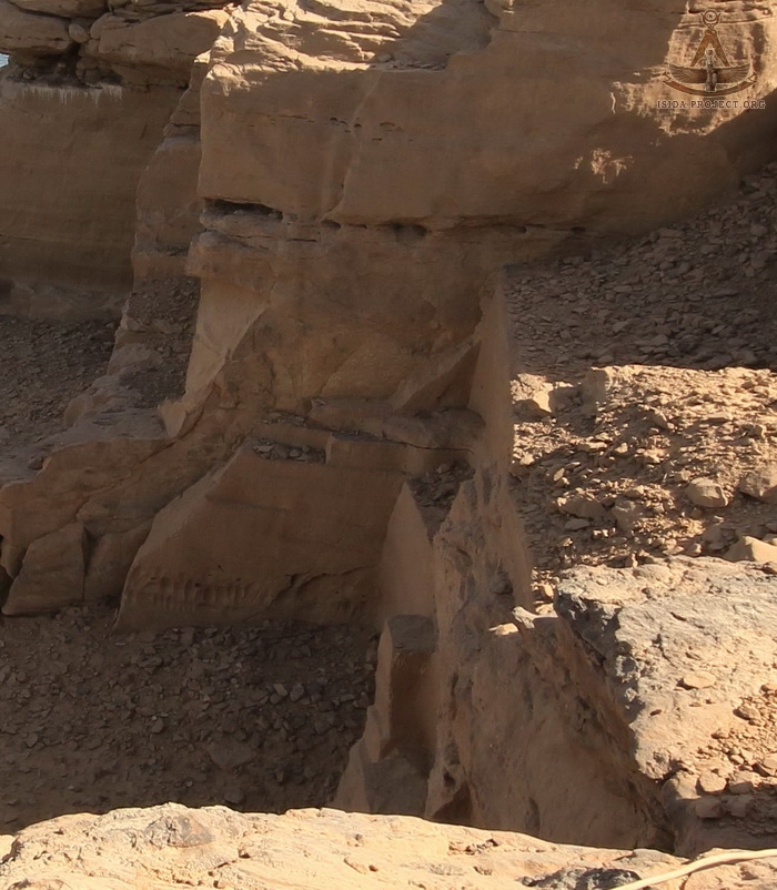
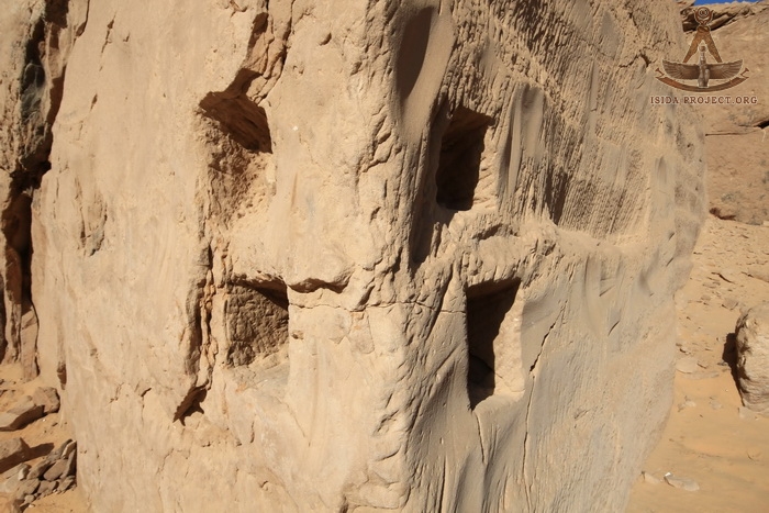
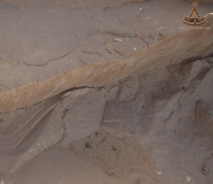
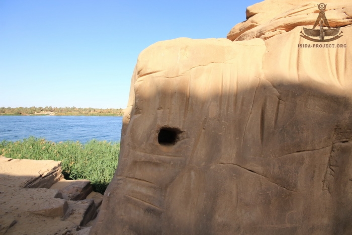
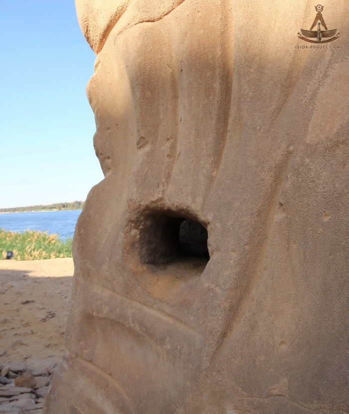
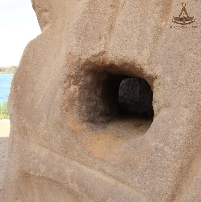
But at the same time, one of the possible reasons, which gave birth to that legend, besides the mentioned above "time error", concerning the translation of the name of the area, could have been the existence of fairly large through-holes in the rocks, which seems too "strong" for fixing of ancient Egyptian boats on the pier.
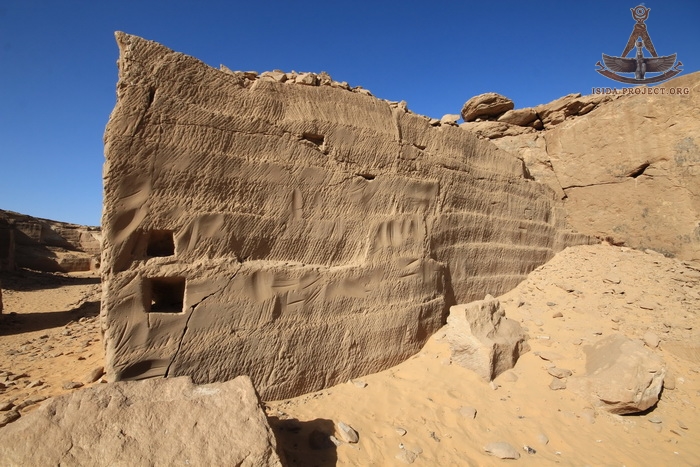
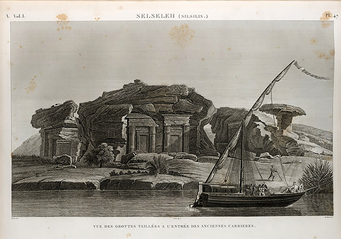
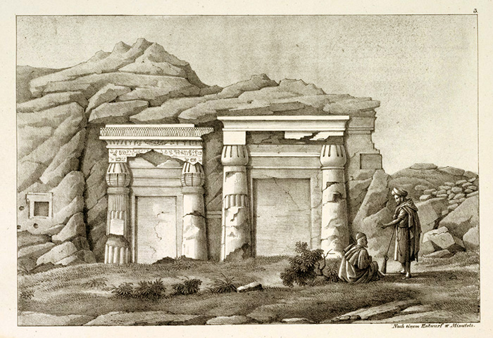
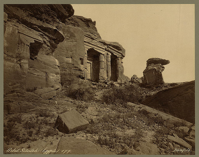
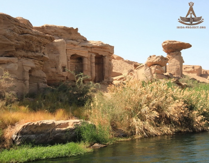
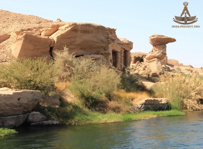
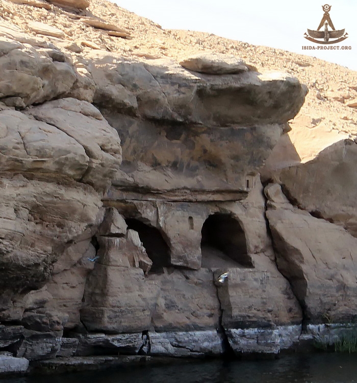
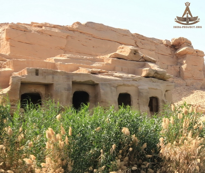
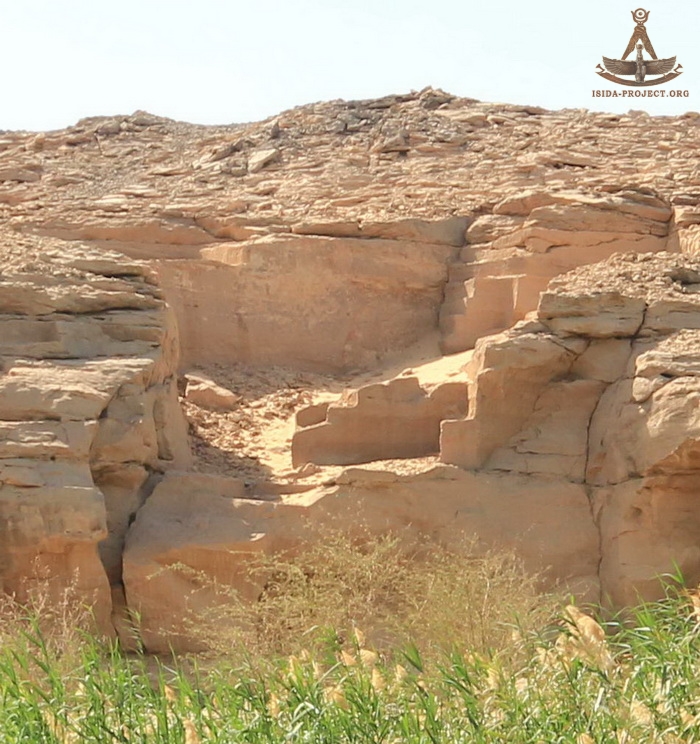
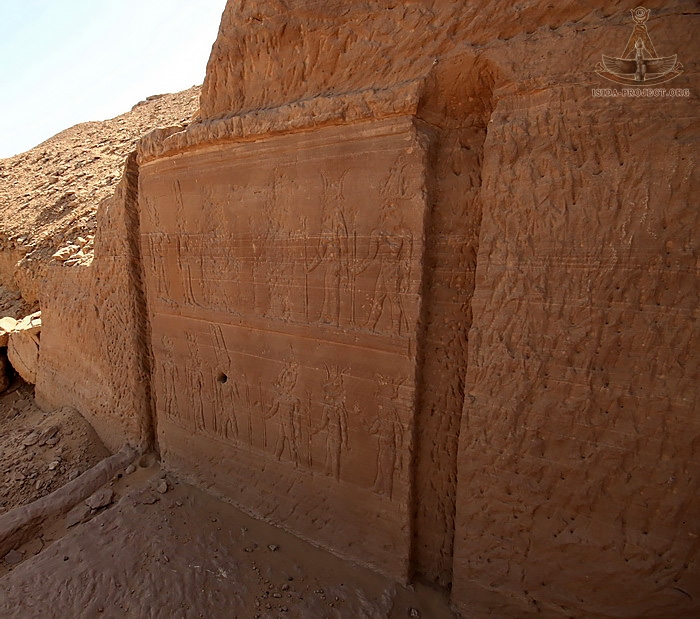
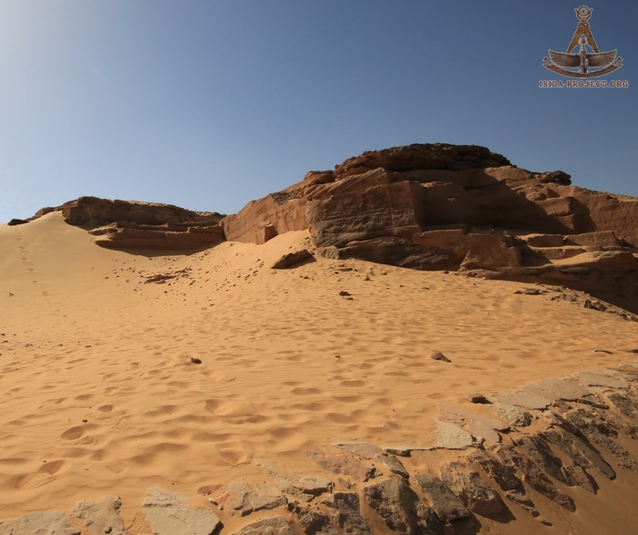
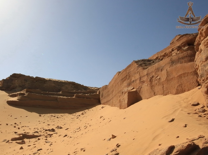
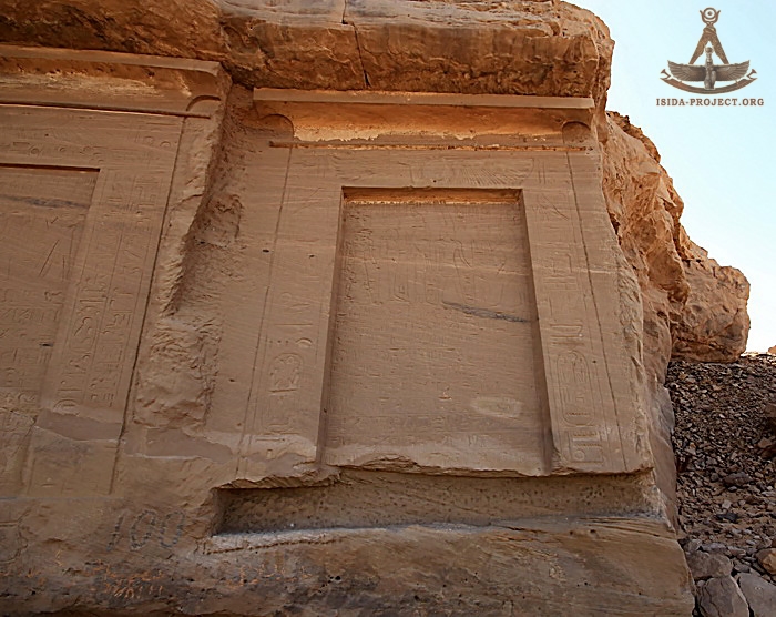
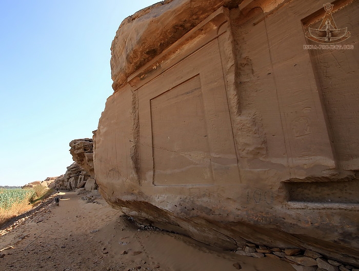
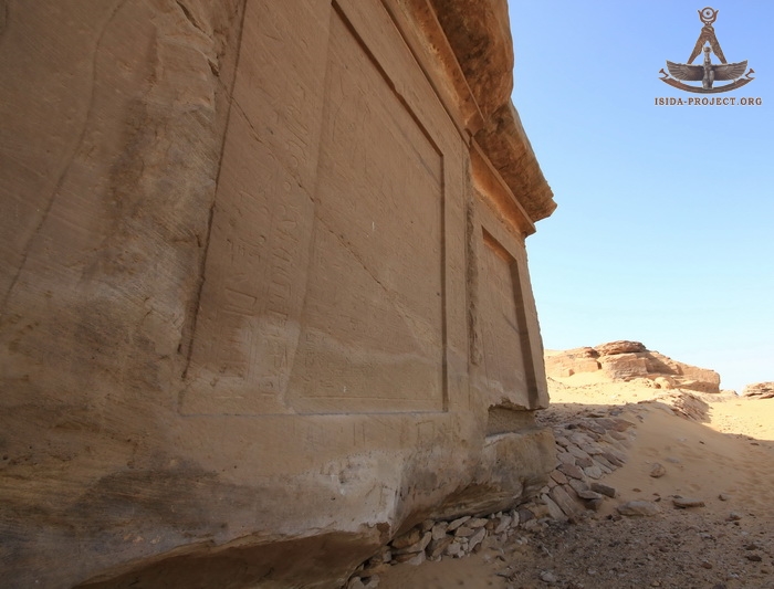
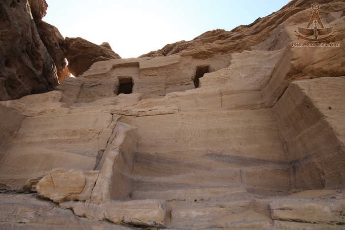
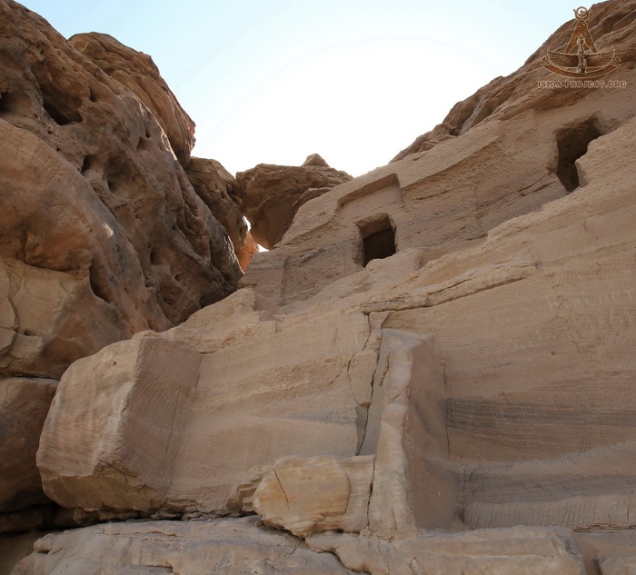
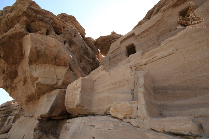
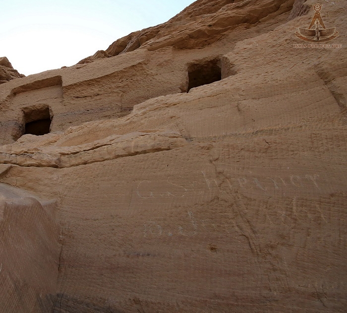
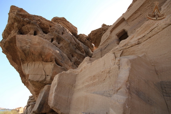
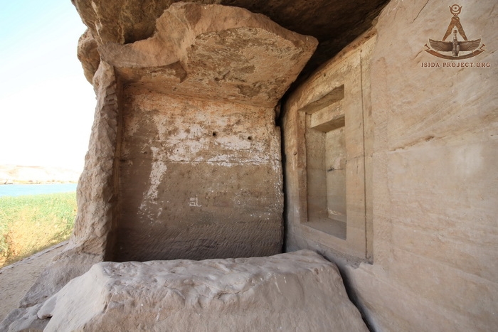
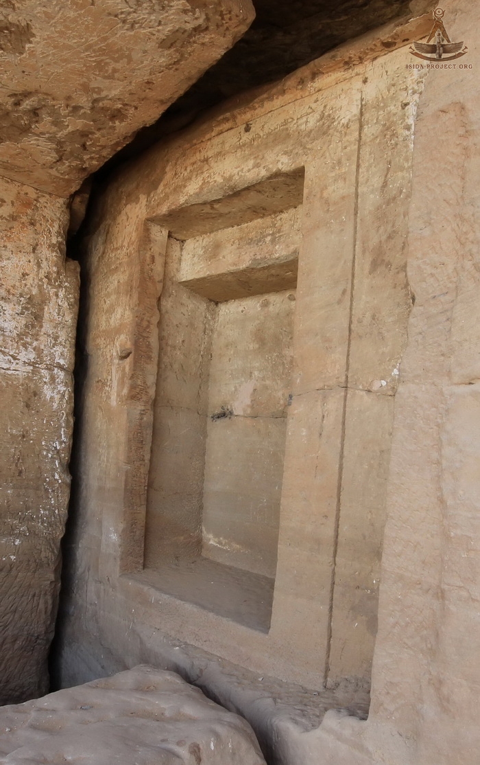
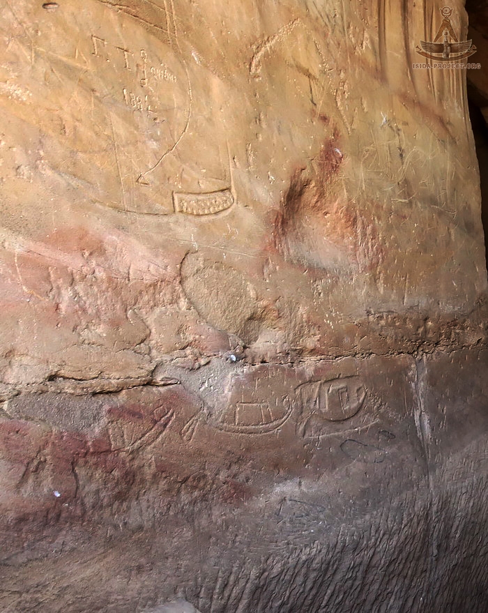
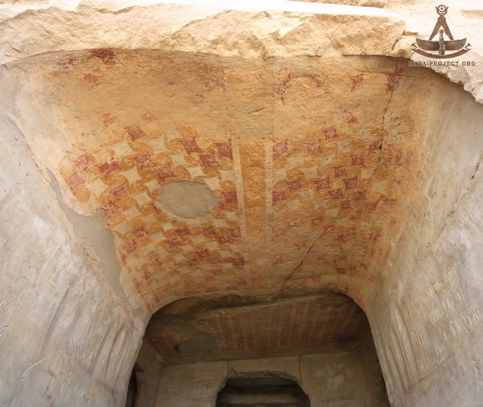
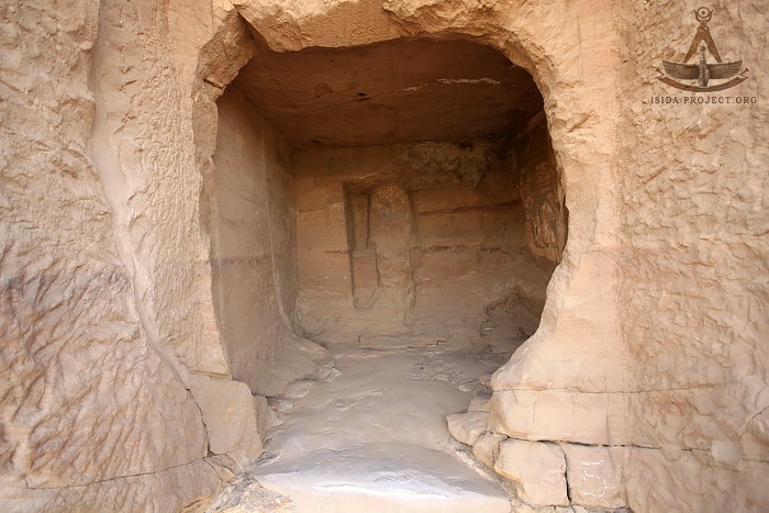
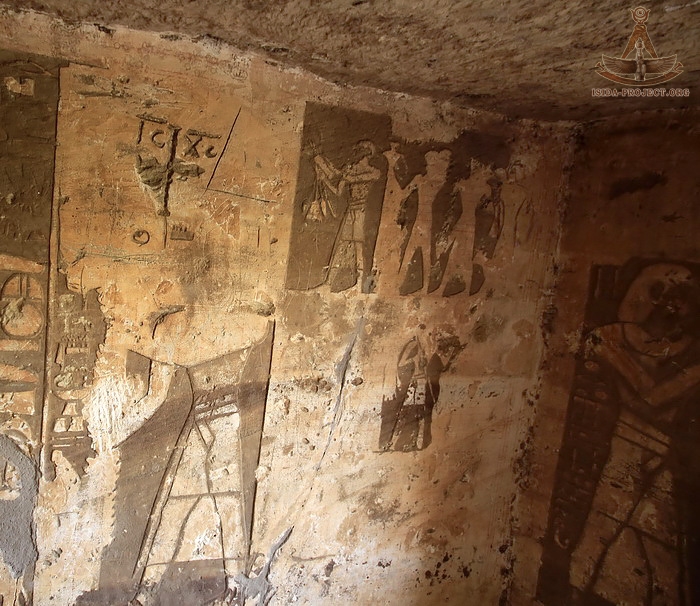
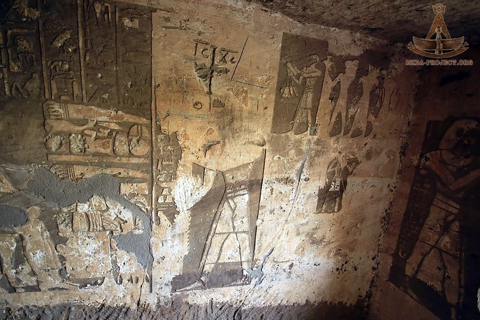
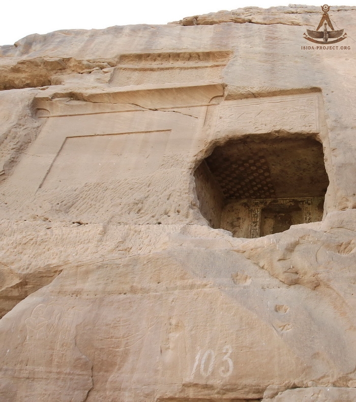
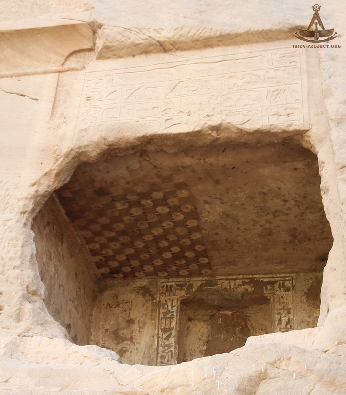
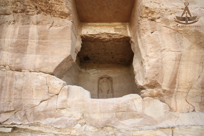
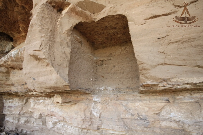
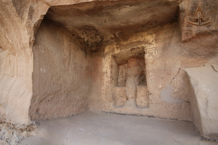
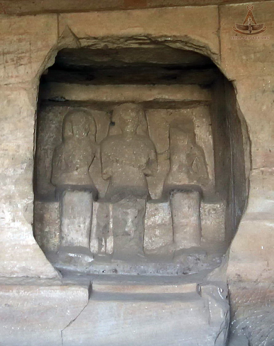
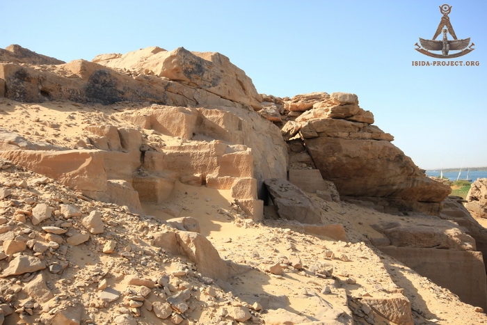
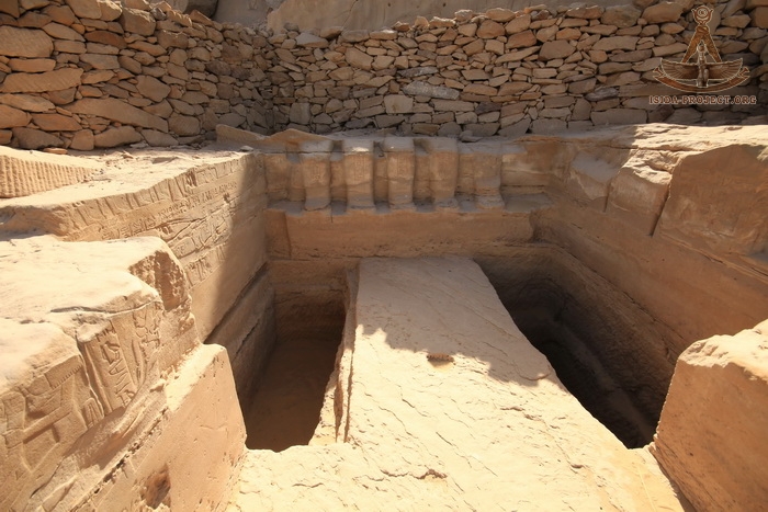
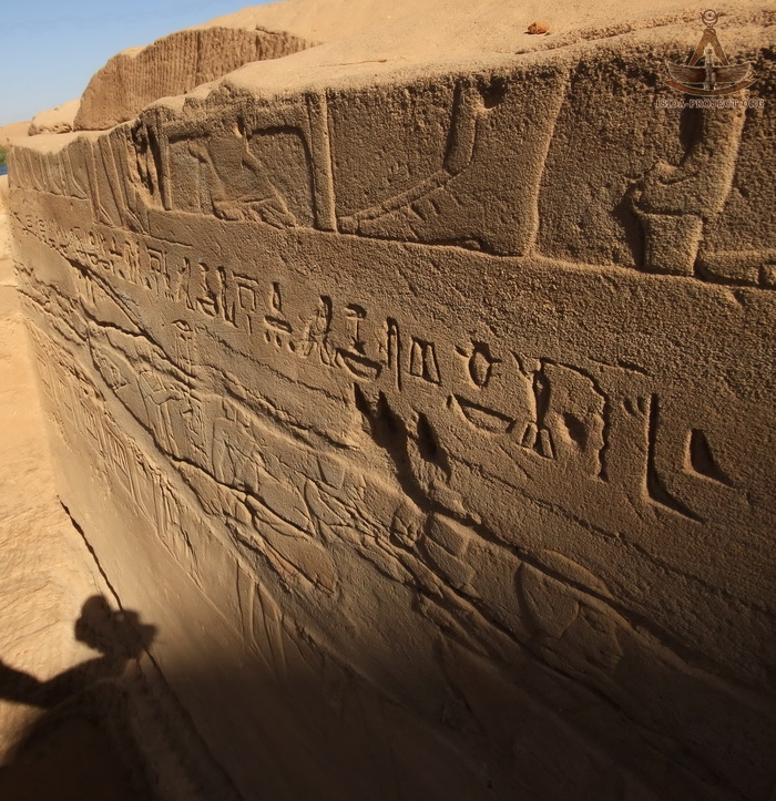
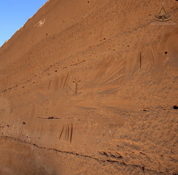
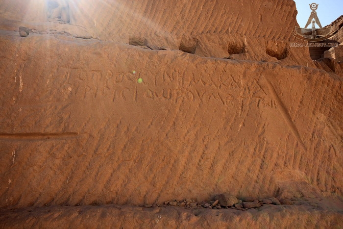
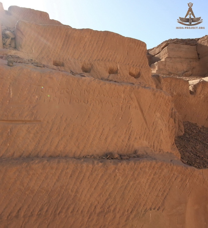
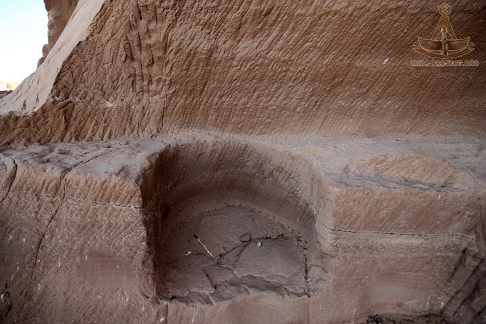
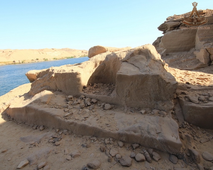
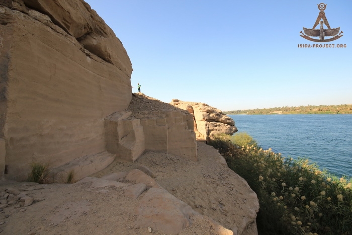
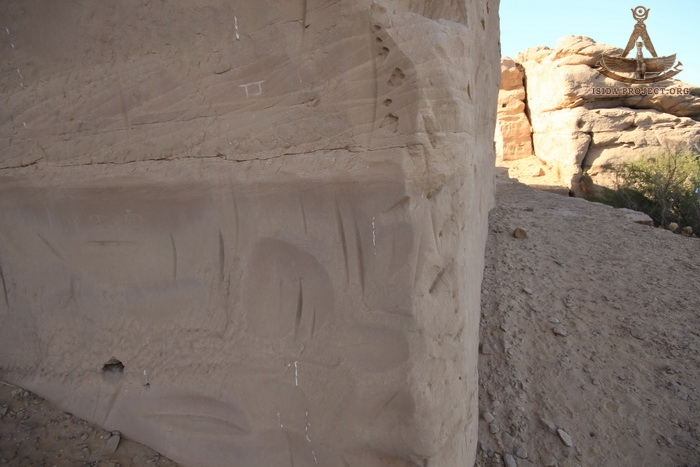
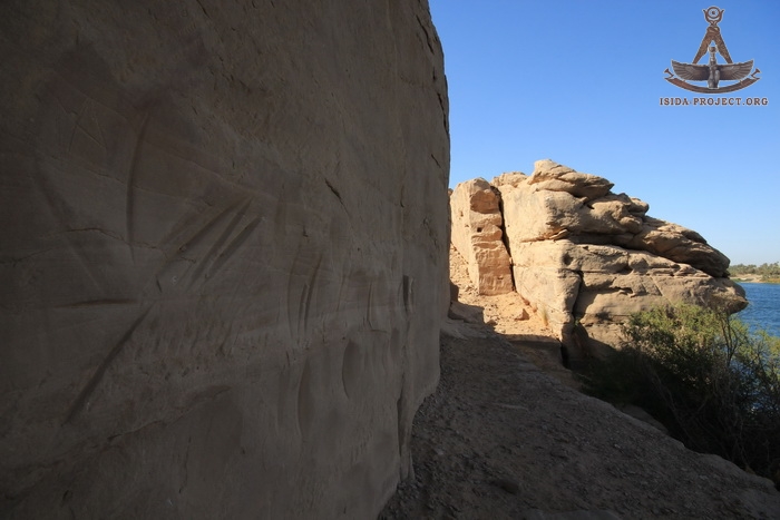
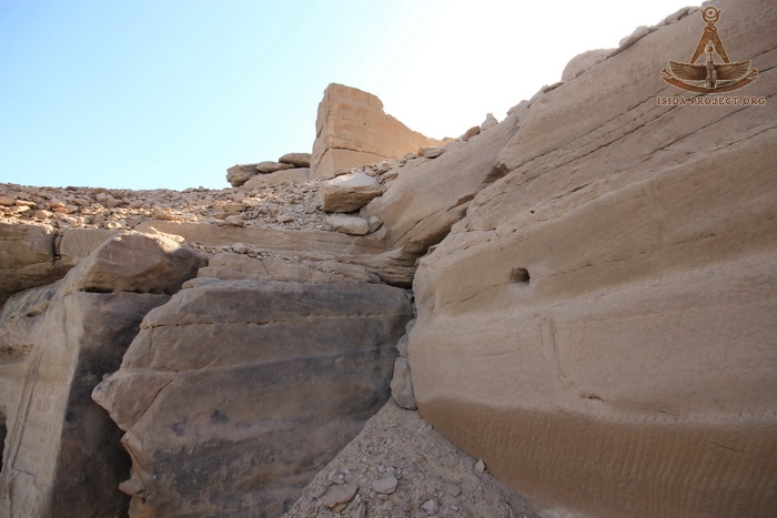
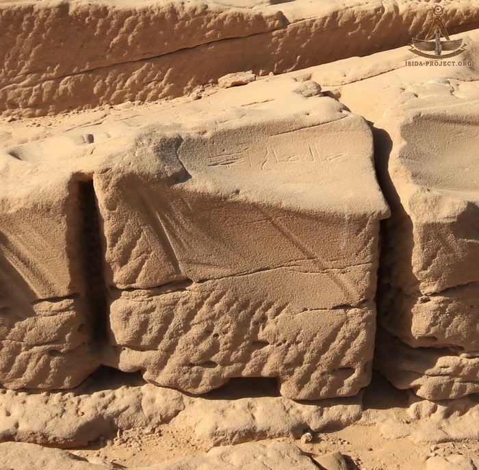
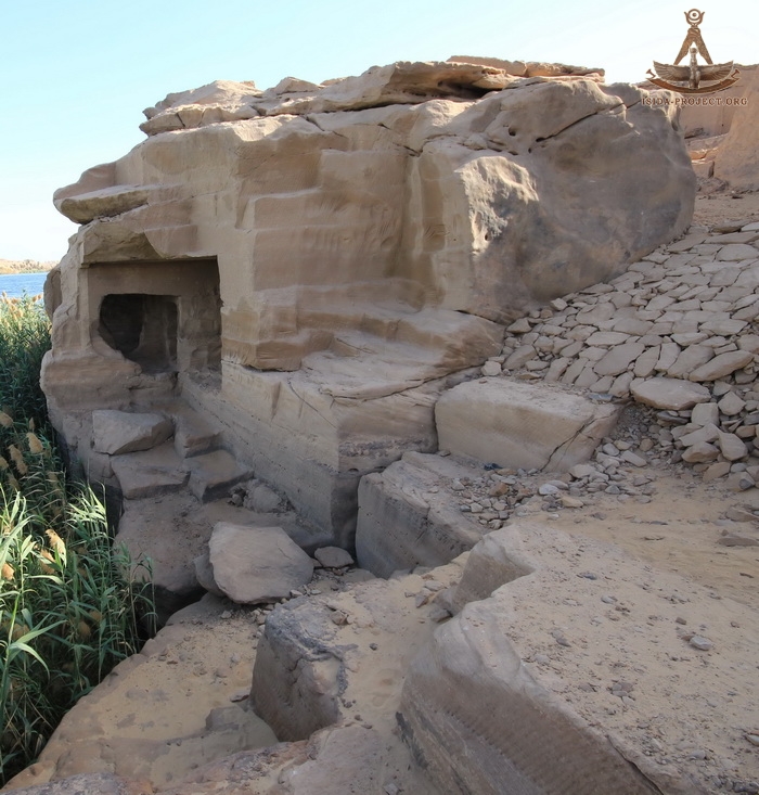
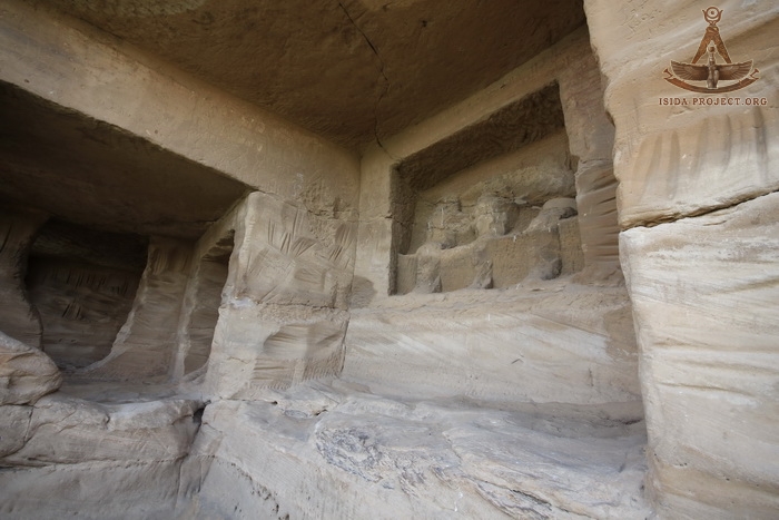
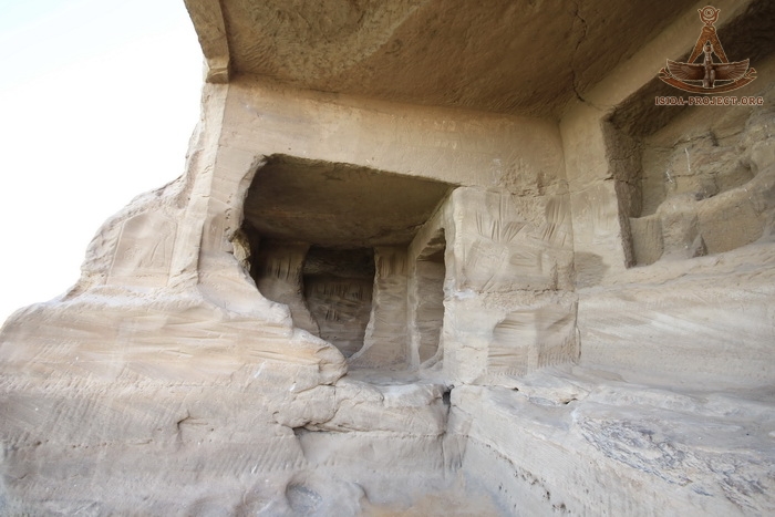
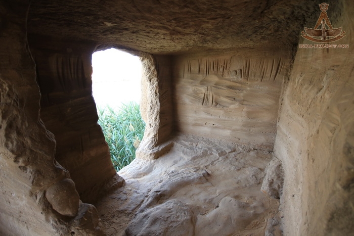
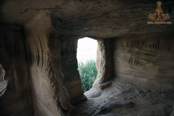
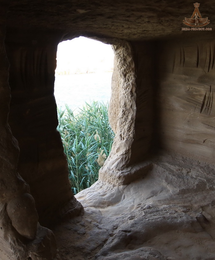
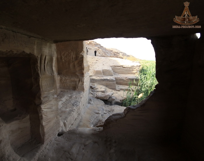
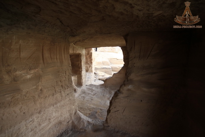
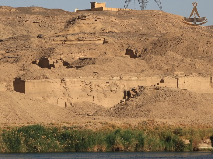
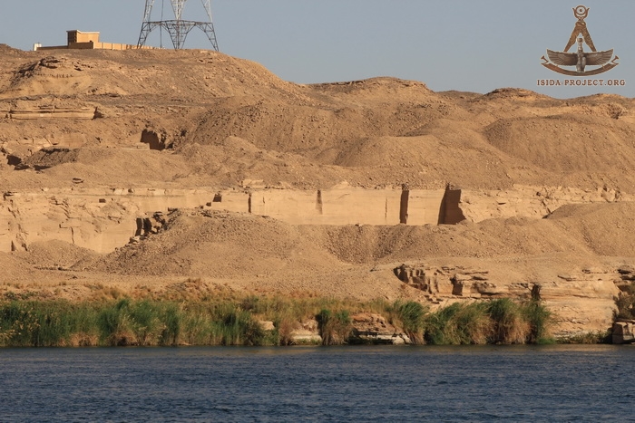
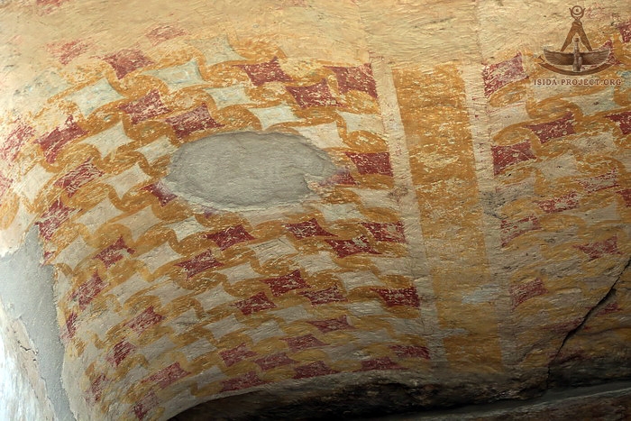
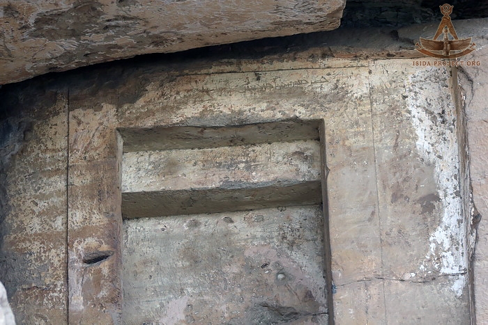
The steep sandy cliffs of the West Bank are carved with ancient graffiti, sanctuaries and stelaes. During the XVIII Dynasty travelers started a tradition to carve small sanctuaries and shrines in the rocks - a places of worship for various Nile gods, responsible for the Nile flood, land fertilizing and harvest. To the present day - there are 33 carved chapels were found. Most of them were carved by the teams of stonemasons and sculptors of Thutmose I, Hatshepsut, Thutmose III, before the times, when Horemheb, the last Pharaoh of the XVIII Dynasty, built his grandiose rock-cut temple, dedicated to Amon Re and other deities that patronize the Nile.
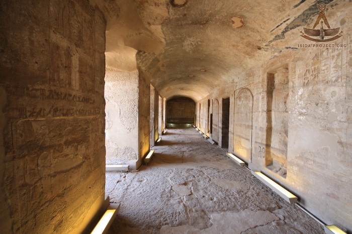
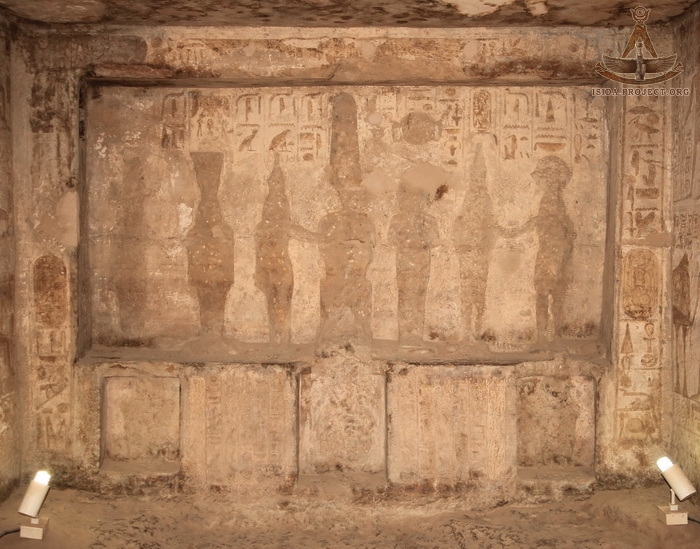
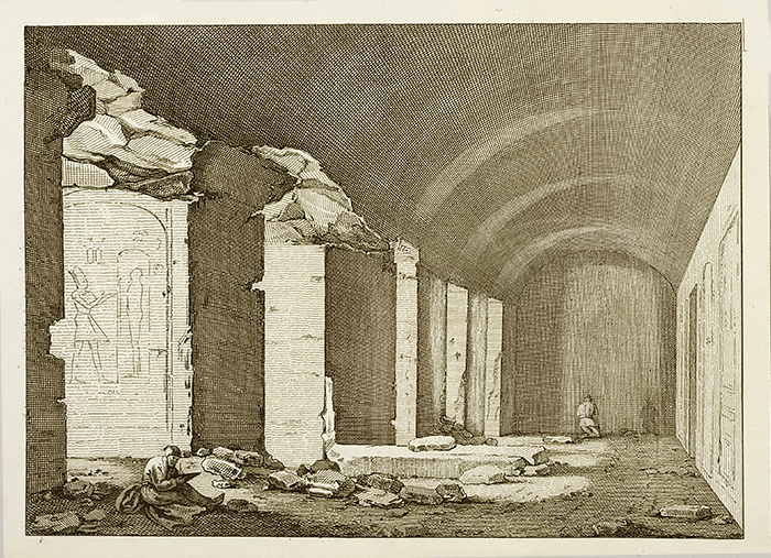
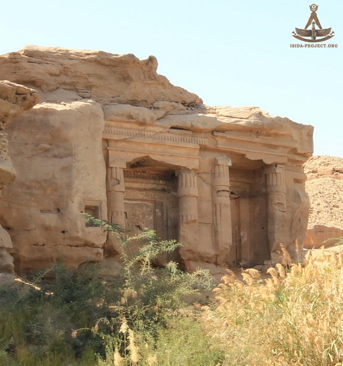
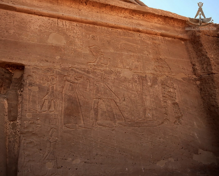
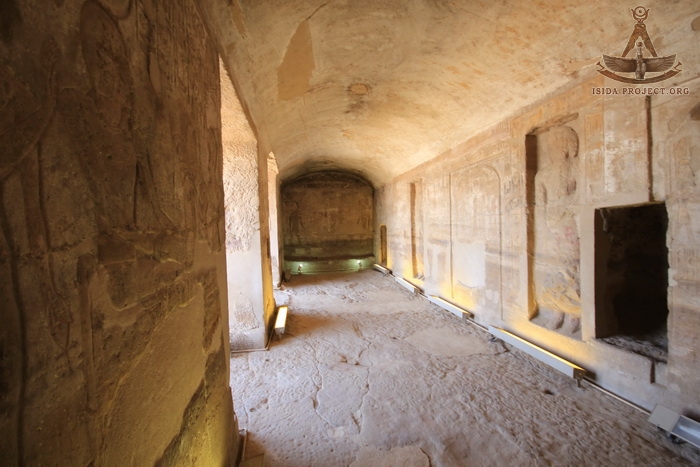
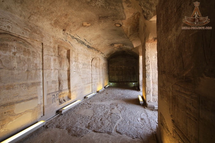
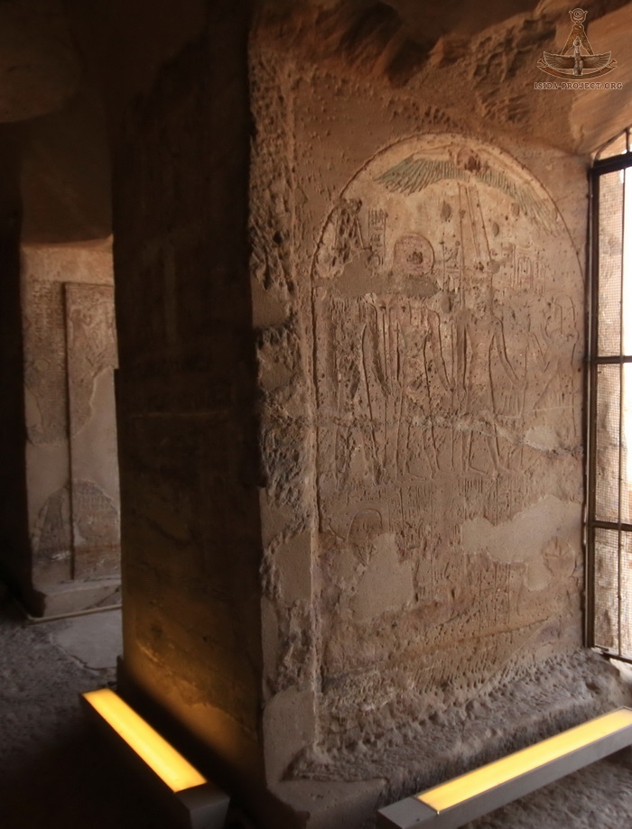
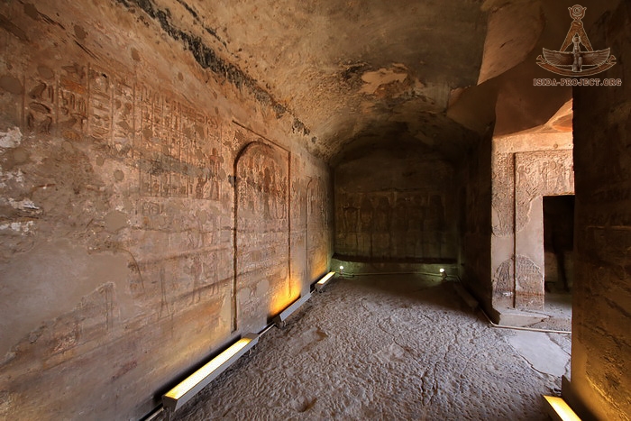
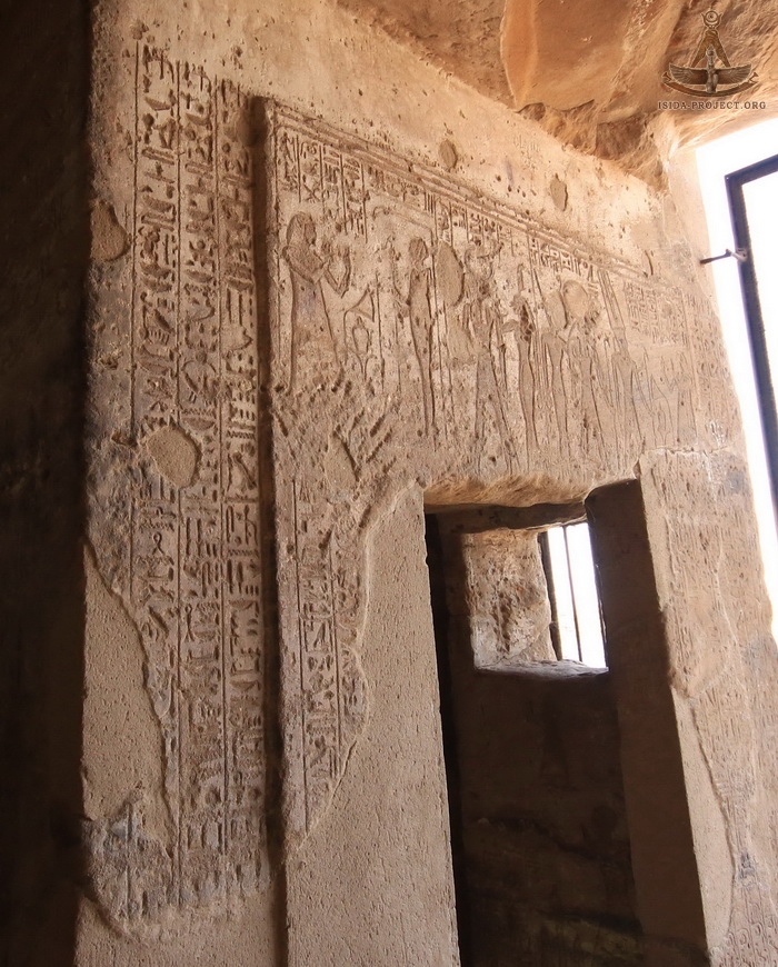
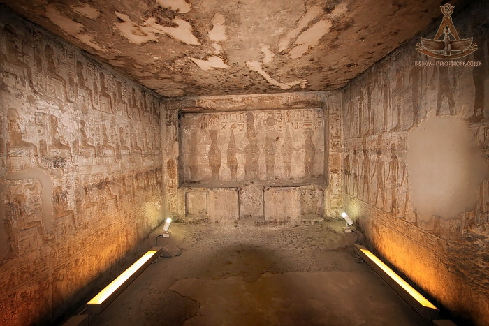
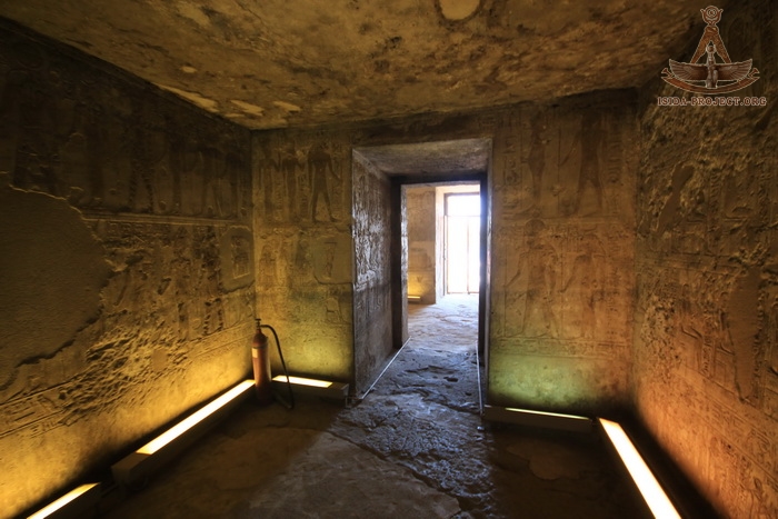
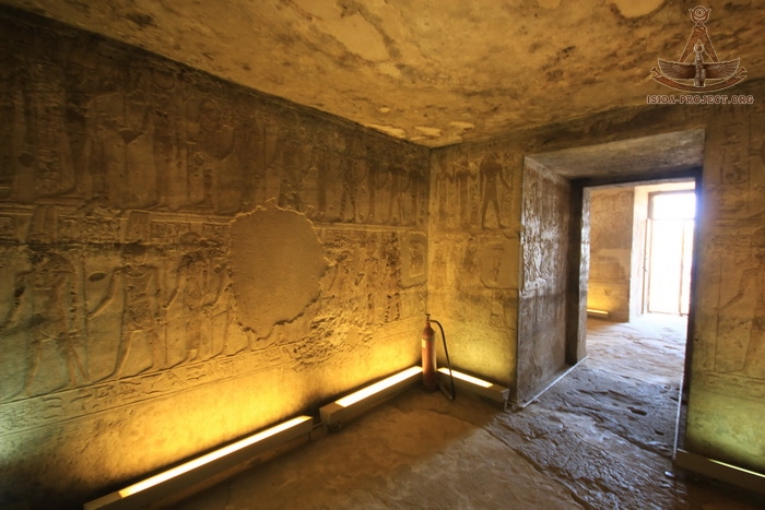
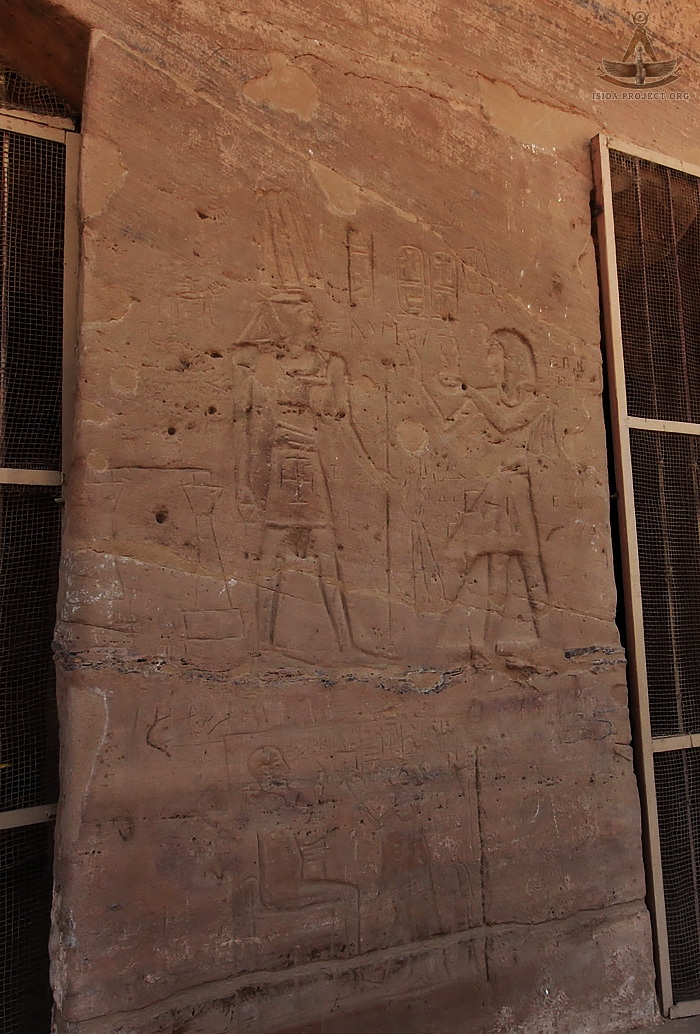
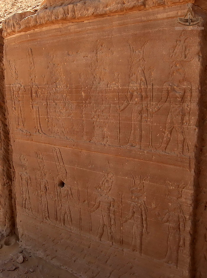
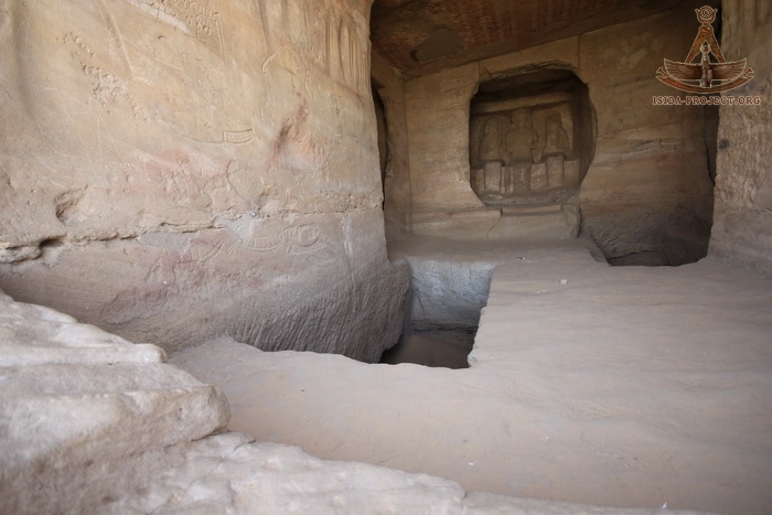
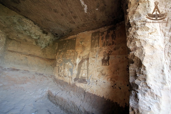
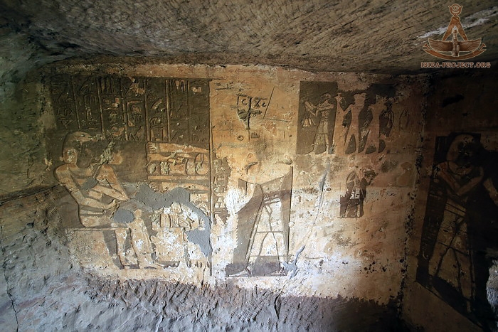
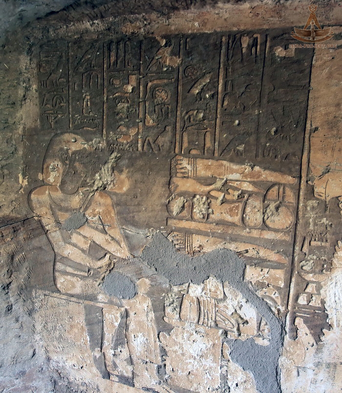
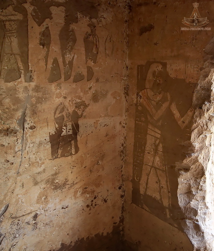
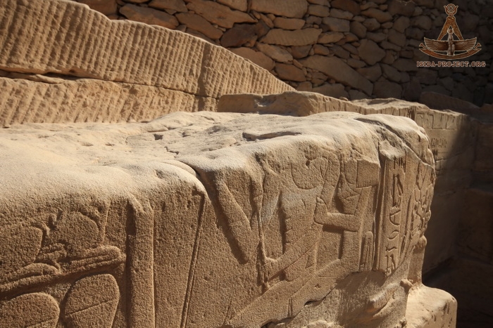
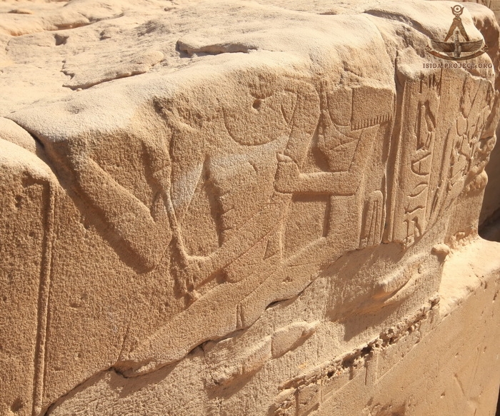
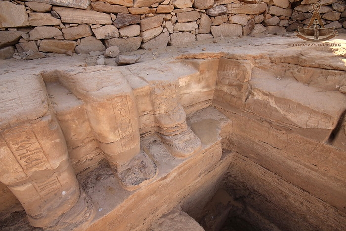
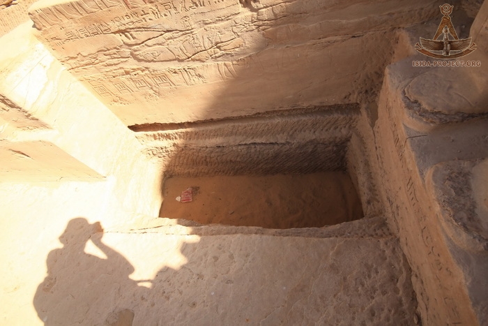
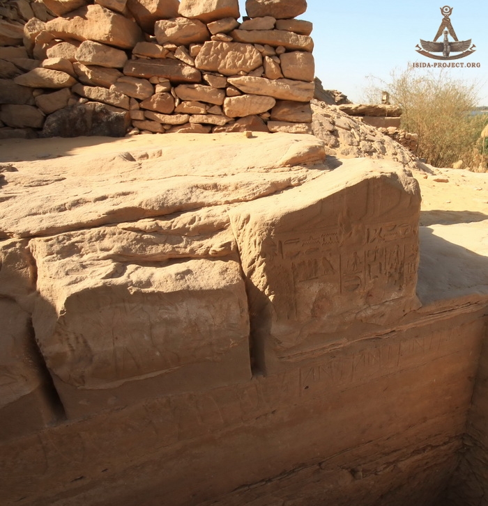
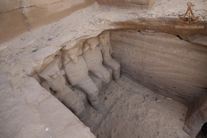
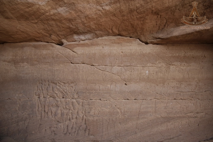
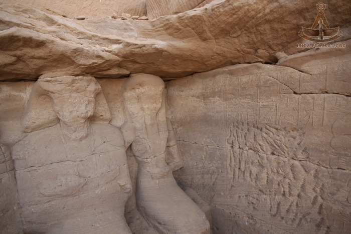
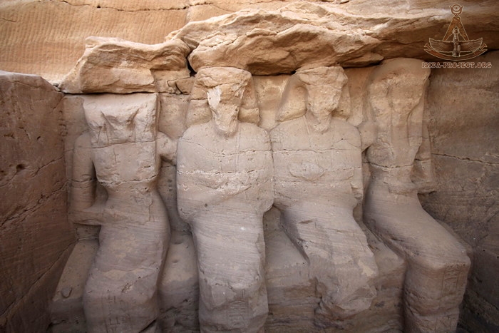
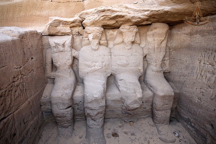
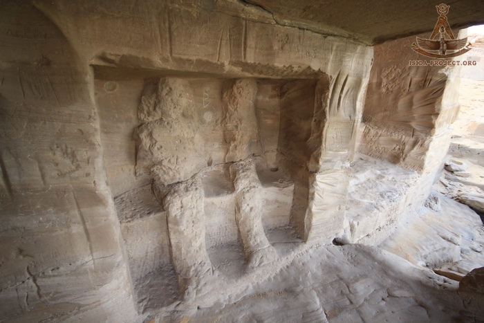
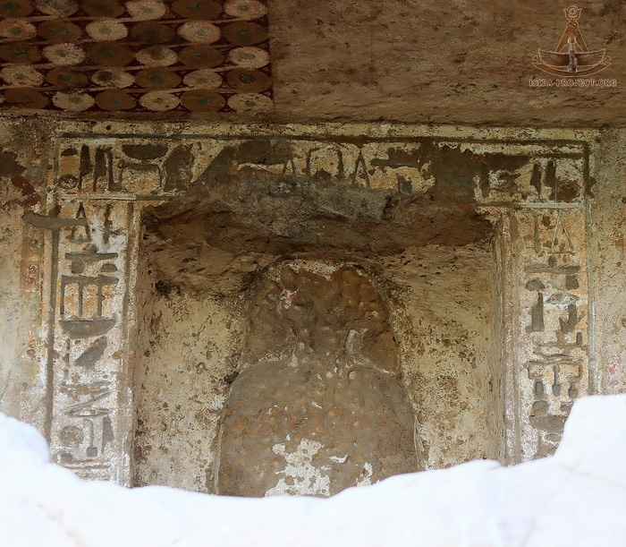
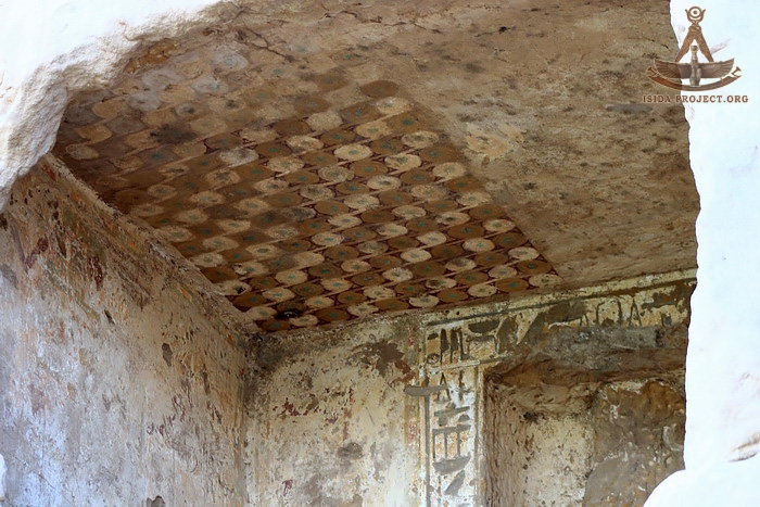
The temple's facade is represended with five doorways separated by columns of various widths, behind which is a long transverse hall with an vaulted roof, at the end of which there is a small oblong chamber - a sanctuary. All the temple walls are covered with reliefs and inscriptions, some of which are badly damaged by the time. Horemheb himself never finished his temple. It was completed later by subsequent Kings and Nobles, who adorned the walls of the temple with their own stelaes and bas-reliefs.
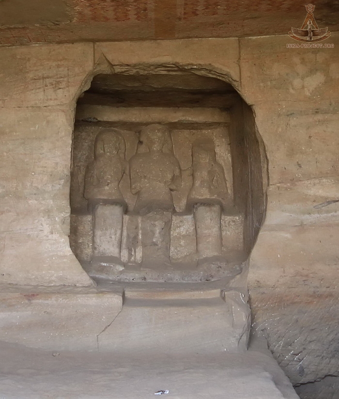
The sanctuary to the rear of the vaulted hall contains seven figures, depicting Sobek, Tauret, Mut, Amen-Re, Khons, Horemheb and Thoth.
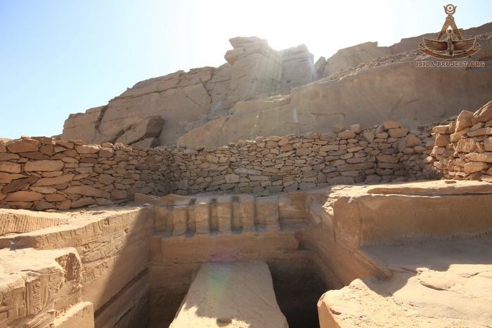
Unfortunately, many of the sanctuaries, shrines and ancient tombs were damaged by earthquakes and quarrying works of later times.
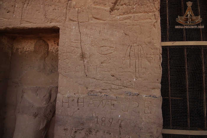
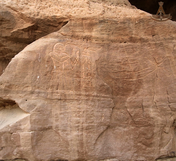
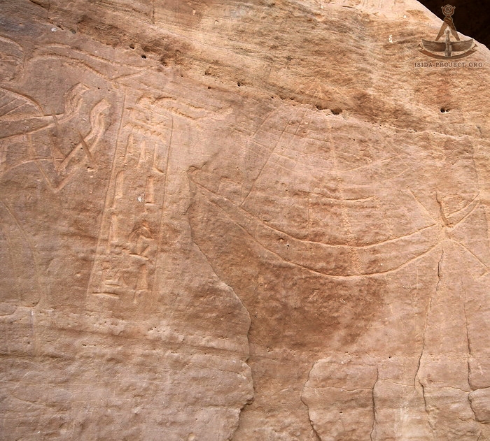
During the XIX Dynasty rock-cut stelaes of Gebel-el-Silsila were carved by Rameses II, Merenptah, Siptah, Seti II, Rameses III and Rameses V. In 1843 and 1844 the expedition of German Egyptologist Karl Richard Lepsius spent several days on both banks of the Nile. Besides the documenting of historical monuments, Lepsius was the first Egyptologist. who has published the inscriptions of the VIII Dynasty. In 1897 French Egyptologist Georges Albert Legrain carried out the excavation works of the Pre-Dinastic necropolis on the eastern bank of the Nile, and subsequently published an article that highlighted some of the issues concerning Gebel-el-Silsila. In 1906-1908 French archaeologist Jacques De Morgan, who studied the Pre-Dynastic and Early Dynastic buildings between Gebel-el-Silsilla and Esna, also reported on some finds from Gebel-el-Silsil. In 2000 Andrea-Christina Thiem has published her dissertation work "Speos von Gebel es-Silsileh : Analyse der architektonischen und ikonographischen Konzeption im Rahmen des politischen ung legitimatorischen Programmes der Nachamarnazeit", devoted to the temple of Horemheb. Artists, photographers and researchers of all the times, who had visited Gebel-el-Silsila, never remained indifferent to this area, which unites in itself both the artistic-historical and geological-technical sides.
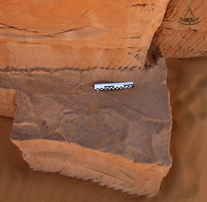
In April 2017, an expedition of the ISIDA Project landed on the western bank of the Nile. The purpose of visiting of Gebel-el-Silsila was to study and to make quality photo-base of the skills of the both of ancient stone artists and quarry workers, who mained the material, forming the foundation for the architectural masterpieces of Ancient Egyptian Civilization, which up to our days attract the attention and interest of the people of the planet Earth.
© Copyright 2017. All rights reserved. |
||||
 |
 |
 |