|
 |
 |
||||||||||||||||||||||||||
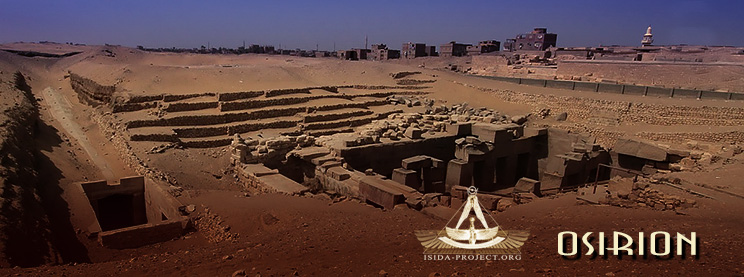
- Abydos. Chapter I -
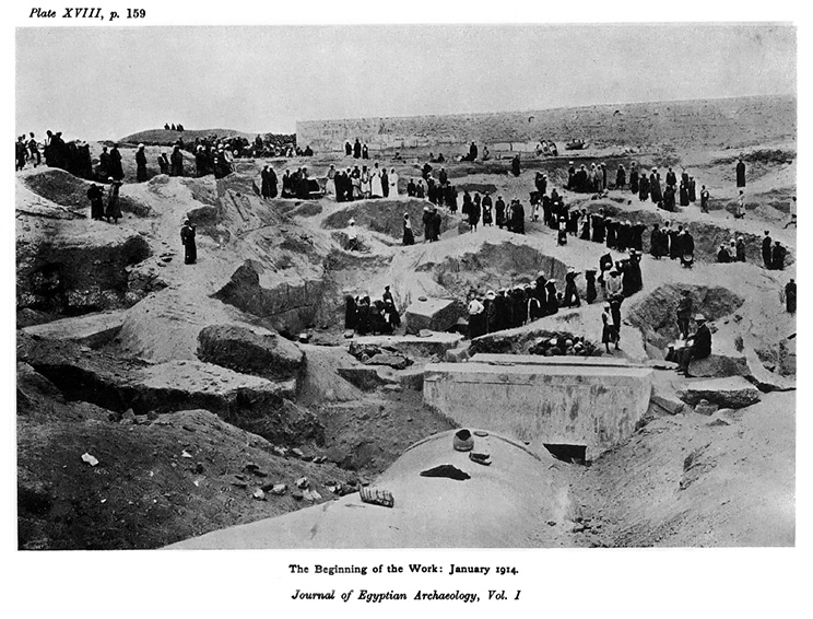
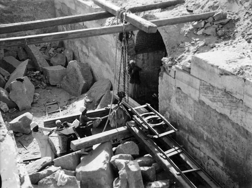
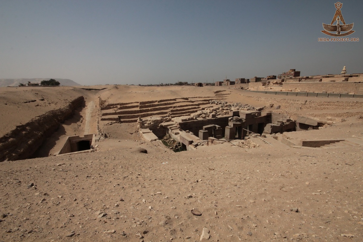
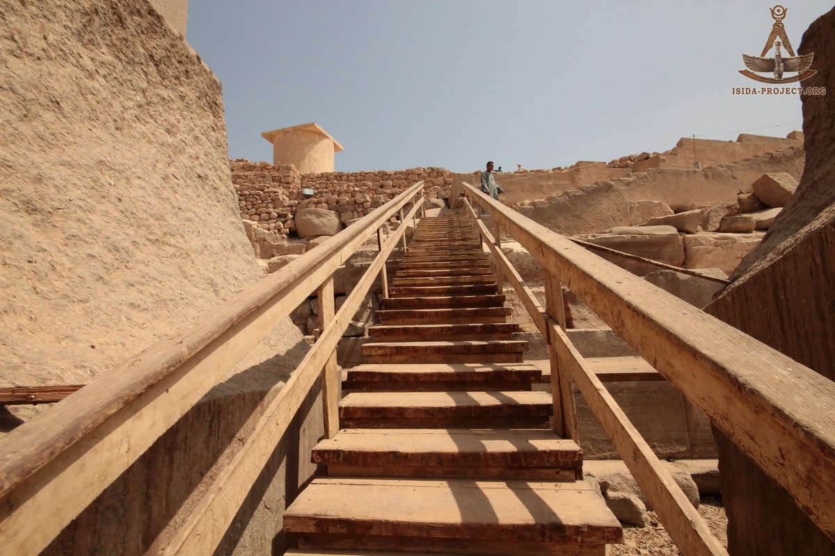
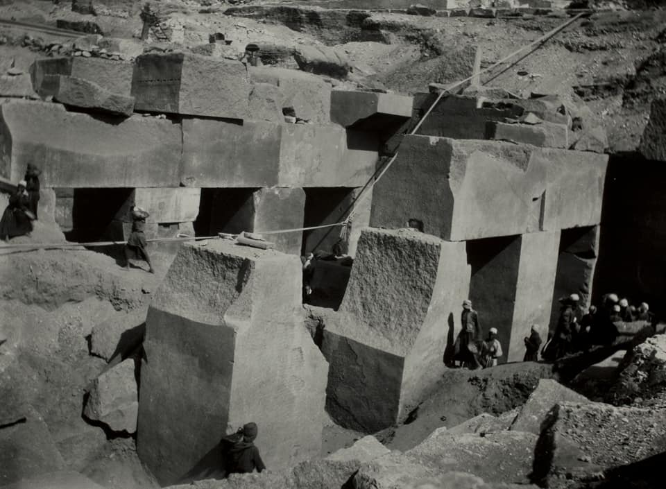
During his reign, Antef II has united all the Southern Nomes up to the First Cataract. After that, he encountered Heti III, his main rival for domination over Abydos - the ruler of the capital Hierakonpolis Magna of the XX Nome. Finaly, the army of Atef II won that war, and as the result the area, containing the Osirion (The Tomb of Osiris), fell into the hands of the Thebans. This fact has so much upset the Hierakonpolis King, that he decided to set peace agreement with Antef II, admitting that he was wrong and truthfully deserved the loss of this territory. 4000 years later... Year 1901 "In the winter of 1901-1902 Mr. St. G. Caulfeild undertook the further examination of the temple of Sety at Abydos. Our work there resulted in finding the temenos wall, and showing the connection between the planning of that temple and the Royal Tombs of the early kings on the desert behind it. When Mr. Caulfeild began to excavate, I noticed some thick masses of crude brick, and suggested that they might be mastabas. He cleared along them and found that they formed a continuous wall, which we then identified as the temenos wall of the temple. I observed that parallel with this there was a slight long hollow on the surface, and proposed that he should clear it out. Some time after, on looking at the site, 1 was told the men had found desert a few feet down. This seemed strange, and on looking at it I saw that there was only blown sand. So they were told to go deeper..." William Matthew Flinders Petrie
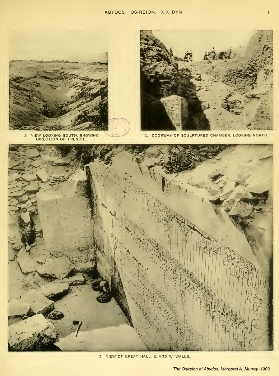
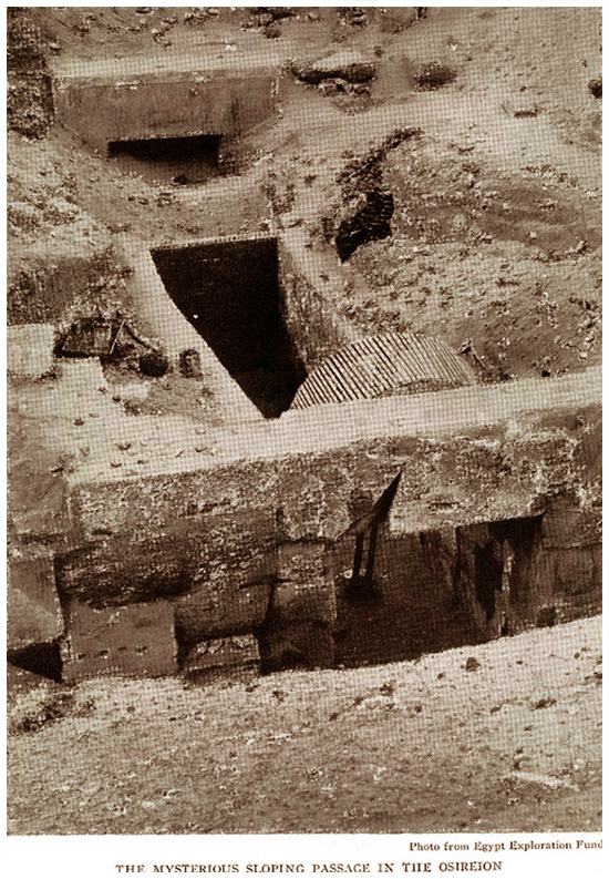
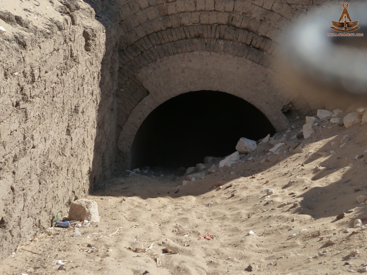
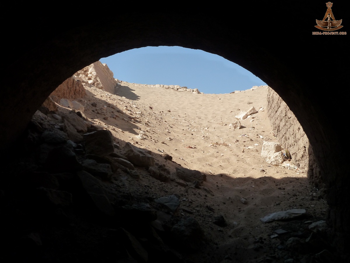
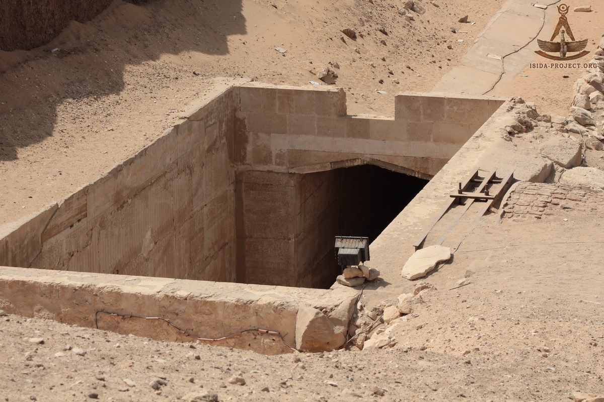
As a result, a 93-meter western tunnel with adjoined Hall and a Chamber was discovered, as well as the beginning of a sloping passage, leading to the Temple of Seti I.
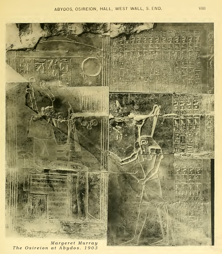
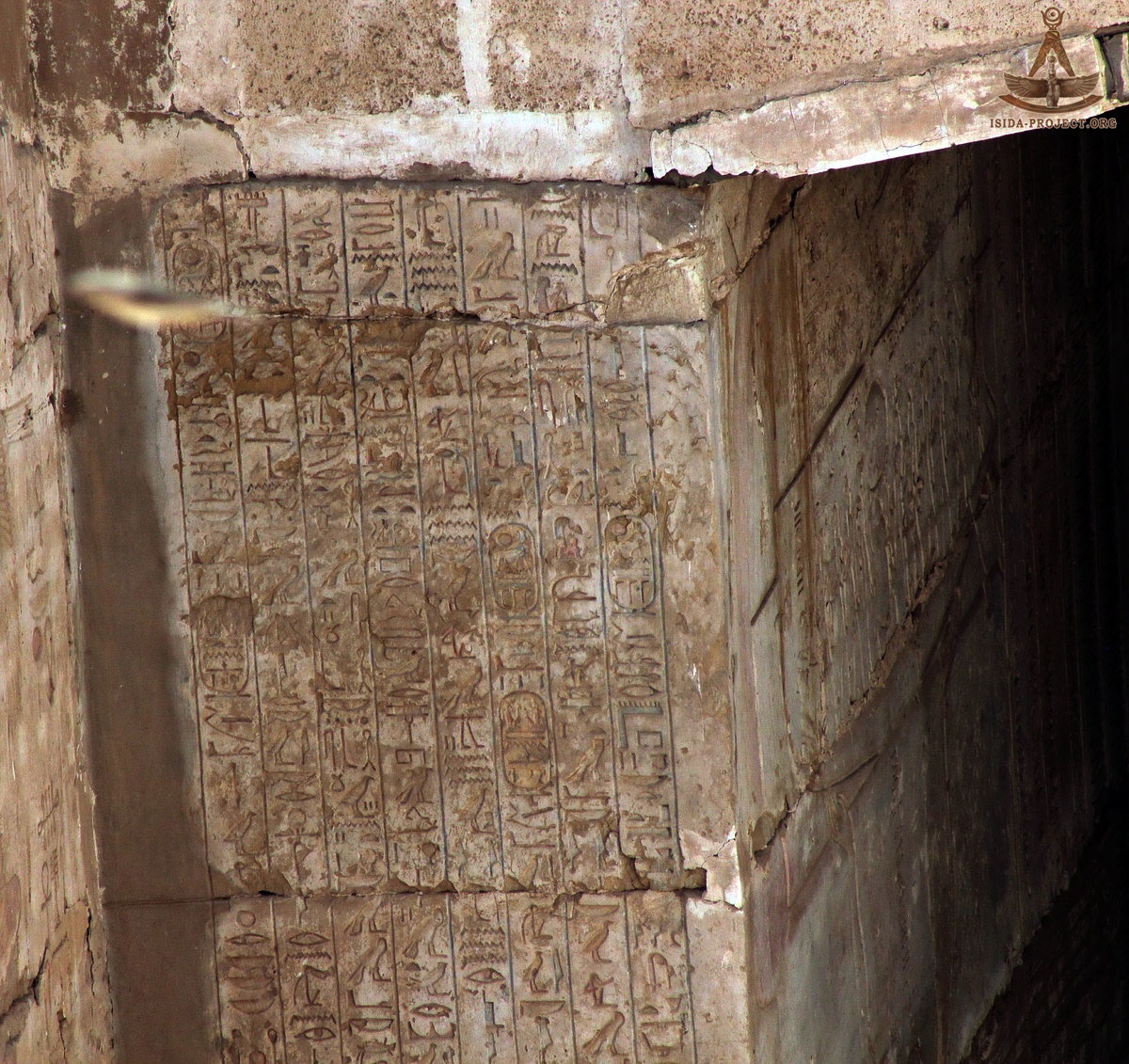
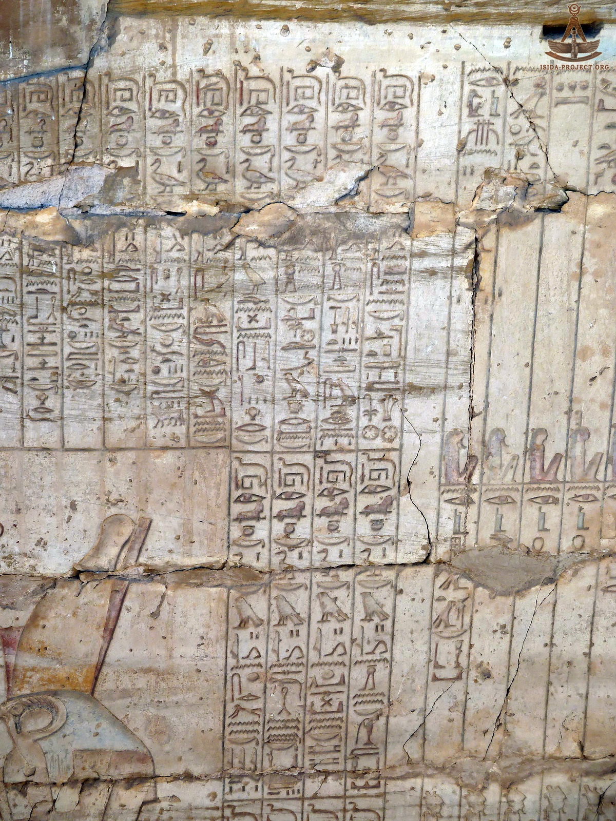
The walls of the excavated structures were decorated with well-preserved drawings and bas-reliefs, depicting the chapters from the Book of the Dead and the Book of the Gates.
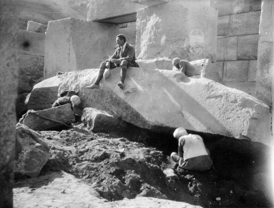
A detailed account on the excavation, drawings and interpretation of the bas-reliefs can be found in the work "The Osirion at Abydos", published of the British Egyptologist Margaret Murray in 1903, who together with Irish Egyptologist and geologist Hilda Petrie (wife of Flinders Petrie), directed the mentioned above excavations. Year 1914 "We have as yet no certain indications of the date of the construction; but the style, the size of the materials, the complete absence of all ornamentation, all indicate very great antiquity. Up to the present time what is called the temple of the Sphinx at Gizeh has always been considered one of the most ancient edifices of Egypt. It is contemporaneous with the pyramid of Chefren. The reservoir of Abydos being of a similar composition, but of much larger materials, is of a still more archaic character, and I would not be surprised if this were the most ancient architectural structure in Egypt." Edouard Naville
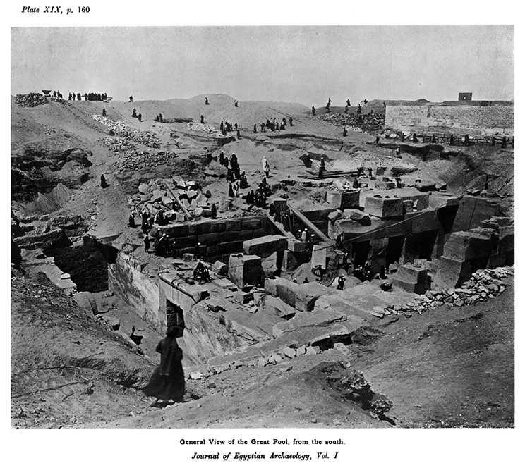
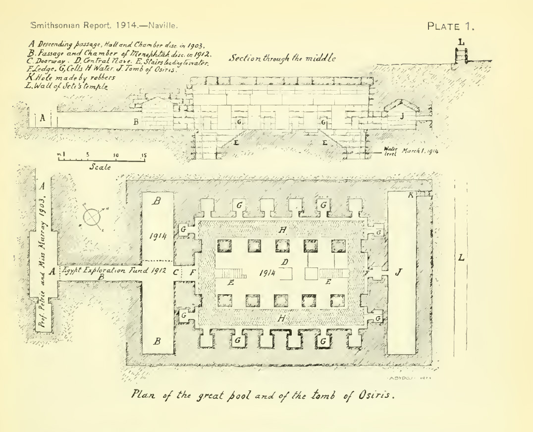
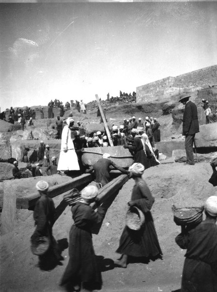
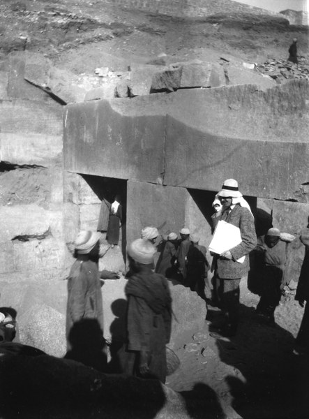
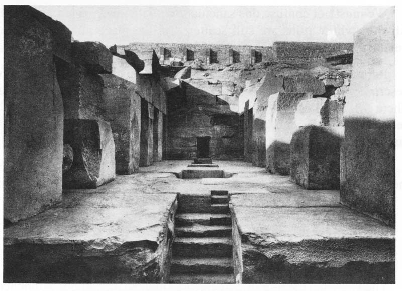
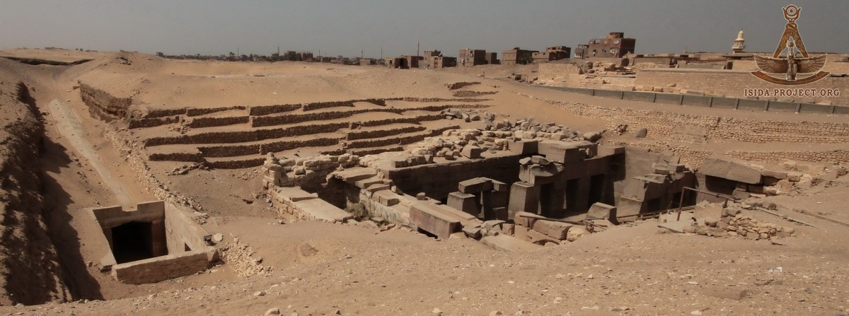
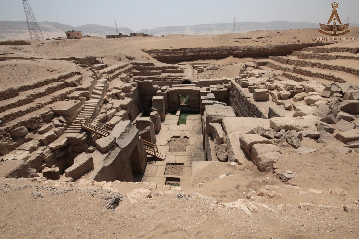
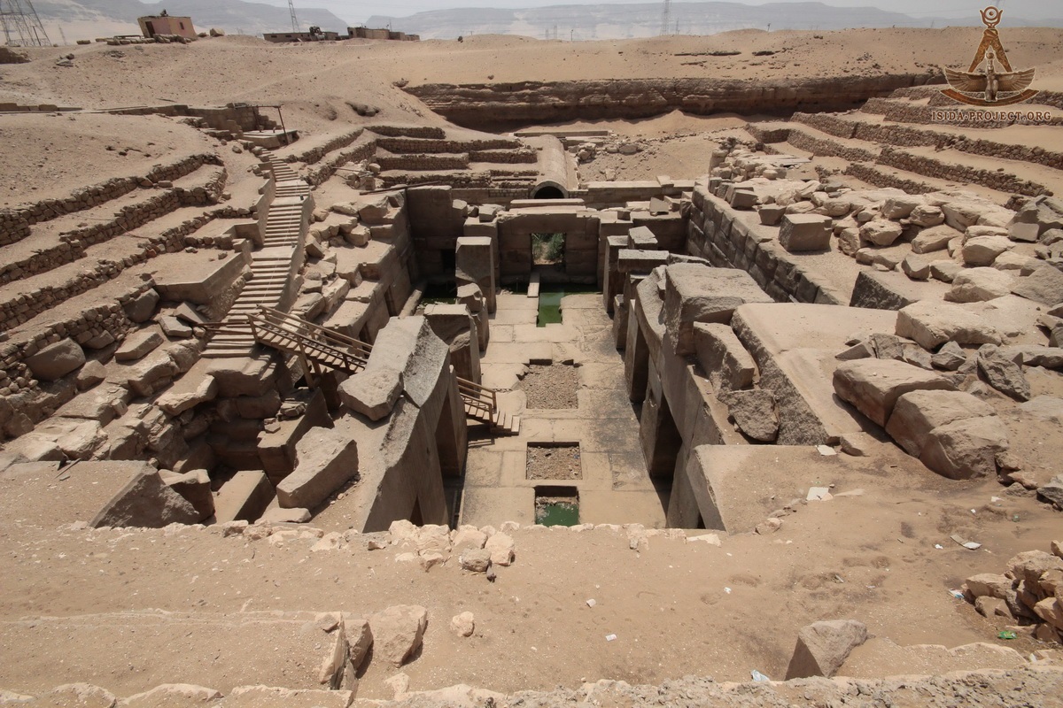
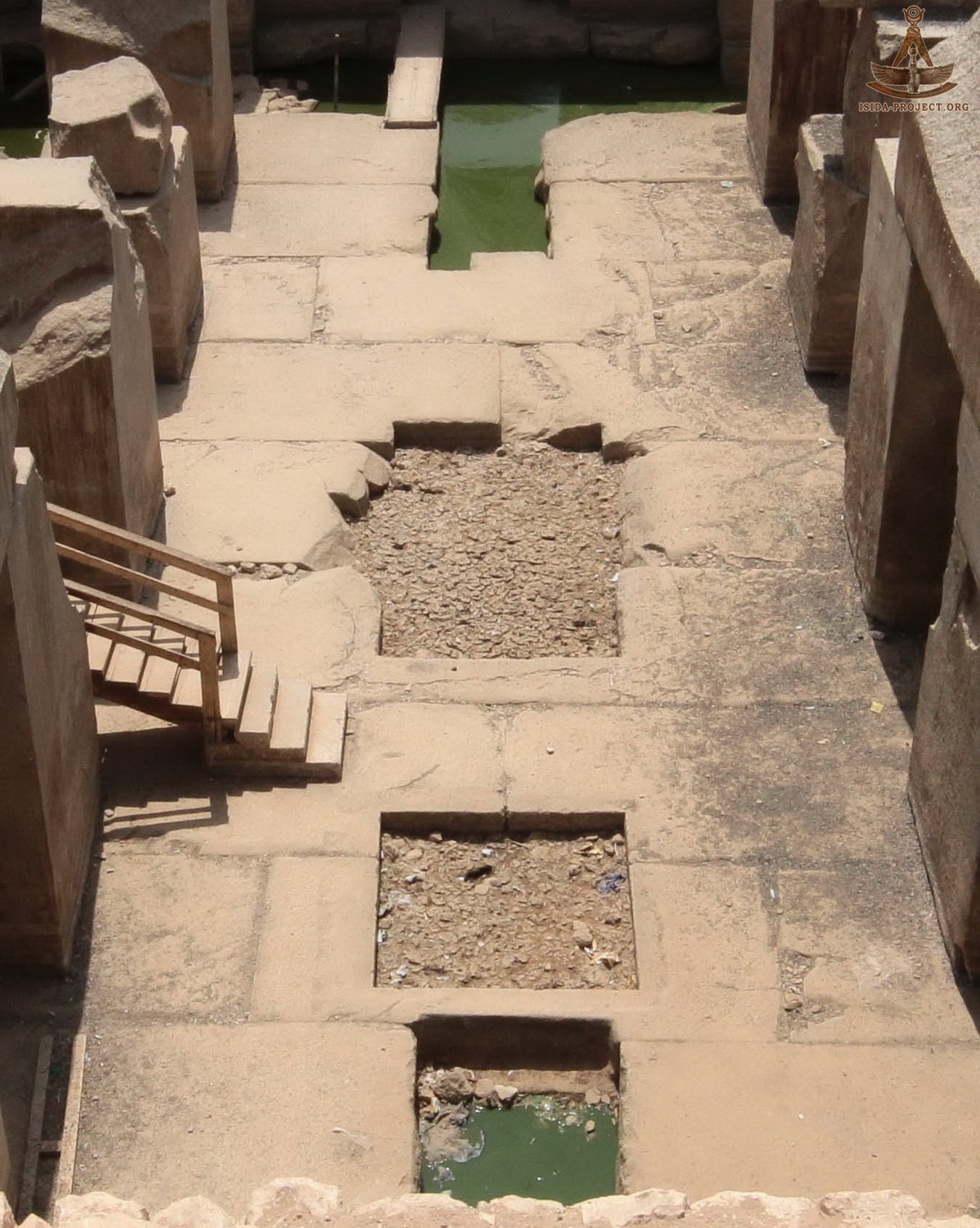
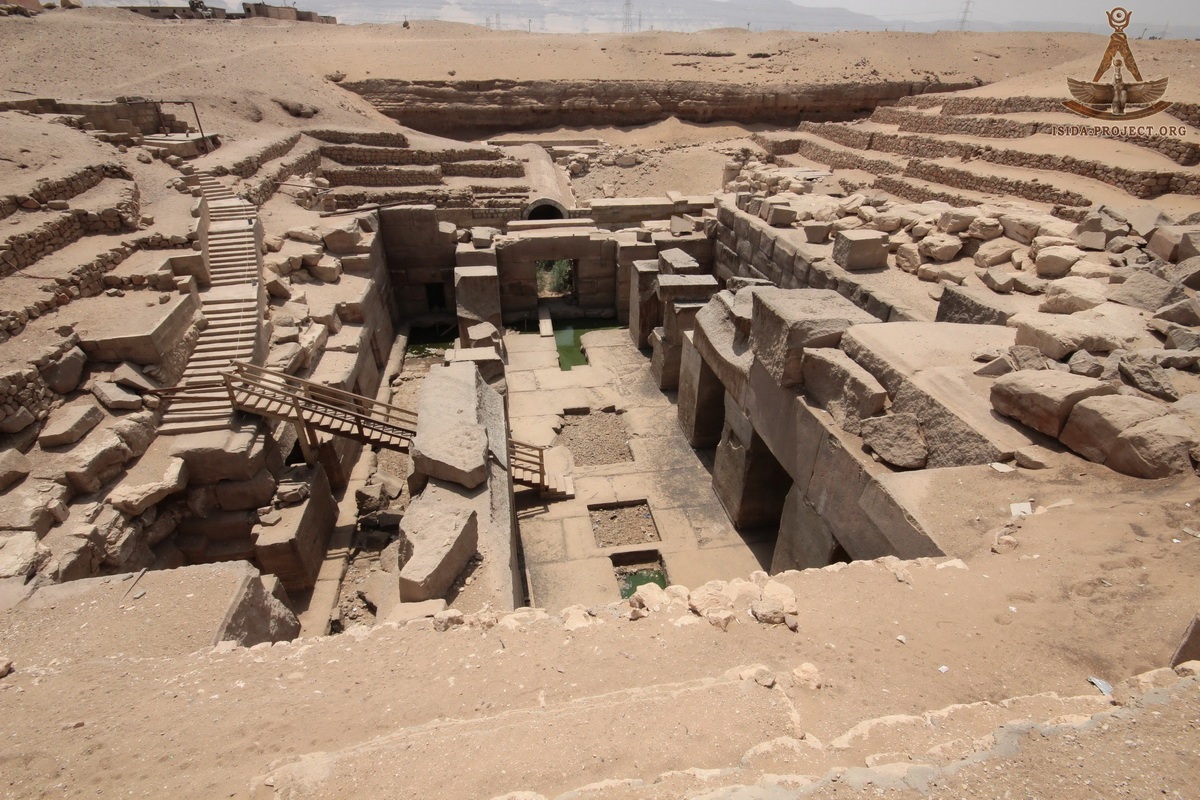
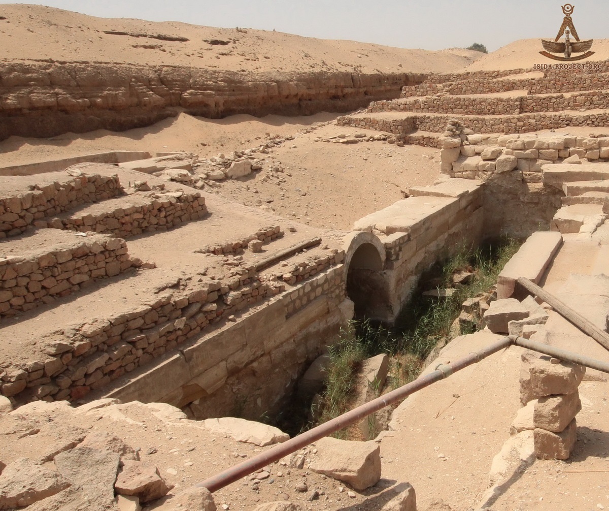
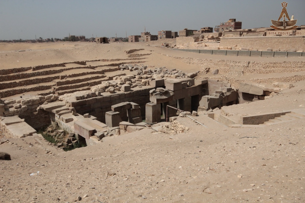
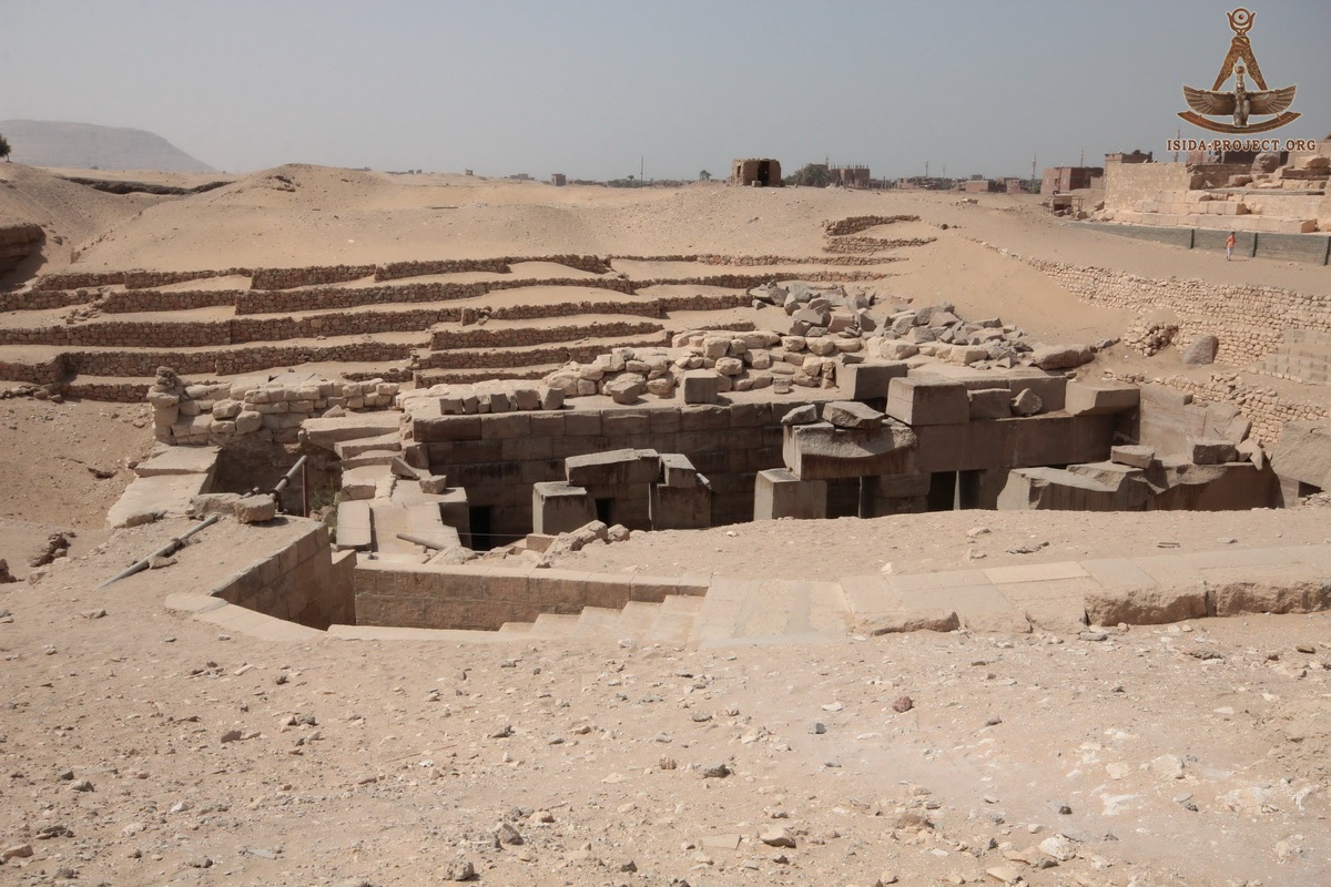
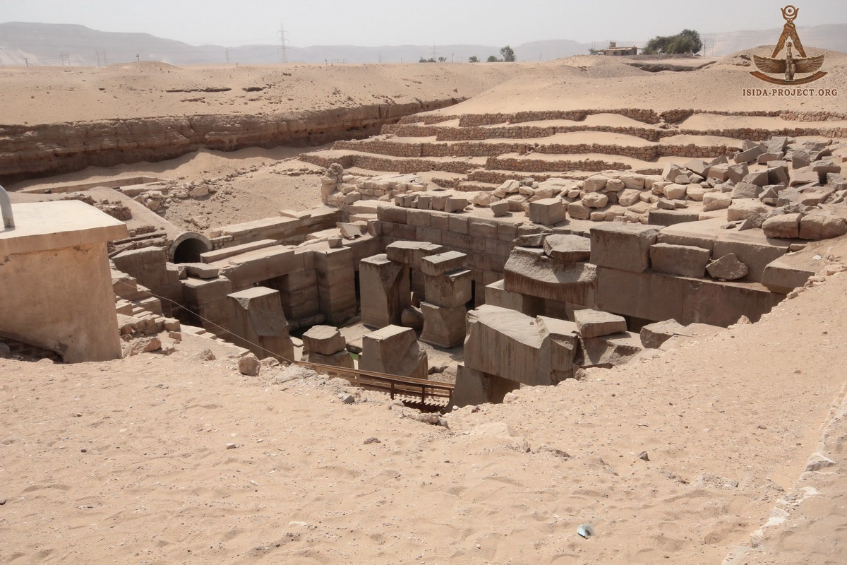
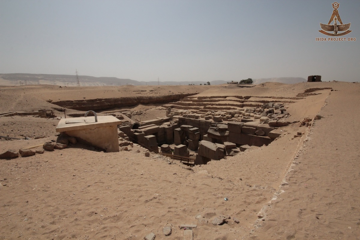
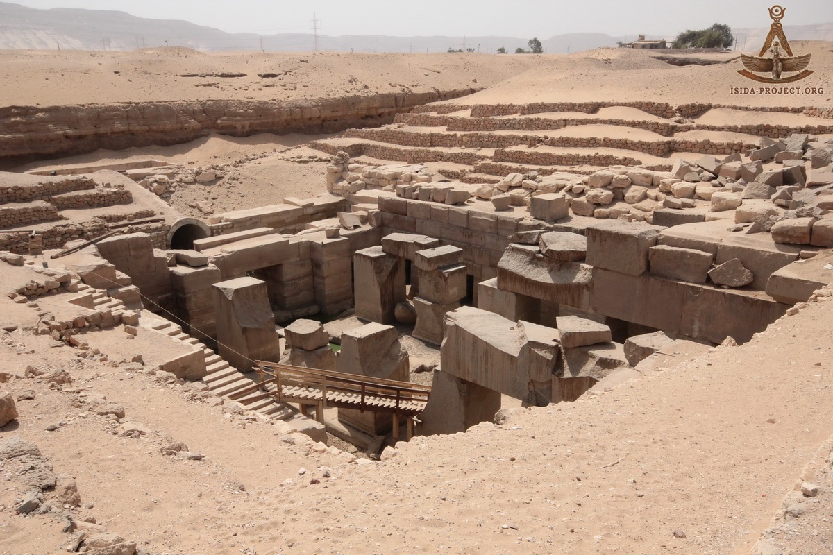
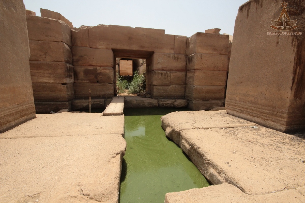
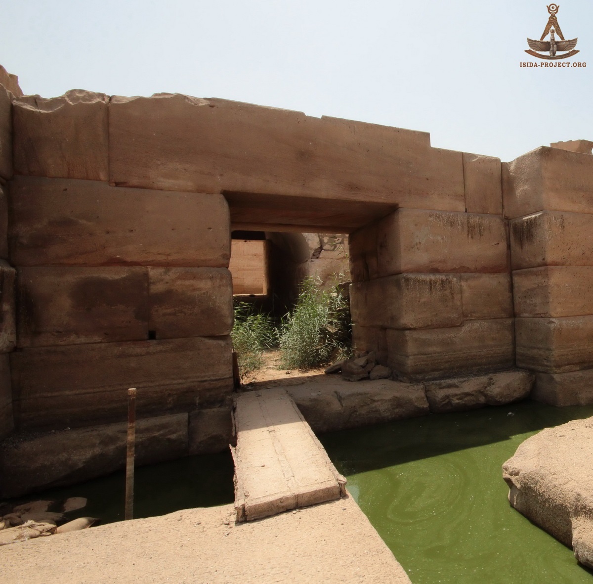
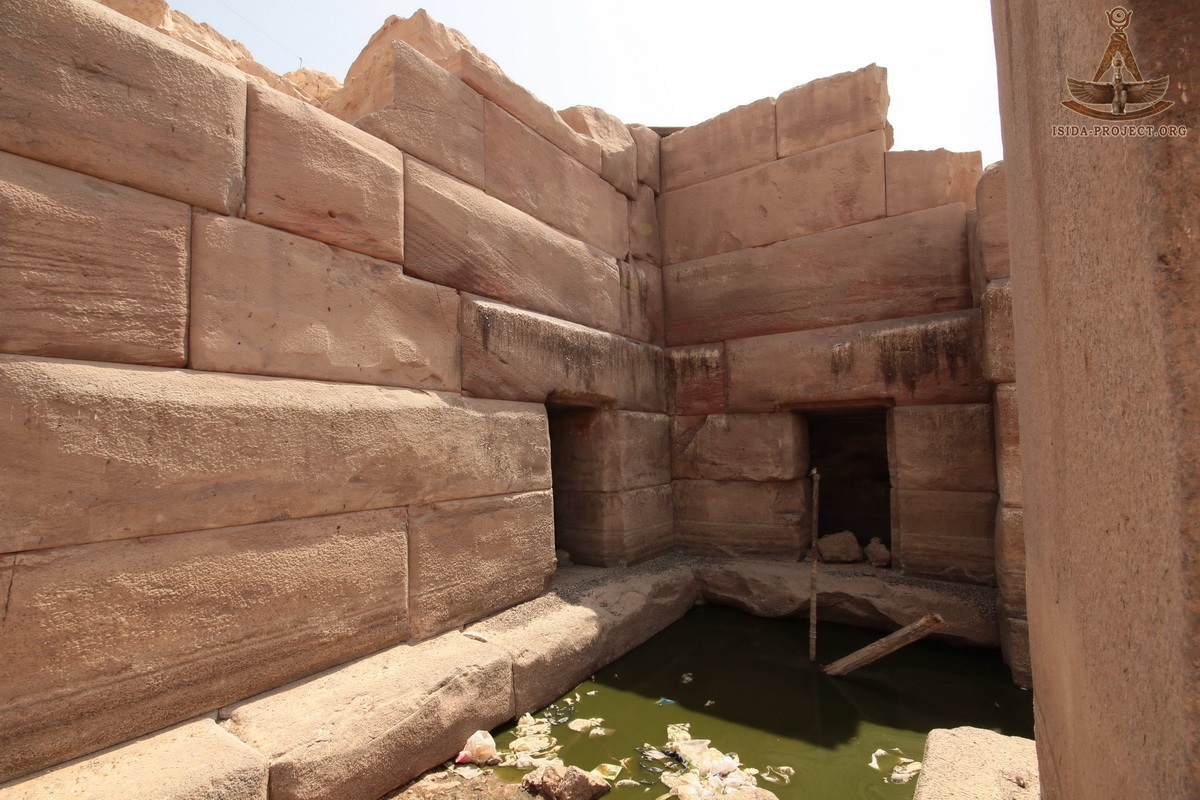
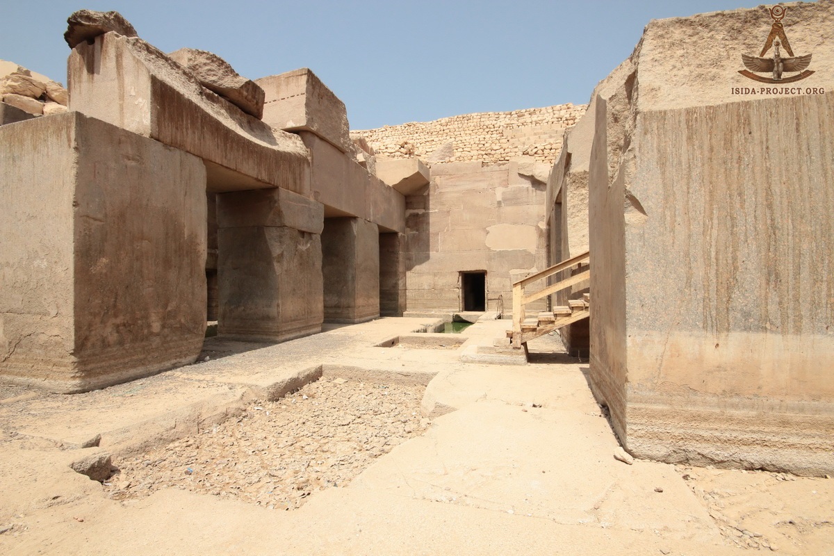
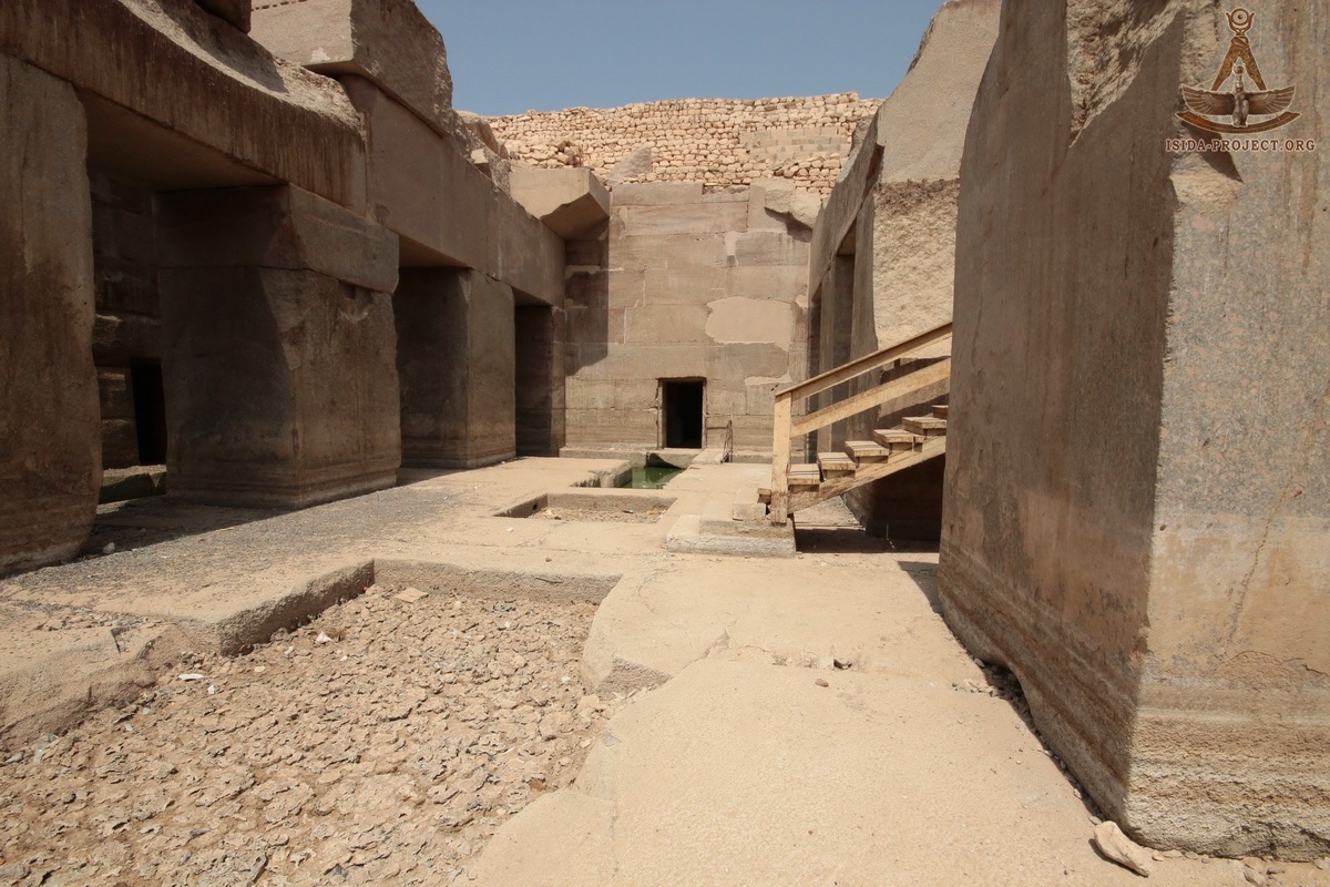
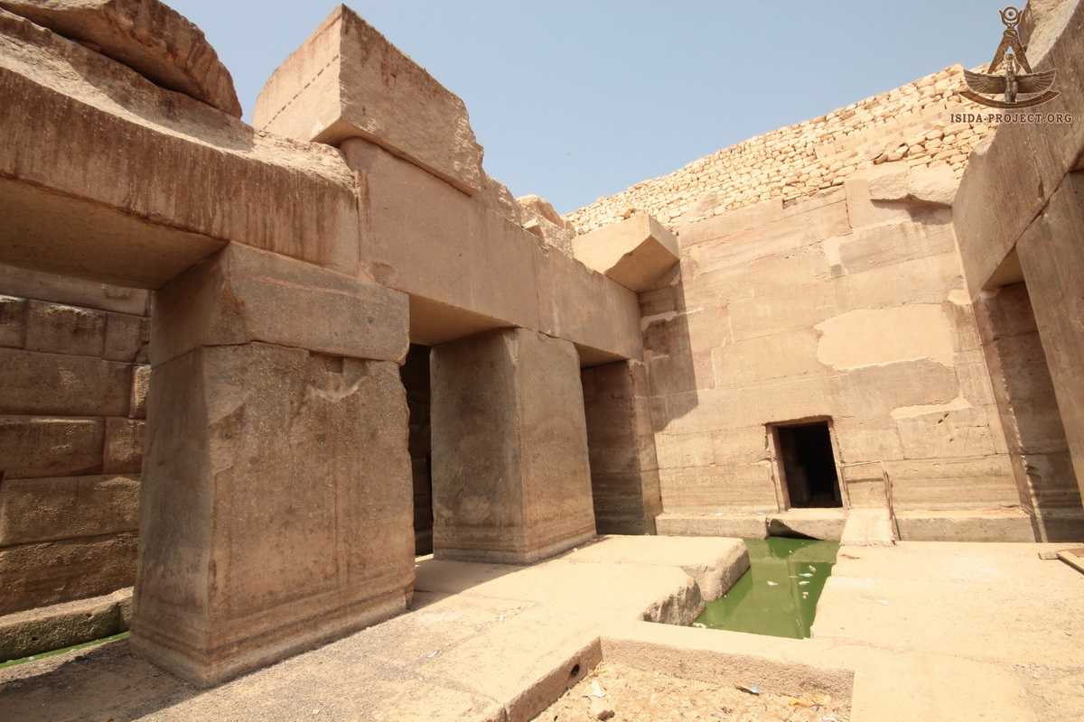
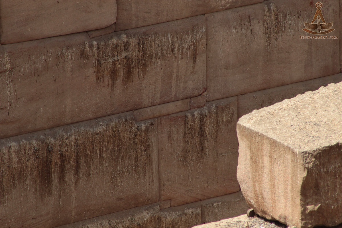
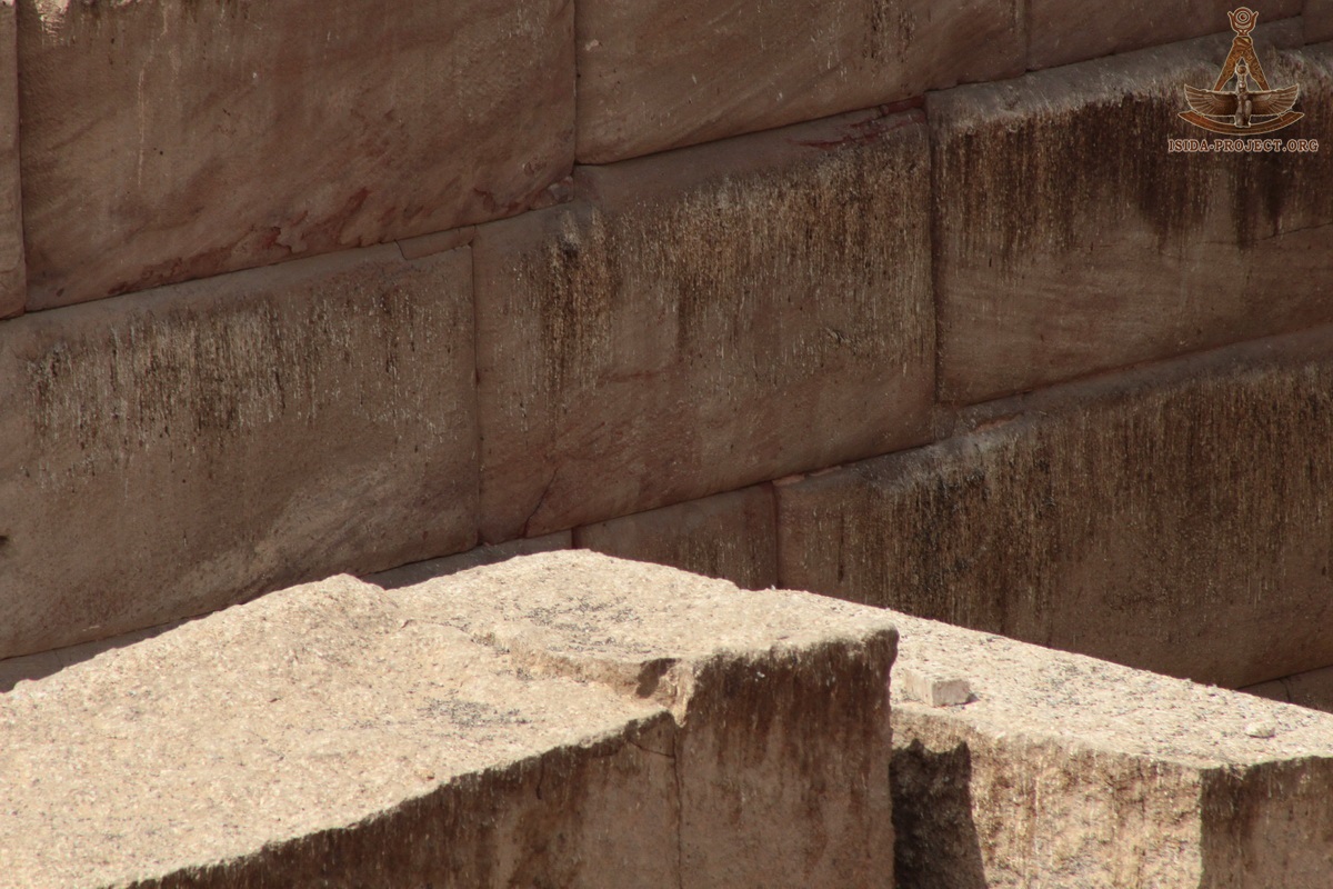
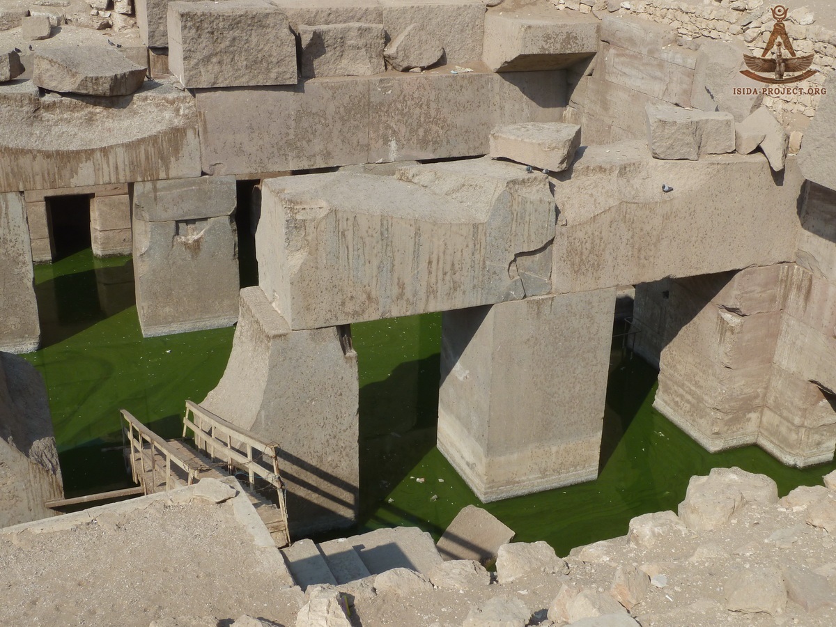
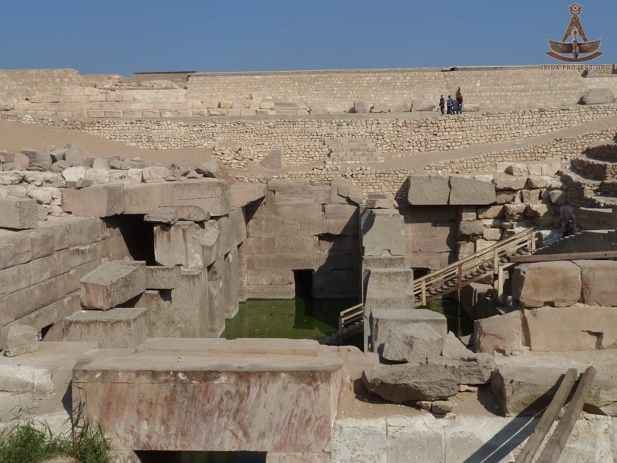
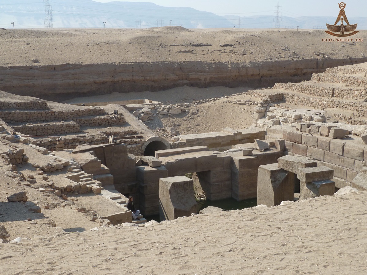
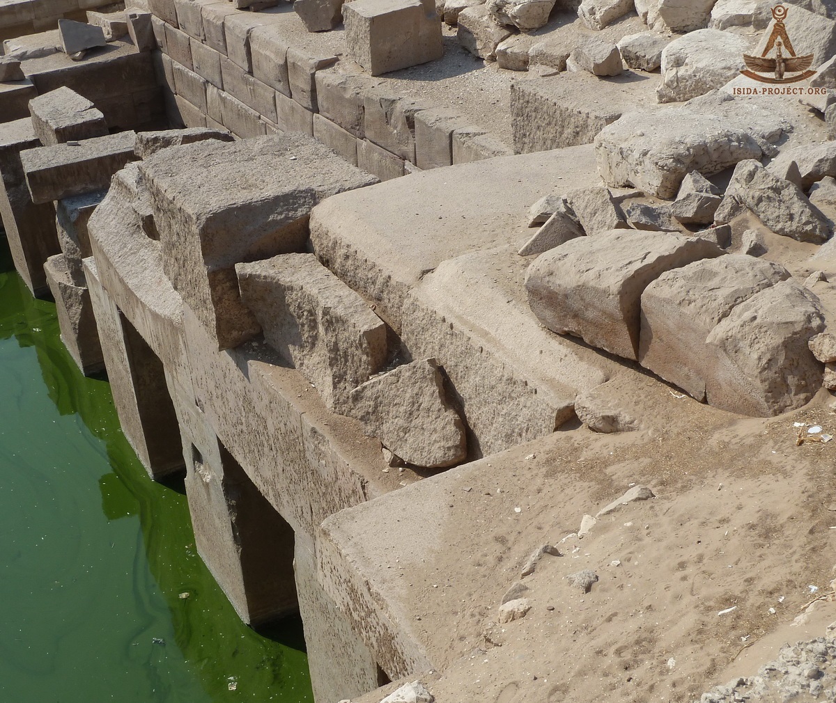
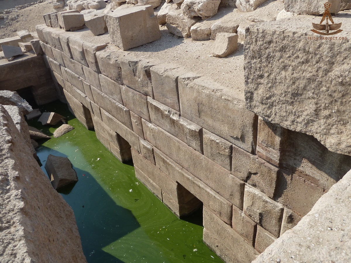
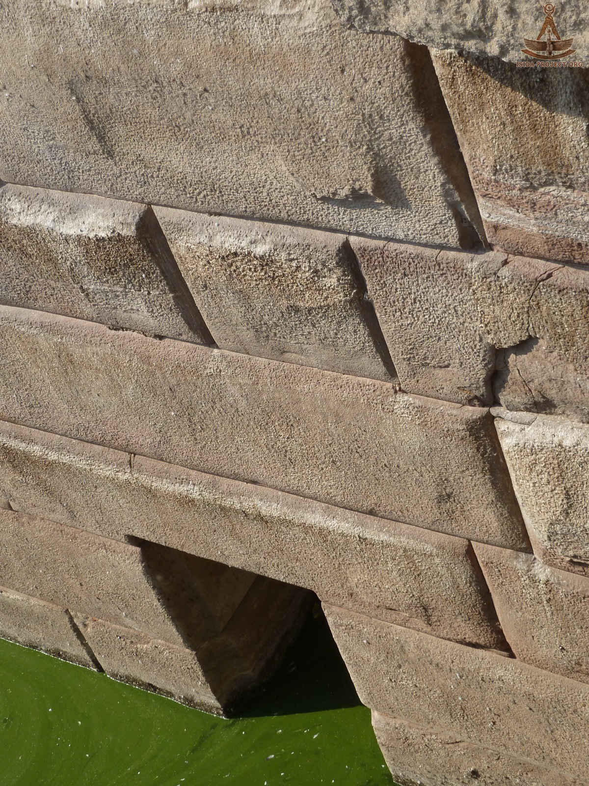
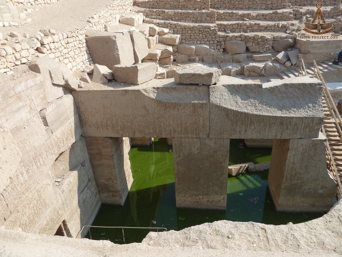
        "I recall that we found ourselves in a rectangular space of 30 by 20 meters, inclosed by a wall 6 meters thick, the outer face of the wall of limestone and the inner face of very hard, red sandstone. This space is divided into three naves, the two on the sides being narrower than the center one. These naves are separated by colonnades made of enormous pillars of granite supporting architraves equally massive. All around this inclosure there are parallel cells in which a man can stand upright. It seemed at first sight quite certain that these cells opened on a pavement and that the entire building had a flooring. Great was our astonishment when we discovered that in front of these cells there was no flooring but only a footpath a little This wall of magnificent masonry continues beneath the pathway and at a depth of nearly 4 meters we discovered infiltration water at the level where it is encountered in cultivated land, although we are in the desert. The masonry may perhaps go another four metres below the present level of the water." Edouard Naville As a result of the archaeological work og 1914 and the complete clearing of Osirion, Professor Edouard Naville has made a detailed scheme of the structure:
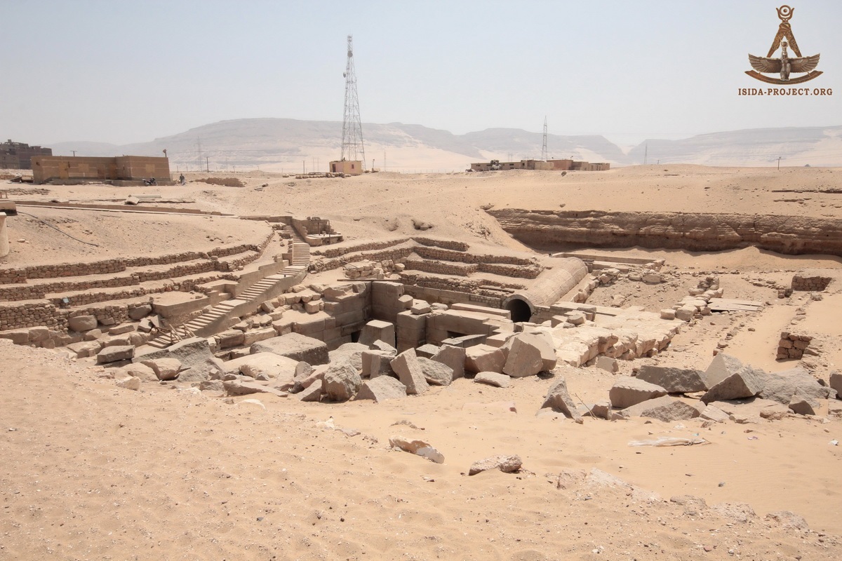
Osirion and the Temple of the Kings, built by Seti I.
"...There is no longer any doubt, then, that we have discovered what Strabo calls the well or the fountain of Abydos. He spoke of it as being near the temple, at a great depth, and remarkable for some corridors whose ceilings were formed of enormous monolithic blocks. That is exactly what we have found. Edouard Naville, 1914 Three years earlier, before the great discovery of the main megalithic part of Osirion, Wallis Budge, in his work "OSIRIS and the Egyptian Resurrection" (Volume 2, pp. 12-13) wrote the following: "The well is mentioned in the Stele of Menthuhetep (Xlth Dynasty), who says that he built it by the order of Horus. The well, or cistern, was either built or repaired under the Xlth Dynasty, and it was certainly in existence in the time of Strabo, who seems to connect it with the "Palace of Memnon." He says that there was a descent to the water, which was situated at a great depth, through an arched passage built of single stones, of remarkable size and workmanship. A canal led to the place from the Nile.." Wallis Budge, 1911
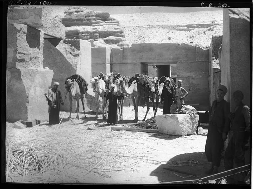
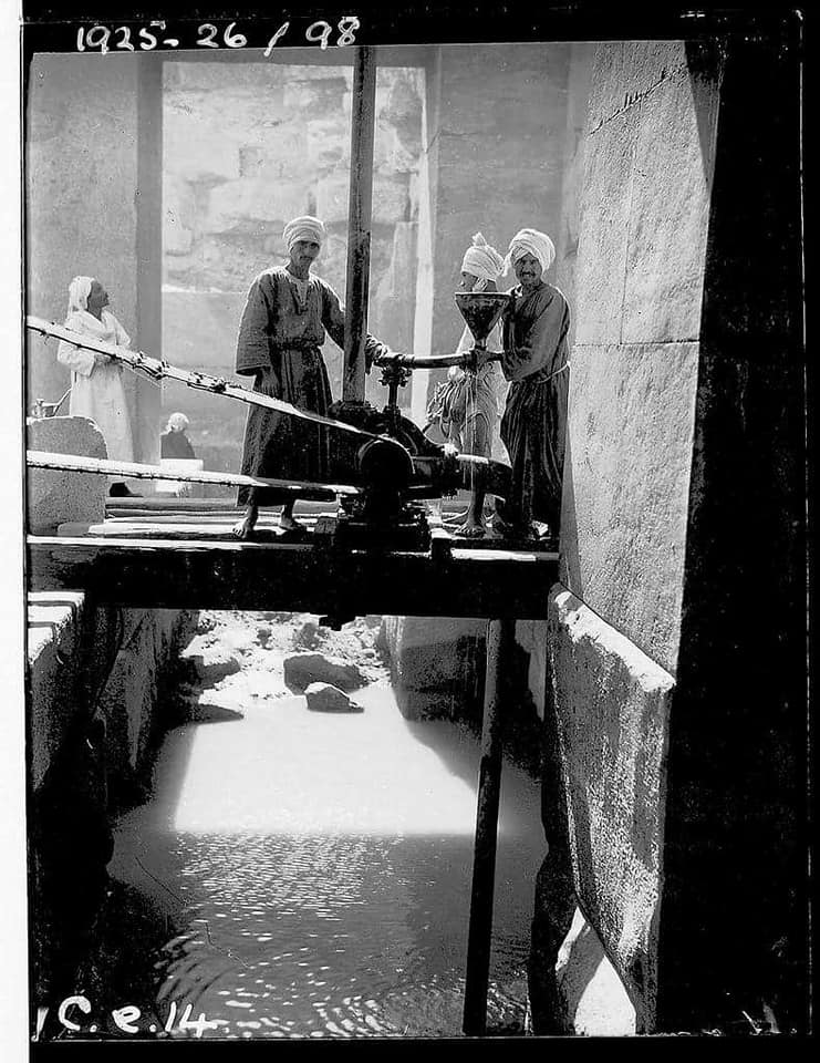
Year 1920-1930 Thomas Whittemore was an American representative at excavations in Abydos in the early 1910s, initiated by the Egyptian Exploration Society (EES) under the direction of Edouard Naville. He also visited Osirion in 1920s and early 1930s, when the excavations were headed by the German Egyptologist, archaeologist and orientalist Henry Frankfort and British archaeologist John Pendlebury.
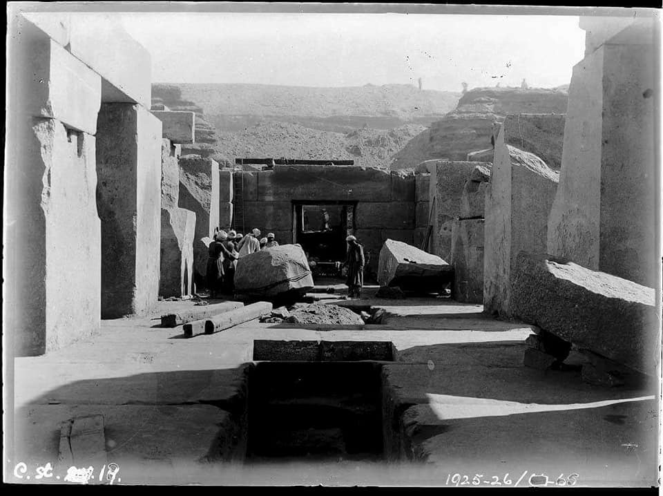
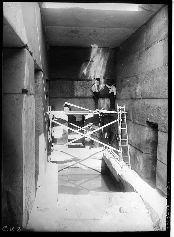
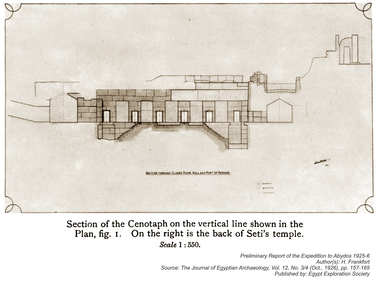
Henry Frankfort devoted several seasons to the additional clearing and careful excavations of Osirion between 1925 and 1930s. One of the tasks set by Henry Frankfort, was the revealing of either the presence or absence of any kind of architectural connection between Osirion and the Temple of Seti I. So, he decided to take excavation works on the axis along the space between these two buildings. As a result, an interesting detail was discovered: the front and rear walls of the chamber (J) continued upward, rising above the limits of the fragments of the Osirion roof, thus playing a role of the walls for holding the sand layer on which the Temple of Seti I was built. The detailed scheme of the vertical section of Osirion, made by Henry Frankfort, with uprising walls above the chamber (J) as well as the fragment of the western wall of the Temple of Seti I is shown below.
The second important task of Henry Frankfort's mission, was to study the nature of water, appearing from the underneath of the Osirion basement. For this purpose, a number of groundwater measurements on the area from El-Balyan to Abydos were undertaken and studied. On the basis of the received graphs, showing the changing of the local water-table, Henry Frankfort made a conclusionm that infiltrated water, flooding the space of Osirion are coming not through the channel, described by Strabo, but from the natural underground aquifer, which extends under the certain parts of the desert, being connected directly to the Nile.
Year 1950 The Egyptian archaeologist Abdel Salam Mohamed Hussein was carrying out works on ground stabilization between the western wall of the Temple of Seti I and Osirion, because the western wall of the Temple was noticeably sinking down into a certain underground void. He also drilled a well in the first Court of the Temple of Seti I and proposed the hypothesis of existance of a ruined ancient water channel, running under the Temple of Seti I and connecting Osirion with the Nile. "The soil brouht up by boring at a point in the 1st court was a mixture of debris, sand and mud. At a depth of about 10 metres fragments or limestone came up indicating a layer 60 cm thick, then came a very thin layer of mud and again limestone for another 60 cm. The tube then droppedin a void 90 cm deep to encounter a third layer of limestone 40 cm thick with sand and mud underneath it. It was evident that a kind of construction existed at that depth; presumably a conduit 90 cm deep with a roof consisting of two courses of limestone and a bed of the same kind of stone. The width of the conduit still remains undetermined. A series or borings put down in the plantations west or the antiquities zone gave negative results until in one lying on the axis granite fragments were brought up from a depth of about 7 metres. Granite was also found at about the same depth in another boring near the last one but on a line perpendicular to the axis. As no naturul bed of this stone can possibly exist in this neighbourhood there can be no doubt that this granite was transported here for construction purposes. These facts suggest that the ancients had excavated the central ditch in the rock to built an underground conduit at its bottom to conduct Nile water from canal to Osirion. If this is the case the canal-end of the conduit will probably be built in granite. Strabo mentions "a canal which leads to this place (Abydos) from the great river". Osman R. Rosten Year 1958-1981 "This imposing subterranean building is one of the great puzzles of Egyptian Archeology. Frankfort made sondage pits down the outside walls of the main hall. At the bottom he found pottery of the Archaic Period and early Old Kingdom. There was no more pottery until very near the present ground level when pots of the XXXth dynasty were found. These suggest that in the period between these dates, the monument was buried in the sand and was inaccessible. Perhaps the structure was built during the early IVth dynasty (maybe by Khufu nimself), became neglected and buried under the sand after the downfall of the Old Kingdom and was rediscovered when Sety's men were digging the foundations for his temple, and so forced them to change the plan of the latter. Lying behind the eastern wall of the Great Hall is another Transverse Hall. It is exactly the same as the one on the western side except that this hall had no connection originally with the rest of the building. Its present entrance is through a hole in the back wall of the central square cell of the eastern wall of the hall, and this hole was forced through in modern times. Yet, during the reign of Sety I, this Transverse Hall must have been accessible as he had decorated its saddle roof with a wonderful scene of the Sky Goddess Nut stretched out over the world. About twenty years ago from the time of writing, the western part of the Temple of Sety I was in danger of collapsing, so fourteen great piers of steel and concrete were sunk in the ground to below water level between the western wall of the temple and the eastern wall of the Transverse Hall. But during this operation no connecting passage or stairway linking the two buildings was discovered, so we still do not know how Sety's men got in to decorate the roof." Omm Sety & Hanny El-Zeini
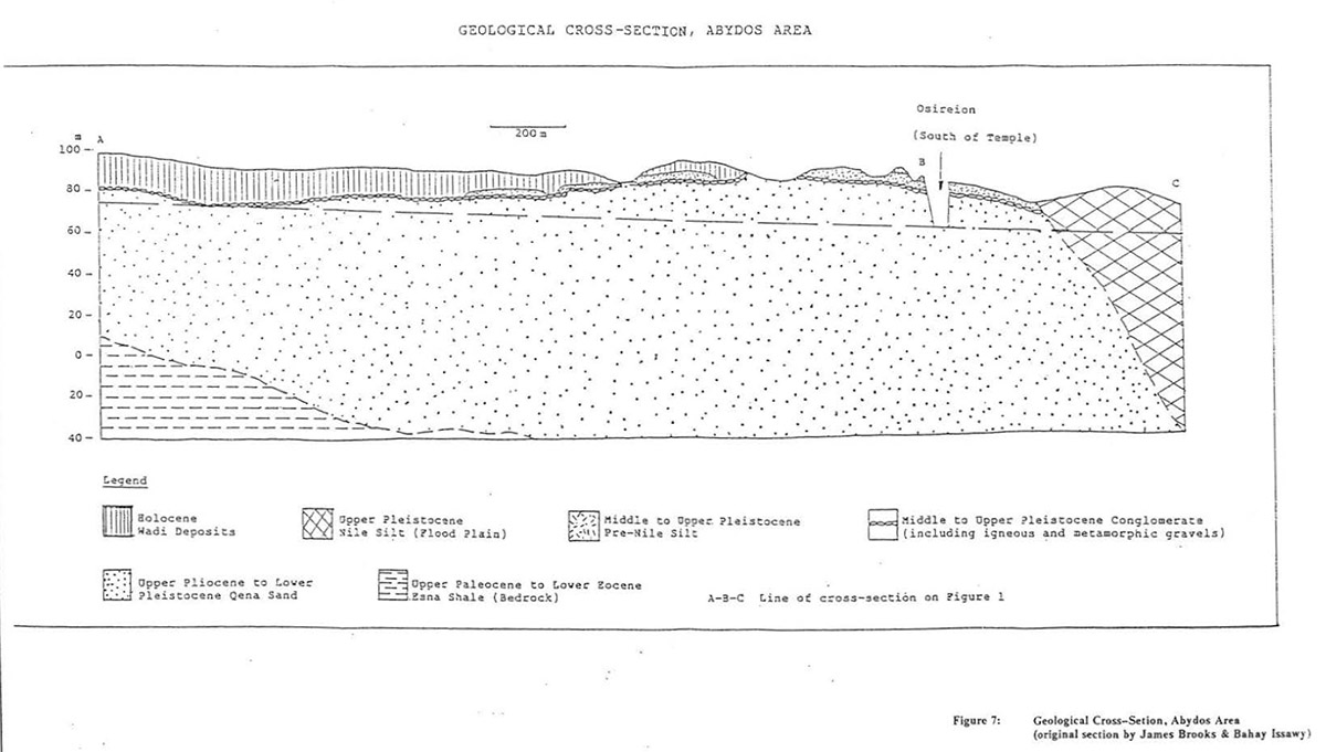
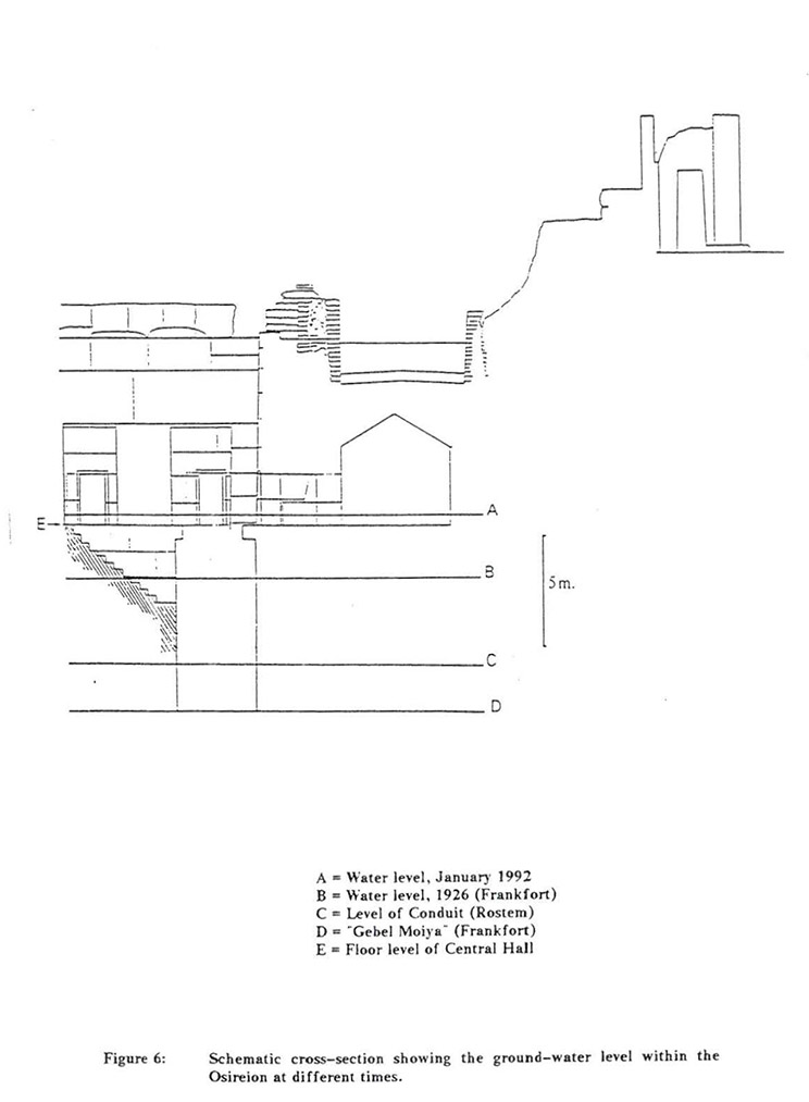
Year 1992 According to American researcher and archaeologist James Westerman, the geological survey carried out by Dr. James Brooks and Dr. Bahay Issawi as a part of the Project, has revealed a radically different interpretation to the specific source of the groundwater within the Osireion, and the geology of the Abydos region as a whole. Their conclusions, described in detail in their report, may be summarised as follows: 1) The source of groundwater within the Osireion is not directly due to the Nile itself, but to an aquifer of fossil water within the Qena Sand, dating from 10 000 - 5 000 B.P., and which drains from the east side of the Western Desert towards the Nile Valley. Geological cross-section of Abydos area:
Cross-section of Osirion:
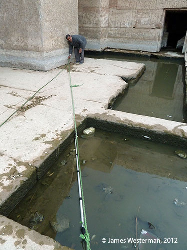
Year 2004 Archaeological mission, headed by the the American researcher and archaeologist James Westerman, has carried out the research works on determining the depth of Osirion, but could not reach the level of its original foundation. According to Henry Frankfort, on the basis of his excavation, carried out in 1920s, the foundation of the building was located at a depth of 7.8 meters below the surface of the central "island". The probe, descended by James Westerman in 2004 to a depth of 8.4 meters, didn't reach the solid foundation layer. The mission has prepared the detailed topographical studies of the area on which the Osirion is located. "As we probed we observed that there were layers of silt and two hard gravel-like layers in between the silt layers. We noticed that the friction joints in the extension pole had a tendency to slip under the pounding action as we punched into the hard layers of gravel. The implications of this are that the construction of the Osireion had to be before the This would have consisted of a deep canal utilizing the water flowing west to east from most likely an artesian spring originating in the Osircion down to the canal system connecting to the Ni.le River. At its western origin this canal would have had to be lower than the foundation level the Osireion actually rests upon. This would provide a direct path for the sandstone and granite blocks to be transported from the Nile to the Osireion construction site. It would also take the water away from the ground level on which the foundation of the massive Osireion is built, as there is no known way of building such a structure on an aqueous silty foundation. It is possible that the supposed conduit discovered by Abdul Salam in the First Court was a conduit system to control the water level in the Osireion canal similar to the system that is used in present day bathroom sinks to relieve overflowing conditions. James Westerman
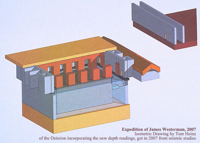
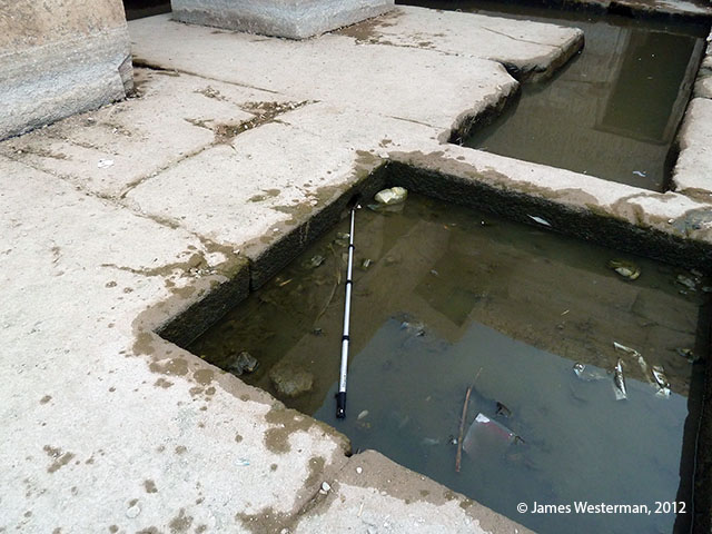
Year 2007 After the seismic survey, an archaeological mission, directed by James Westerman determined the depth of the central island of Osirion. It is about 15 meters below its surface. Studies of the Westerman's mission also showed that there are cavities and voids inside the central island, which purposes are unknown.
Year 2008 "Based on the topographic survey it was found that the water level in the Osireion was approximately one meter higher than the level in the Roman well in the second court of the Seti Temple. This indicates that the water flow in the area is from west (out of the Sahara) to east (towards the Nile). The ultimate source of this water has not been determined. Hydrologic studies show that the water in the Osireion is very drinkable and does not have any predominant taste. Preliminary results show that the water is actively flowing beneath the Seti Temple. It appears to be coming out of the ground from a spring at the foundation level of the Osireion. Because the ultimate depth of the Osireion is approximately 28.5 meters below present grade, the question of how and when the building was constructed is very puzzling. A case can be made that it was built when the level of the Nile was much lower. When the Nile level was low enough to divert the water down to the foundation level of the Osireion was over 5000 years ago. It is for this reason that it is conjectured that the foundation level of the Osireion may be the oldest known stone structure in the world." James Westerman Year 2009 "To the south of the antiquity site (Osireion) the level of the water in the Nile assumes an average height 66 m above sea level, but the water level fluctuated between 67 and 64m depending on the Nile floods. However, with the building of the High Dam south of Aswan it becomes possible to have a steady water level depending on the irrigation engineering system adopted for irrigating all the cultivable land of Egypt. The Nile water usually seeps to the west and the east for some distance depending on the lithological section in the valley. In general it is common for the locals to tap this water by drilling in areas just on the boarder of the cultivated land. In the Osireion area, the locals drilled west of the antiquity site reaching the Qena sands aquifer, which gets water from the seepage from the Nile in the south. This water is suffocated in a channel bordered to the west by the Esna shale, to the east by Nile itself and slopes to the north following the general slope of the pediment surface. The northerly sloping water is trapped in the Osireion pit where it gushes out as a spring when the topography in the pit reached a level below the water in the aquifer. The water rises 64 m a.s.l. coeval with the southern catchment area of the aquifer. The water in Osireion represents the only gushing spring in the whole western site of the Nile Valley. Nowhere in this long stretch, approximately 1000km, is the topography lower than the aquifer except in the area of the Osireion. The recent geophysical and pisometric studies in the area of the Osireion and Seti I temple prove a constant slope of water from west to east, from the desert to the Nile. The source water being the Nile itself, seeping through a subsurface aquifer (Qena Sands) channelized between the Esna shale to the west and the cultivated land and Nile to the east. The fact that variable analyses results came out from the different wells and sites in the study area, depends on the passage of water through the different beds with varied lithology. The sands in the aquifer form a kind of filter for some impurities hence some wells differ from others in their water content which maybe potable or semi-potable." Bahay Issawi – Geologist Year 2010 The archaeological mission of James Westerman has discovered that the water in Osirion differs in its chemical composition from the water, taken from the newly drilled wells to the west and to the north of it, thereby questioning the theory of the aquifer. It was also determined that the flow of water comes, presumably, from under the central island. Richard R. Parizek, Head of Mission, Professor of Geology and Geo-environmental Engineering, Geosciences Department The Pennsylvania State University in his scientific work "HYDROGEOLOGIC INVESTIGATIONS: OSIREON AND SETI-I TEMPLE AREA, ABYDOS, EGYPT" mentions the following: "Rather, groundwater flow was being directed eastward along a more permeable pathway that extends from the Osireon, below the Seti-I Temple eastward along a still poorly defined canal, ancient drain or other pathways. Splitspoon soil samples and rock core borings will be needed to define the limits of this pathway. Pumping tests and analysis of groundwater samples should reveal the permeability of its fill and its postulated hydraulic connection to the Osireon." Dr. Bahay Issawi in his "Report for Explorers Club Flag 172 Expedition April – May, 2010" writes: "The retreat of the sea off the Egyptian land took place during 3.6 to 1.8 million years ago. While retreating the sea water deposited a limestone section about 15 – 20 meters thick, highly brecciaed, very hard in the form of small and big lenses, approaching beds in both side of the Upper Nile Valley, east and west of the Nile very near to the course of the river. This hard limestone is known as the Issawia Formation and considered of middle Pliocene age (3.6 – 2.6 million years ago). The sand section above the Issawia known as the El Wastani Formation was dated to 2.6 – 1.8 million years ago.
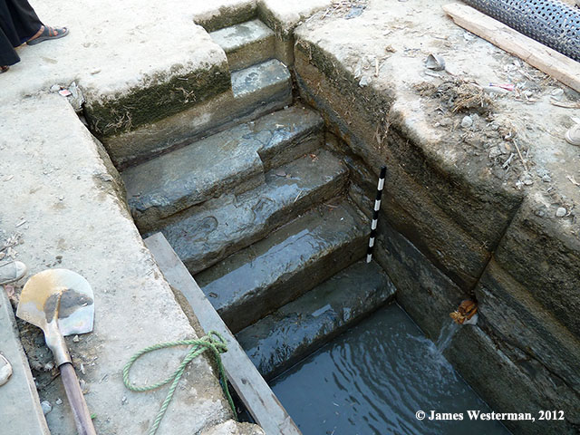
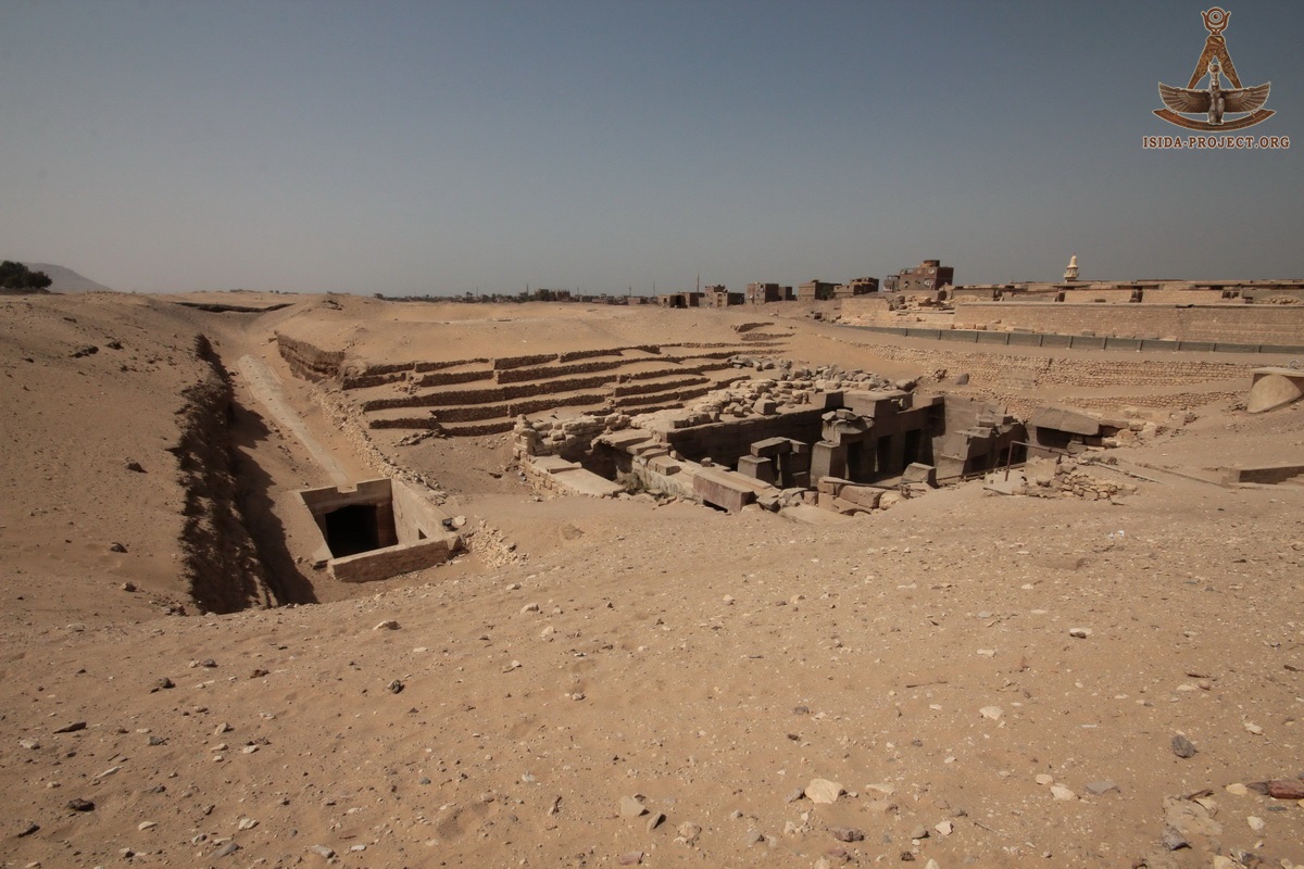
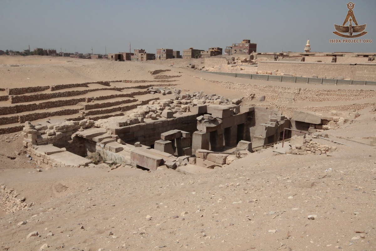
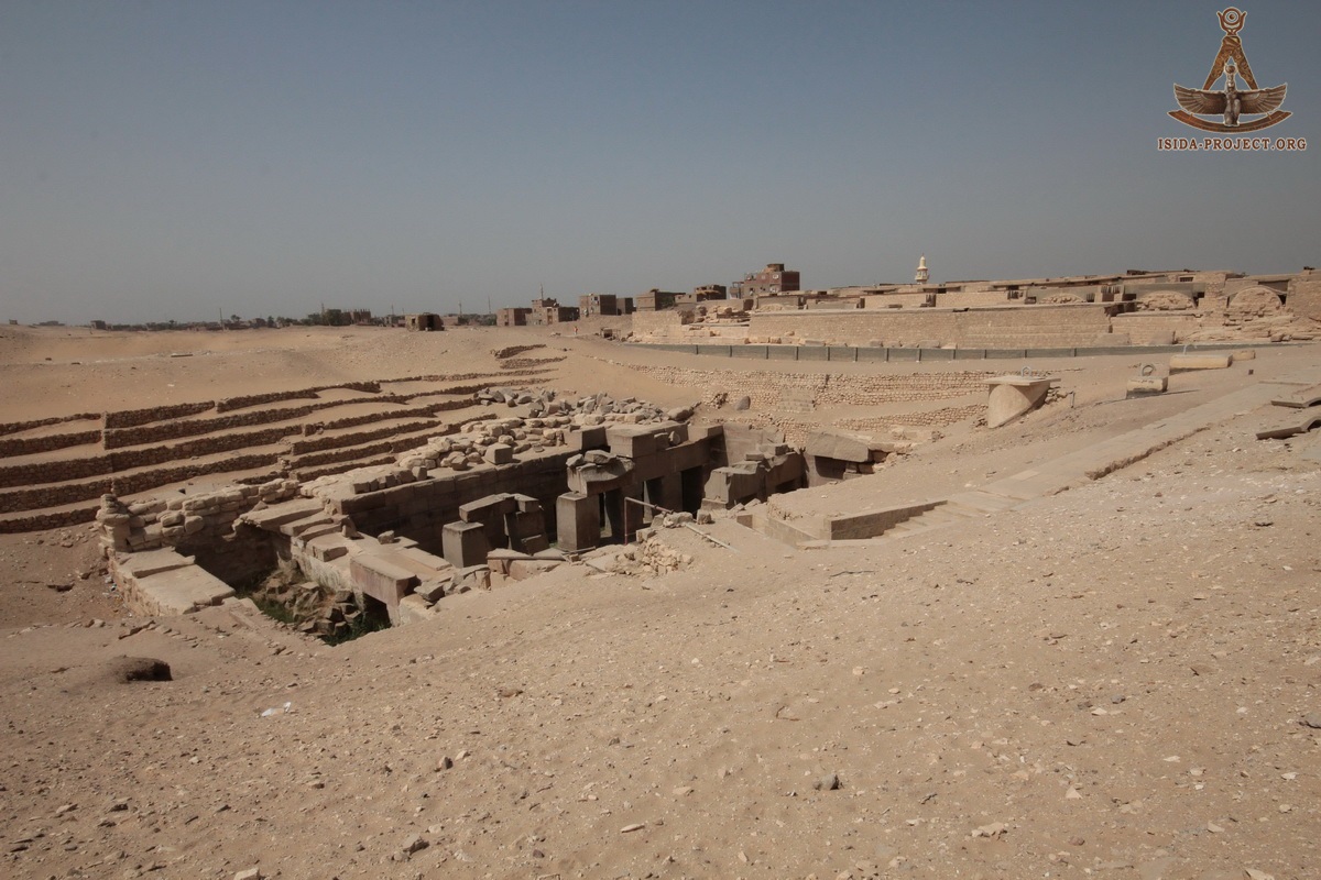
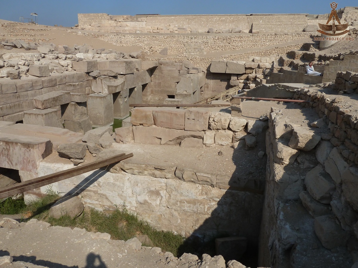
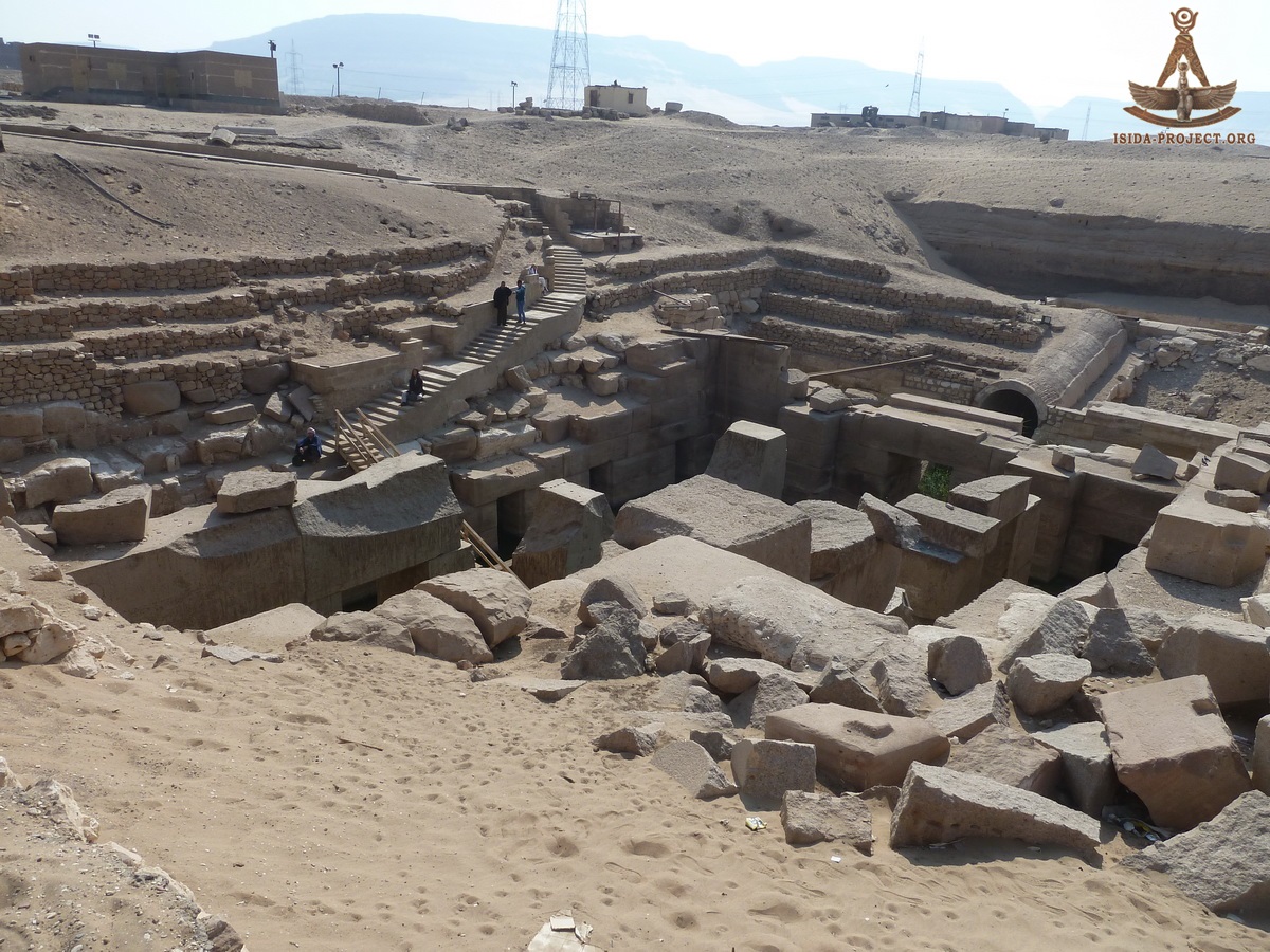
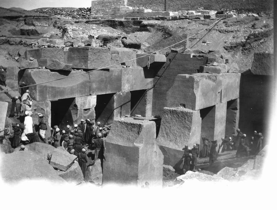
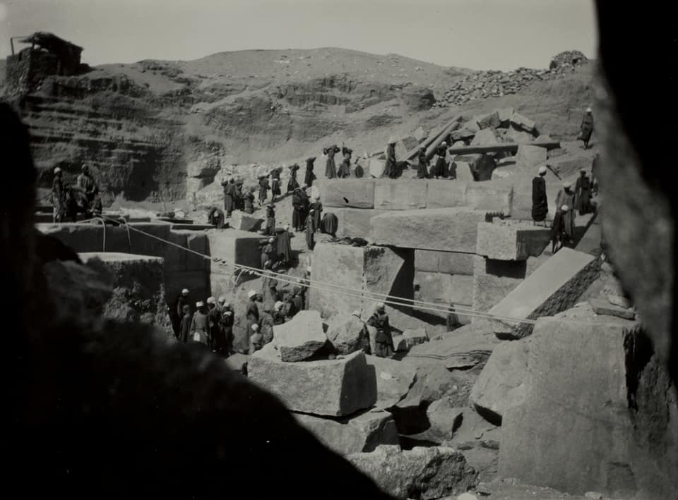
"I discovered a temperature anomaly between water in two piezometers in the west channel of the Osireion, compared with water surrounding the piezometers. Year 2012: After several earlier visits to Osirion, the ISIDA Project Research Group was first allowed to photograph the interior of the underground part of the Great Reservoir of Abydos in December in 2012. Our aim was to study the geometry of the structure and draw some parallels with the structures of Giza, mentioned by Edouard Naville. As it turned out, such parallels are really existing.
The detailed information about the first visit of Osirion, undertaken by our group is documented in the report "Expedition to Egypt 2012. Osirion." At the same time, we considered the possibility of the possible continuation of the underground part of Osirion, going deep into the foundation of the Temple of Seti I. This hypothesis was studied long and mindfully. Finally, the second expedition was organized, the results of which are set forth in the report "Expedition to Egypt 2013. Temple of Seti I". Year 2018: So, in searching for more new evidences for strengthening of our previous hypotheses and in order to find answers to the new questions, after five years of the detailed studies, we have organized our next expedition to Abydos in April 2018, when Nile was in its low phase ...
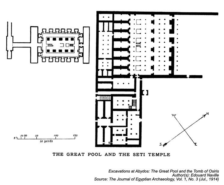
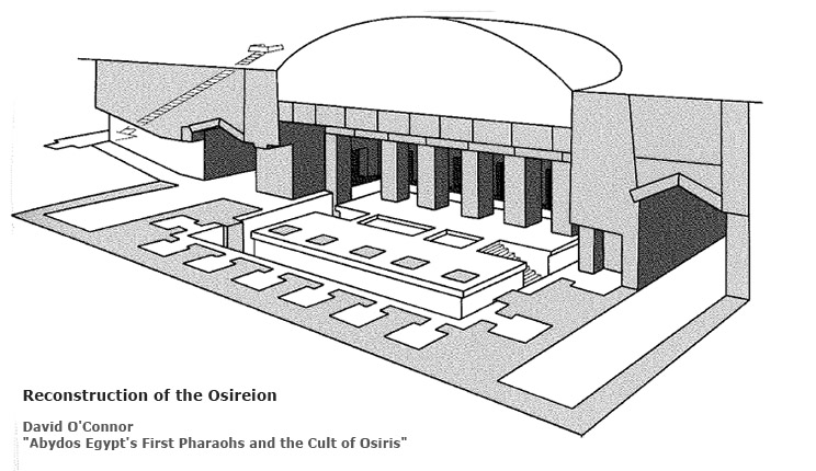
For a better understanding of the architectural complex, below is the reconstruction scheme from the book "Abydos Egypt's First Pharaohs and the Cult of Osiris", written by the Australian Egyptologist David O'Connor.
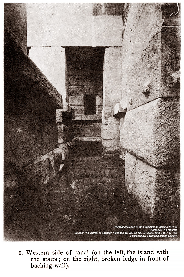
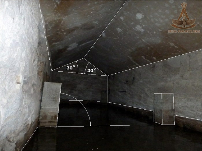
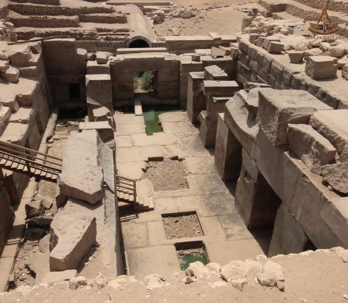
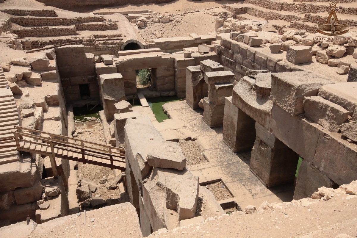
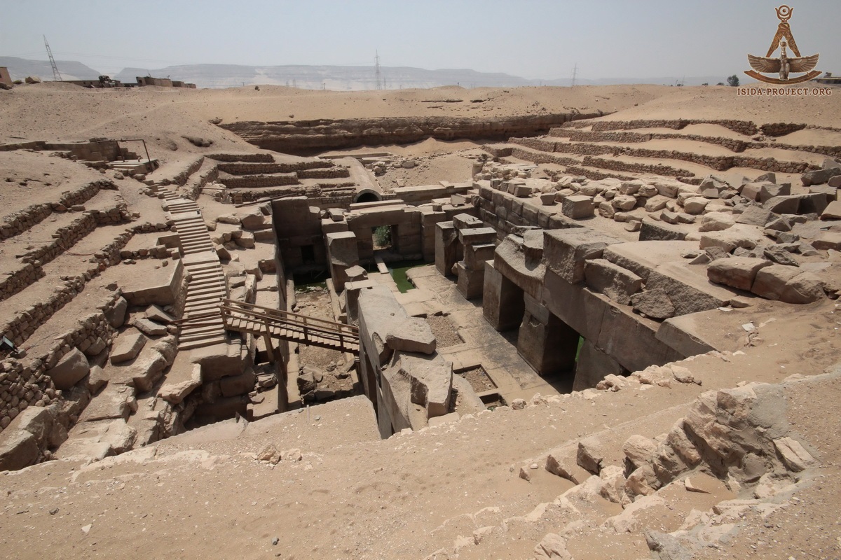
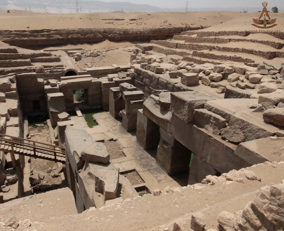
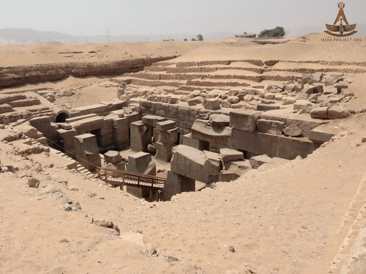
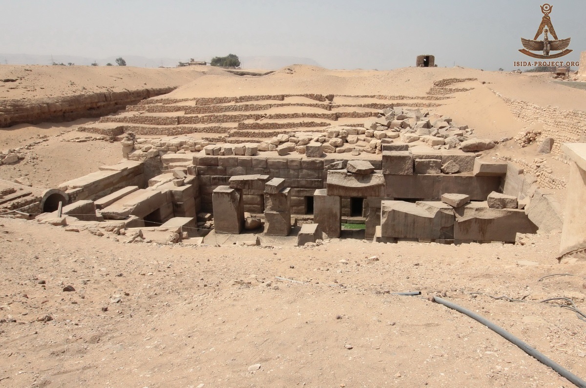
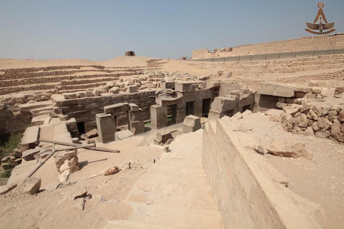
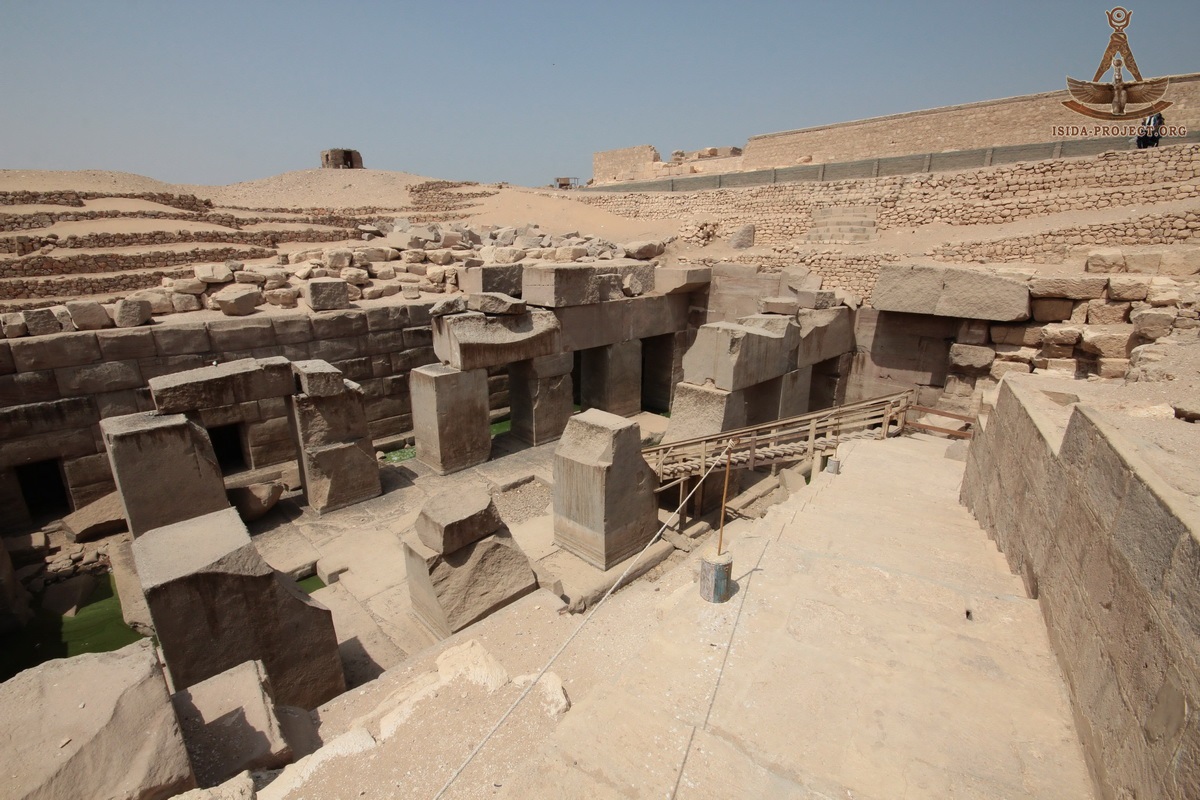
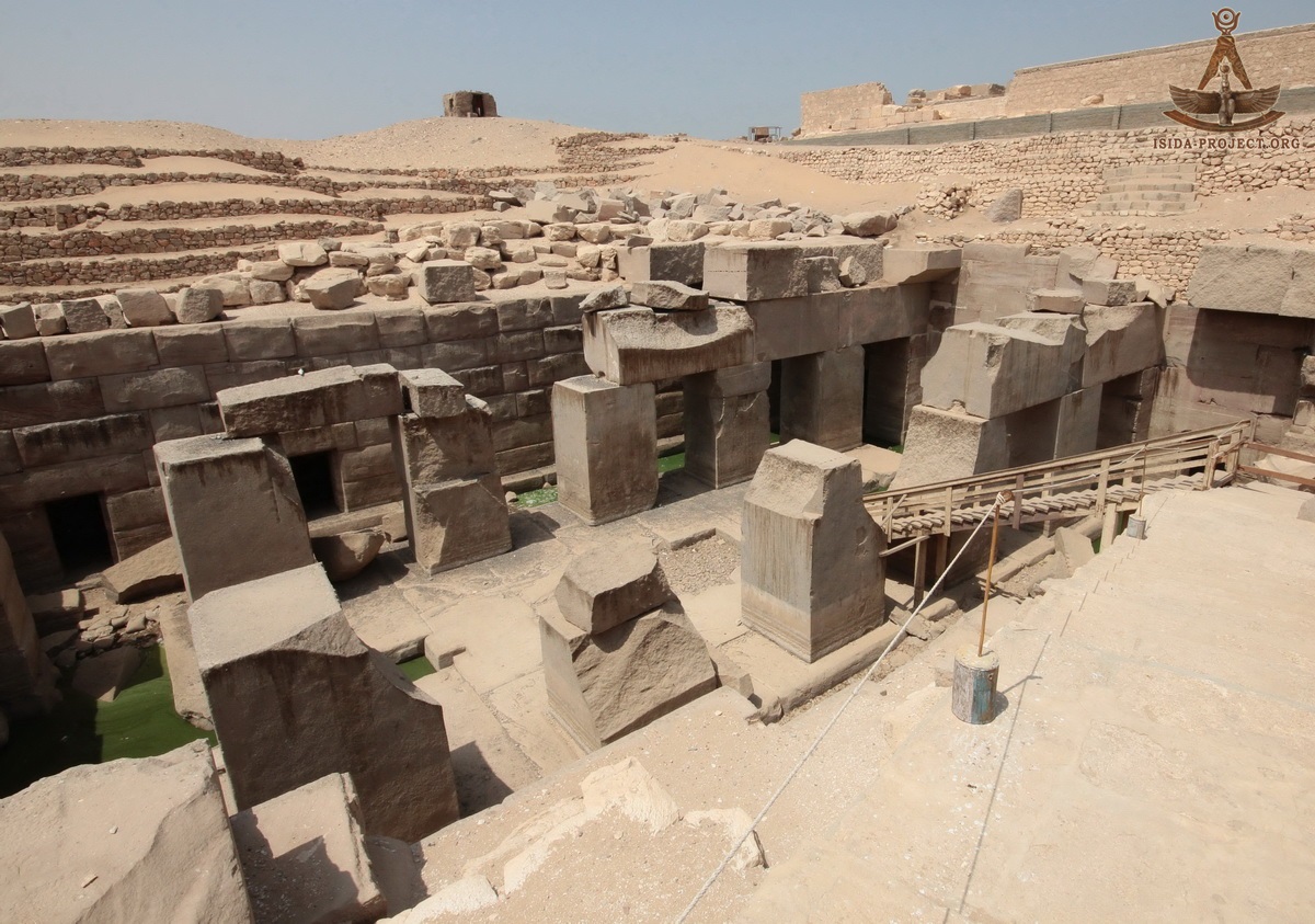
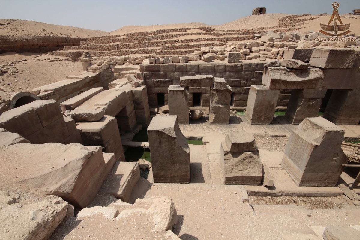
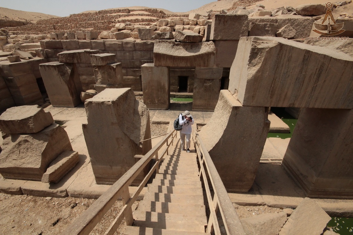
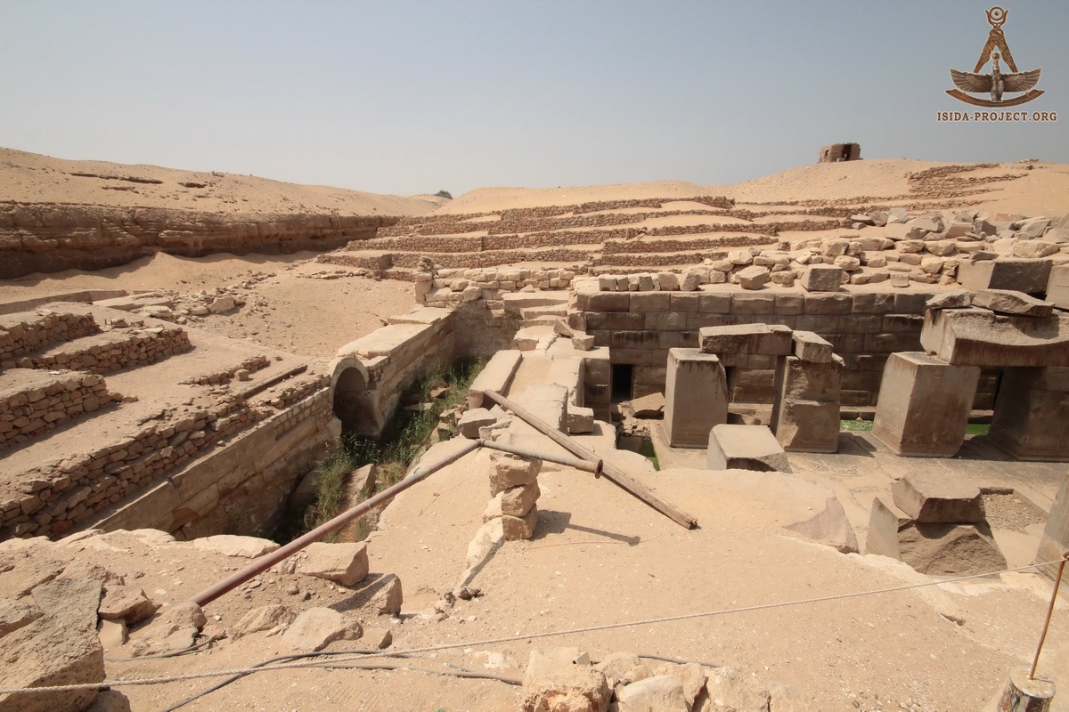
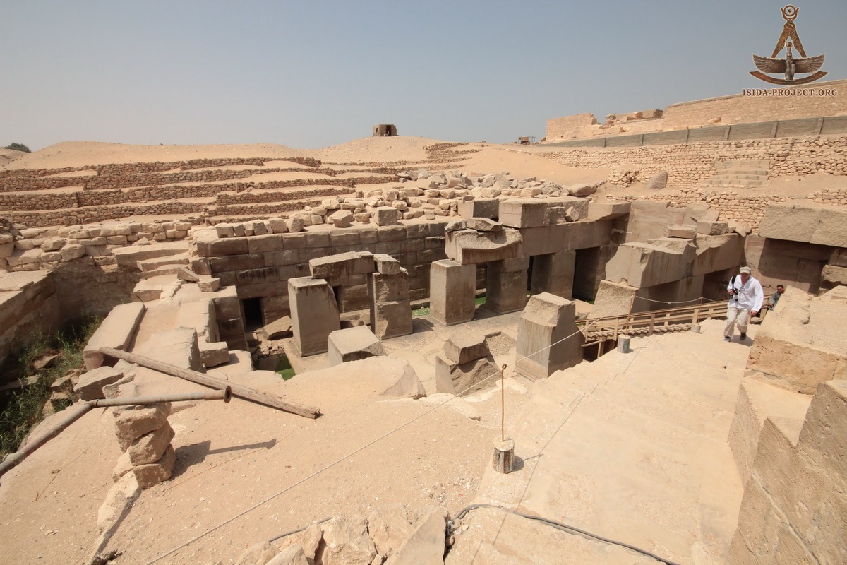
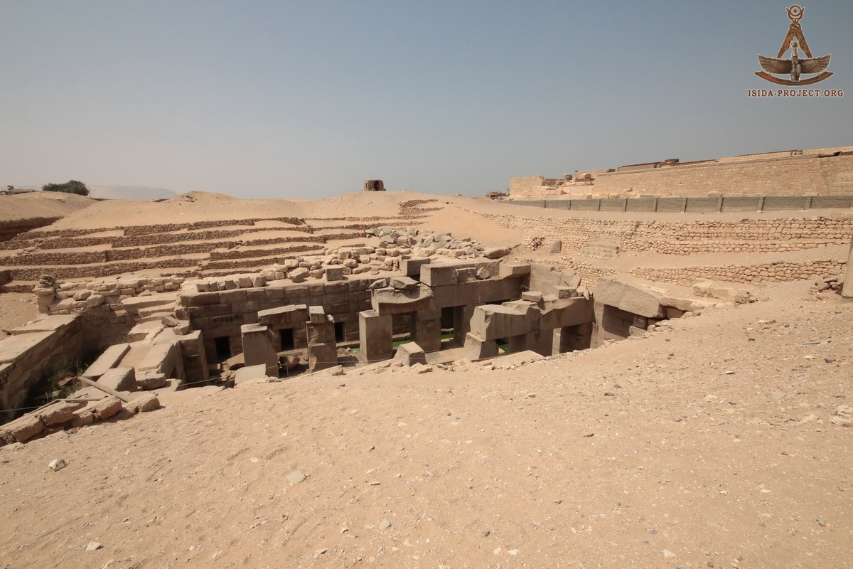
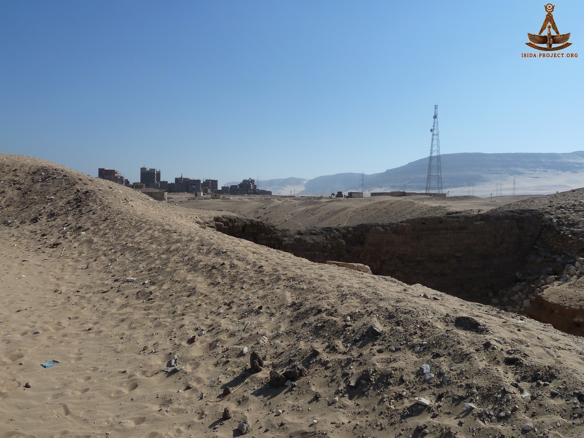
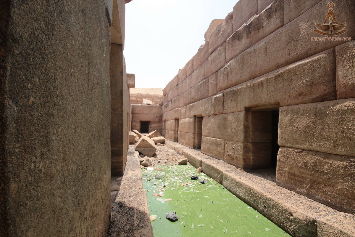
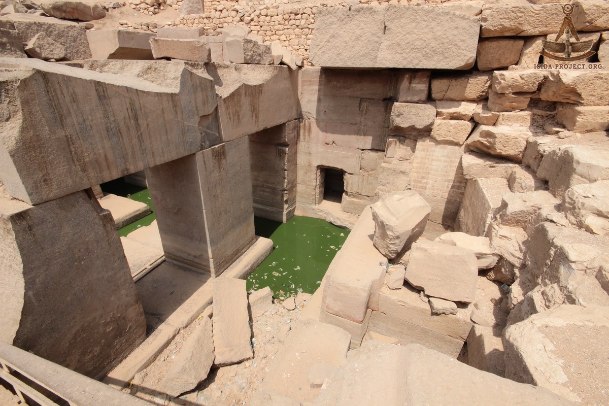
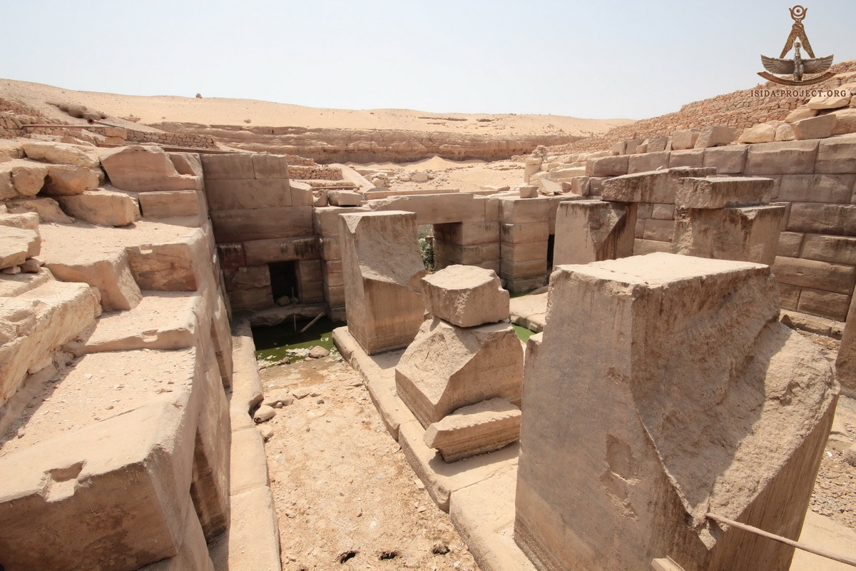
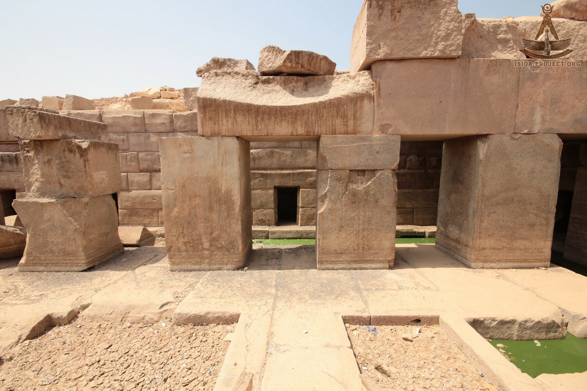
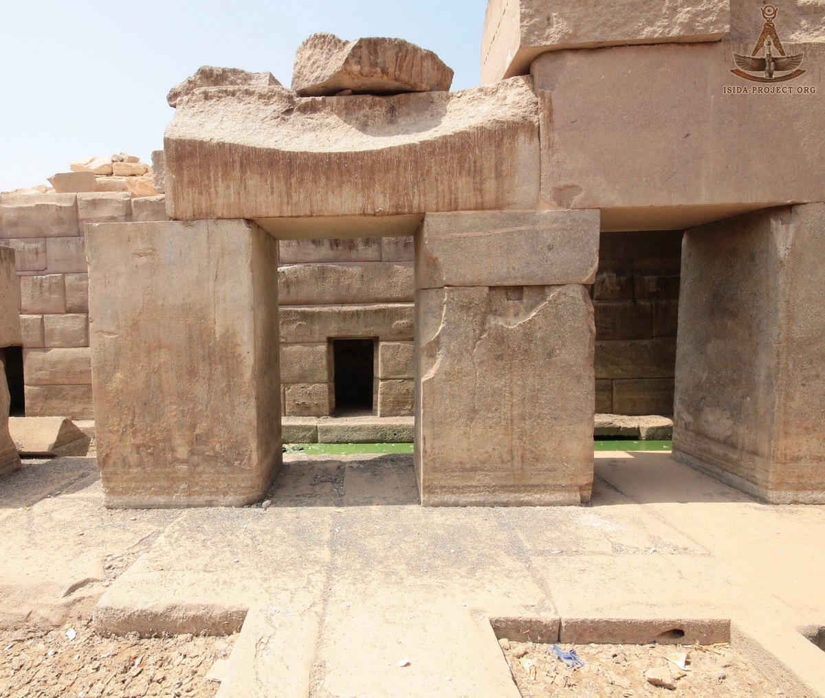
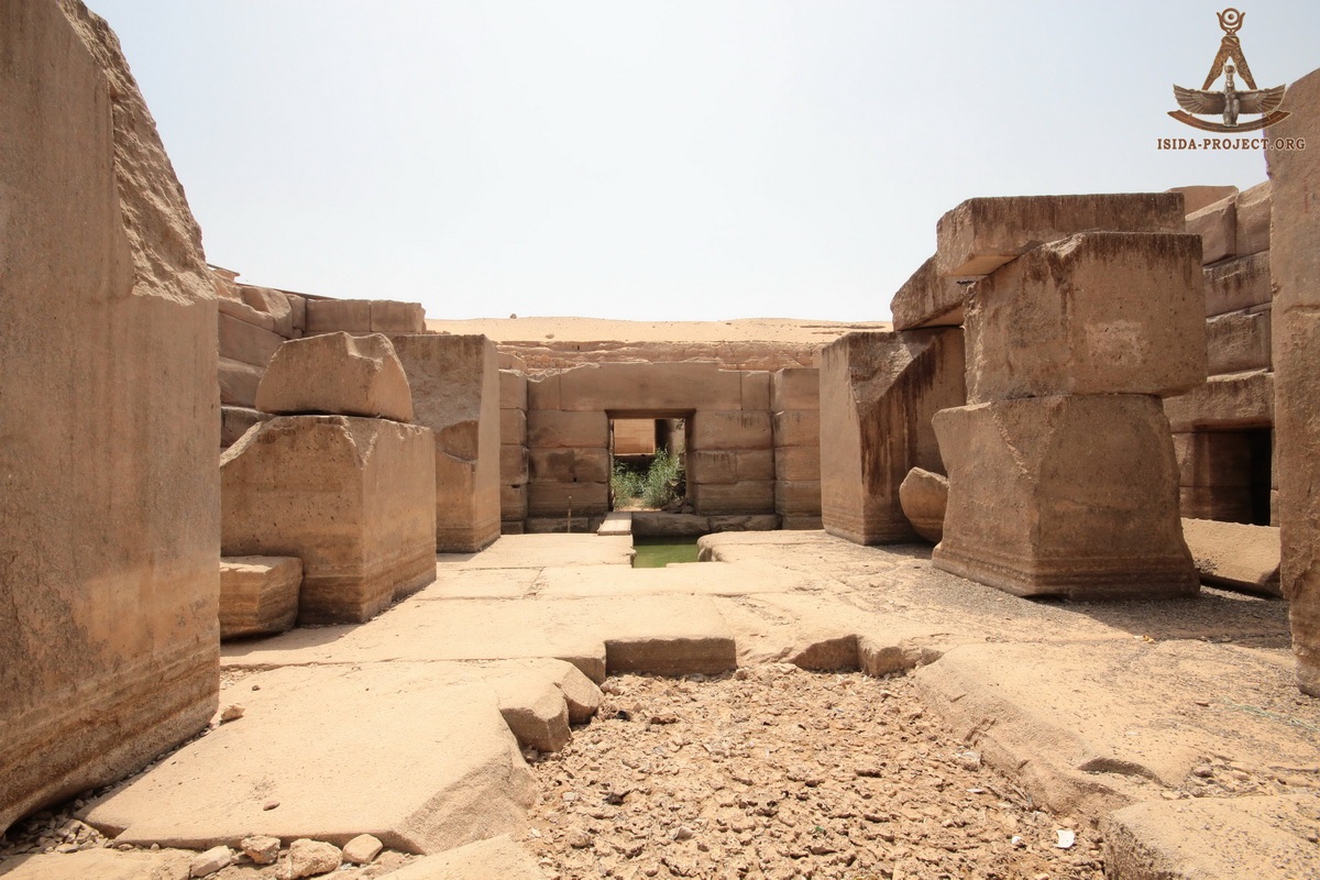
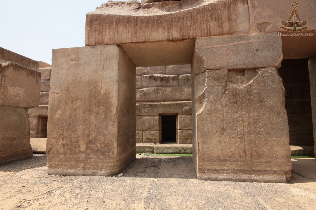
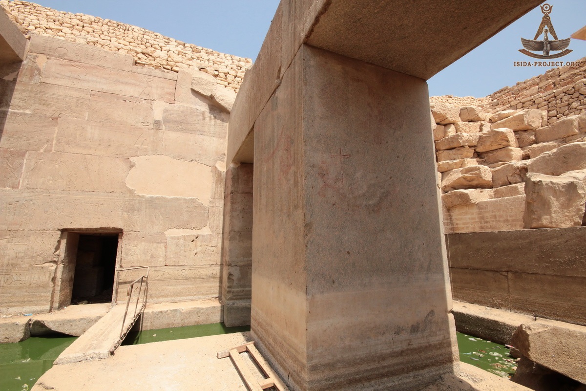
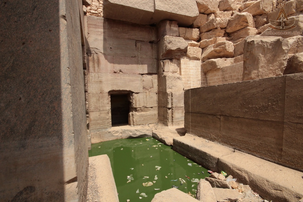
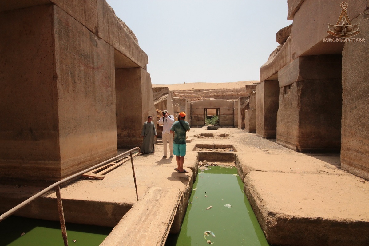
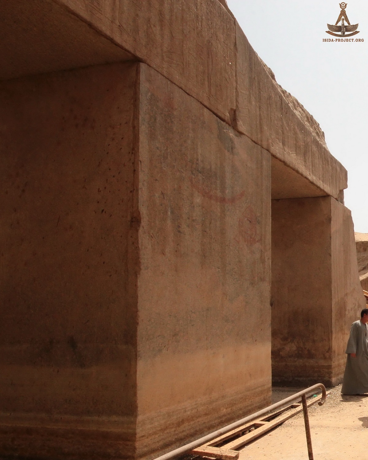
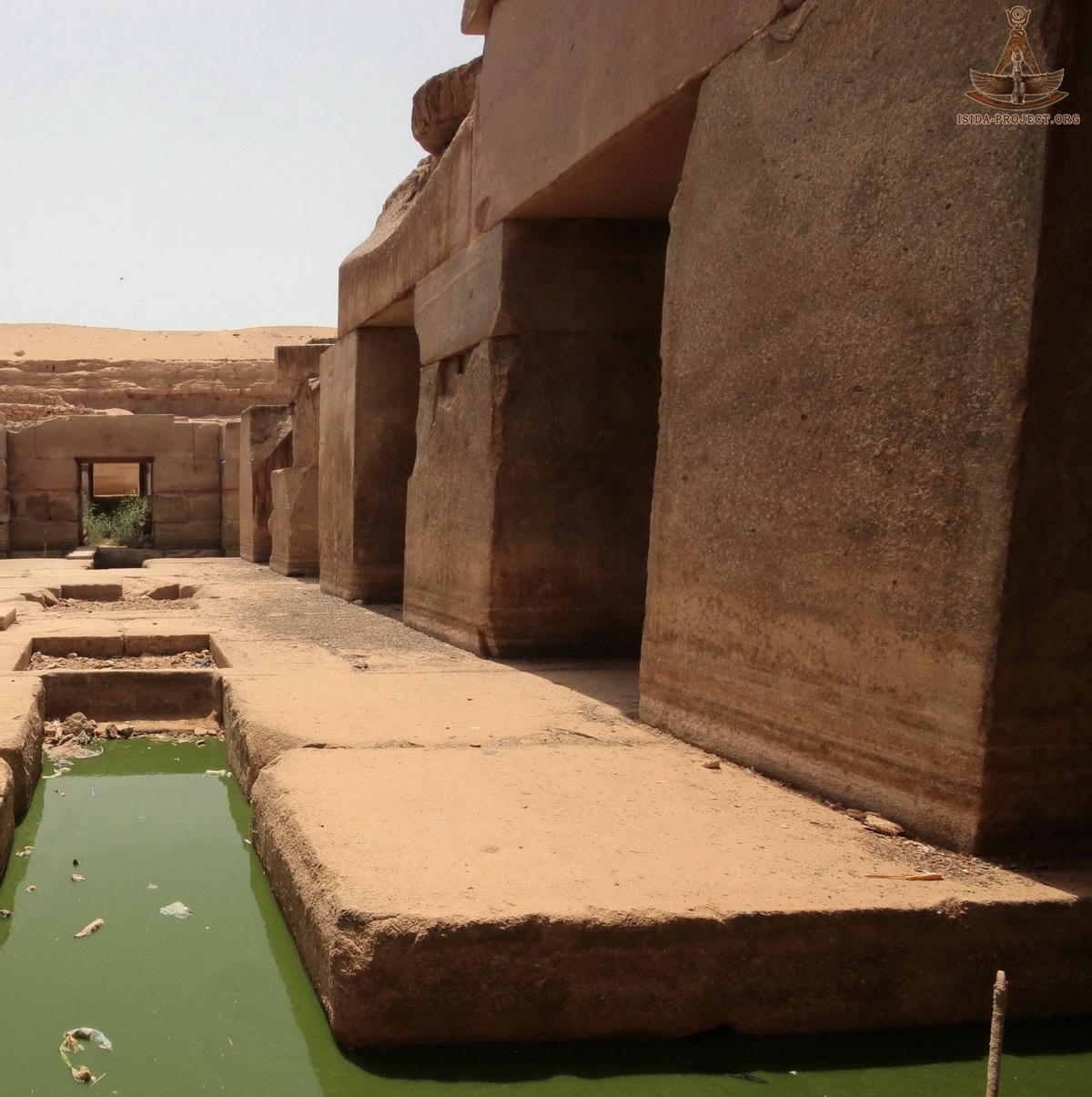
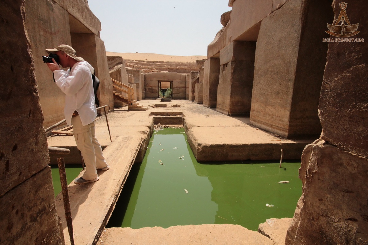
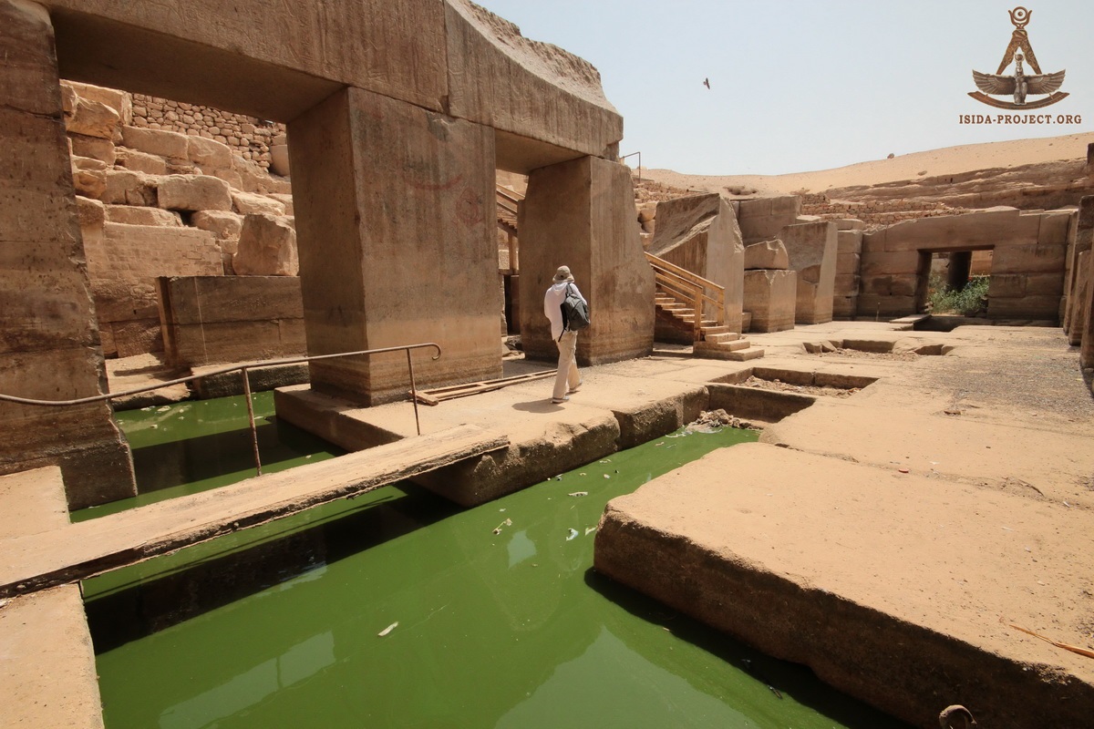
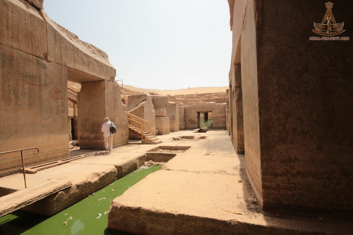
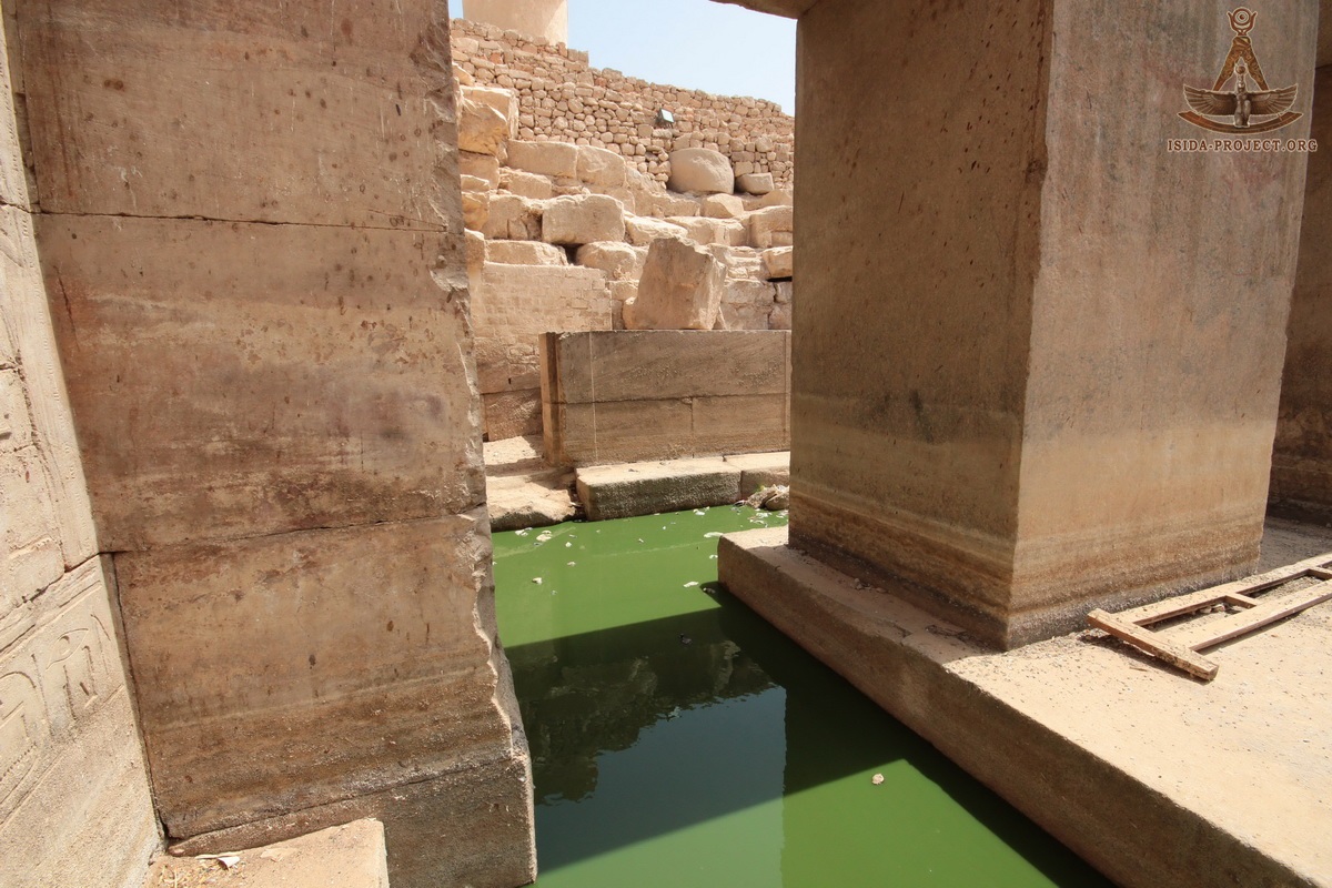
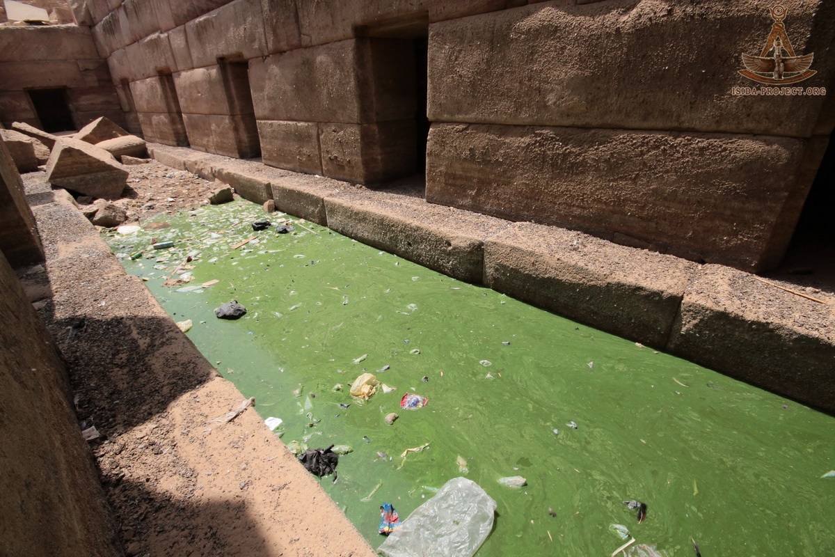
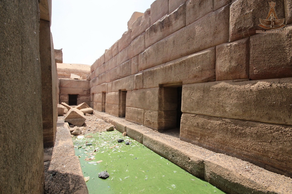
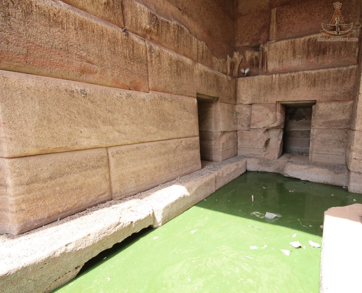
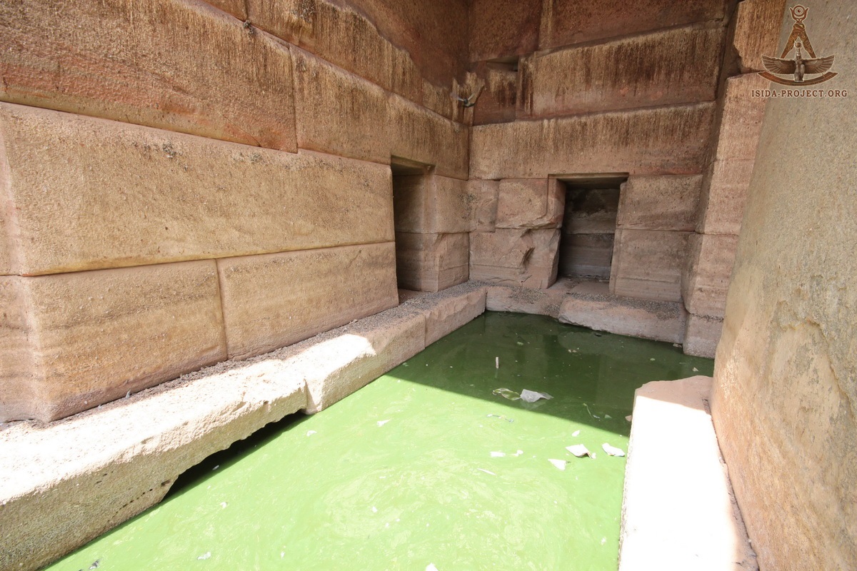
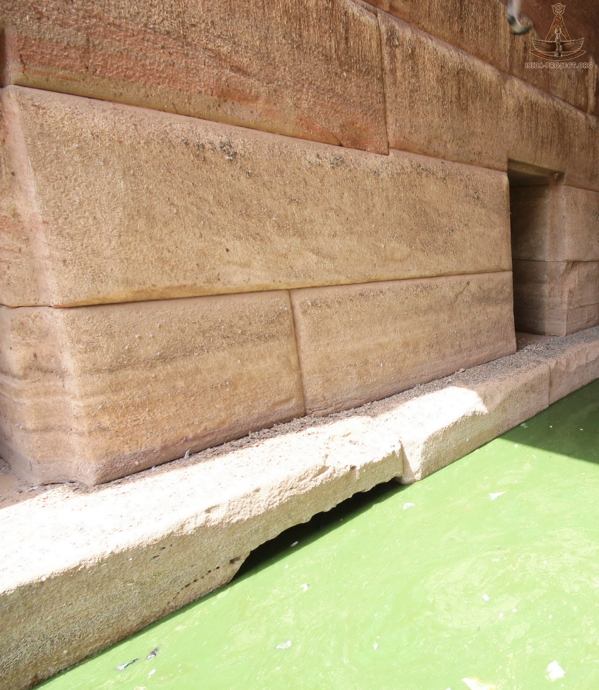
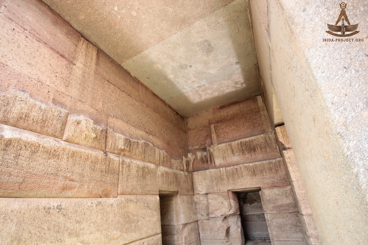
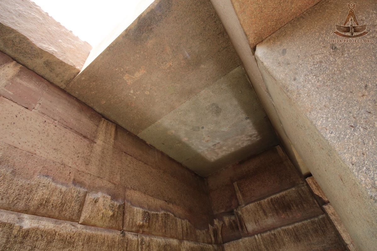
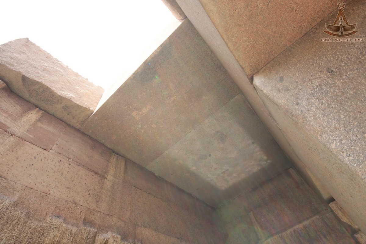
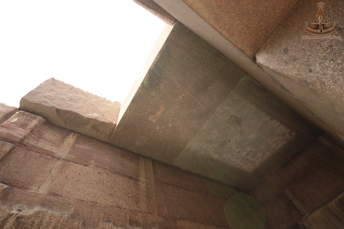
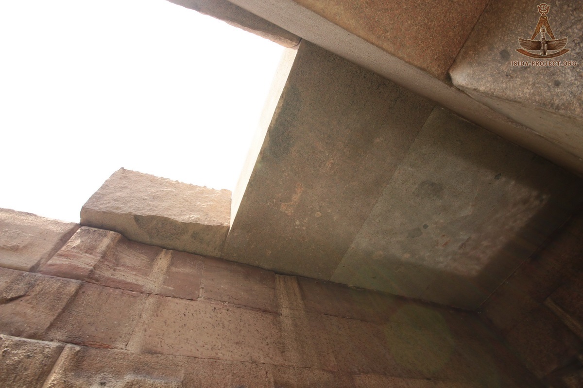
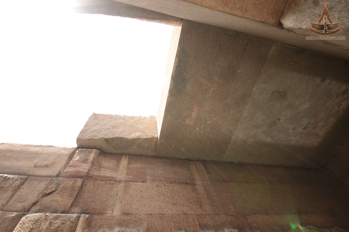
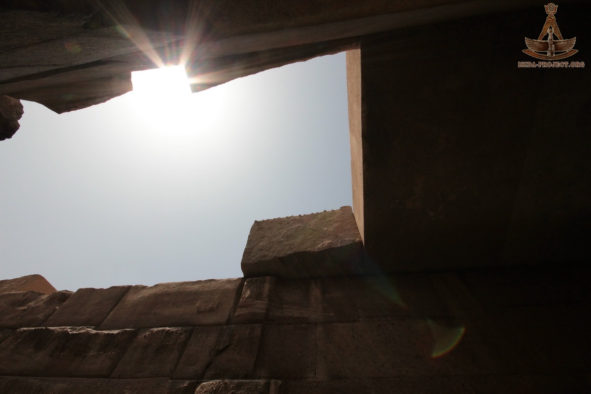
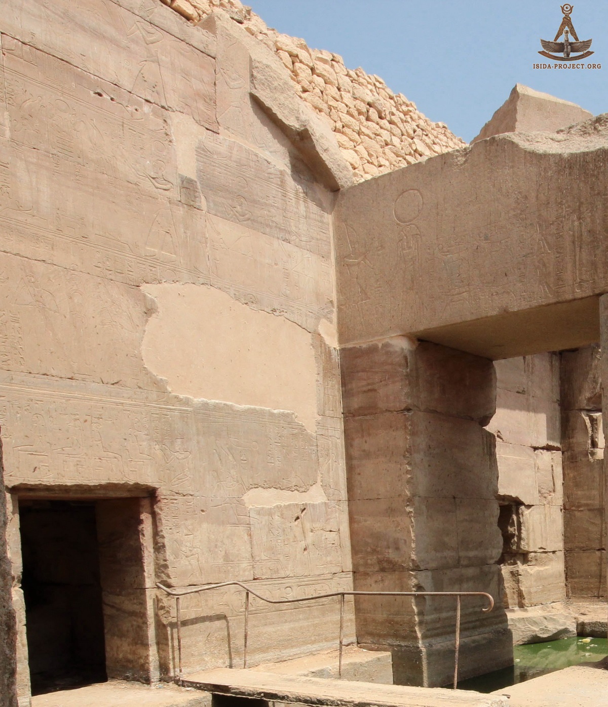
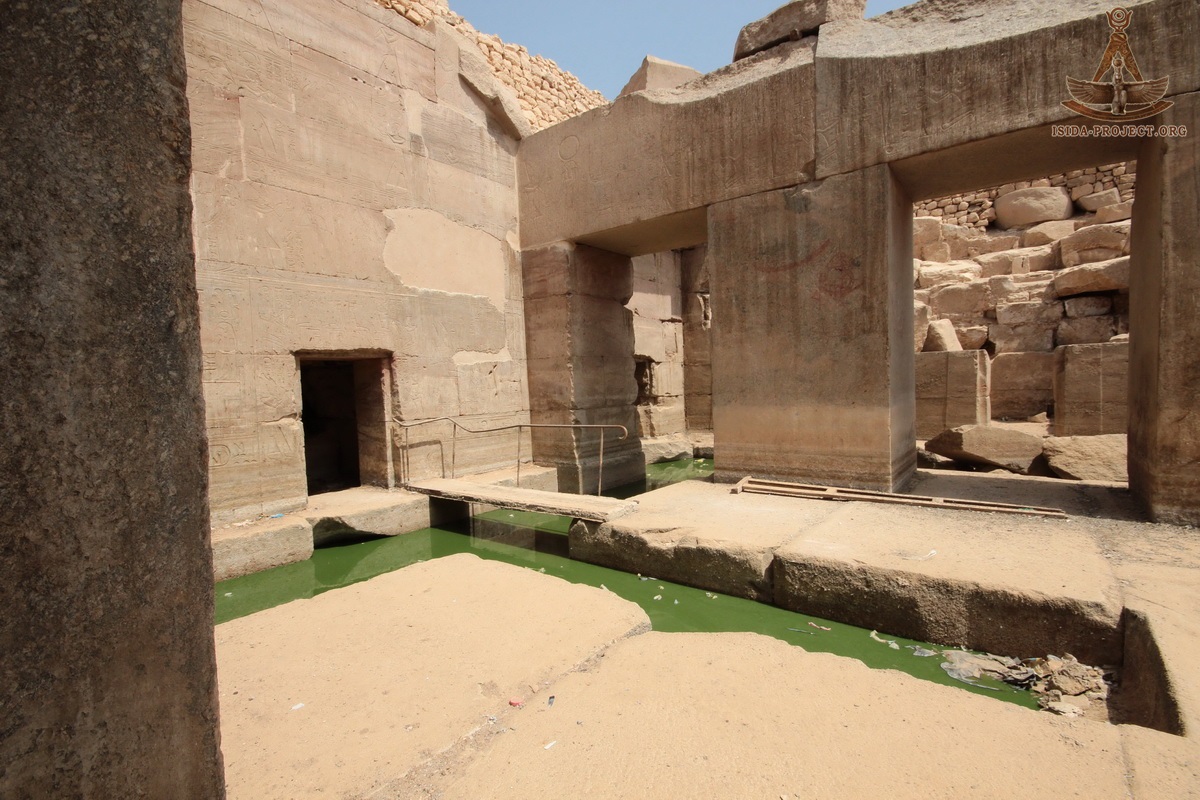
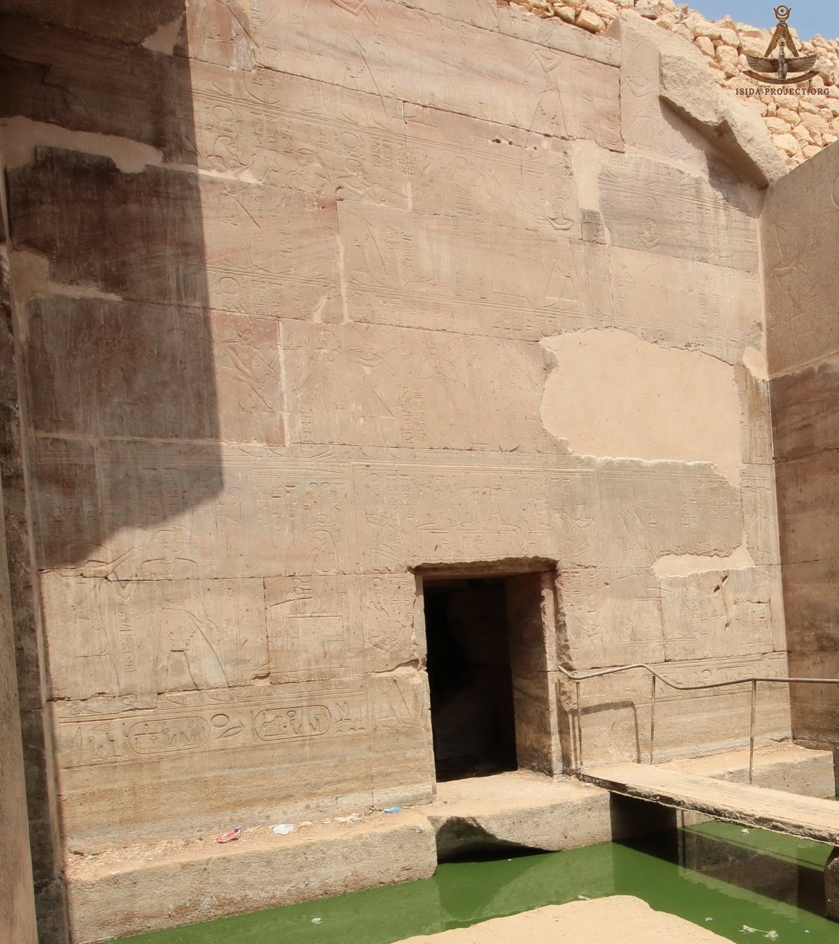
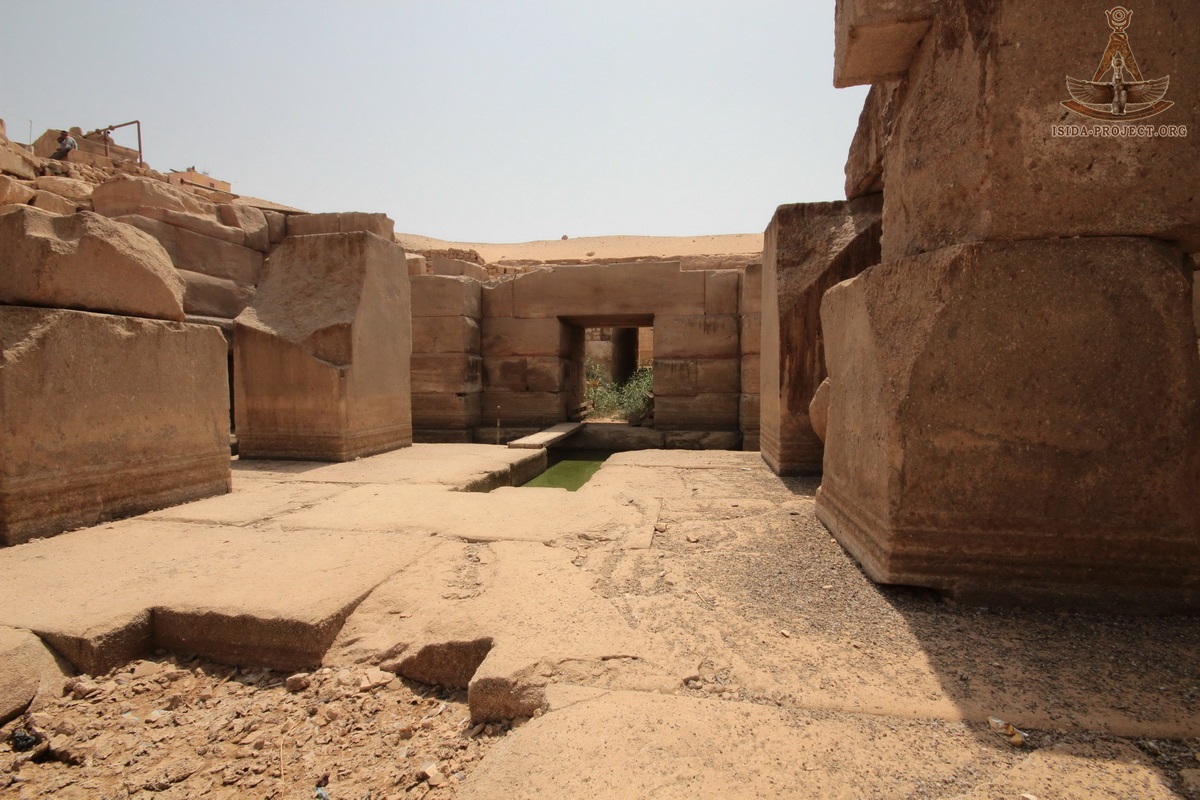
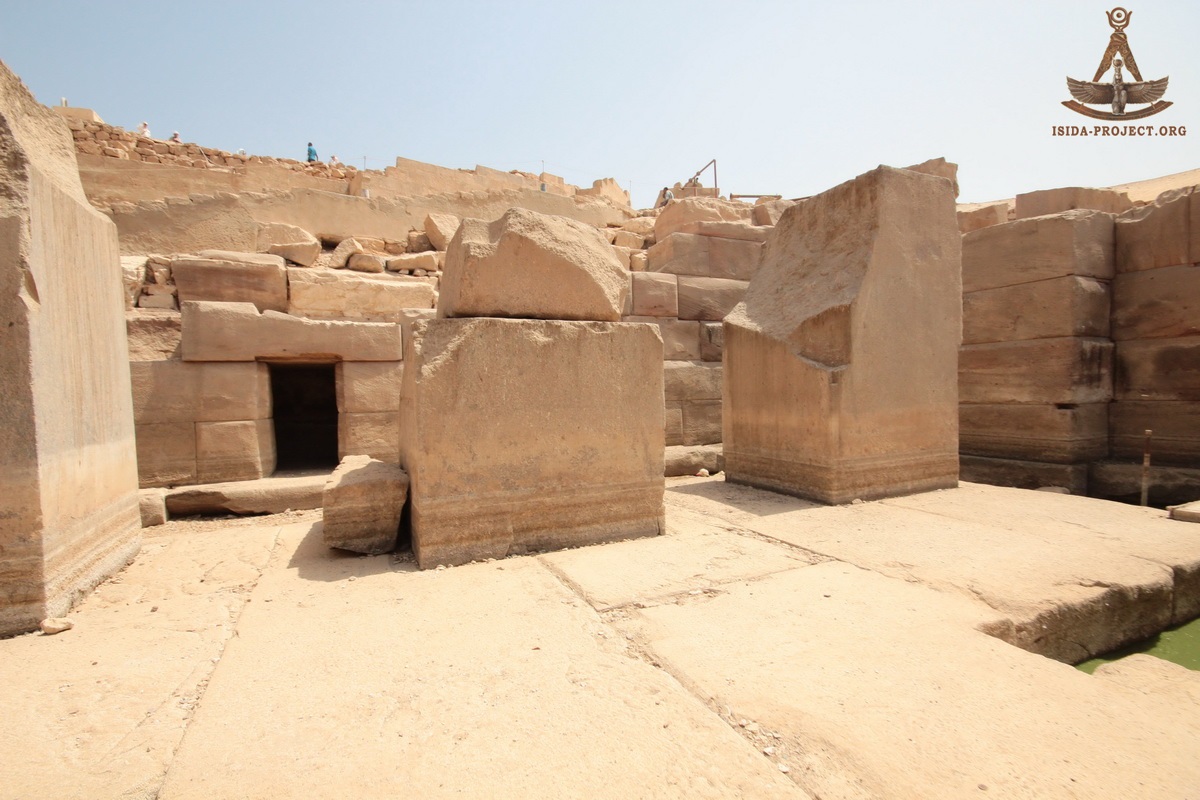
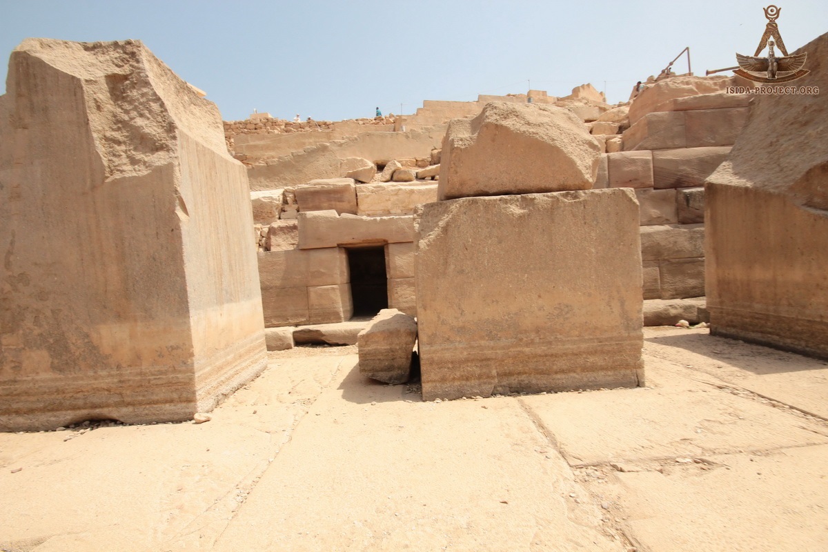
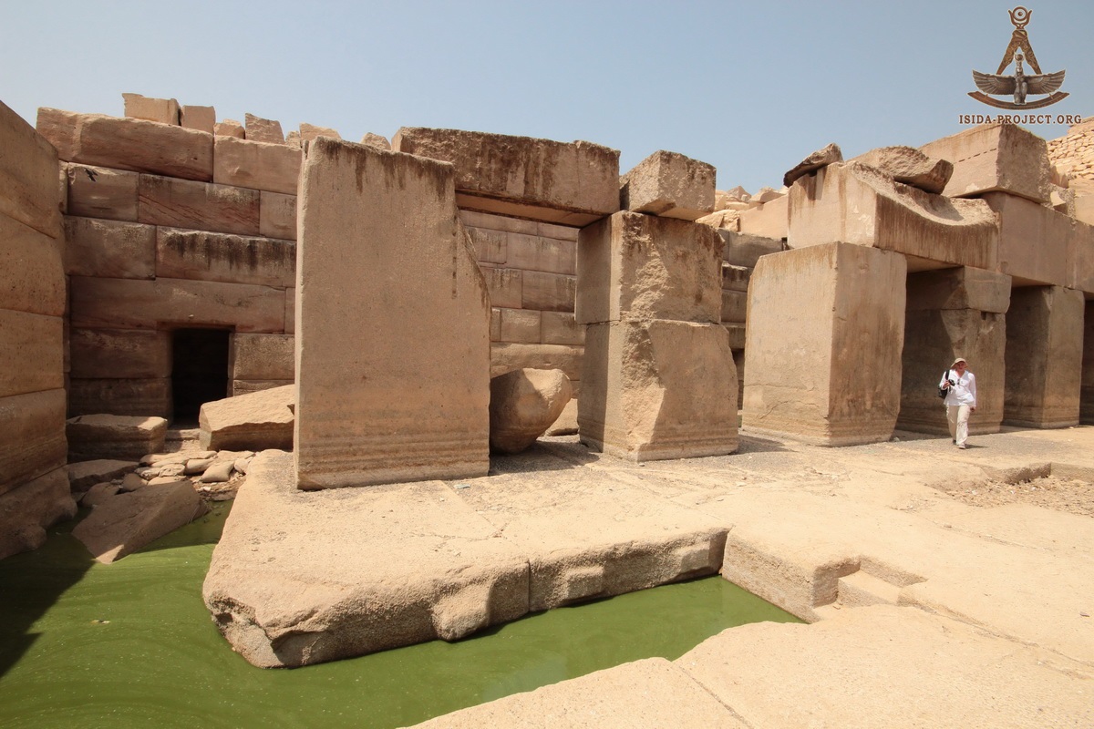
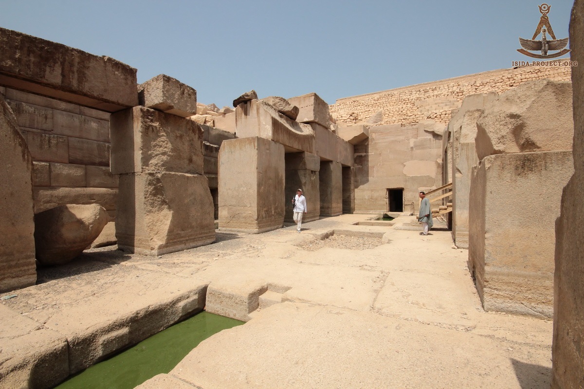
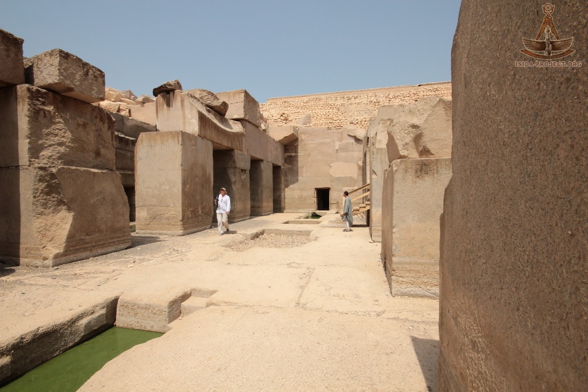
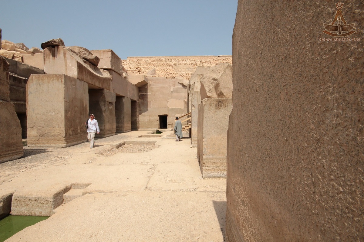
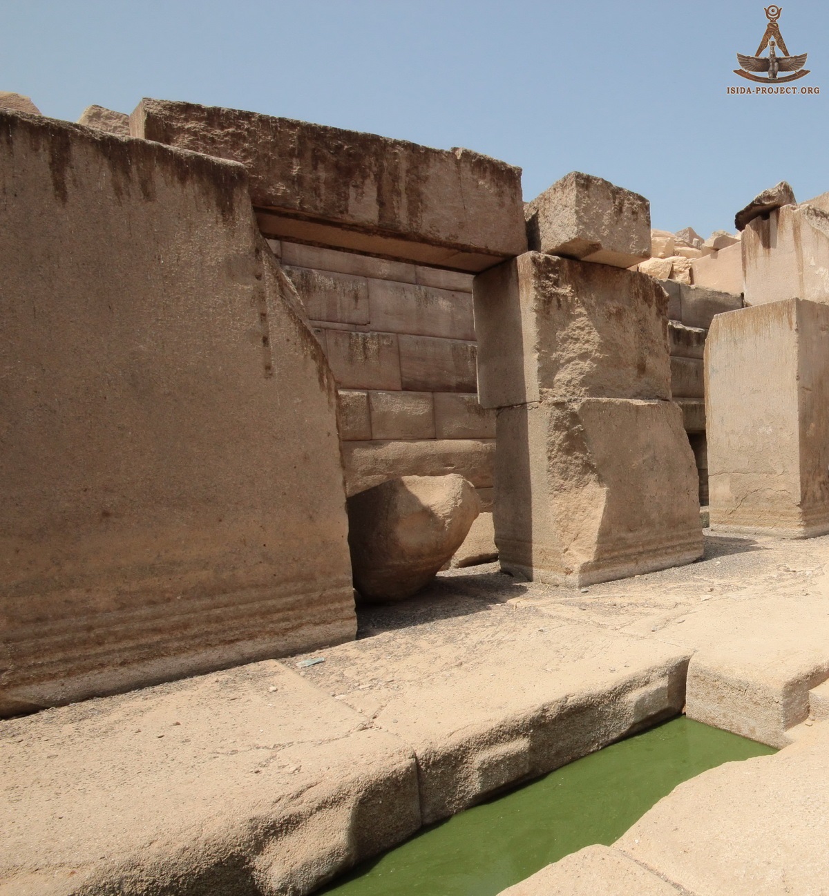
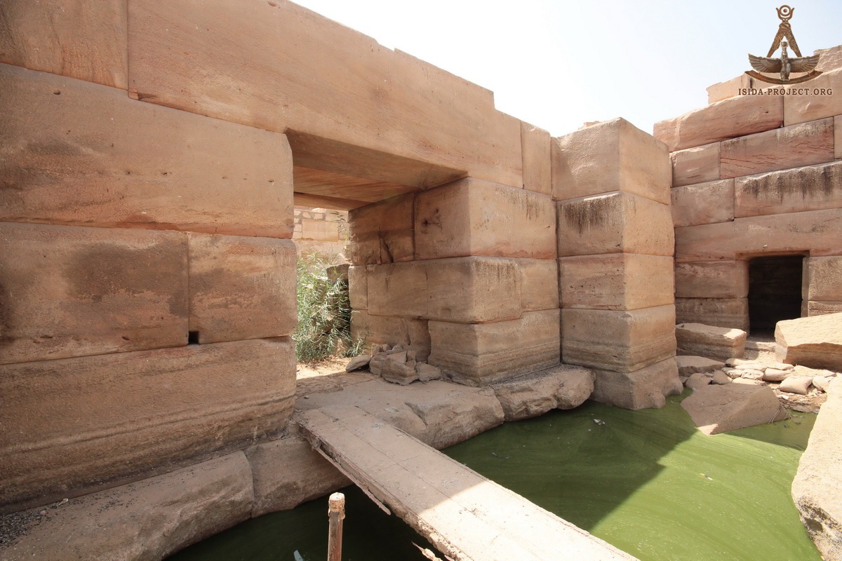
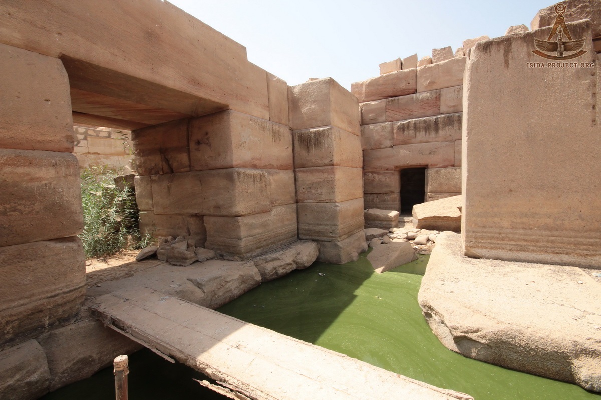
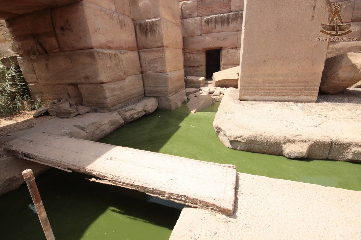
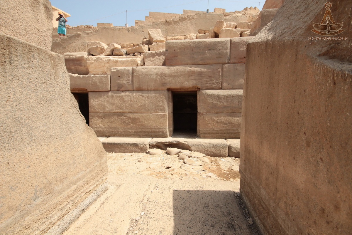
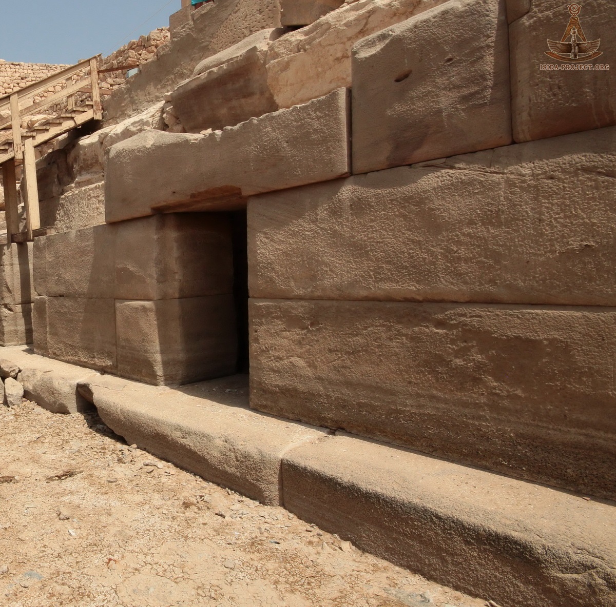
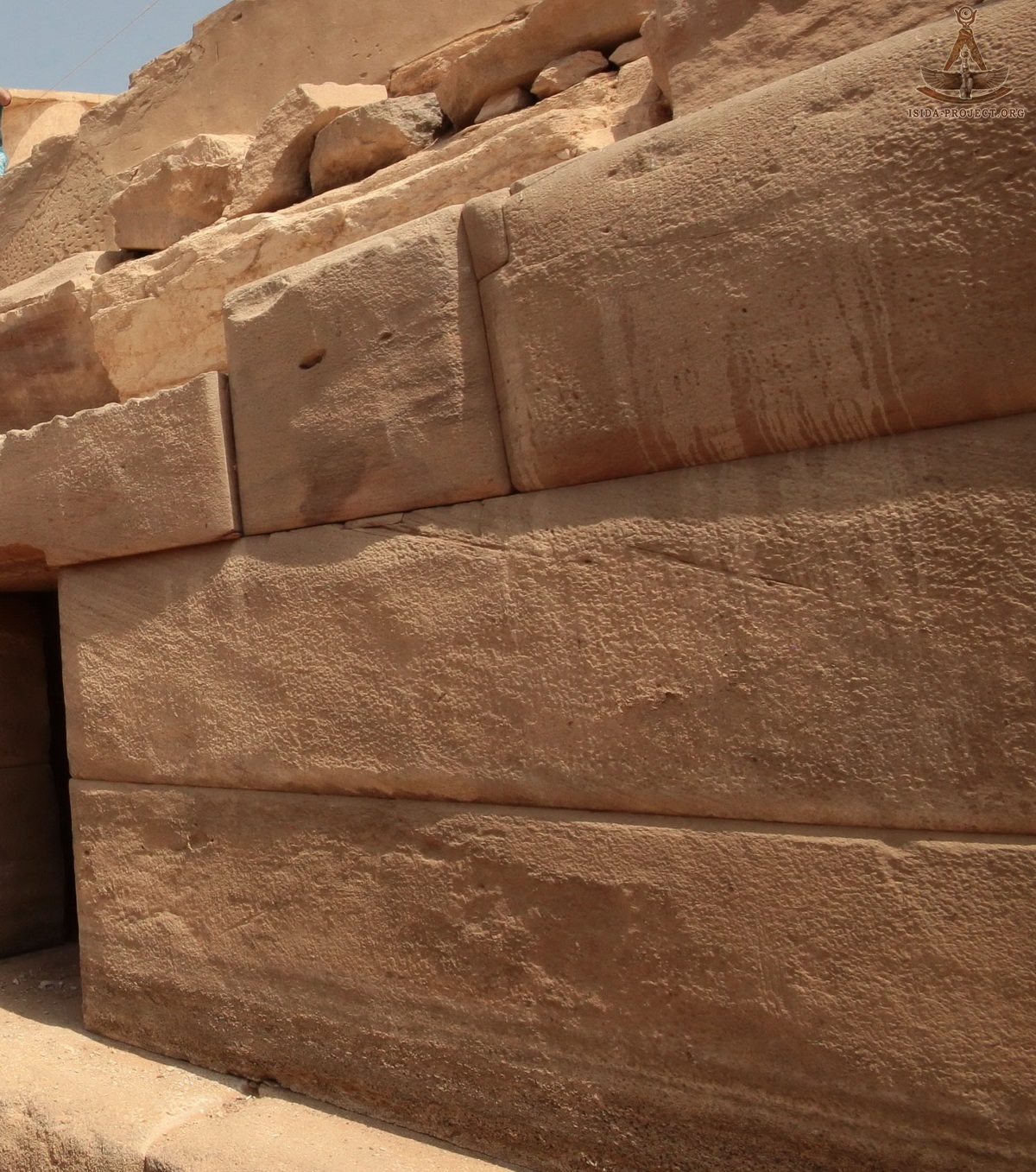
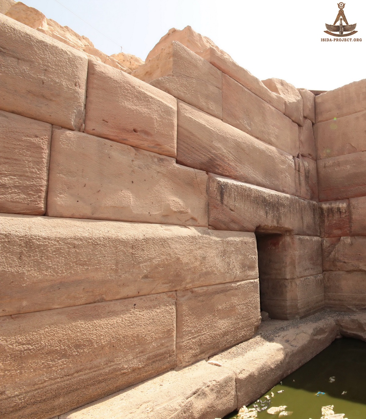
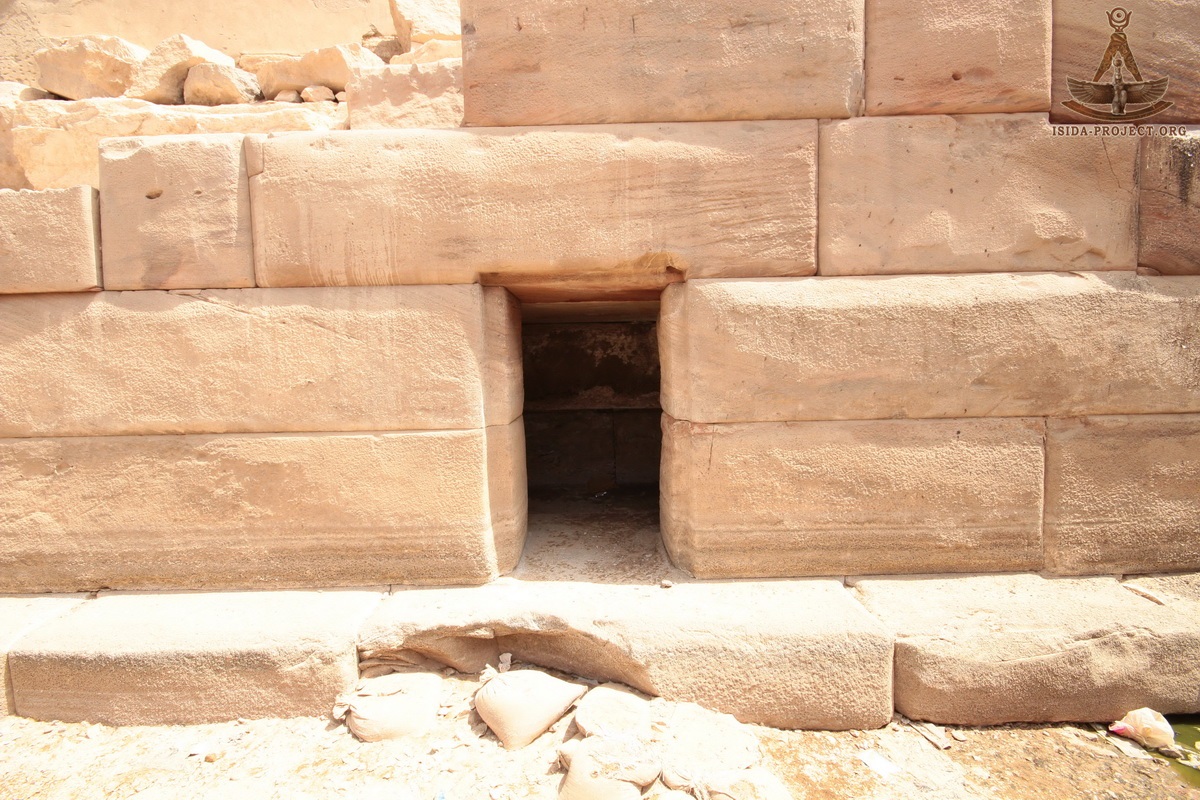
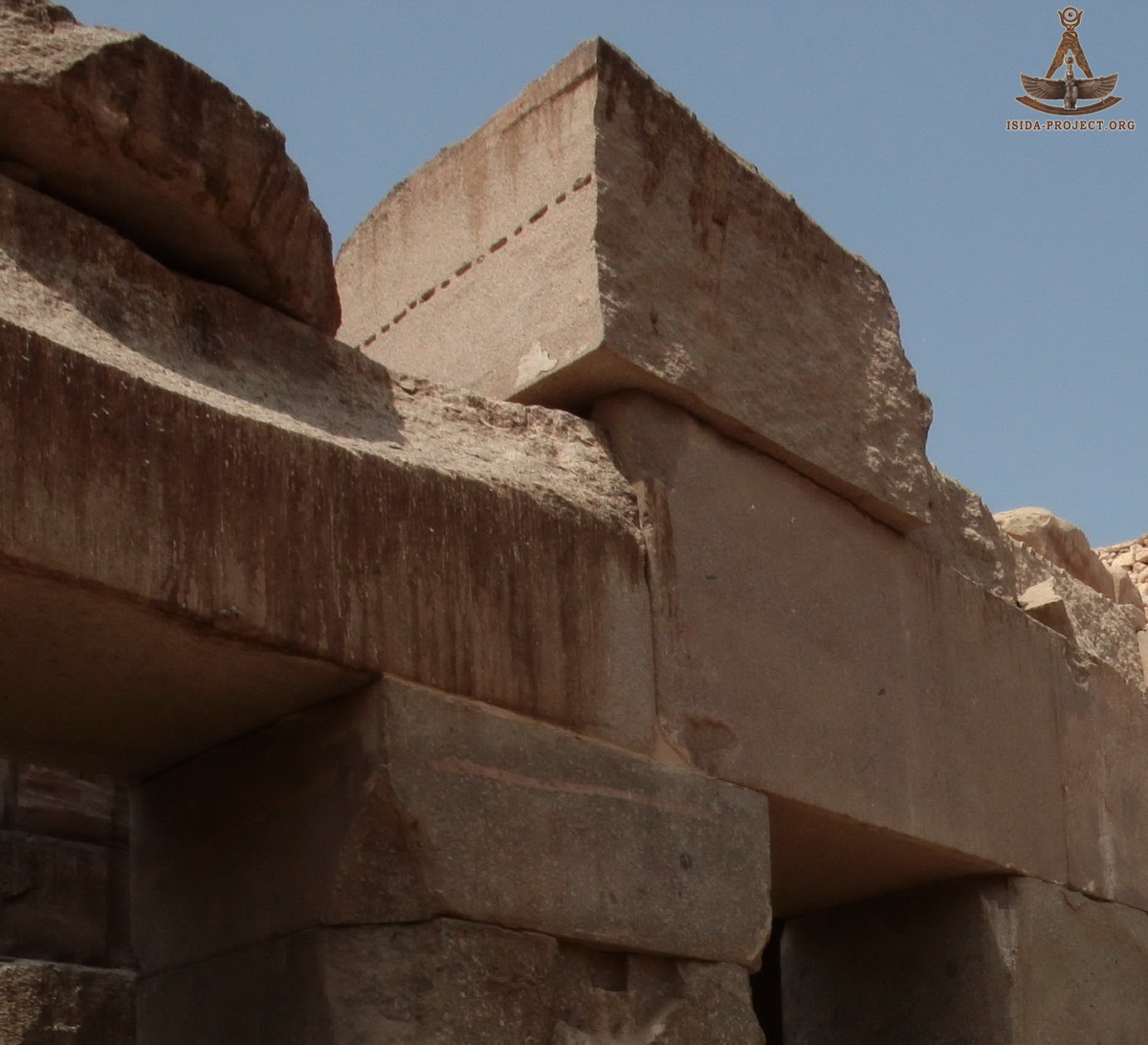
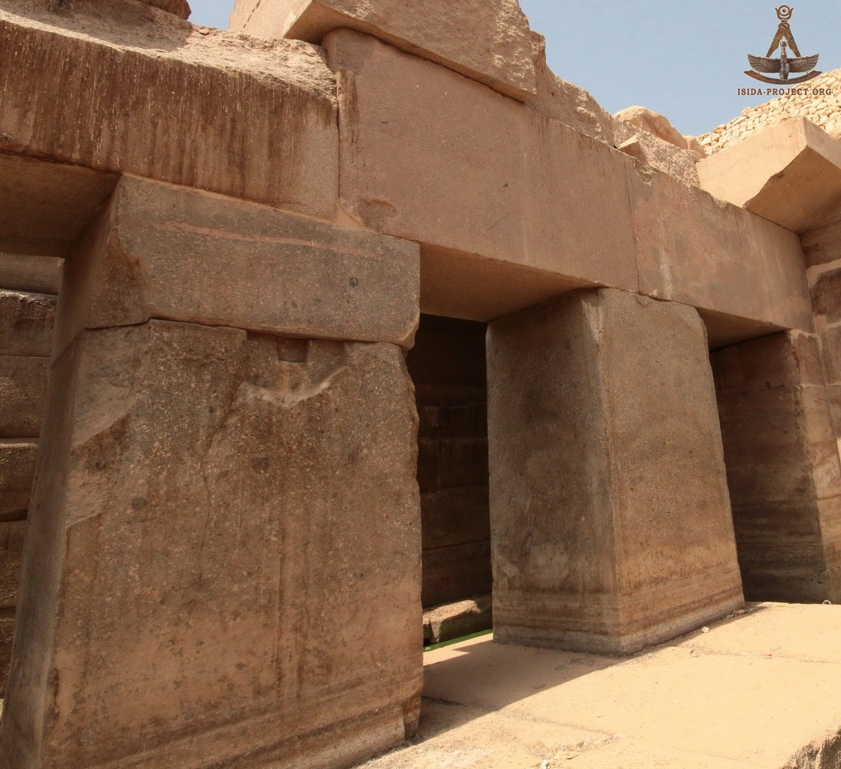
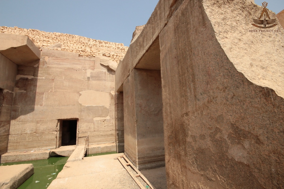
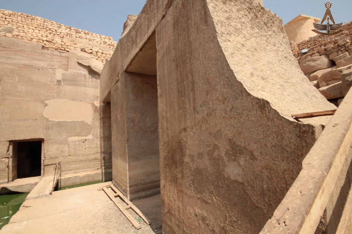
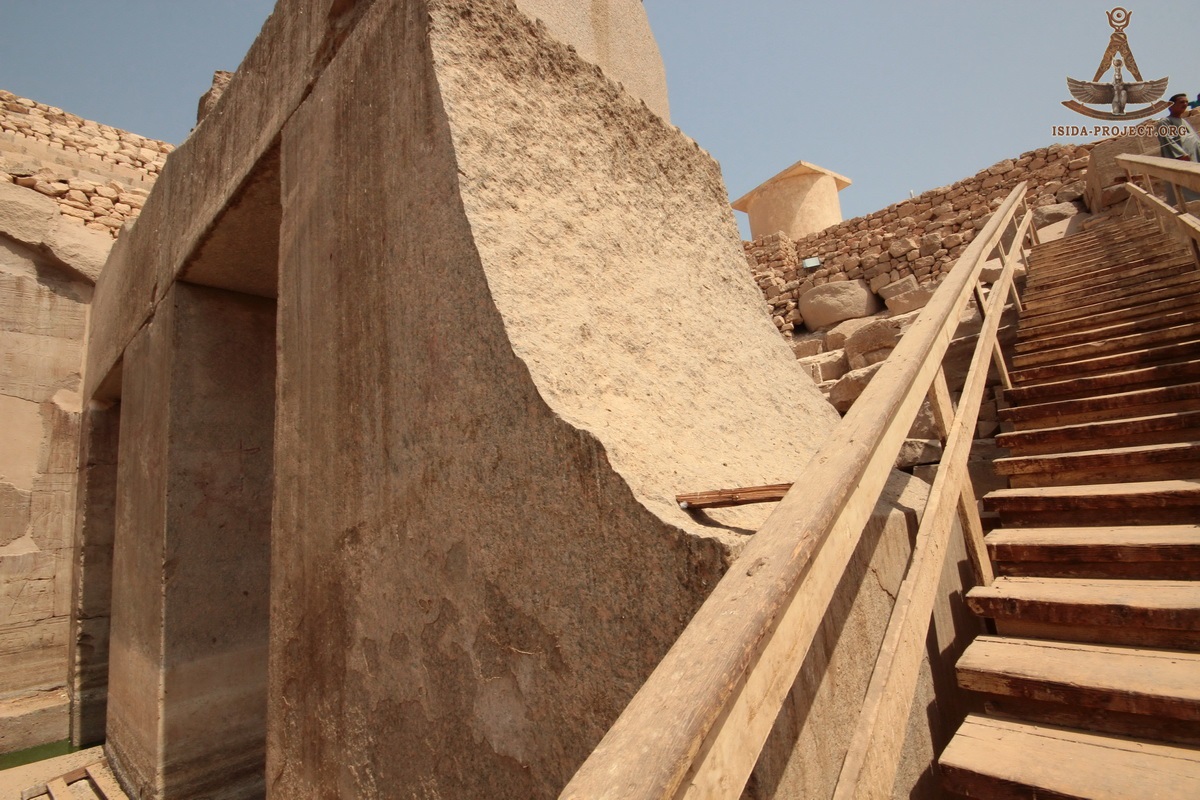
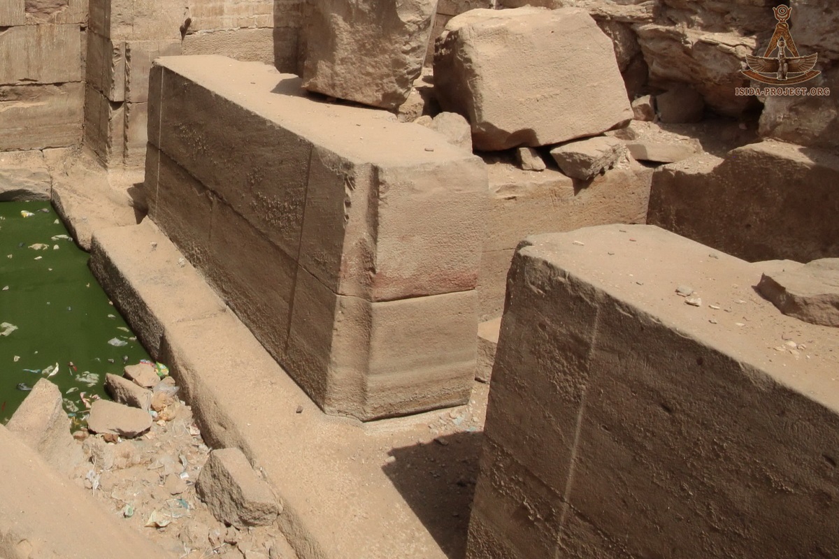
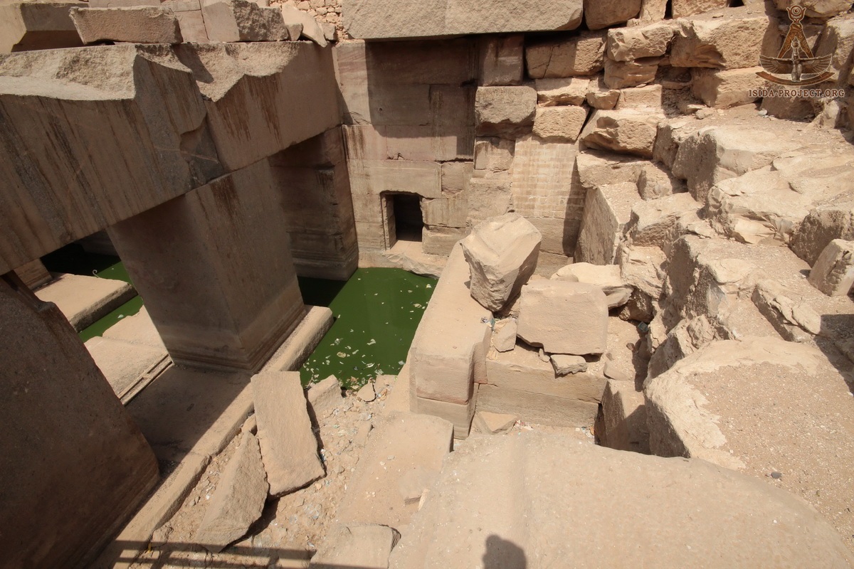
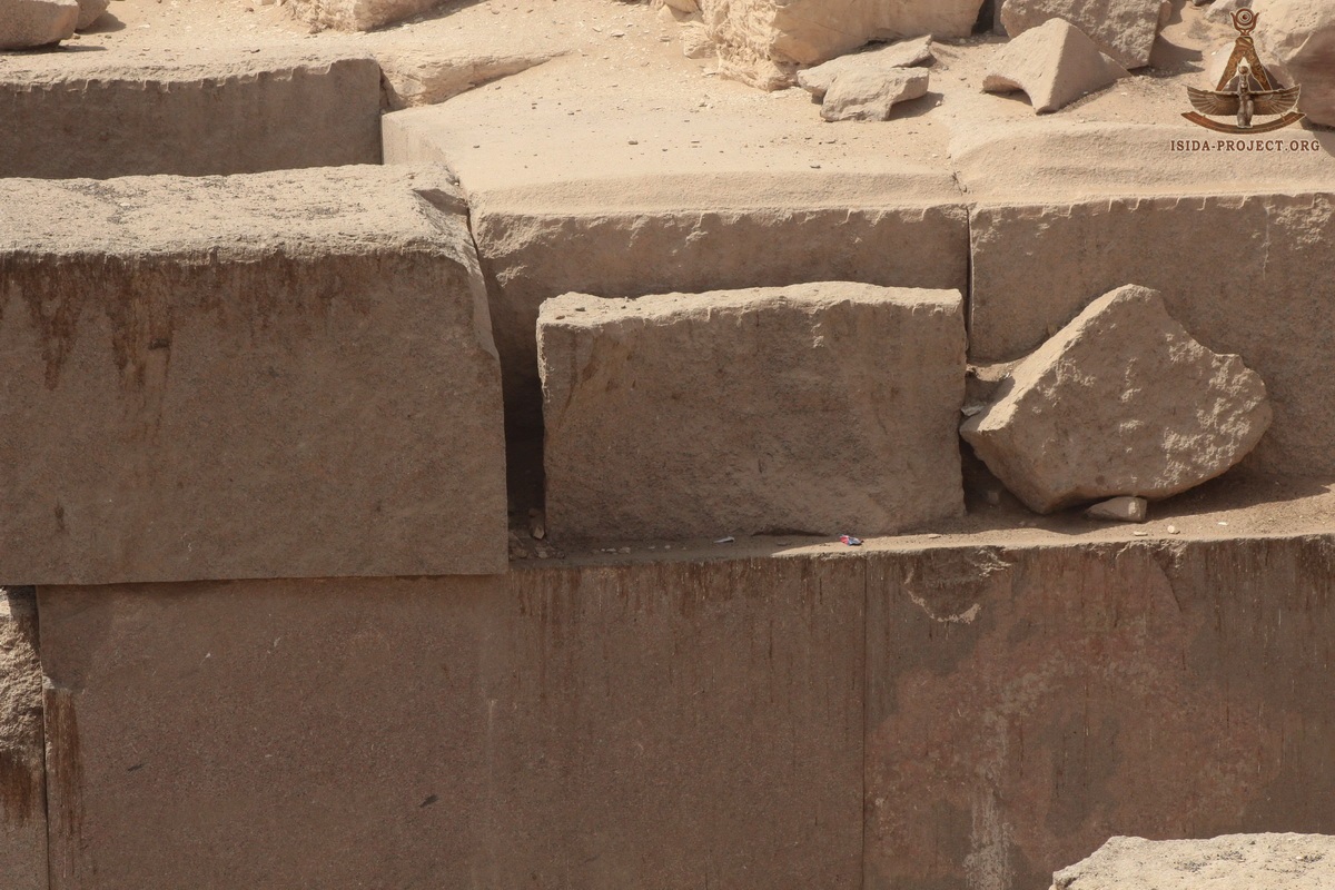
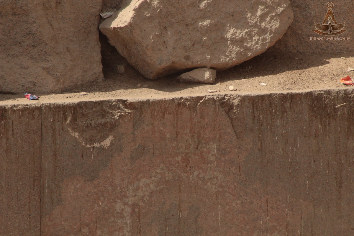
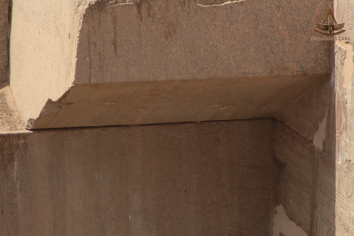
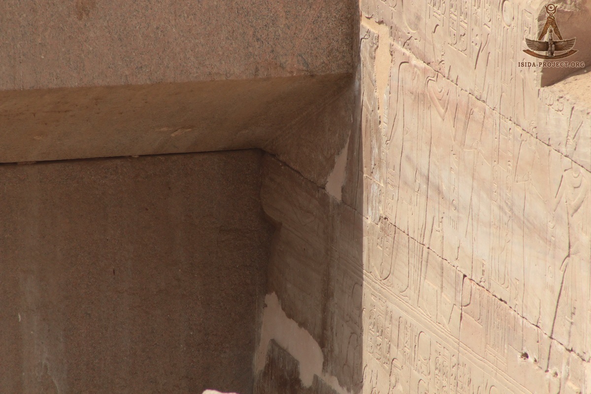
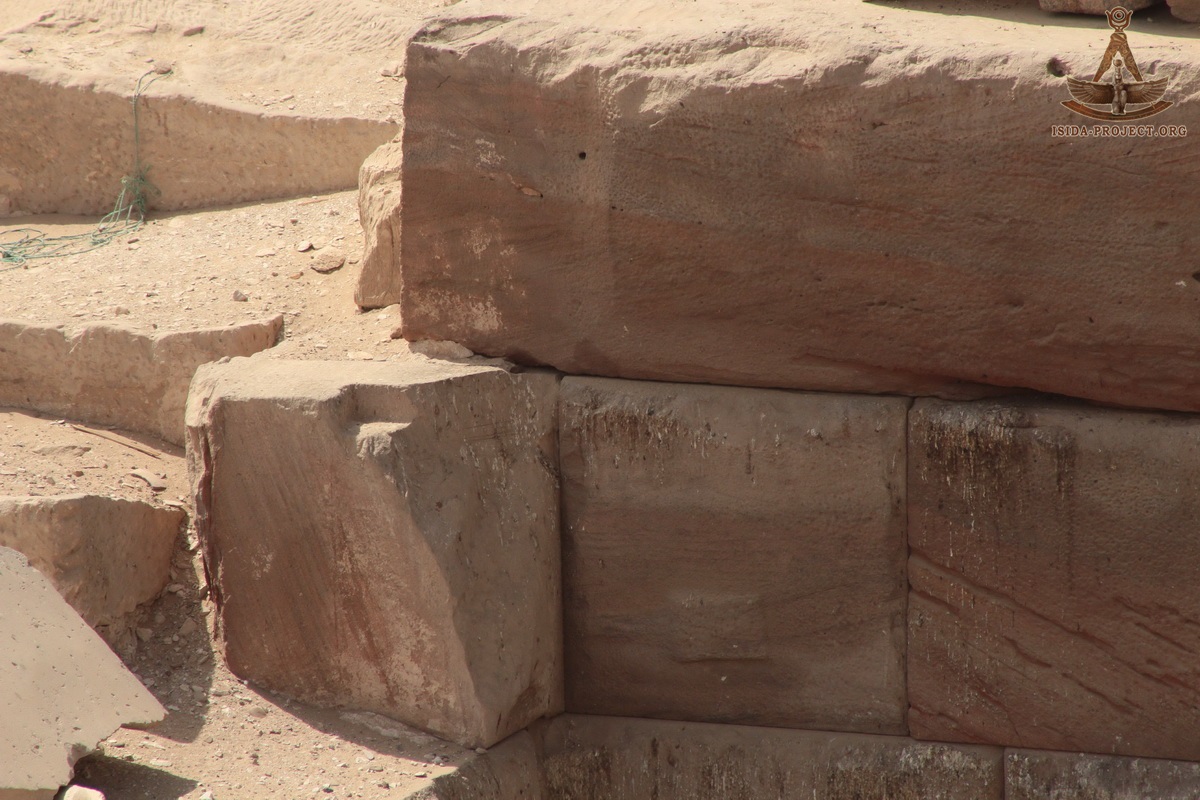
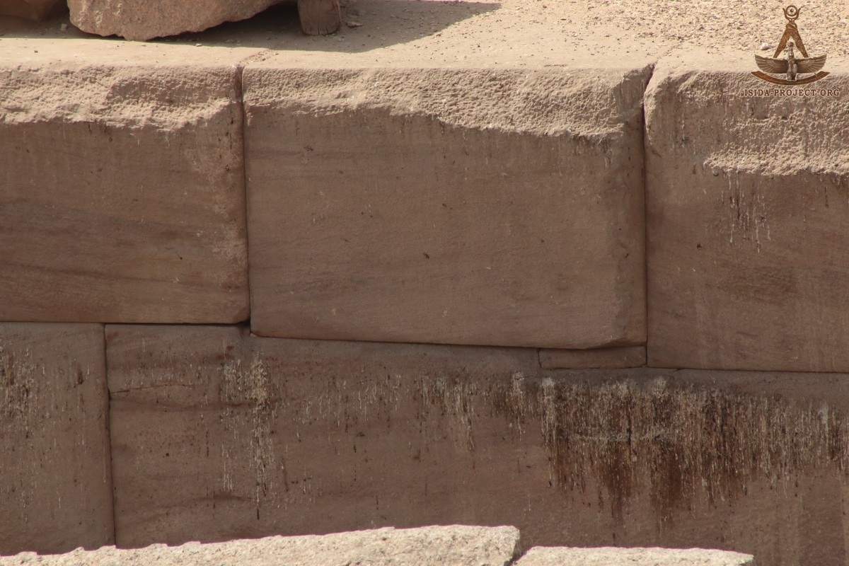
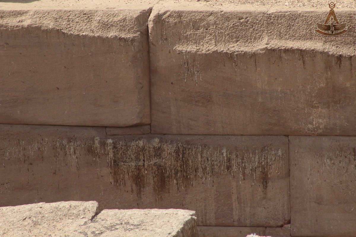
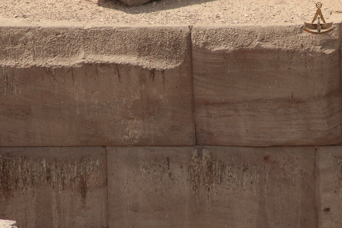
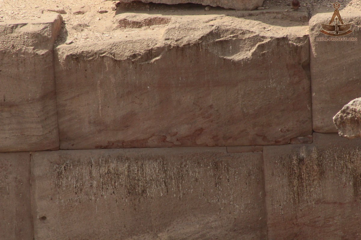
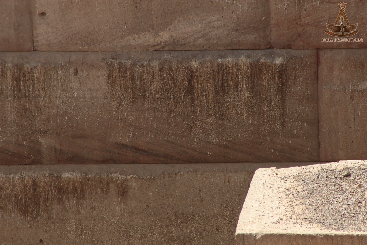
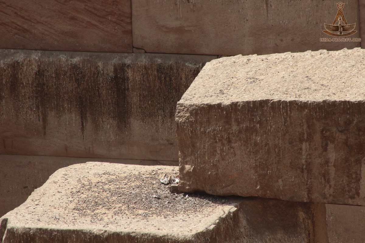
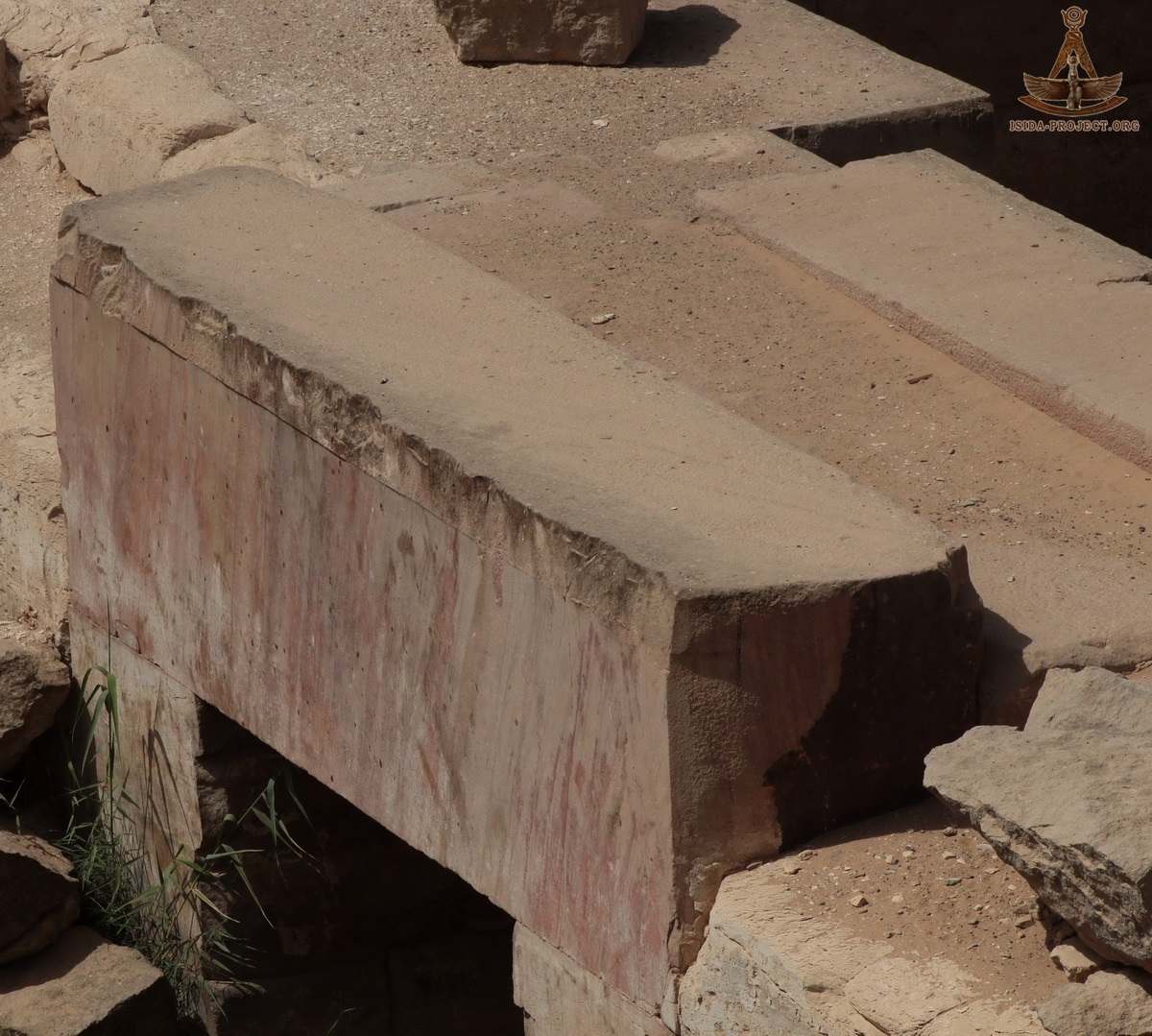
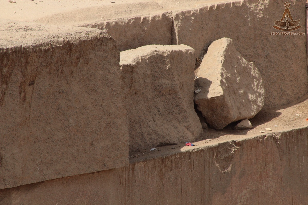
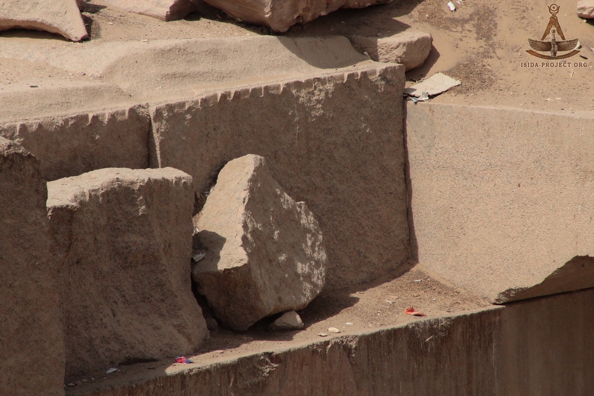
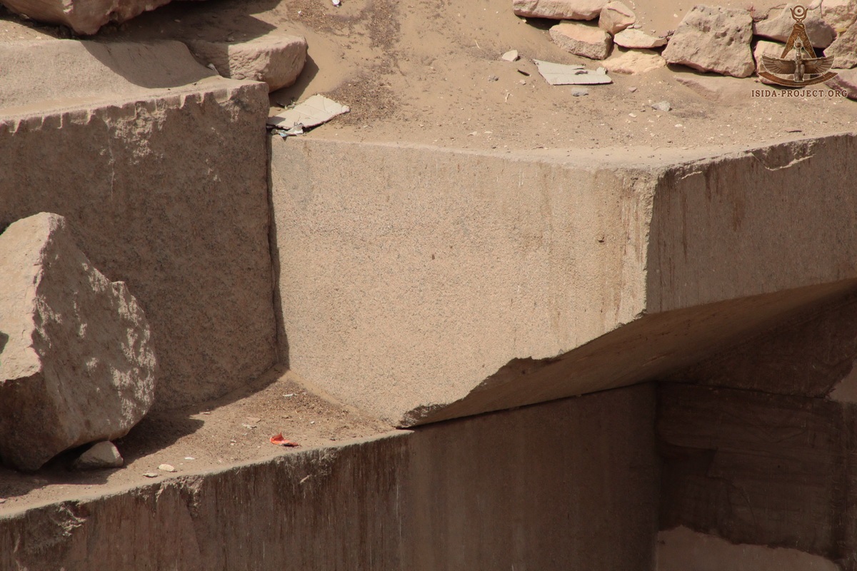
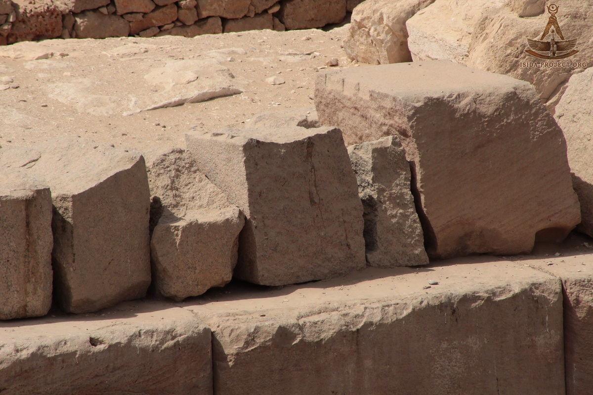
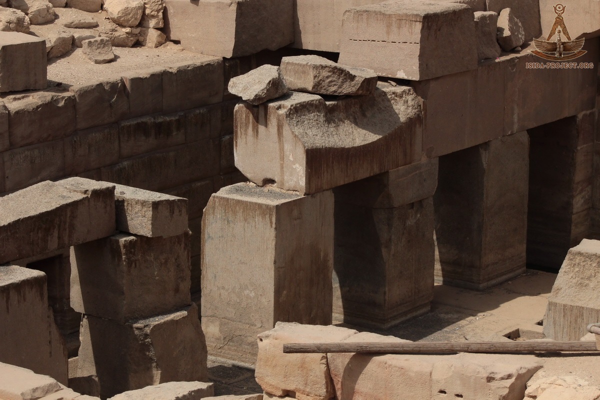
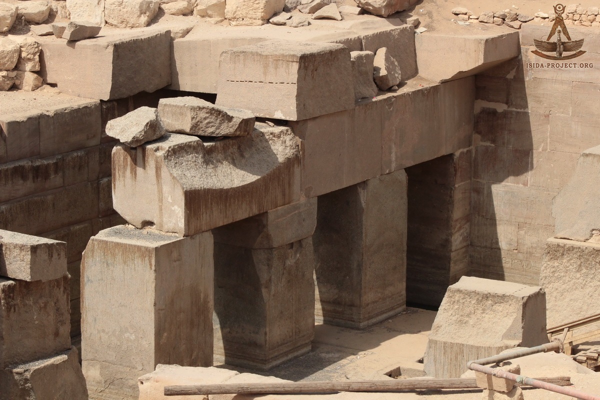
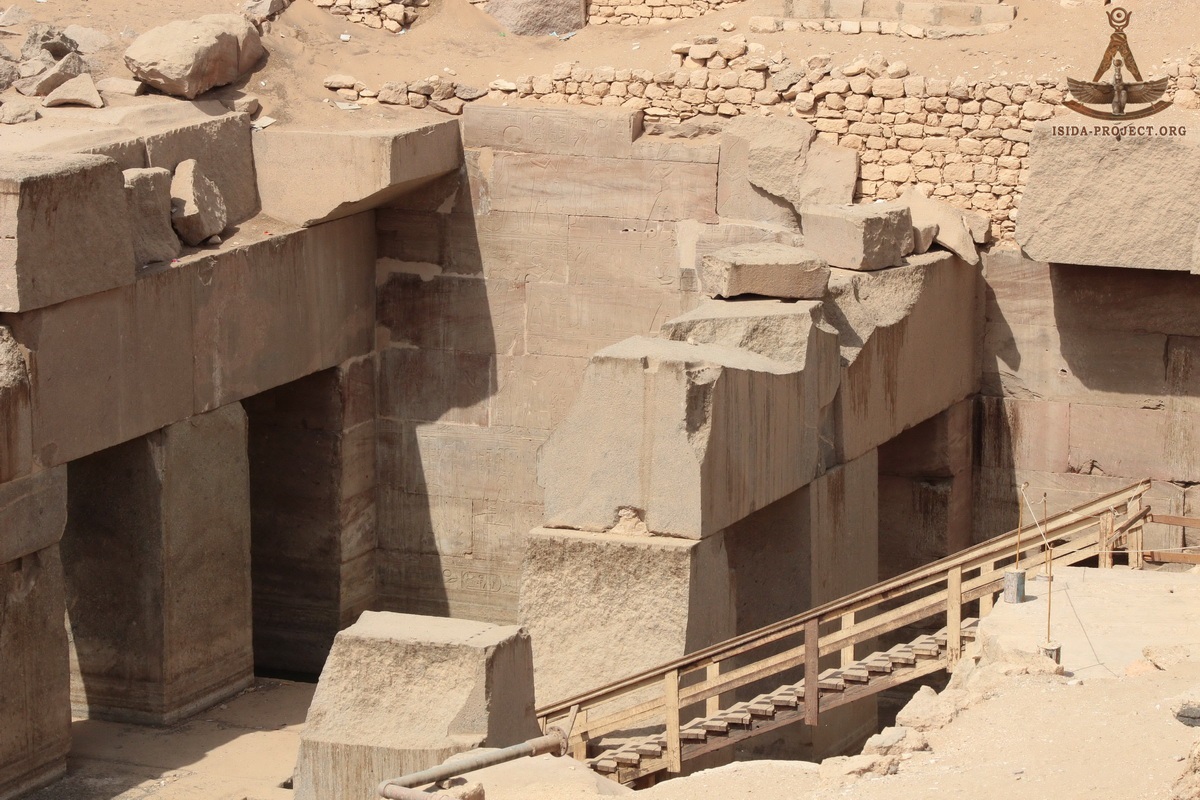
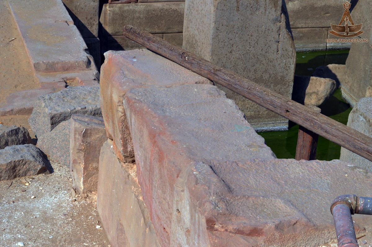
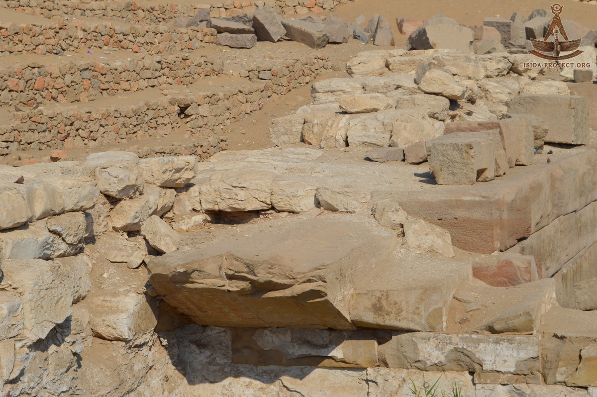
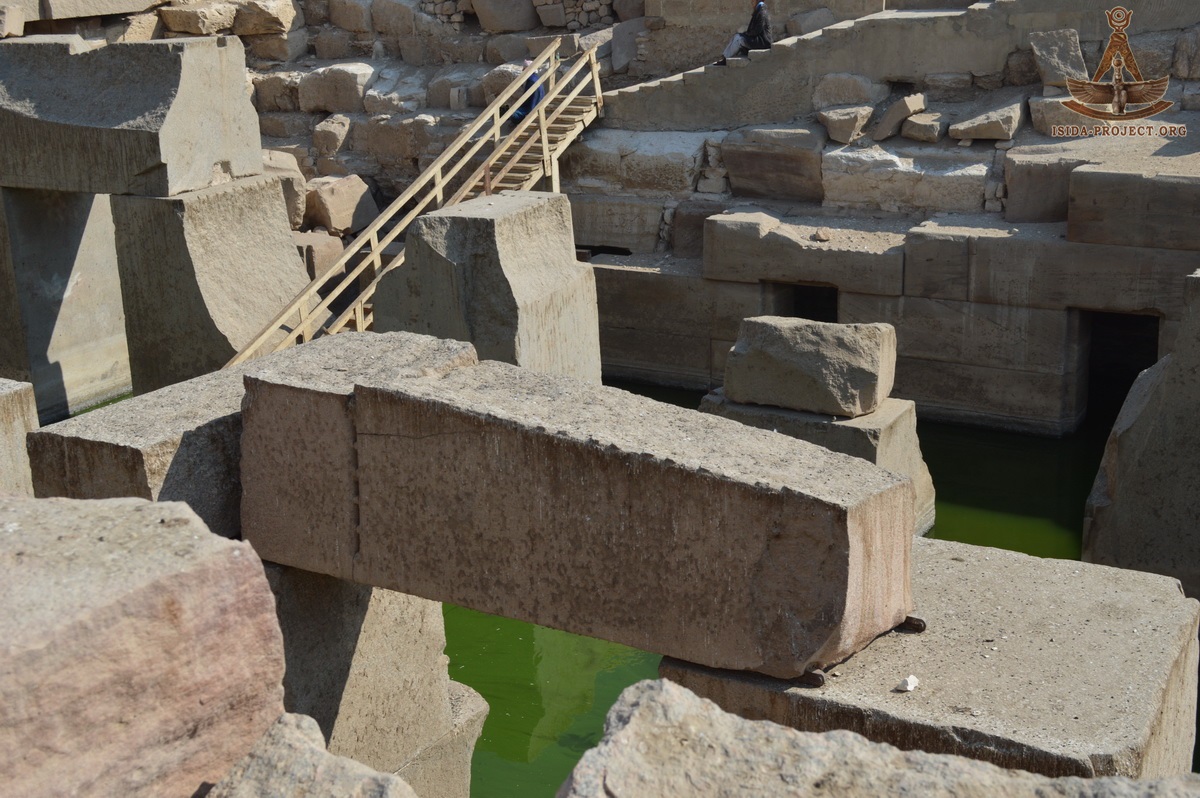
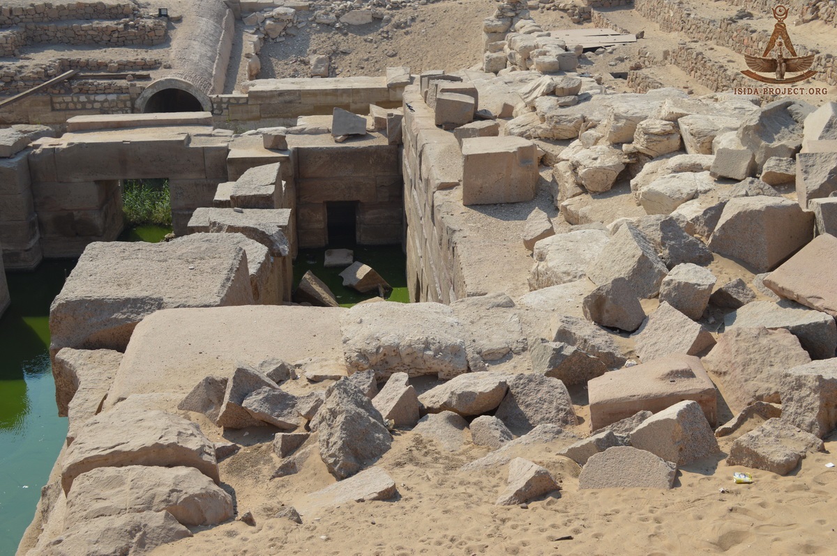
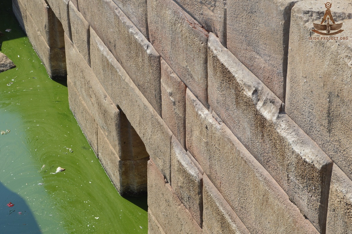
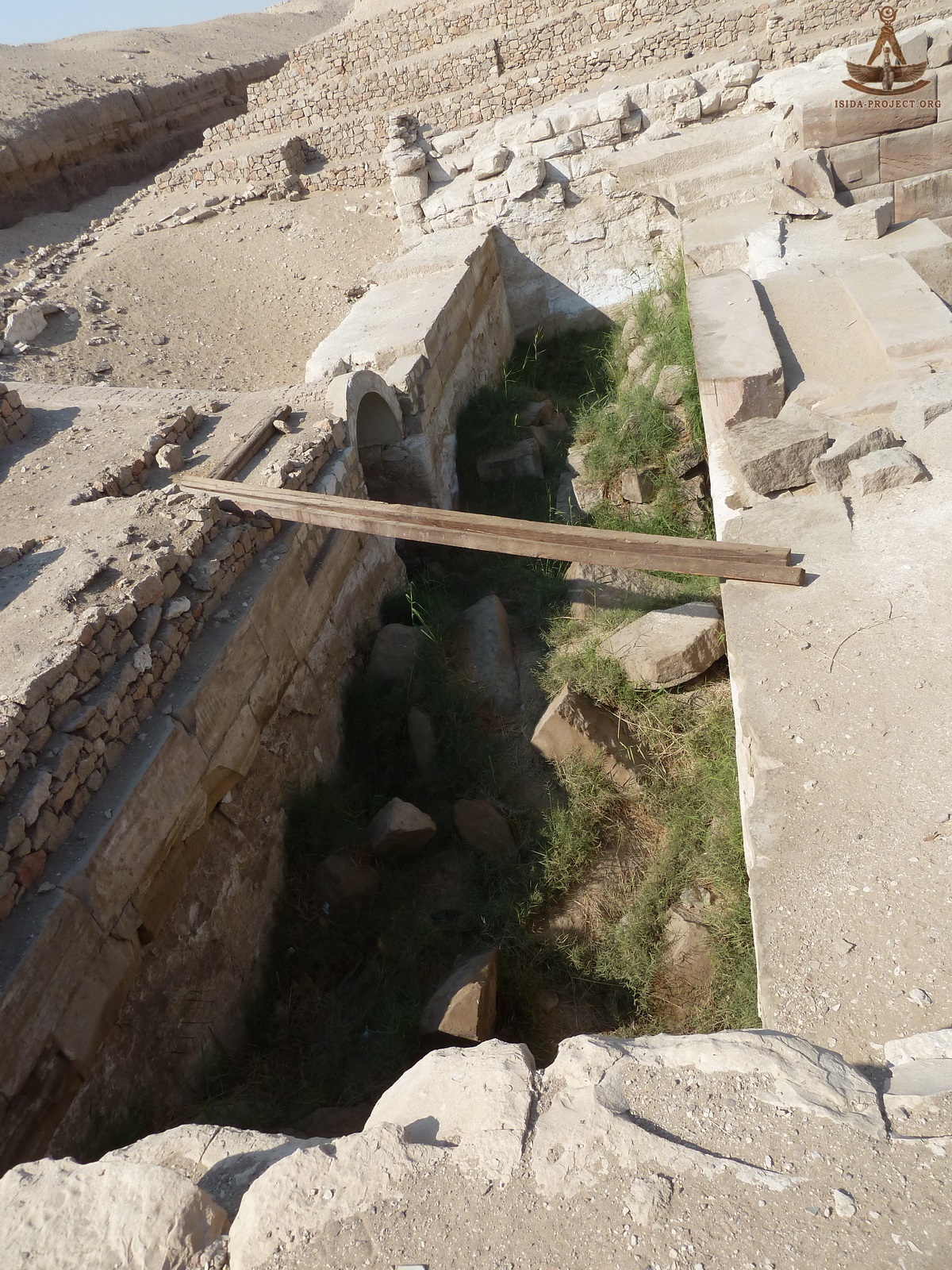
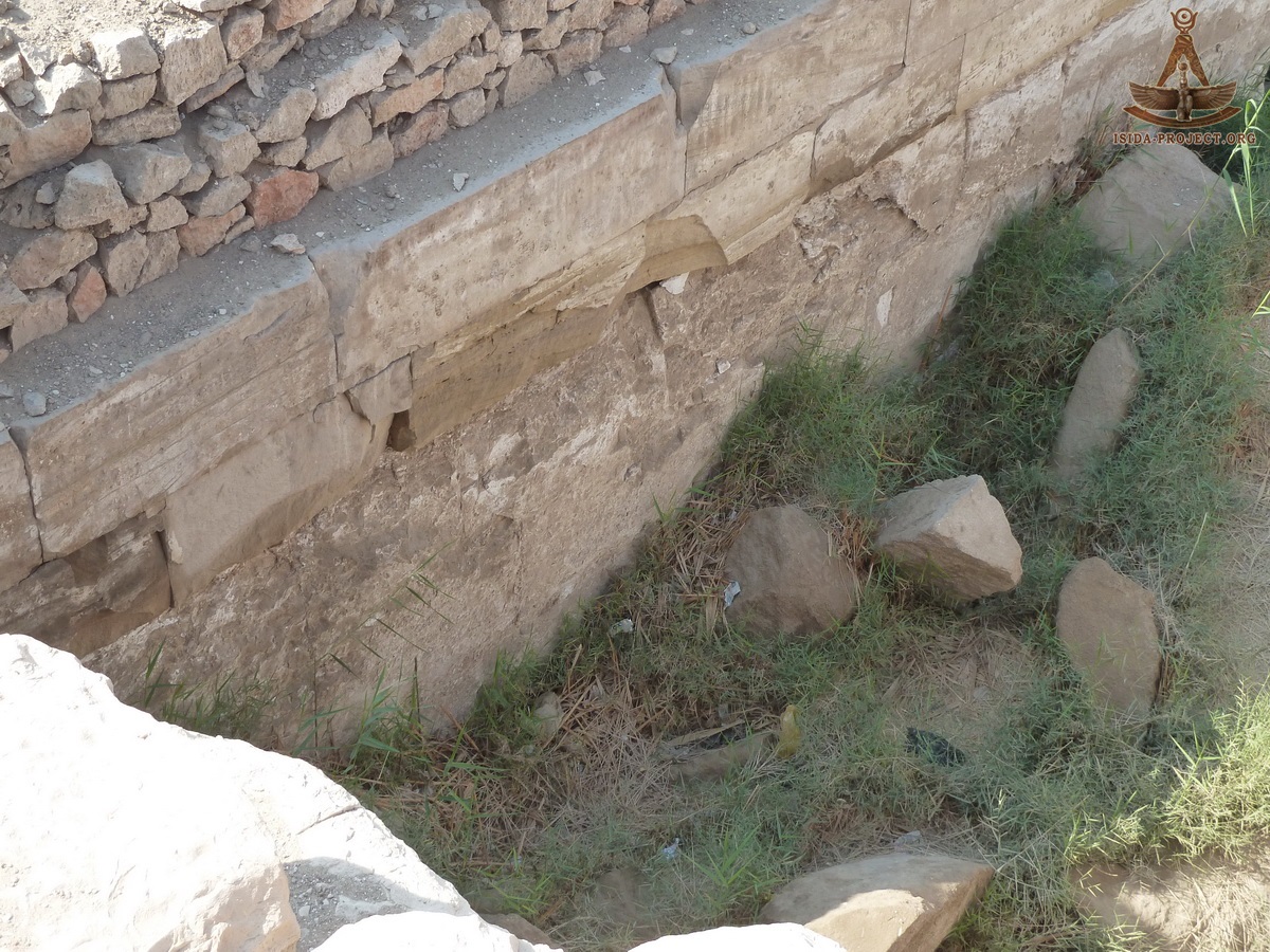
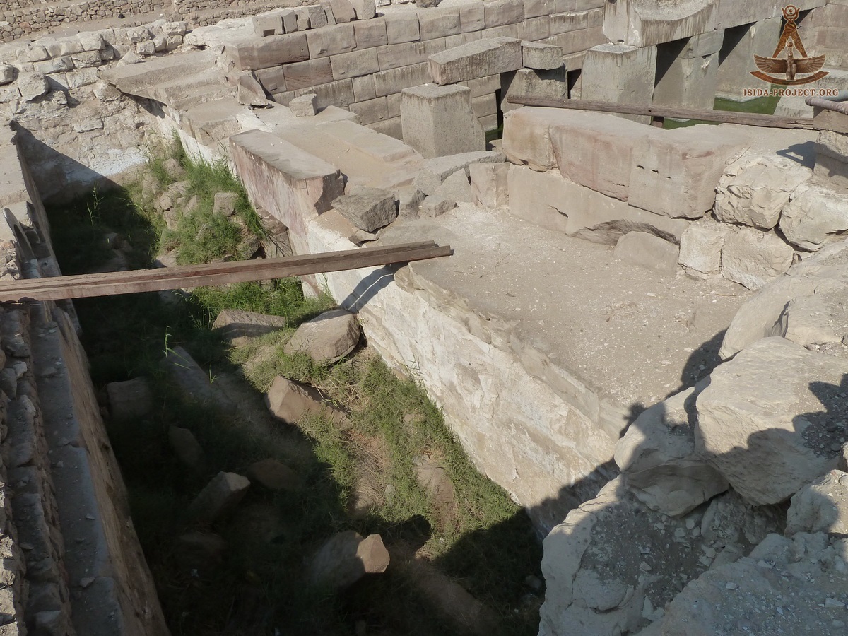
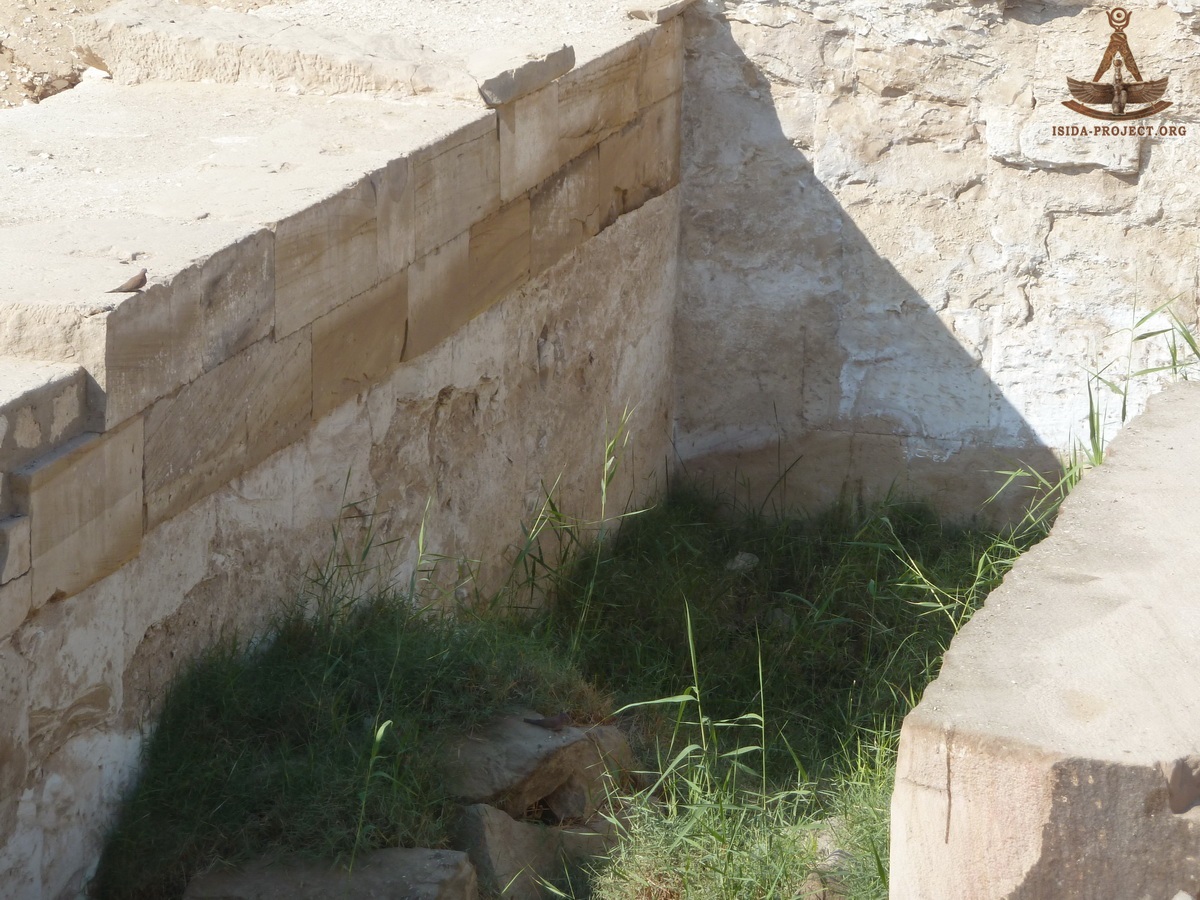
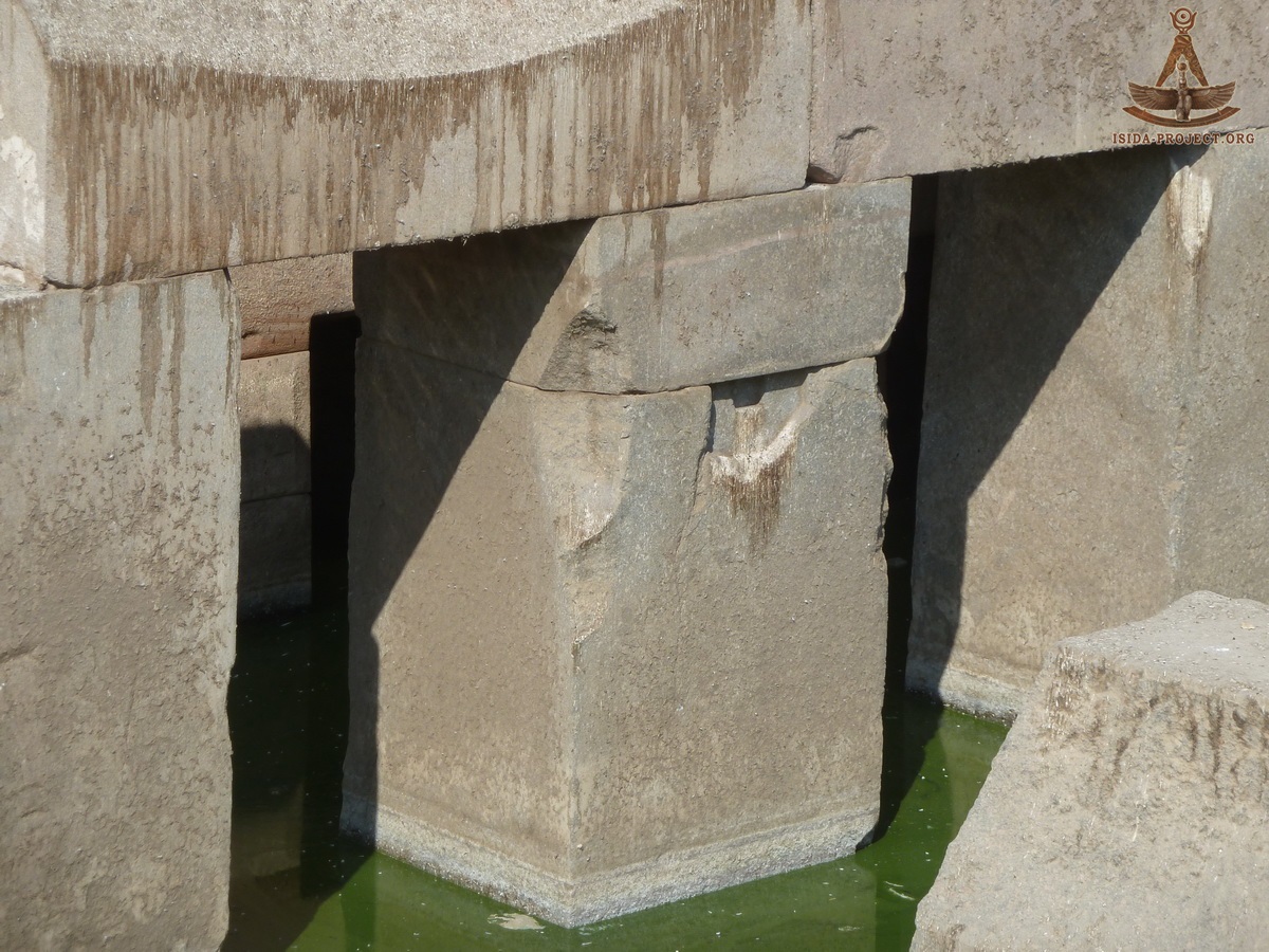
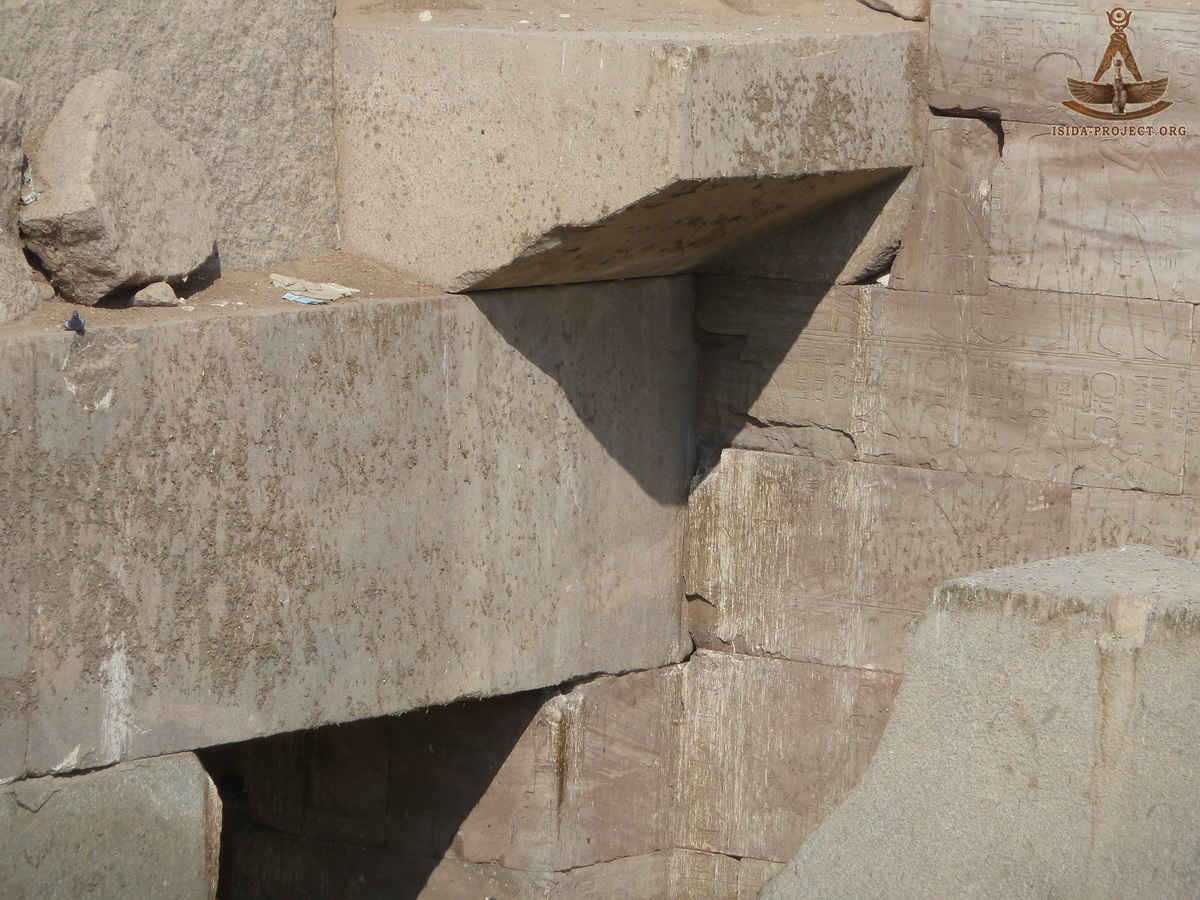
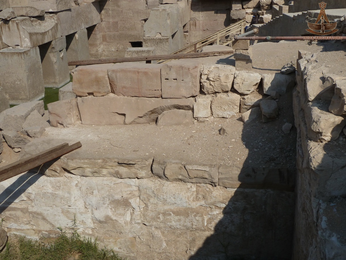
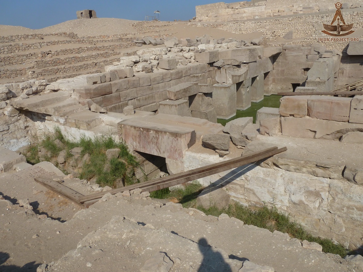
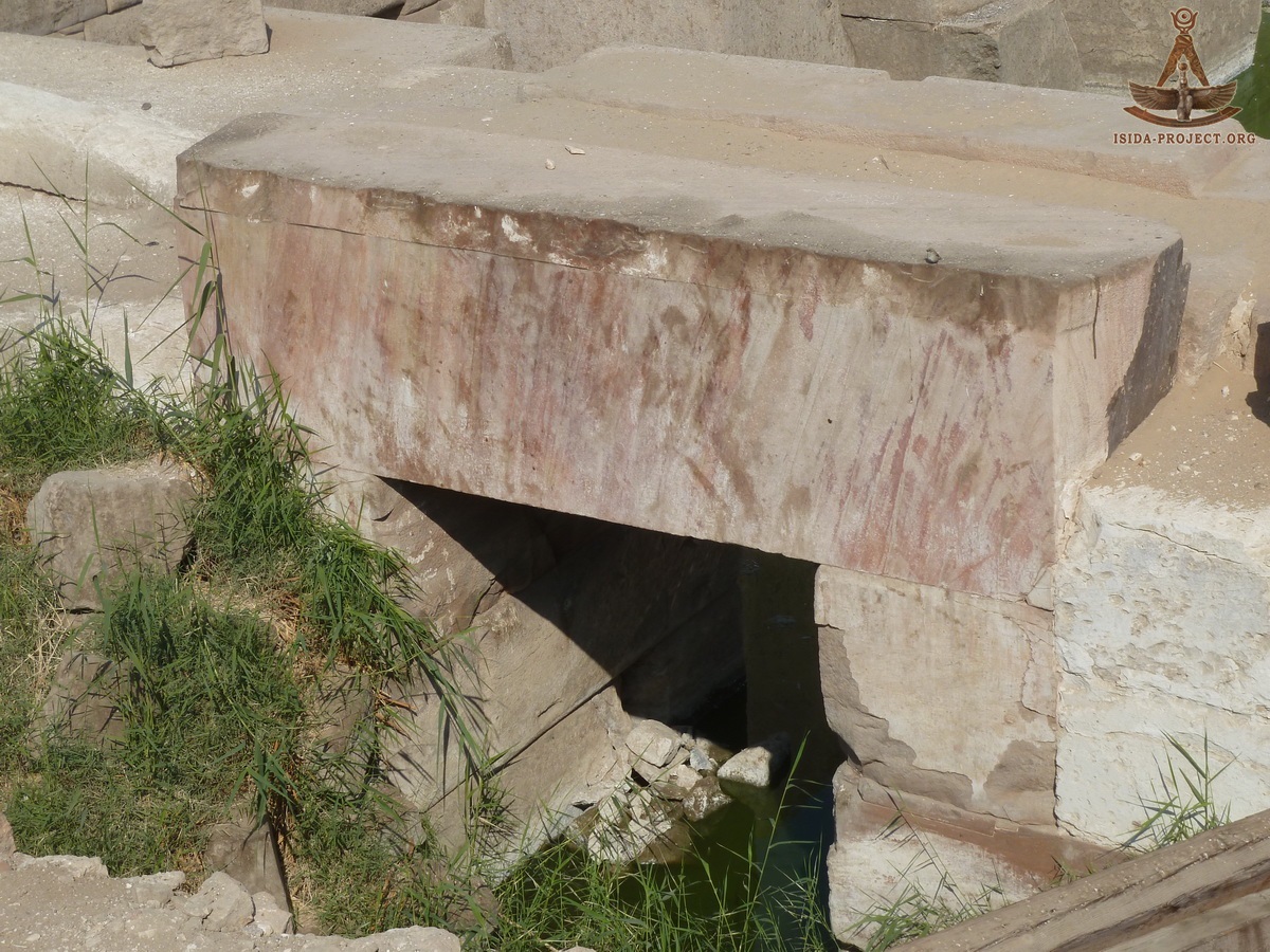
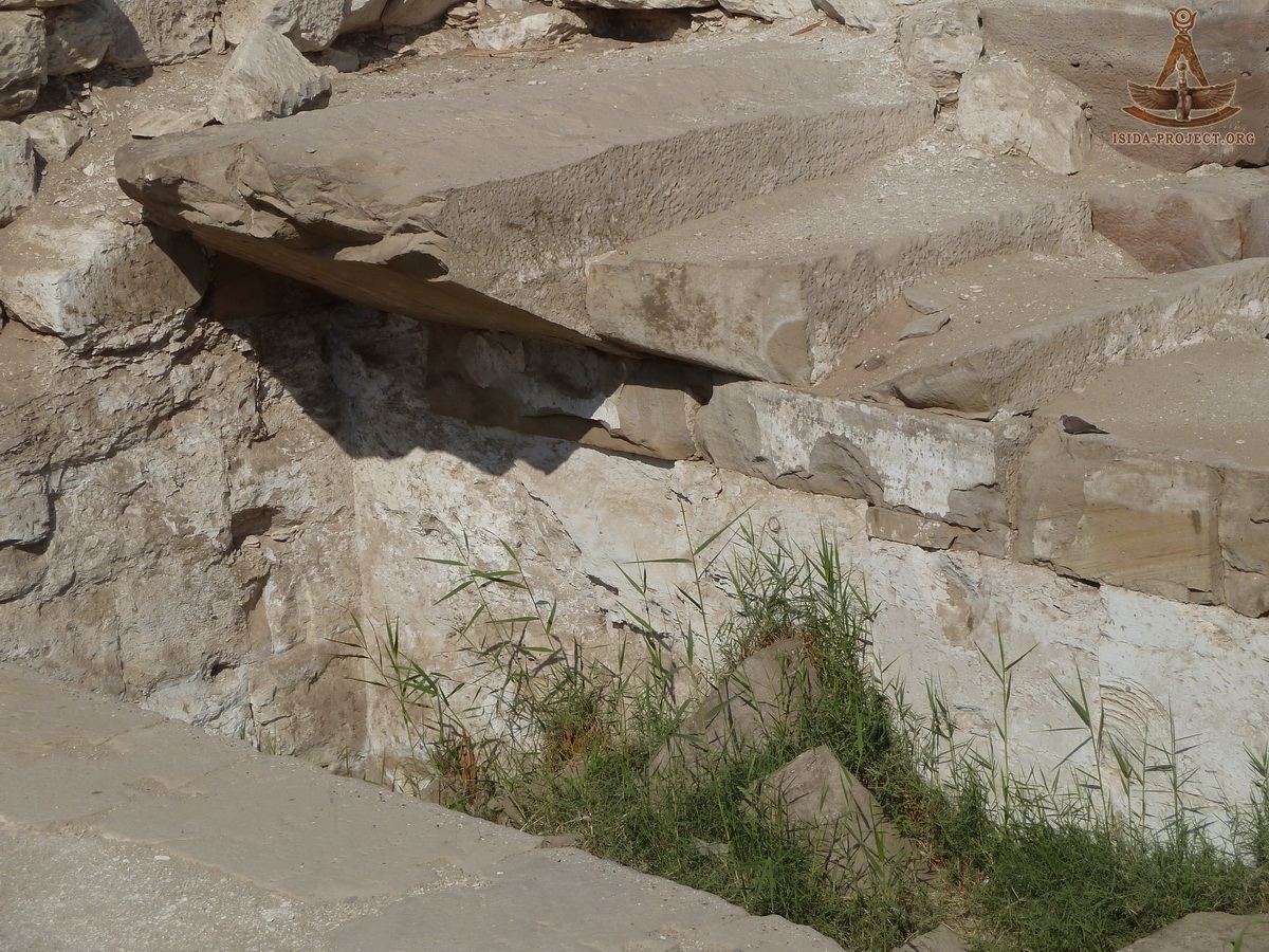
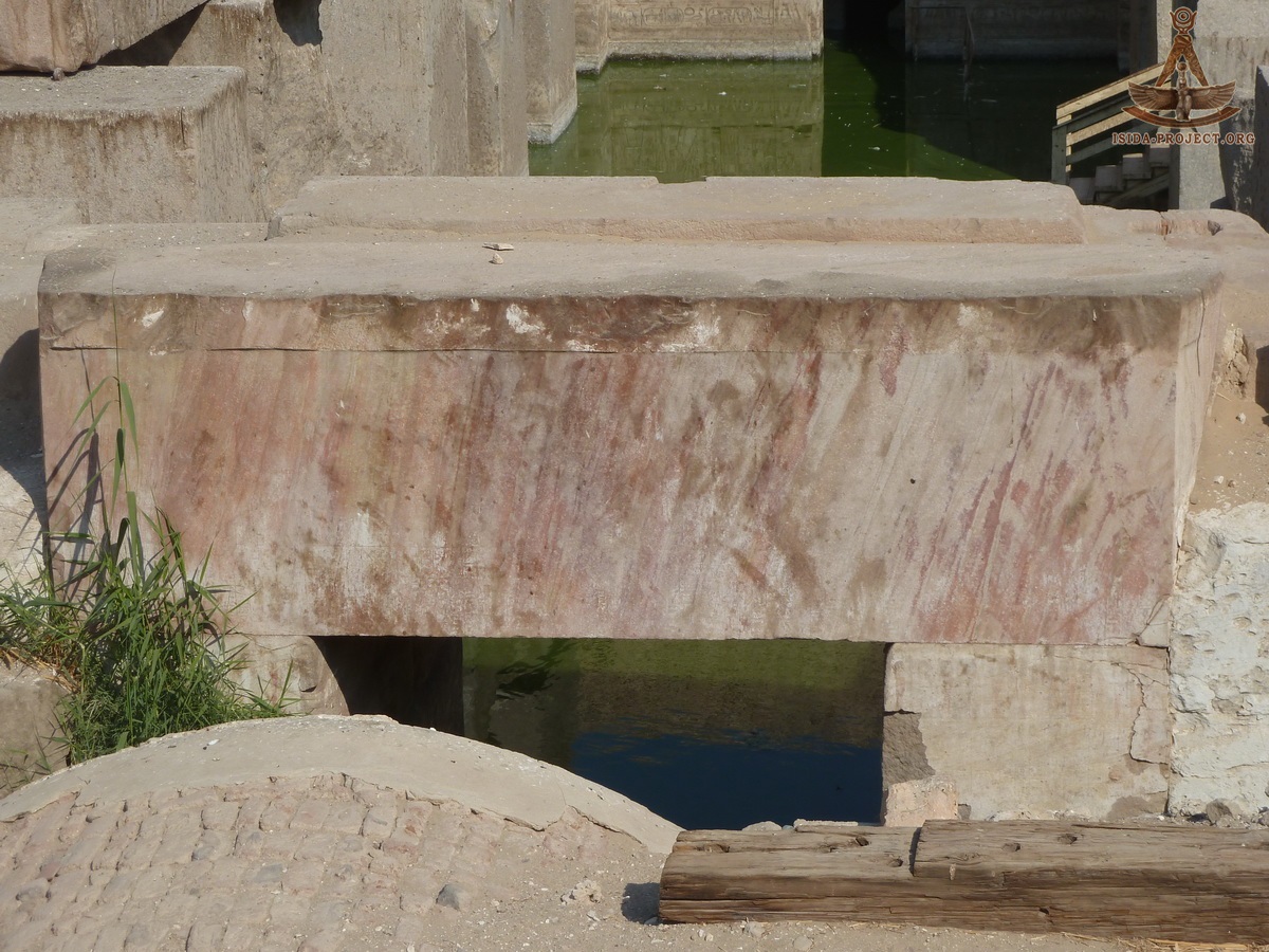
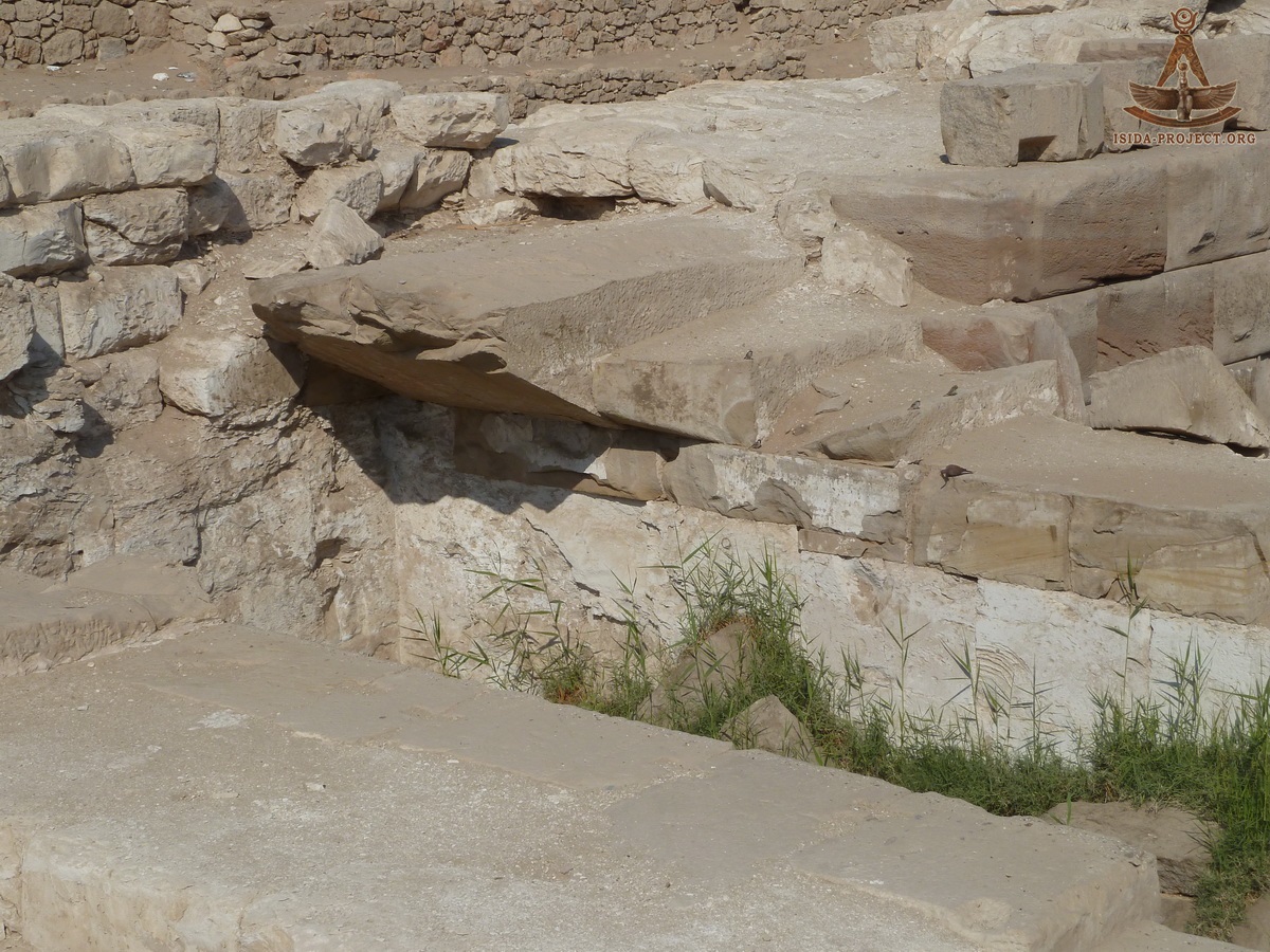
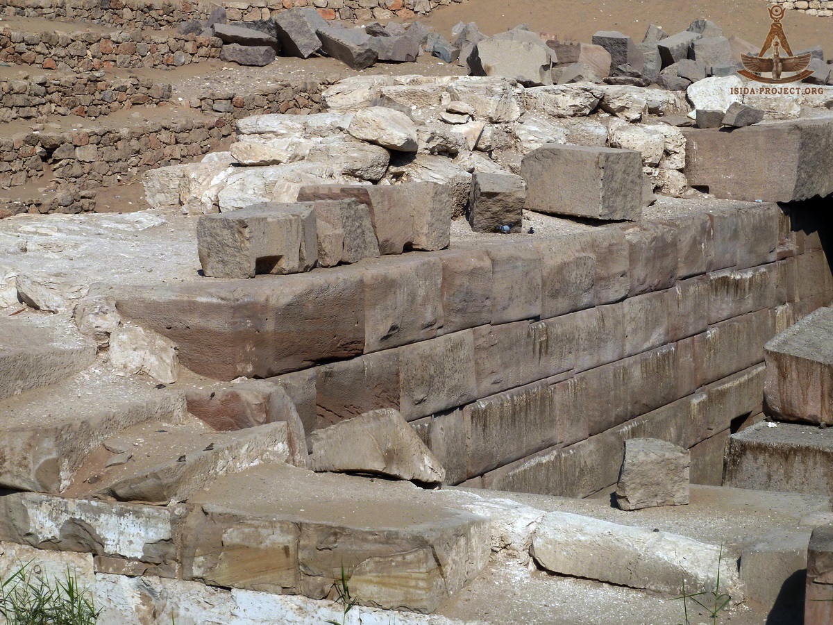
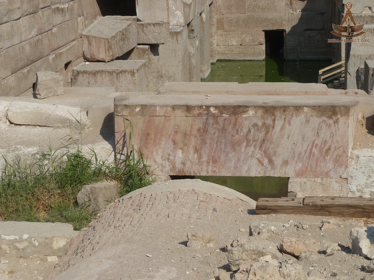
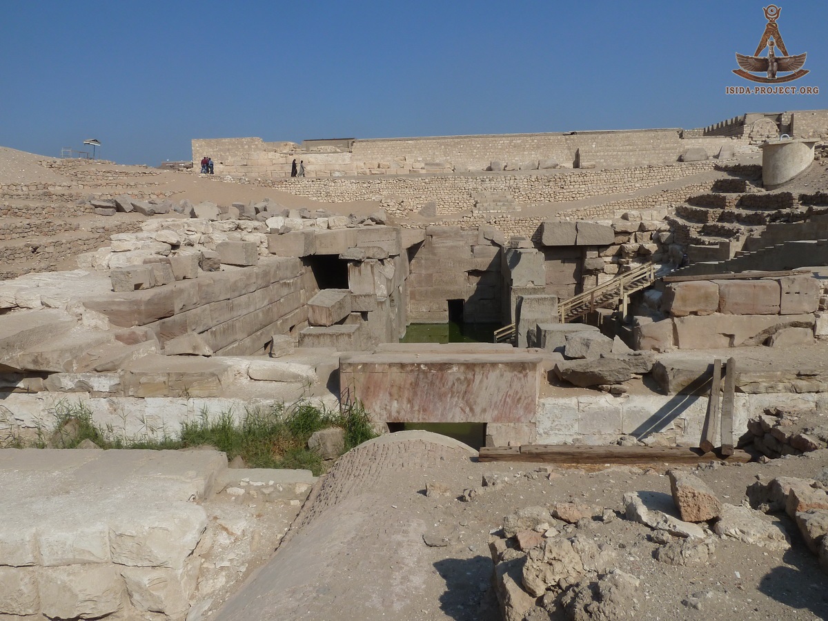
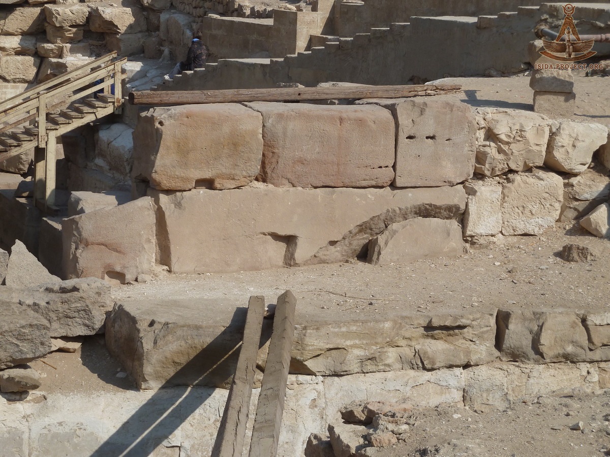
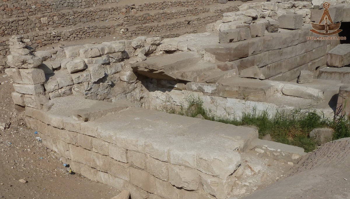
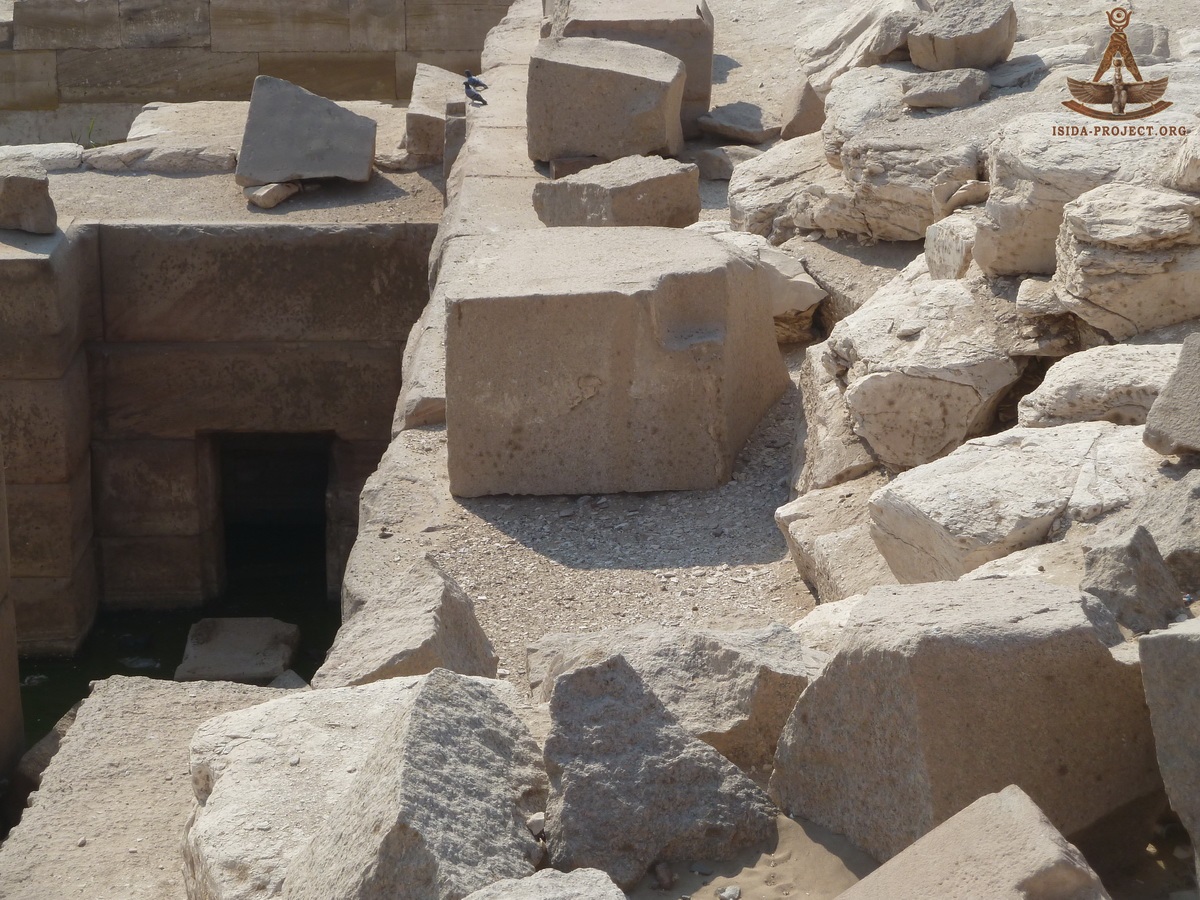
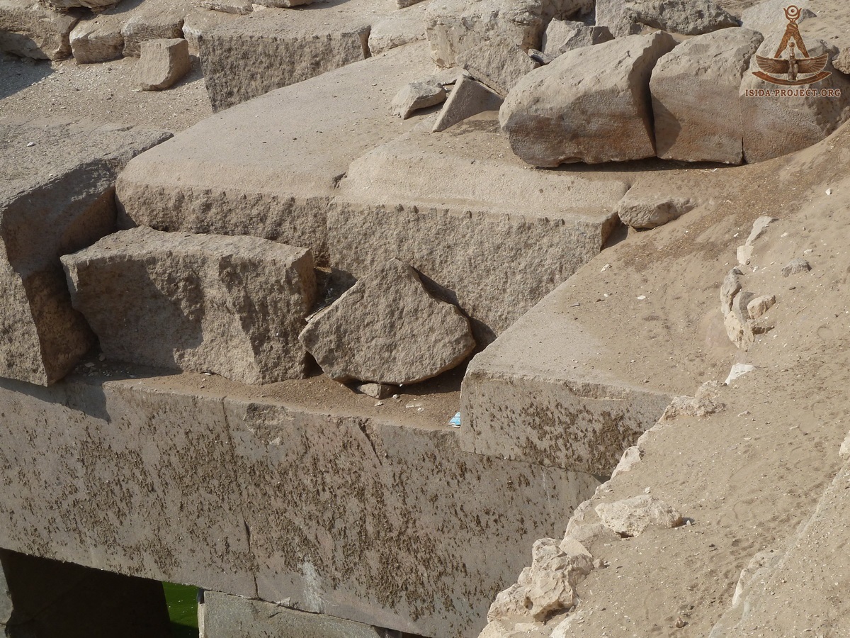
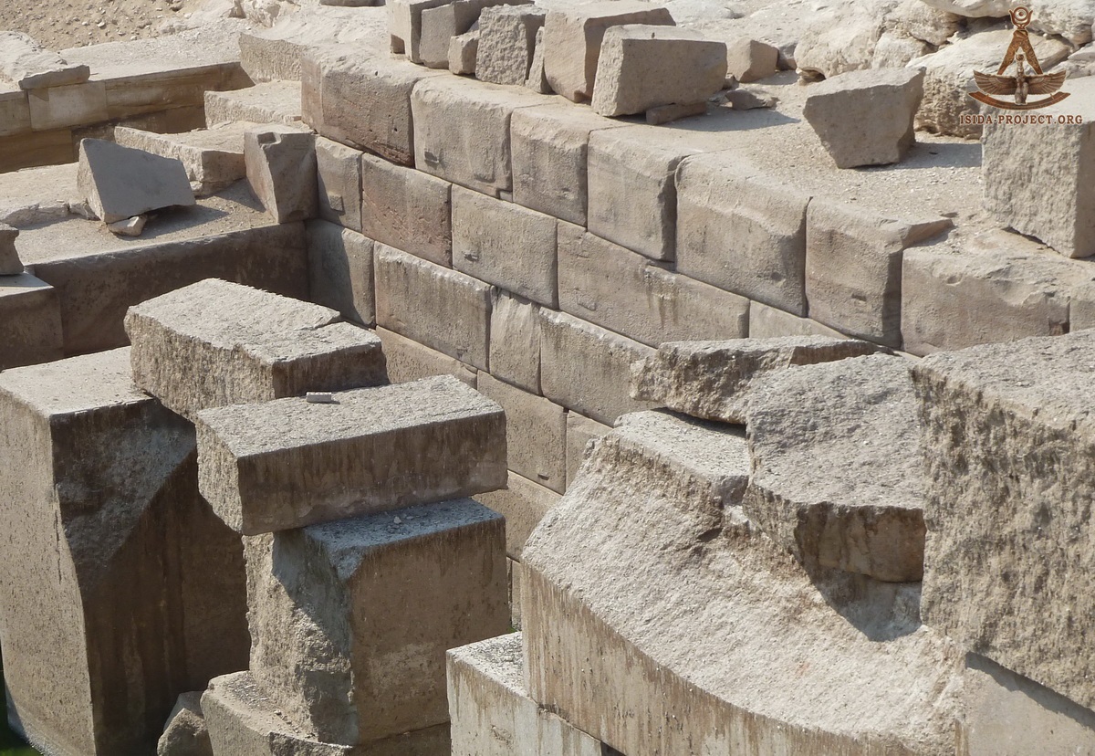
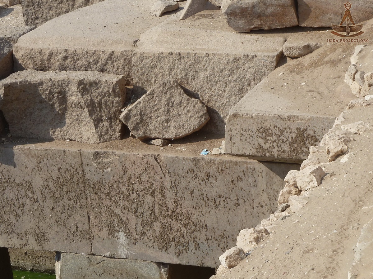
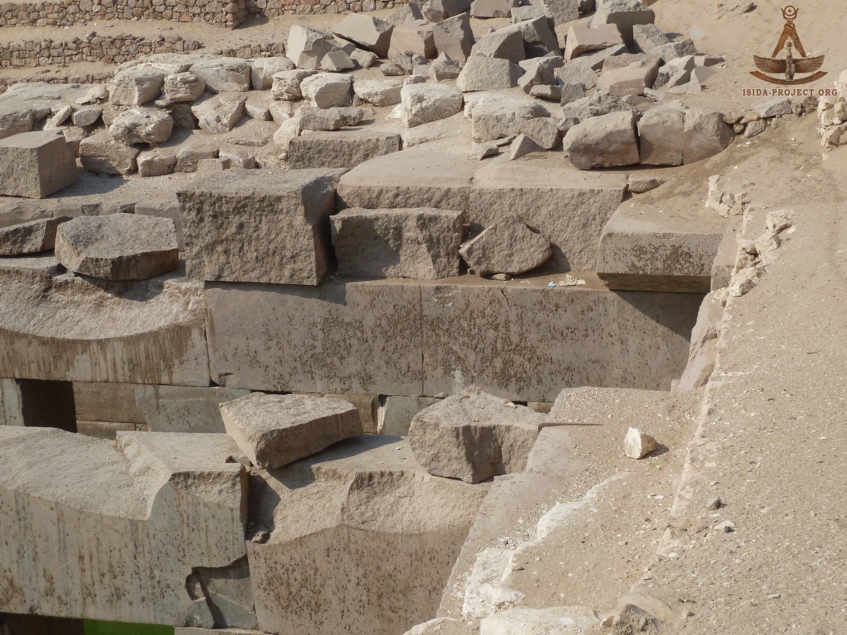
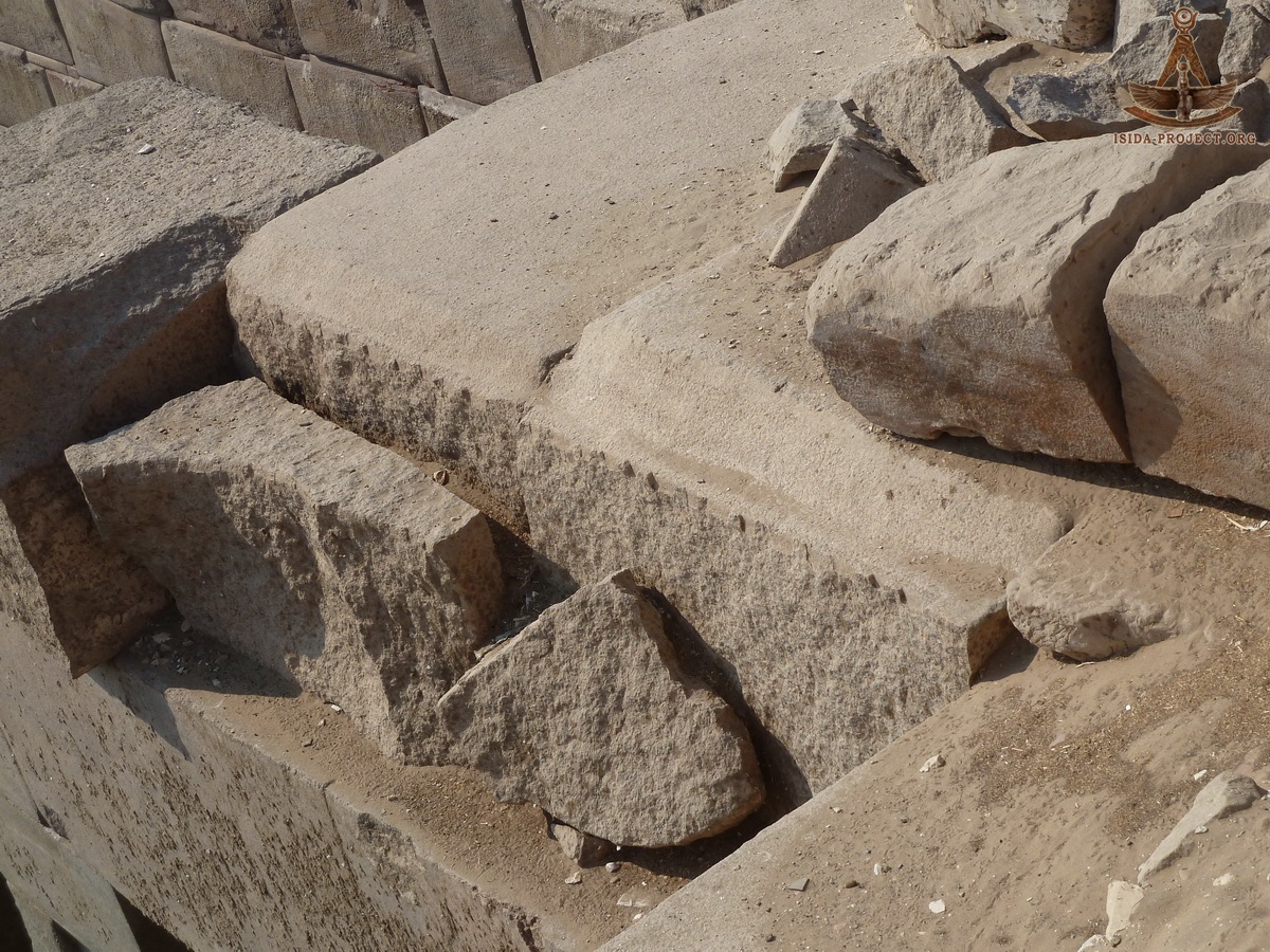
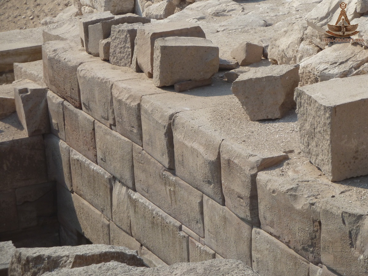
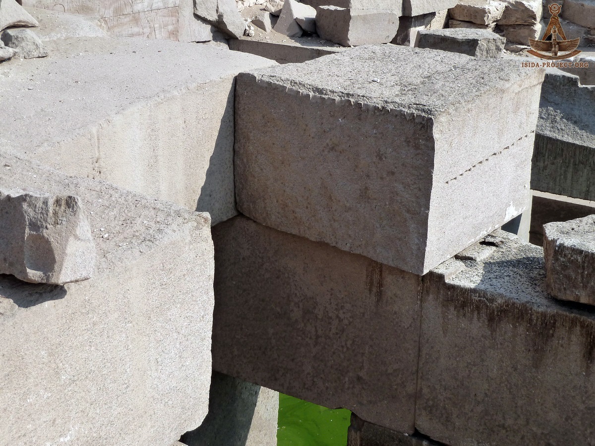
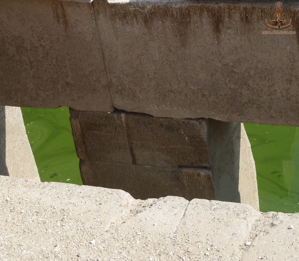
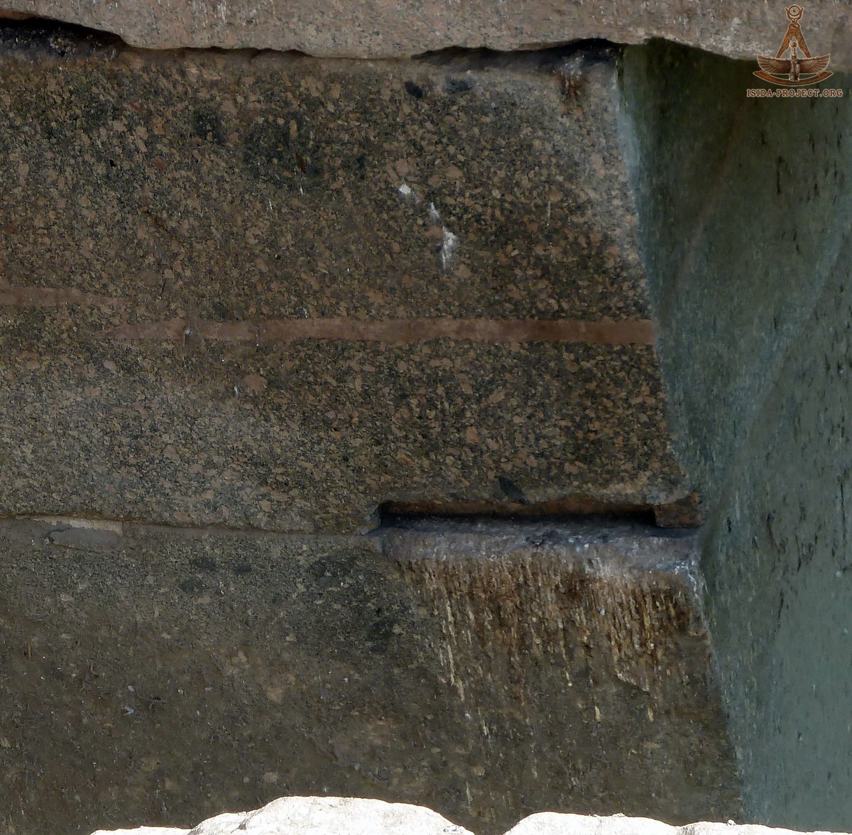
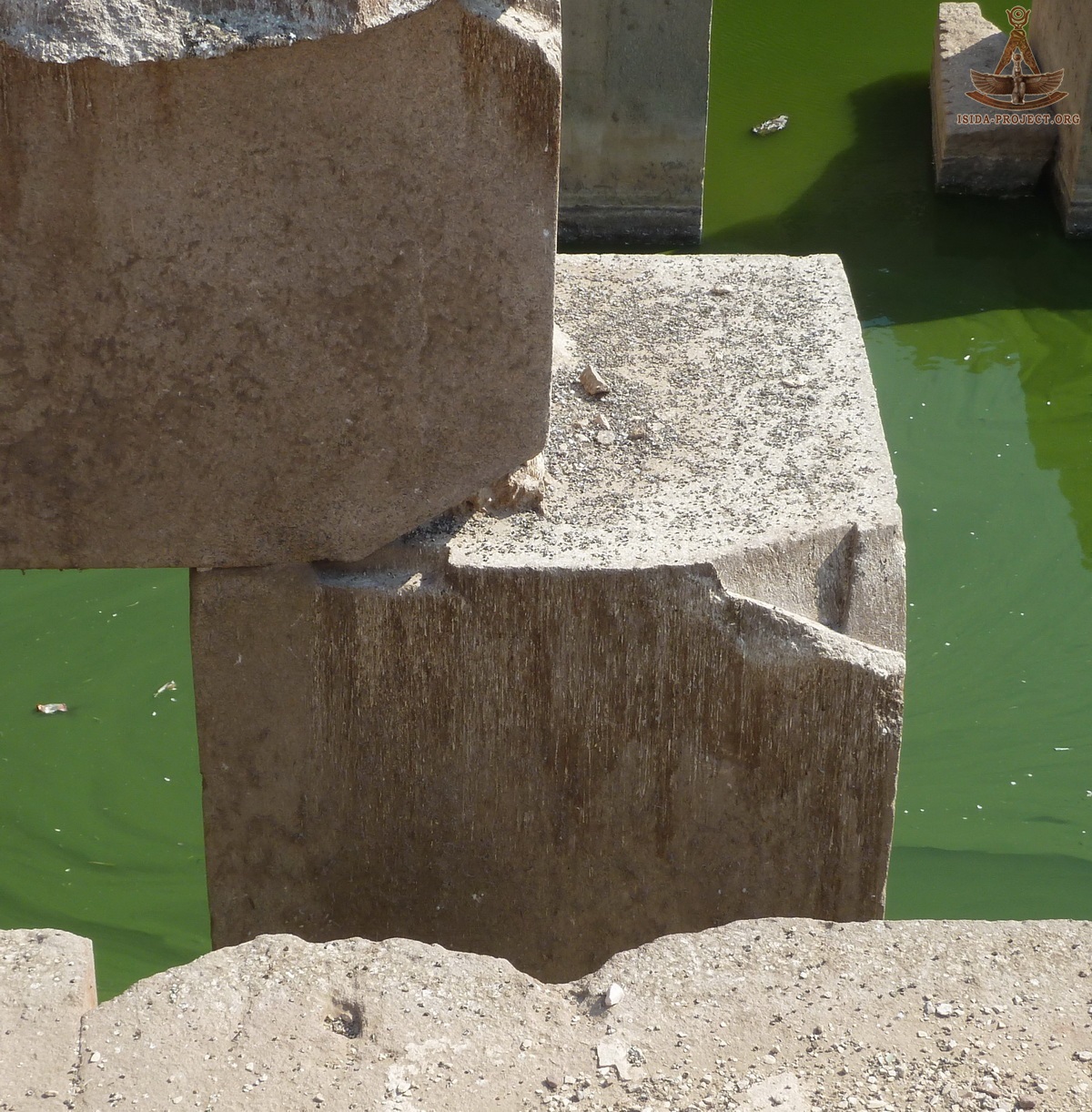
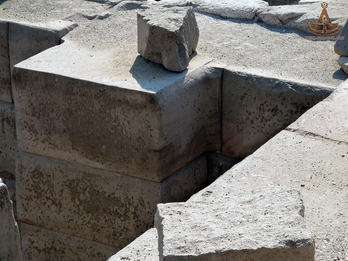
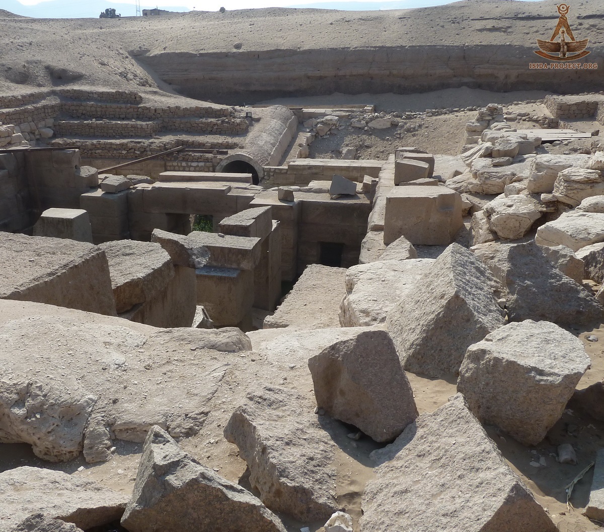
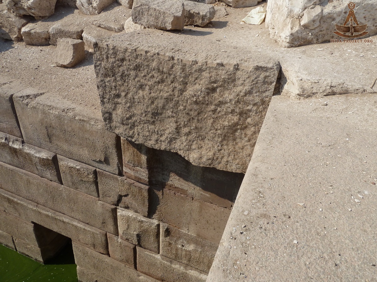
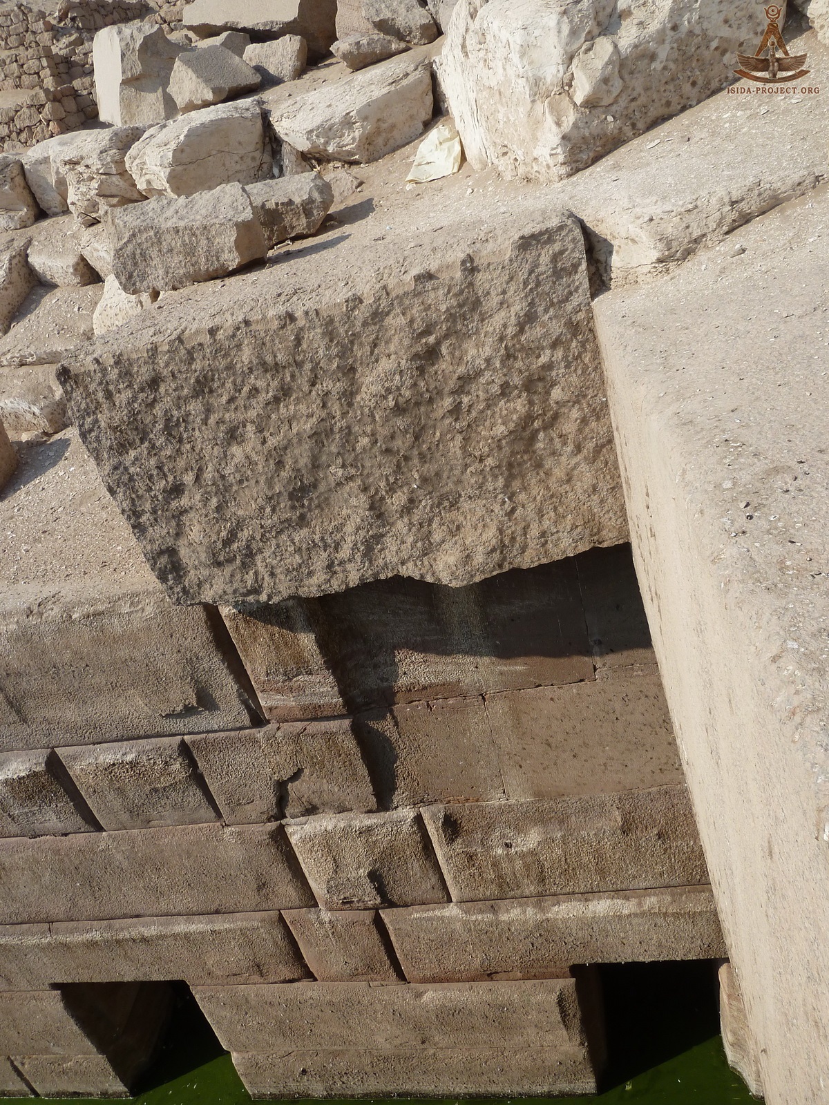
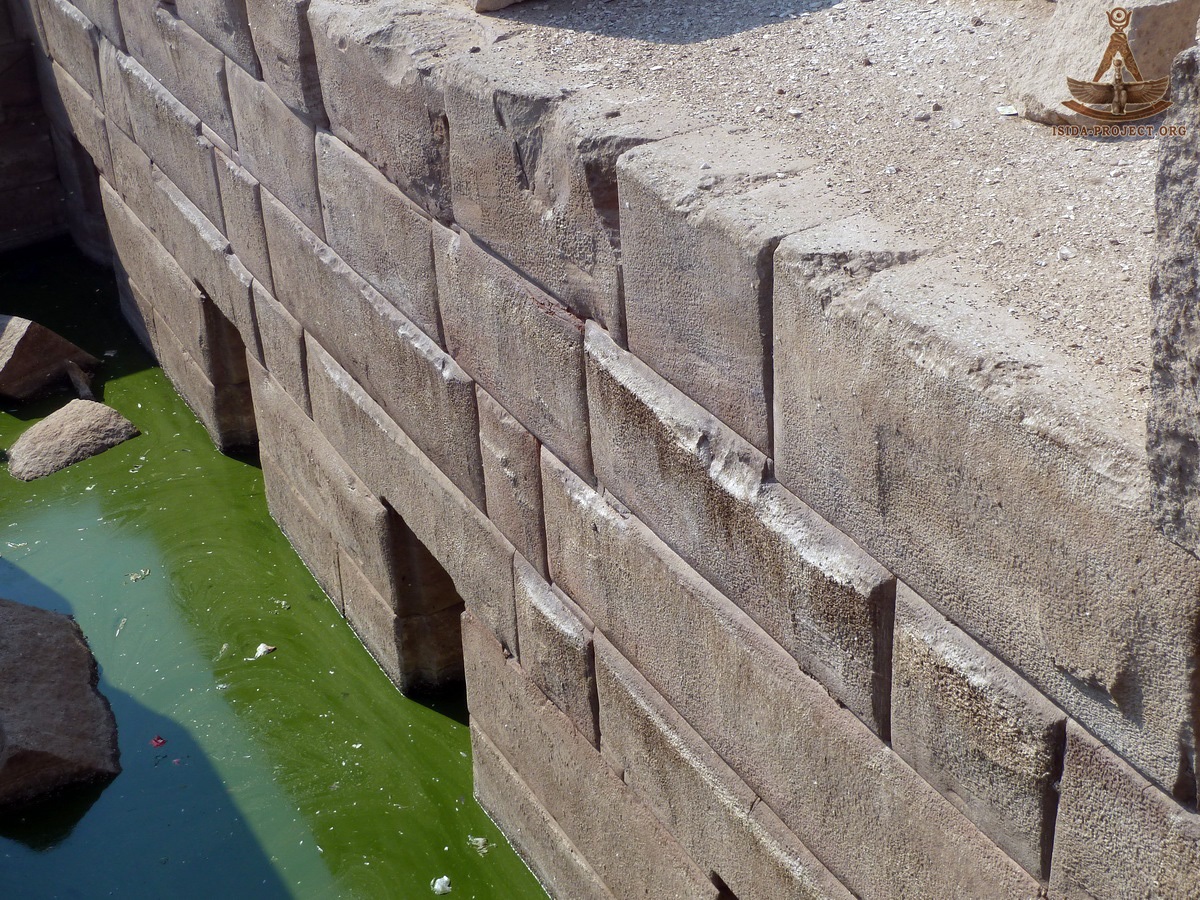
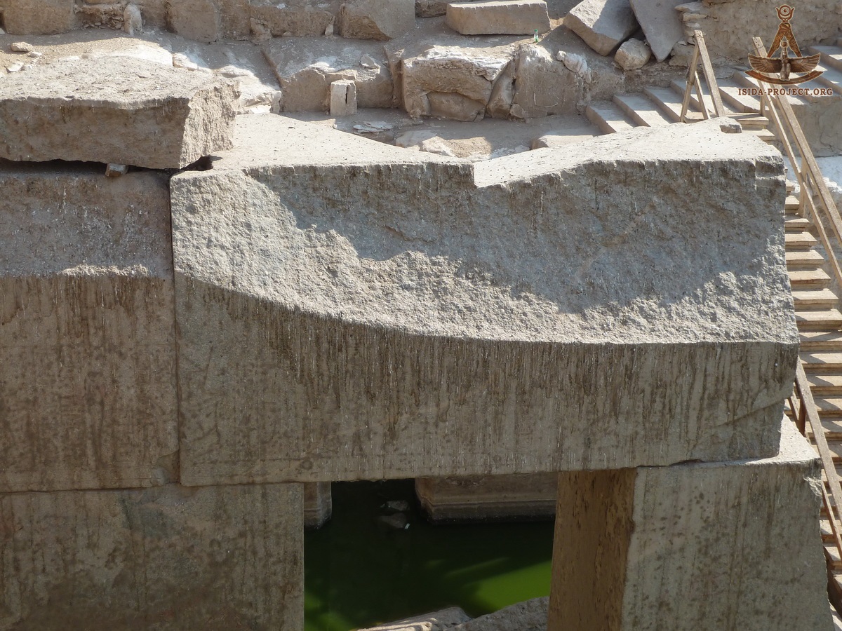
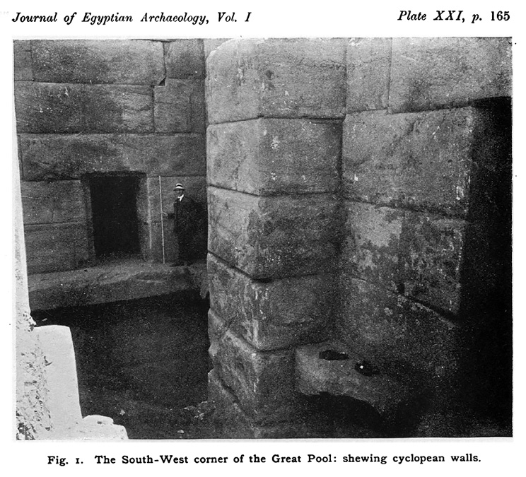
Internal architecture of Osirion The northern wall with cells and floor pavement of 60 cm width, encircling the entire inner perimeter of the room and, in particular, the base of the nave near the northern wall:
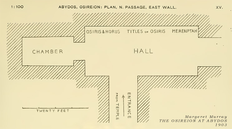
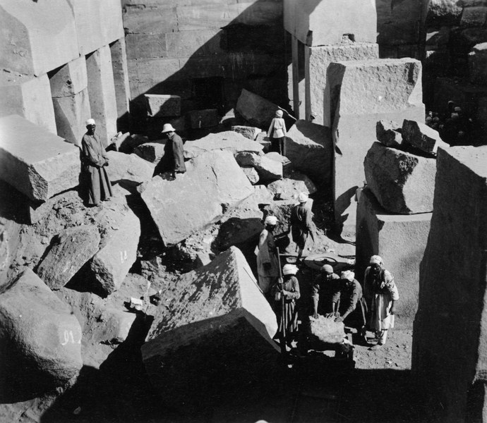
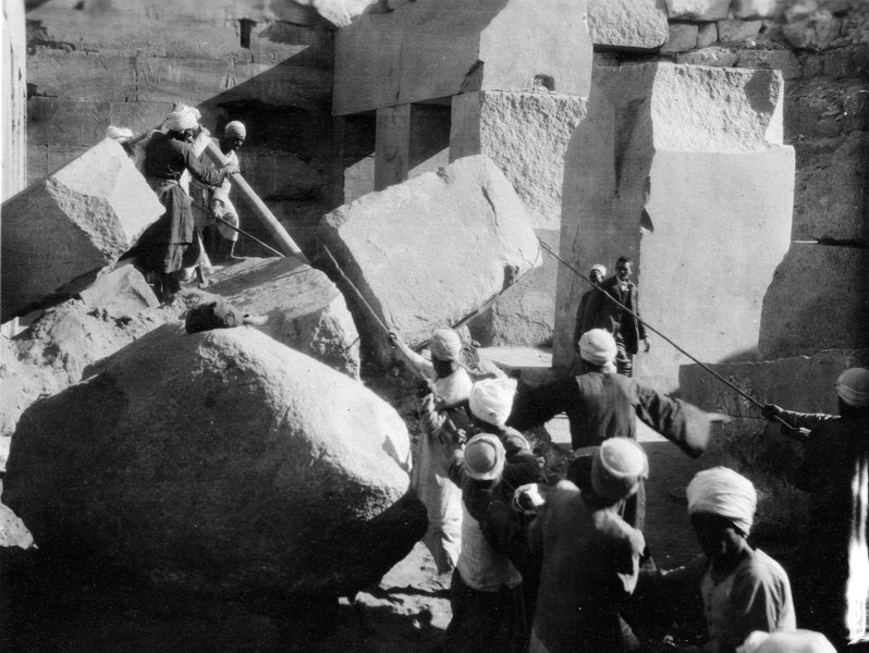
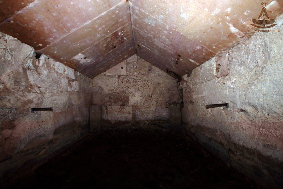
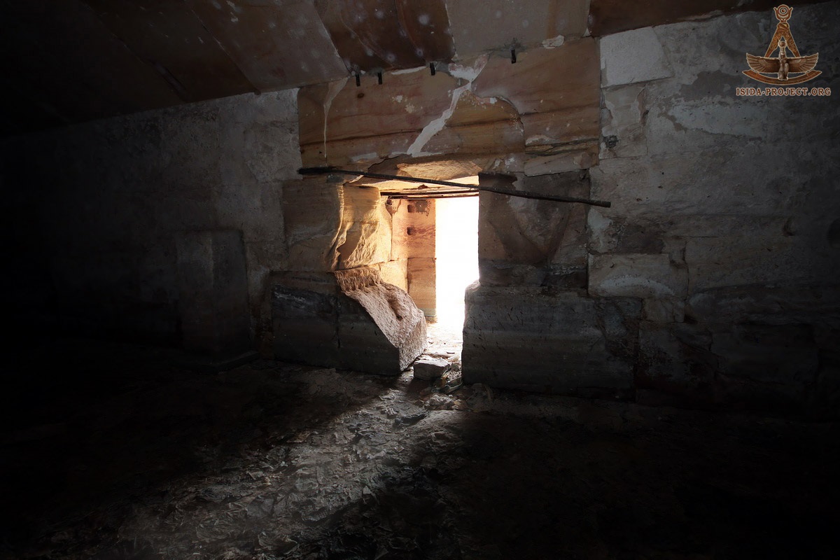
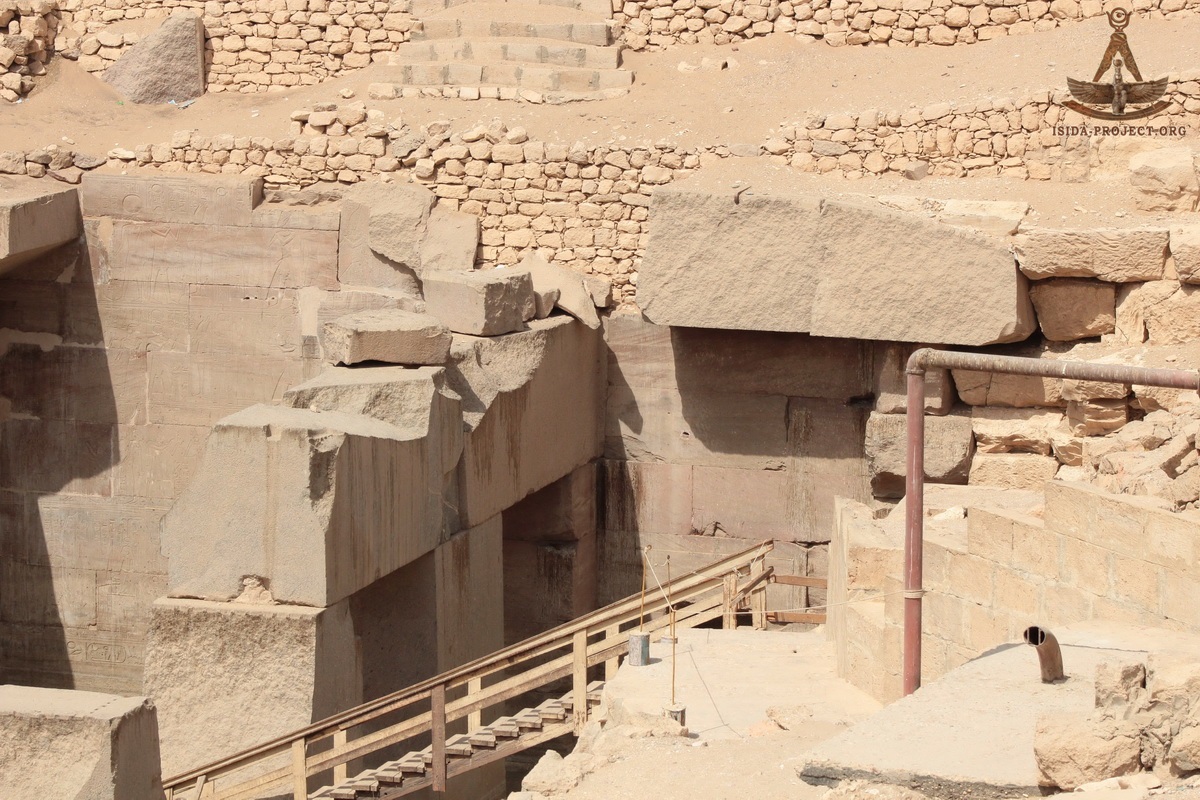
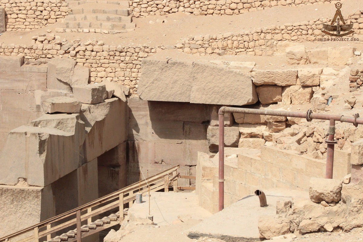
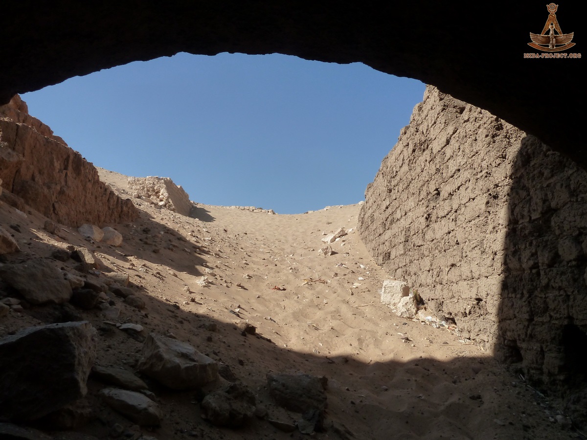
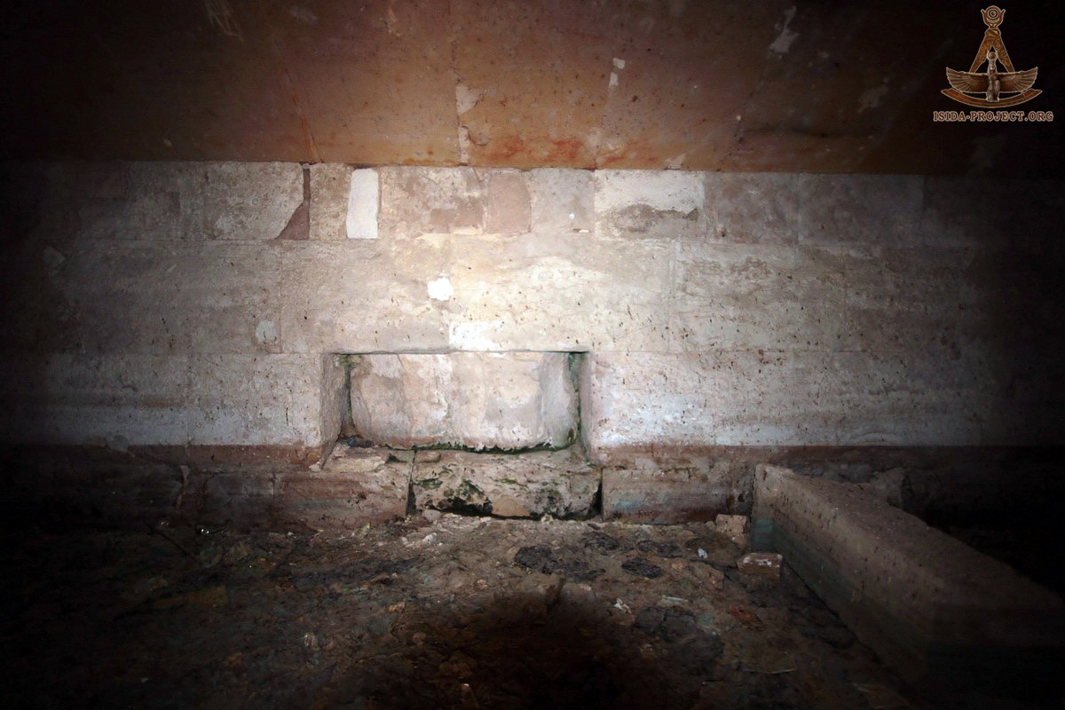
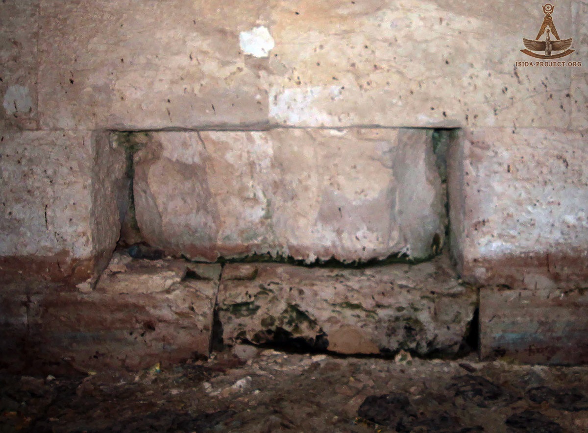
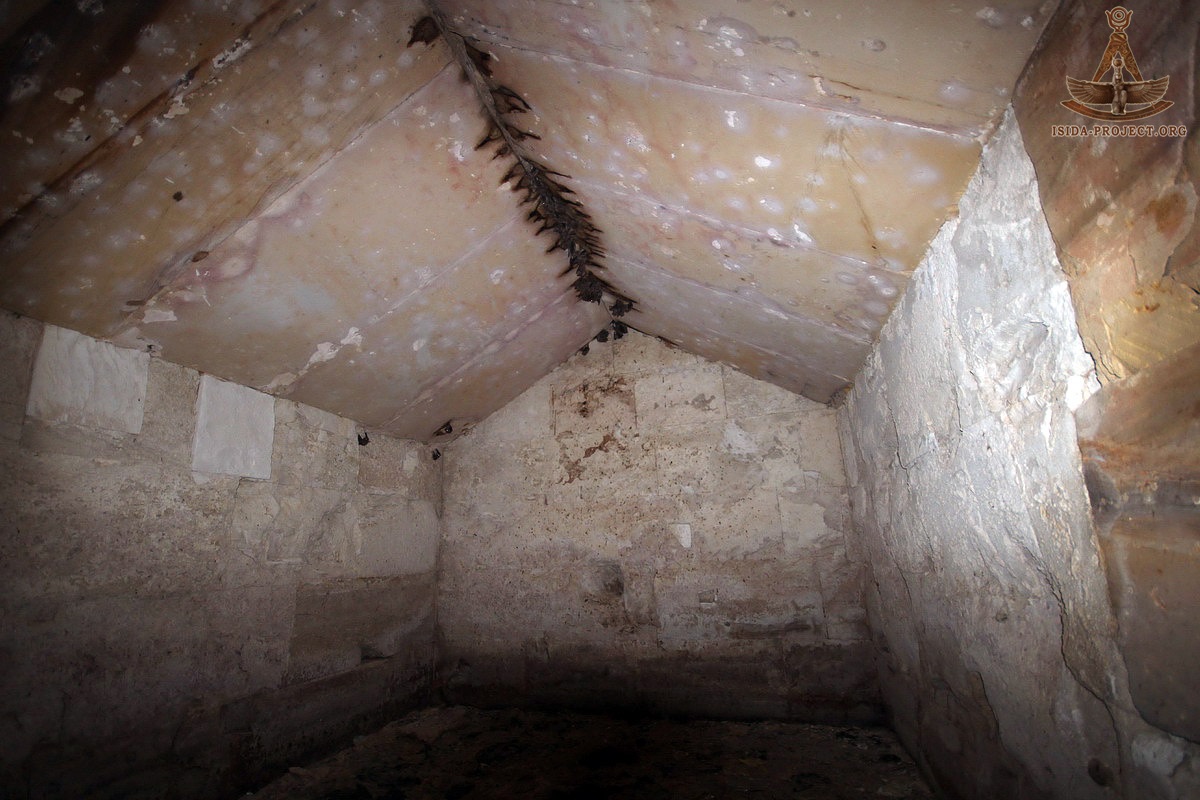
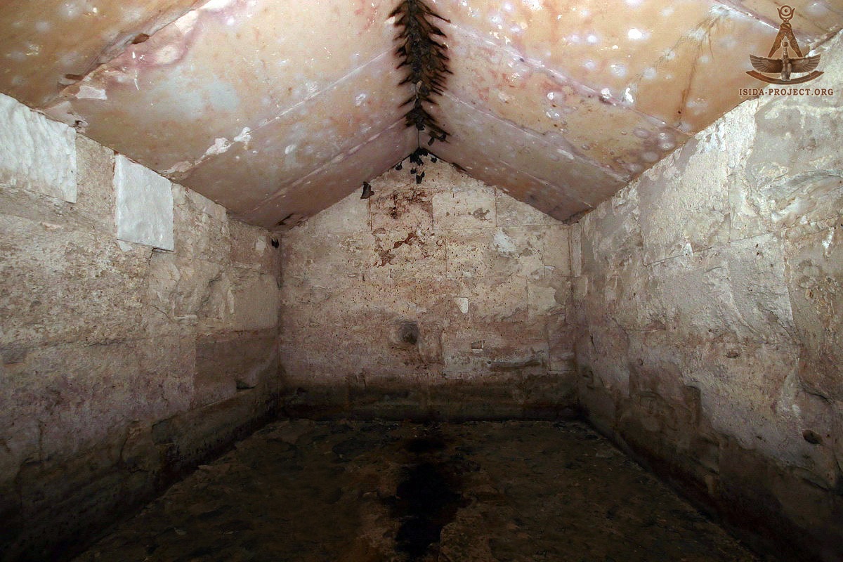
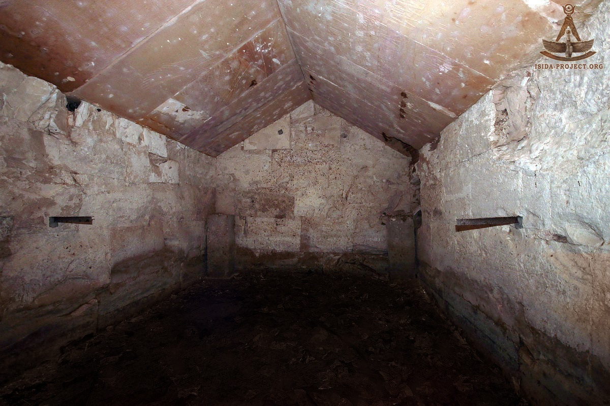
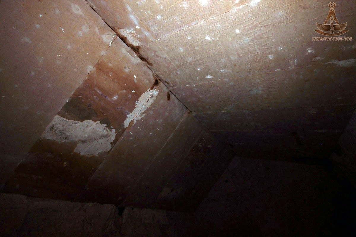
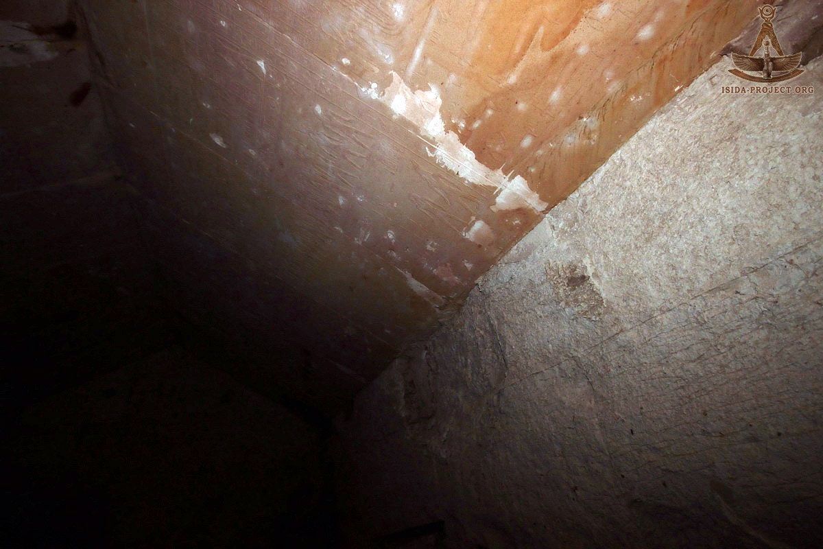
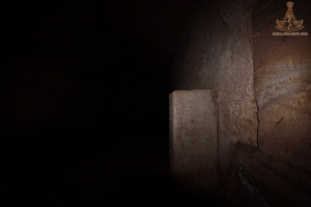
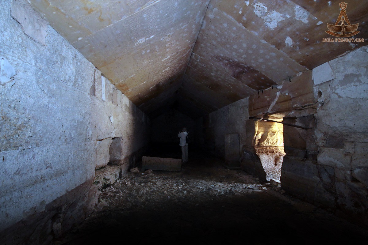
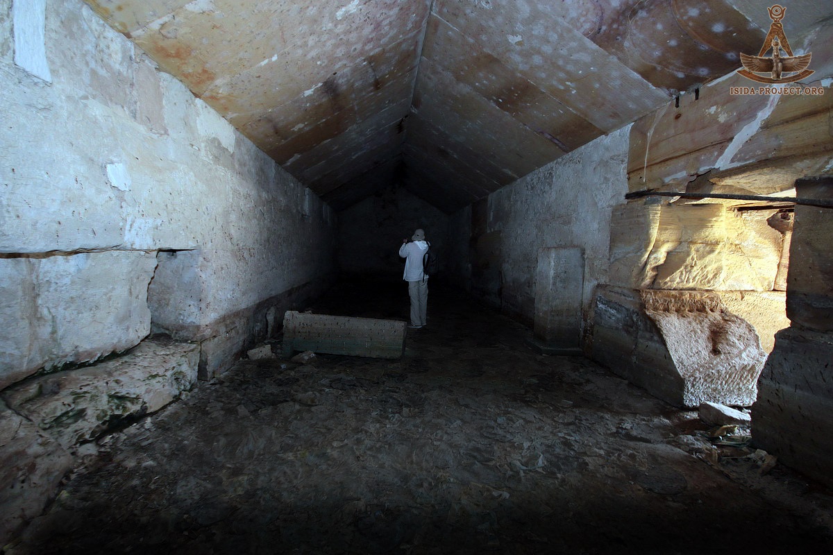
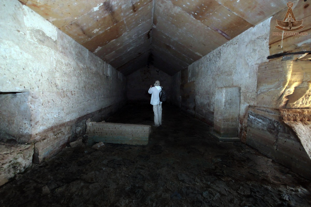
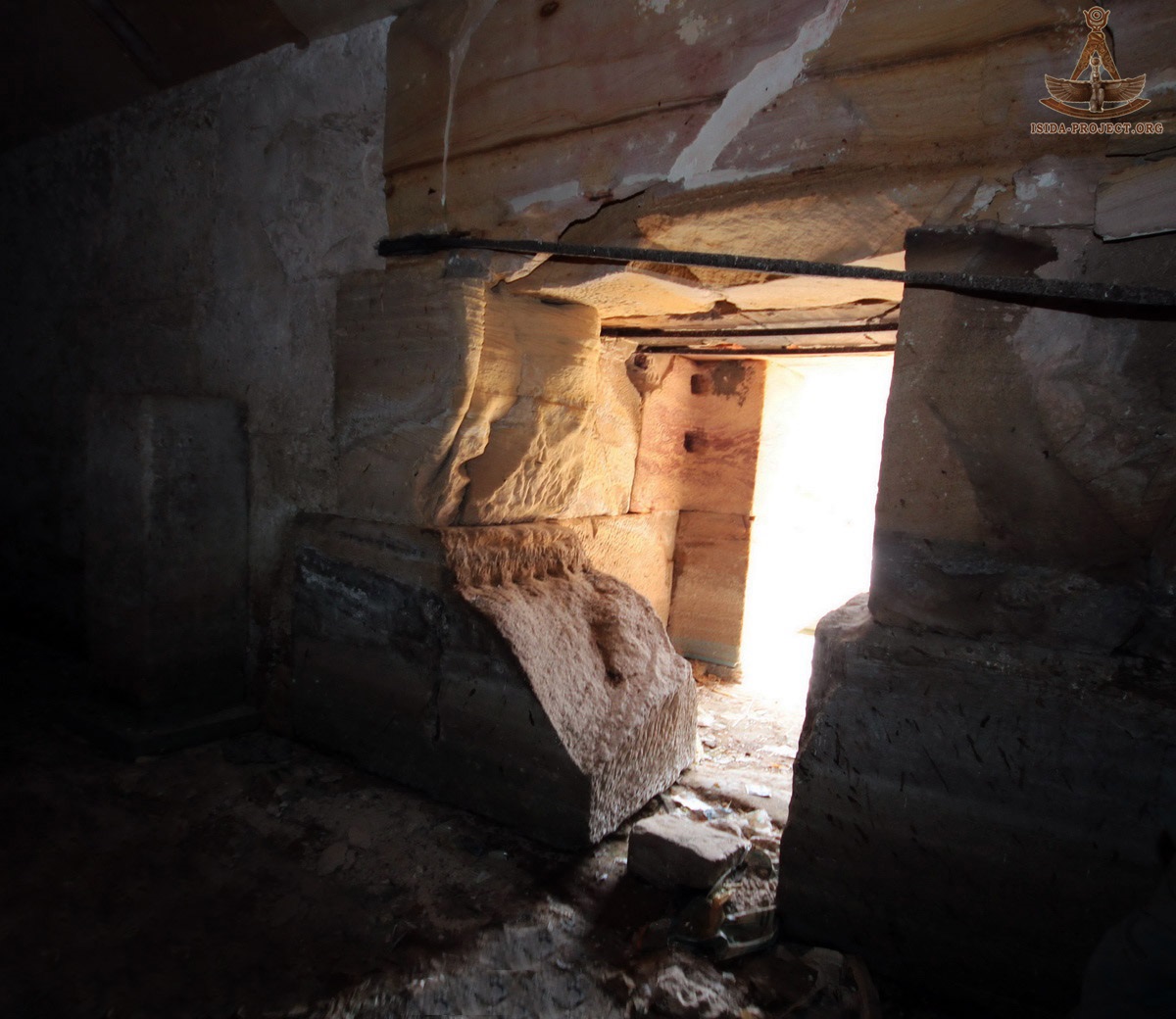
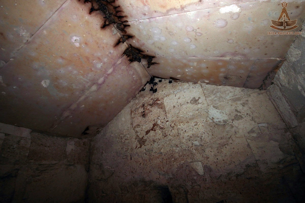
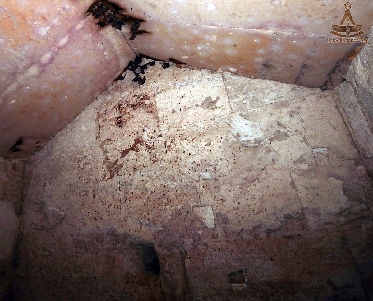
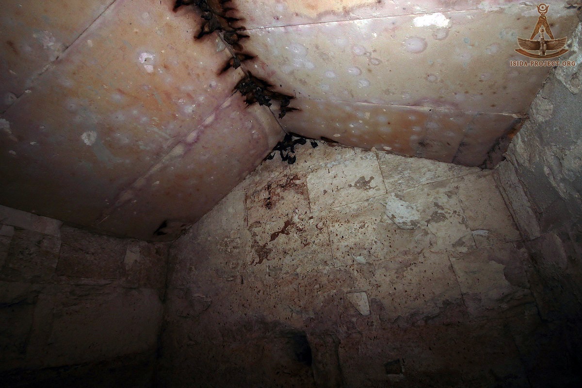
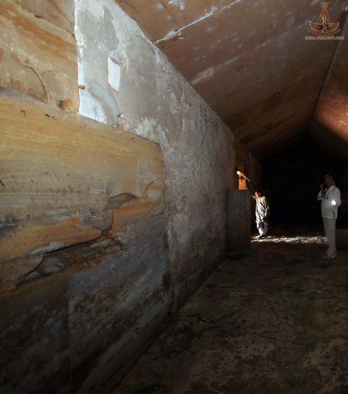
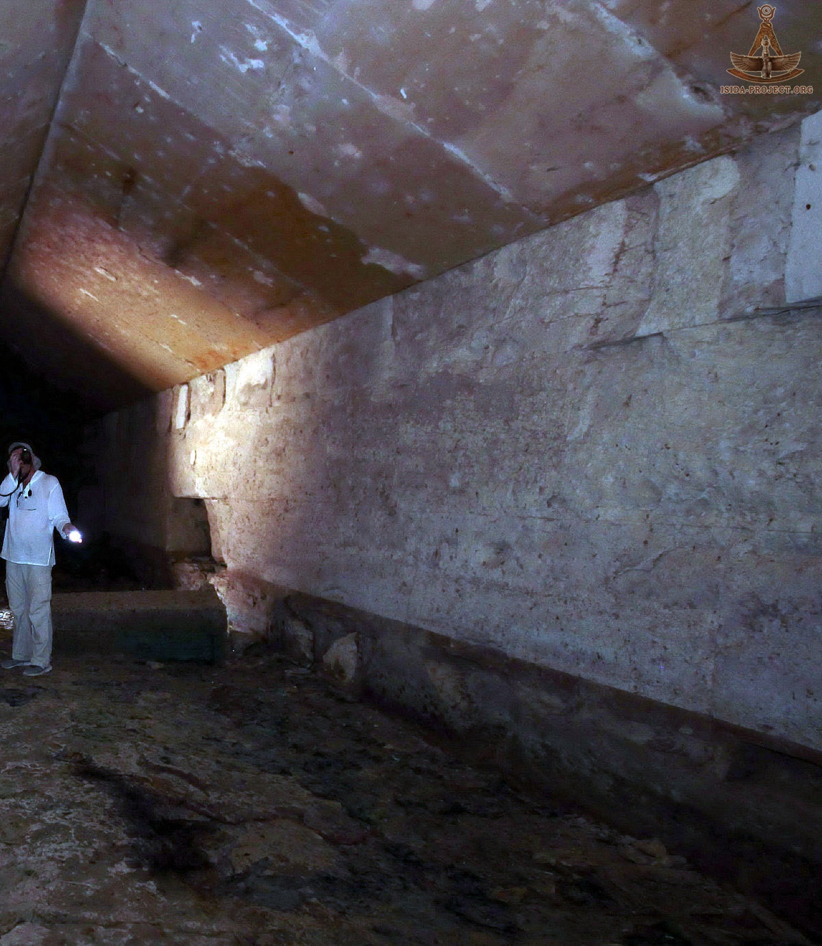
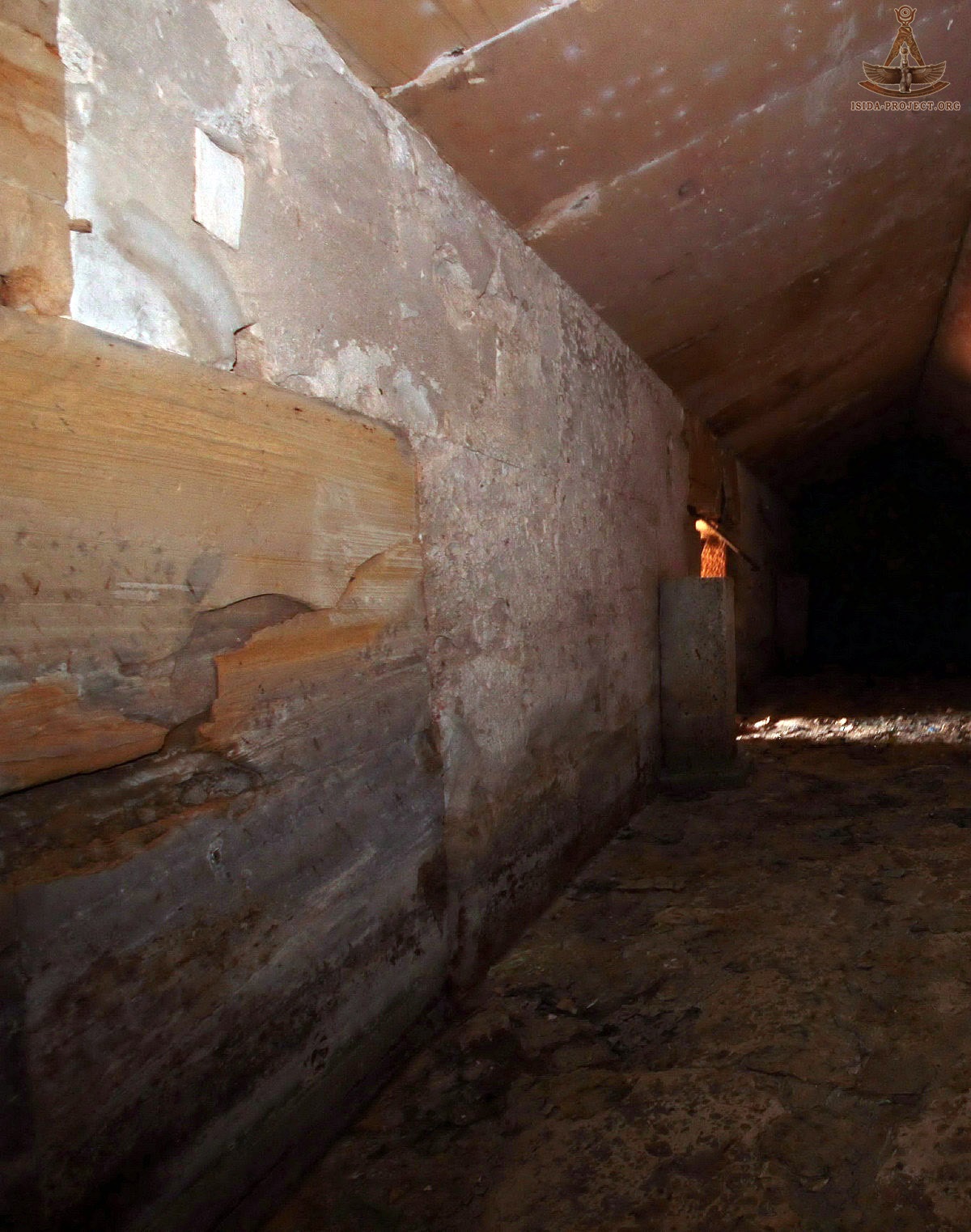
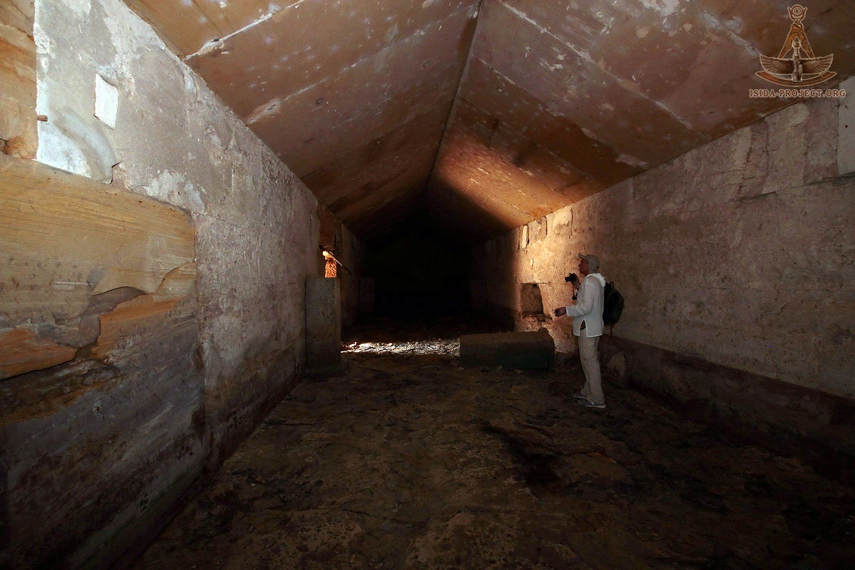
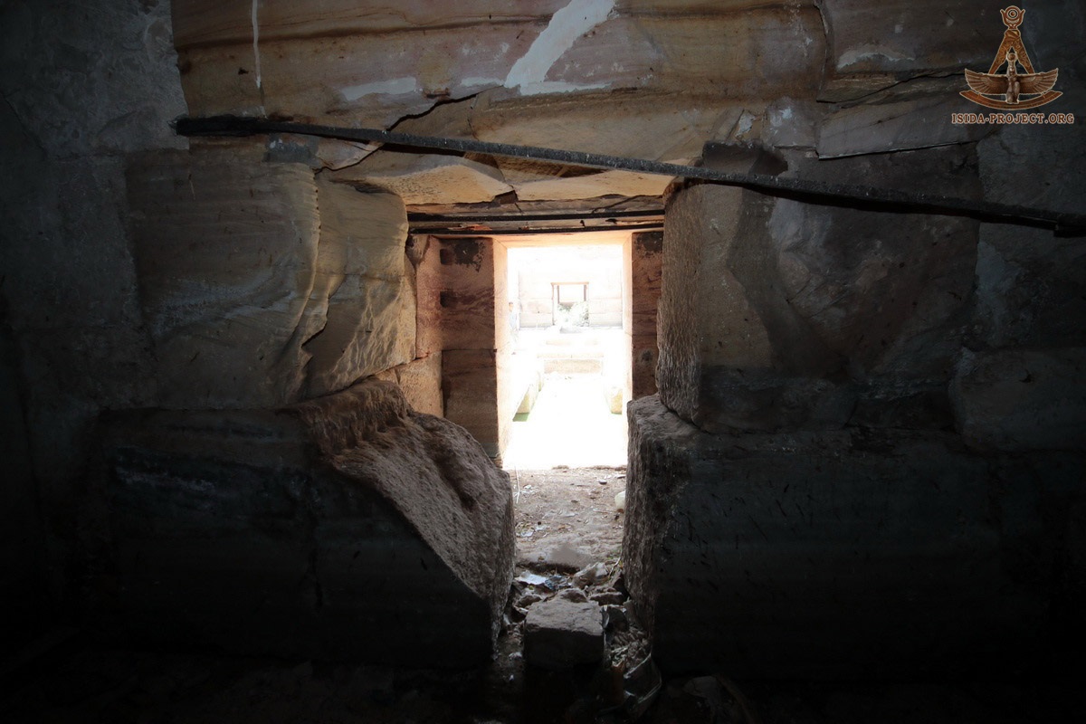
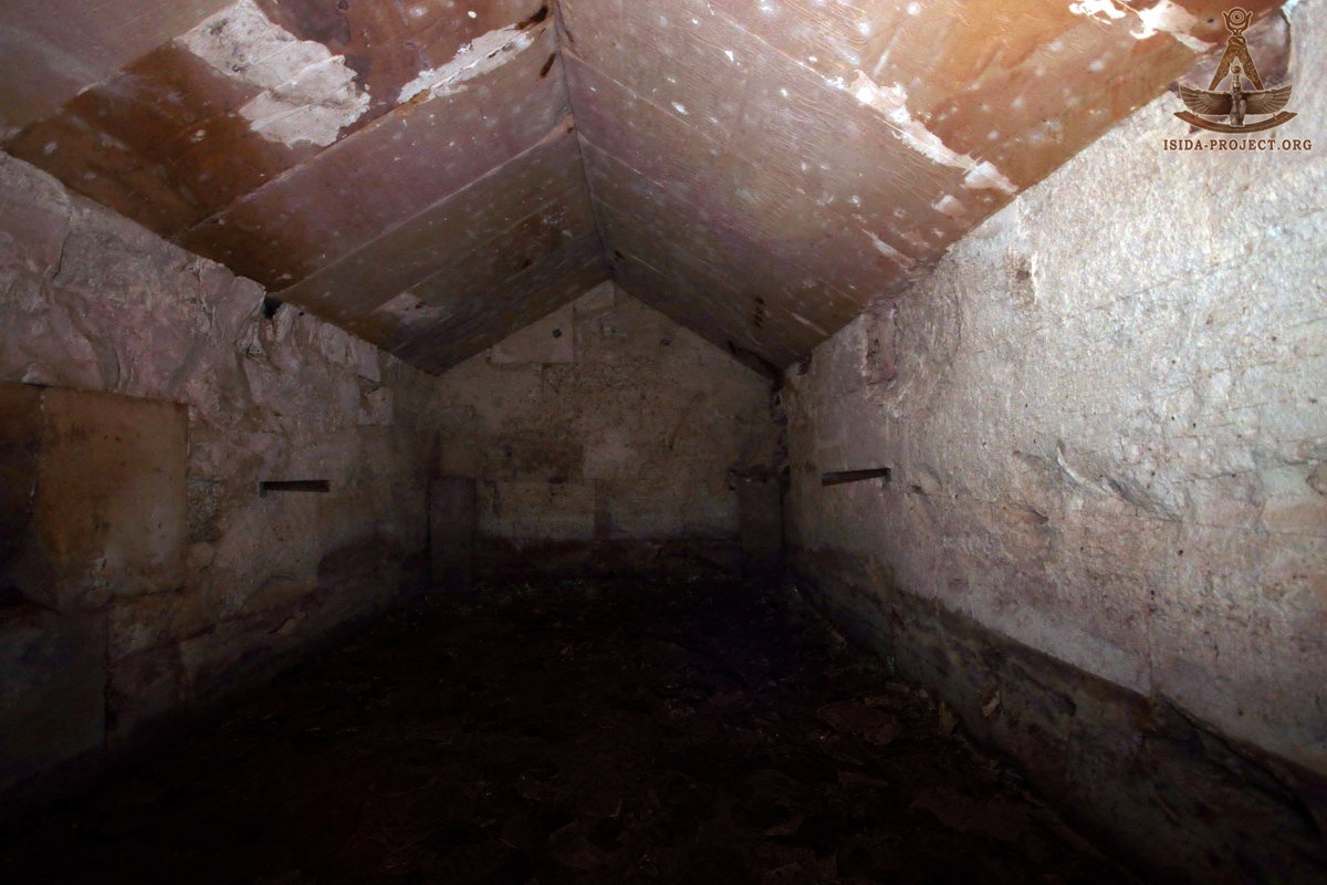
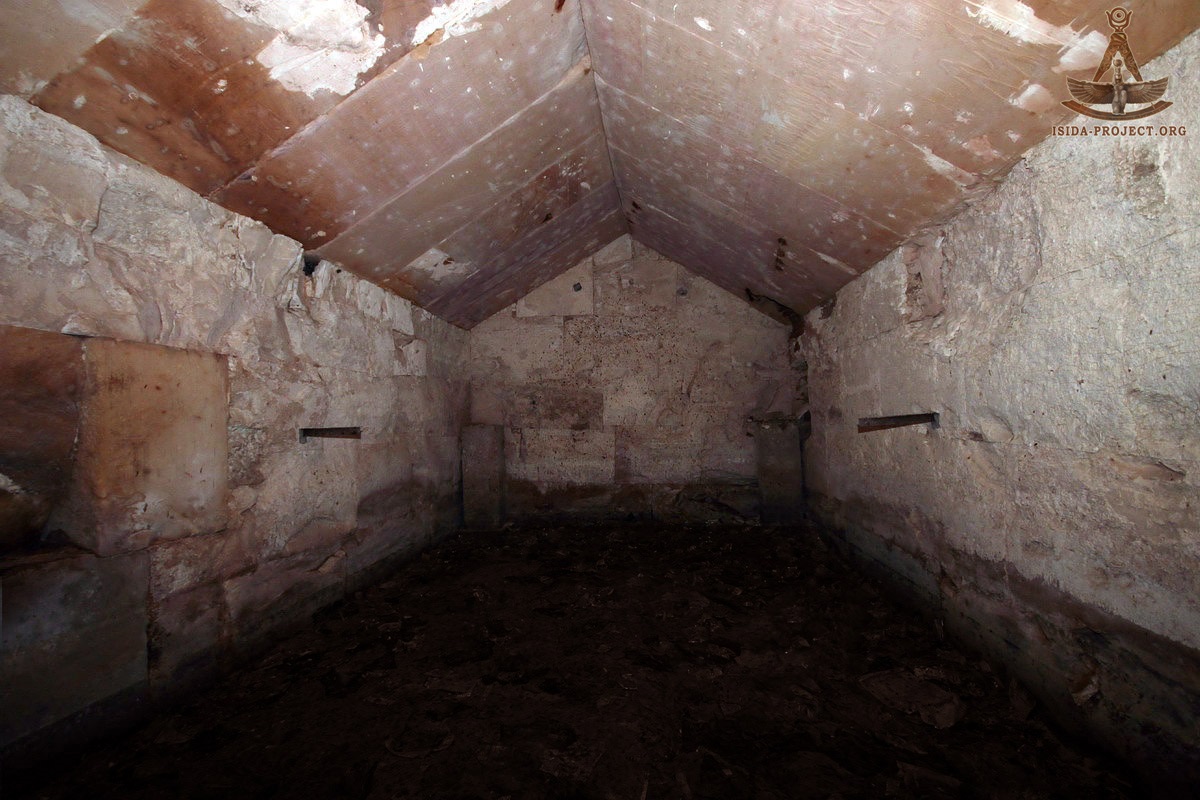
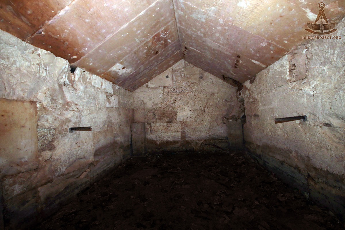
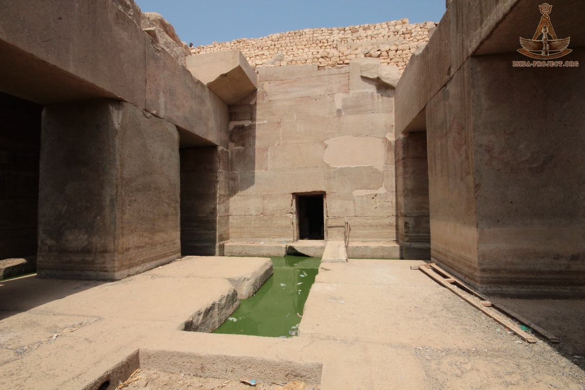
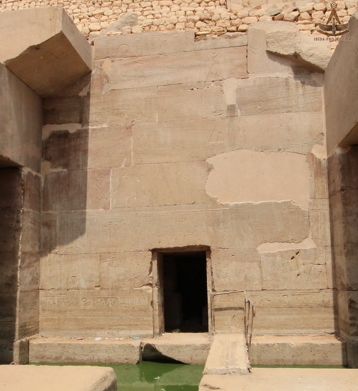
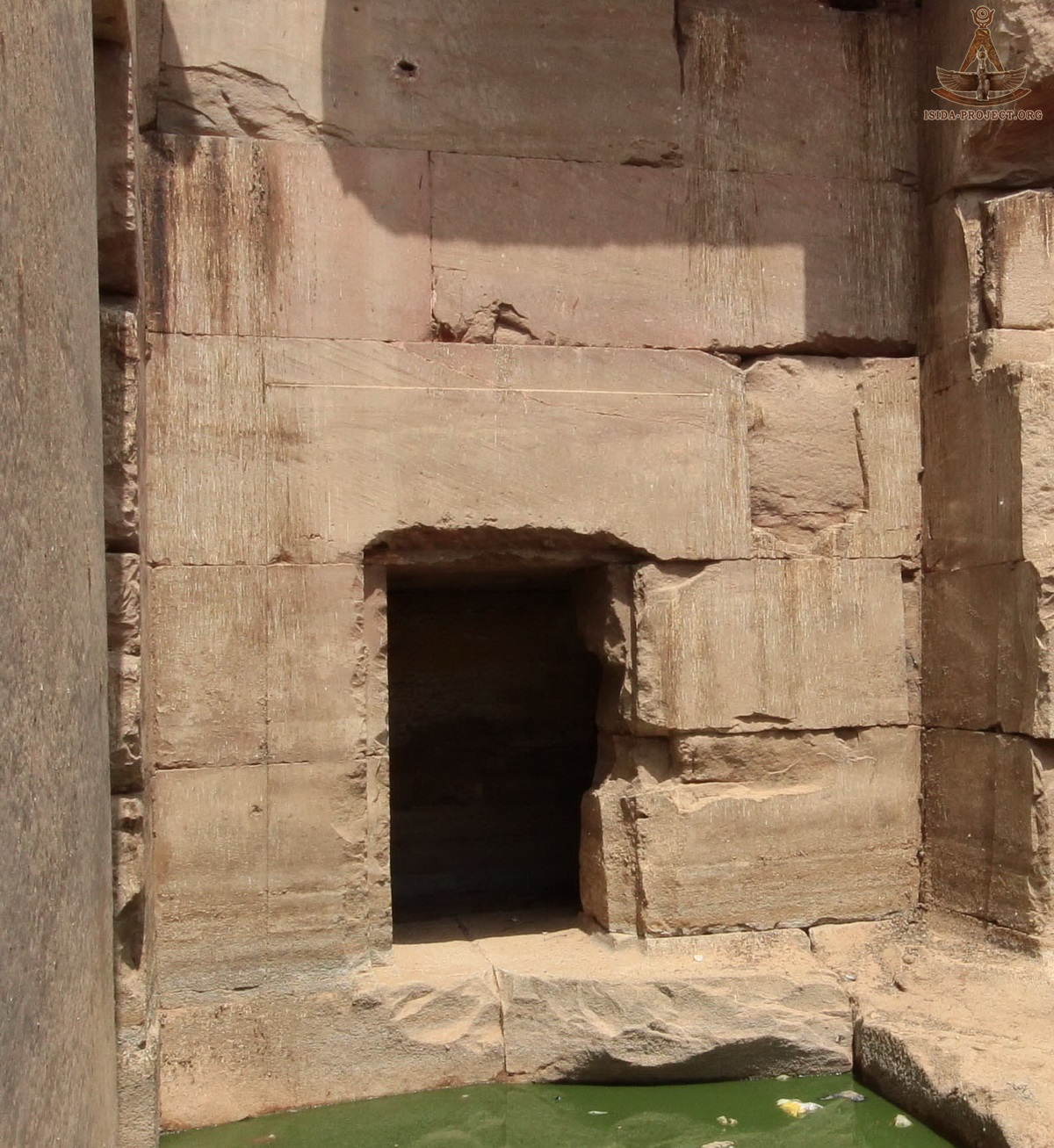
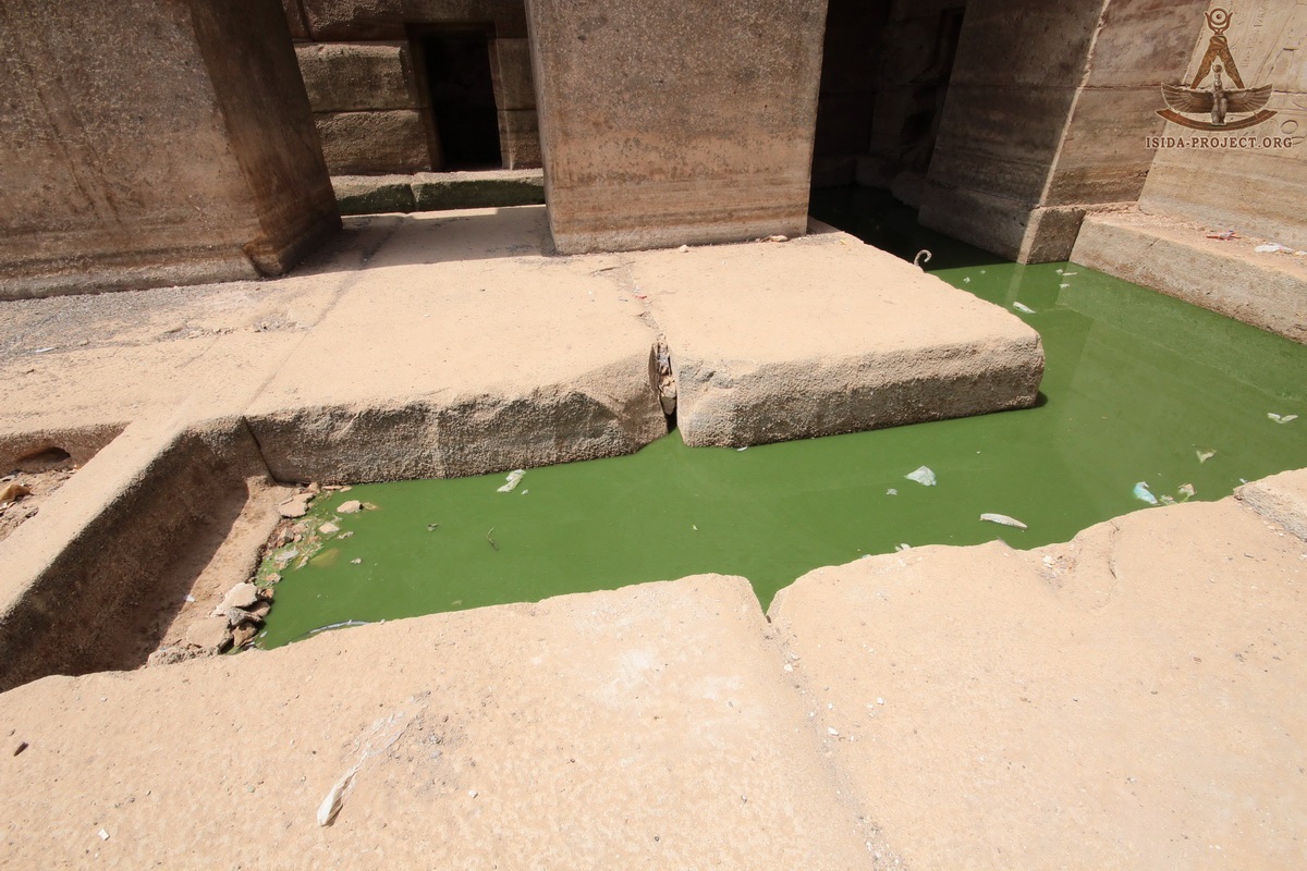
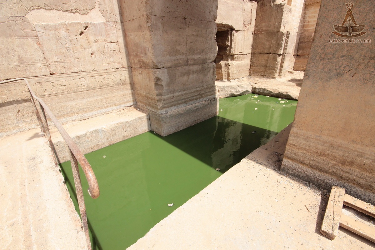
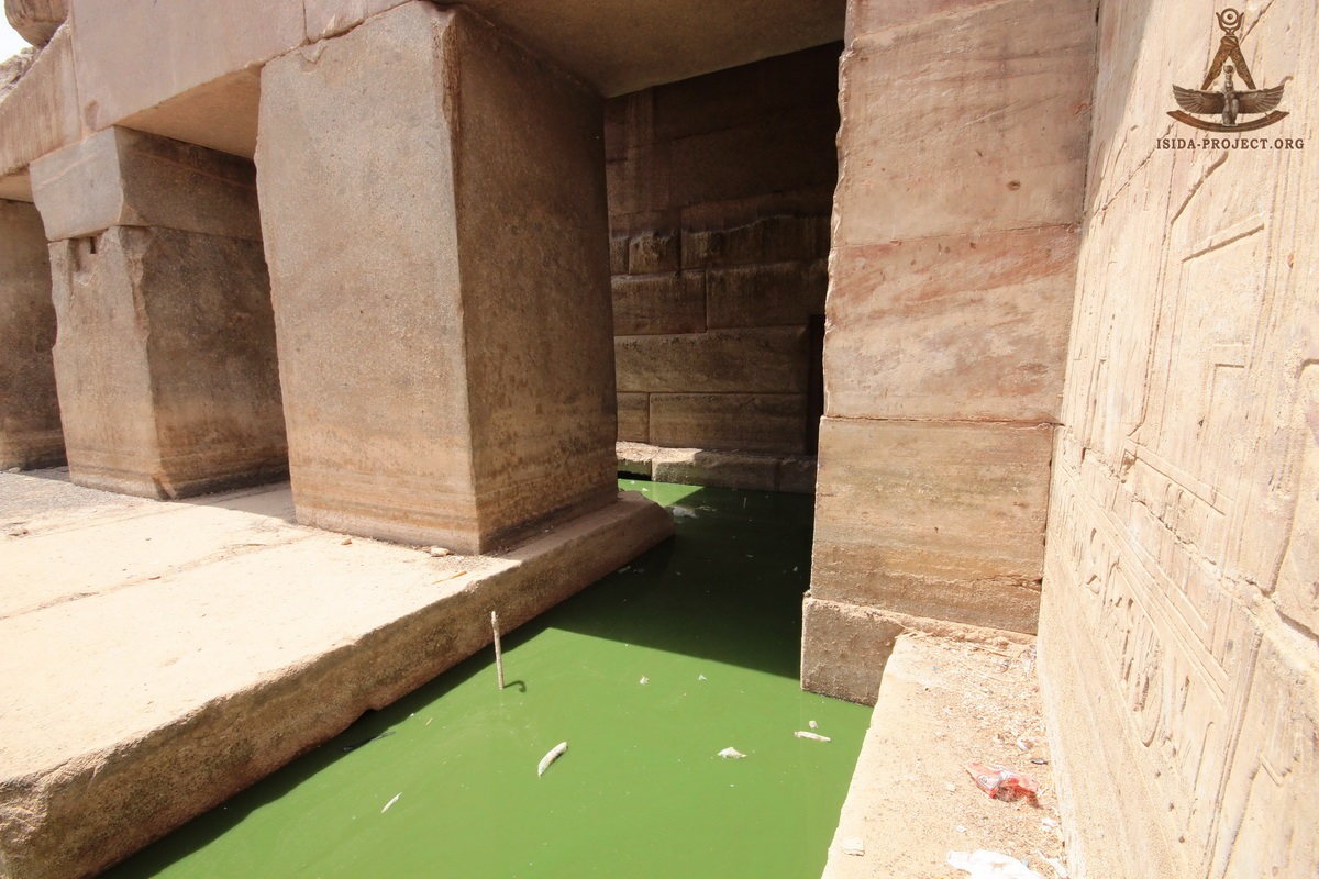
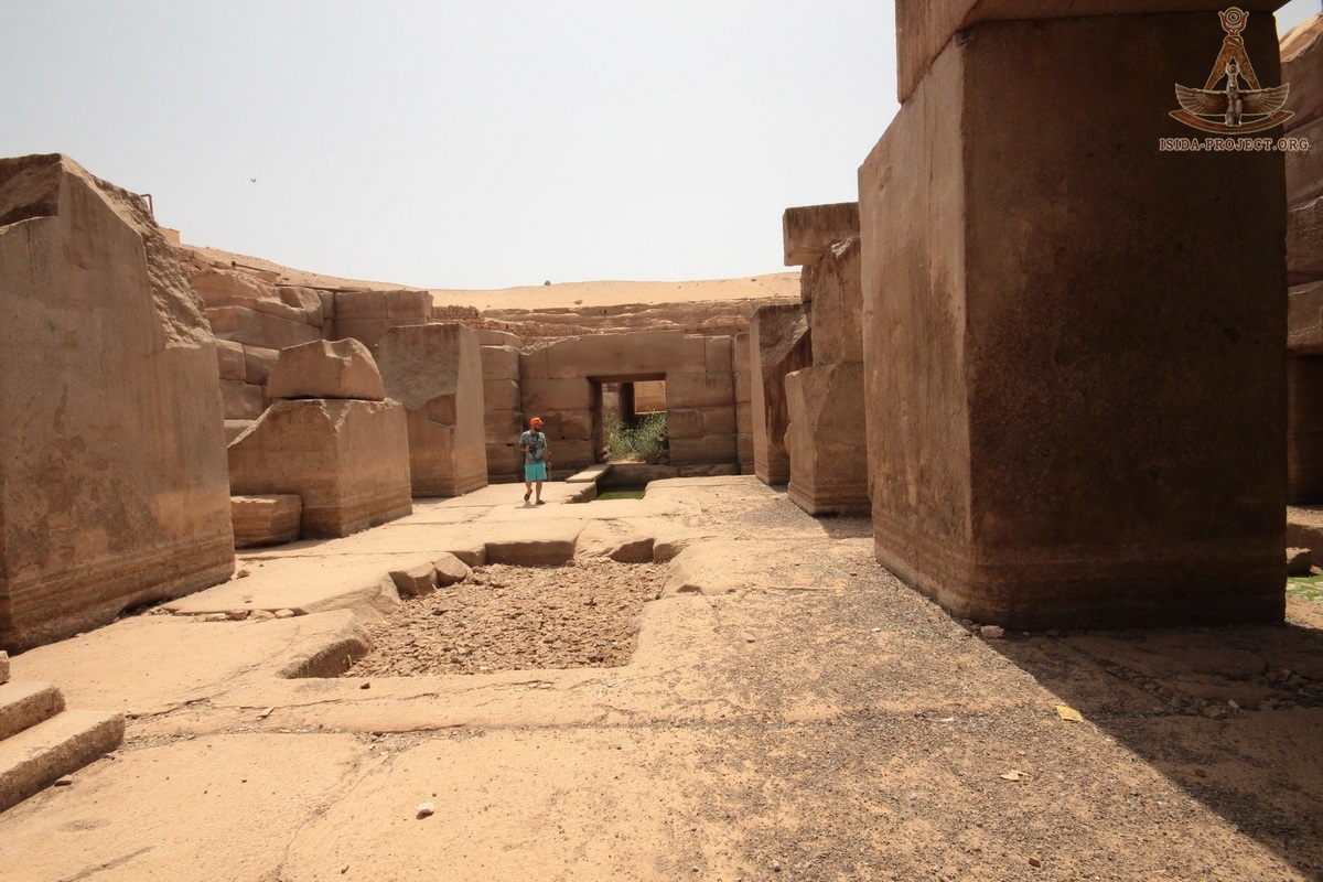
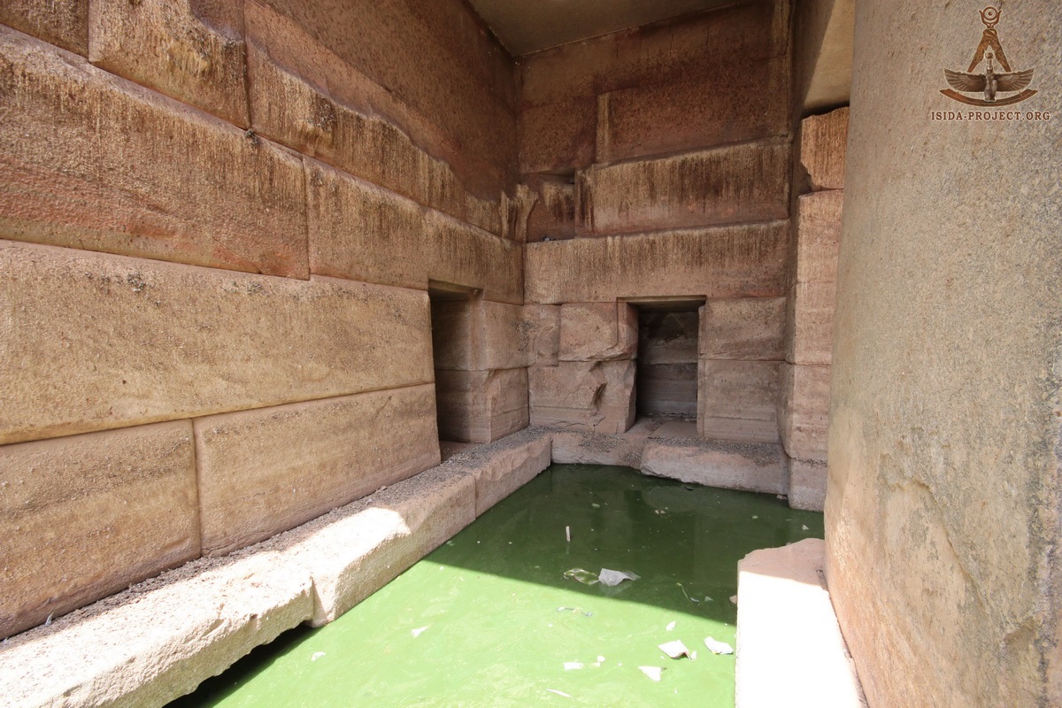
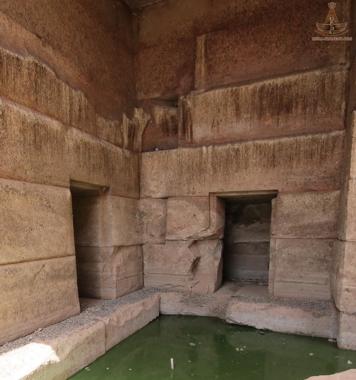
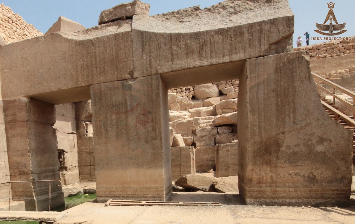
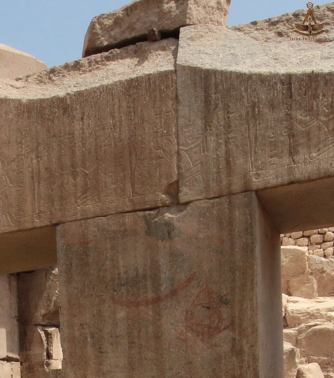
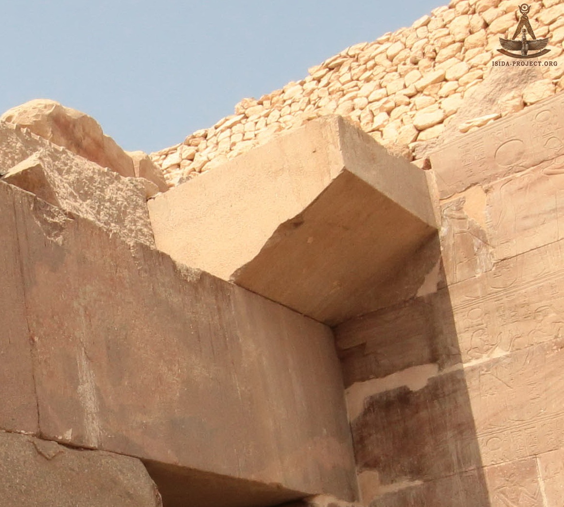
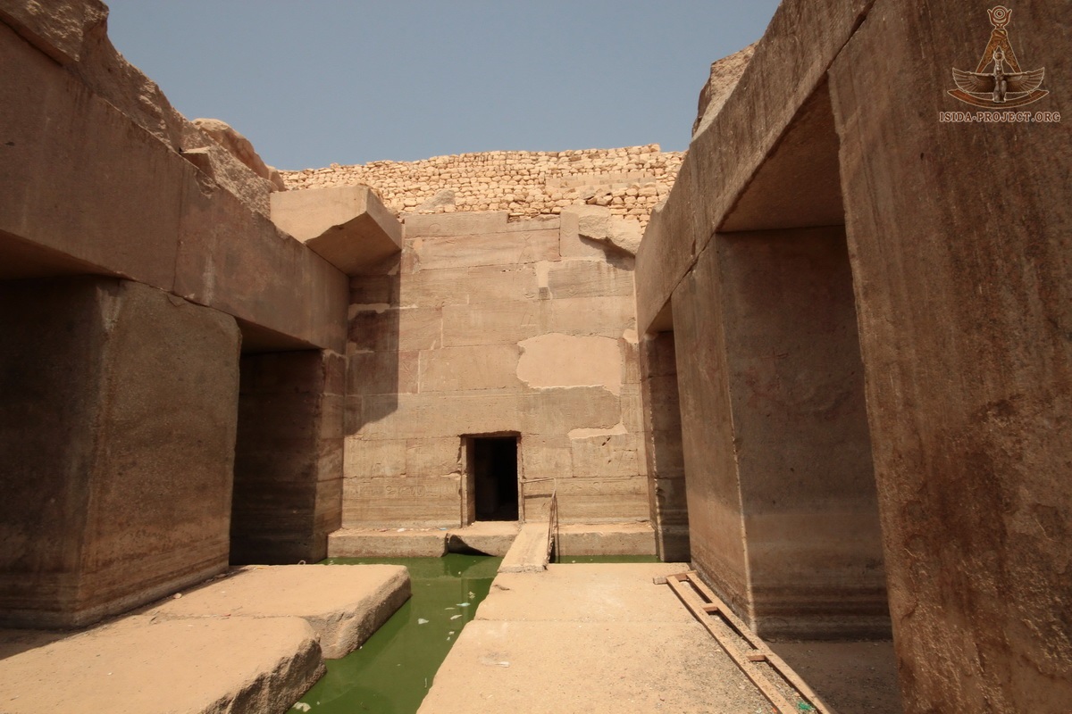
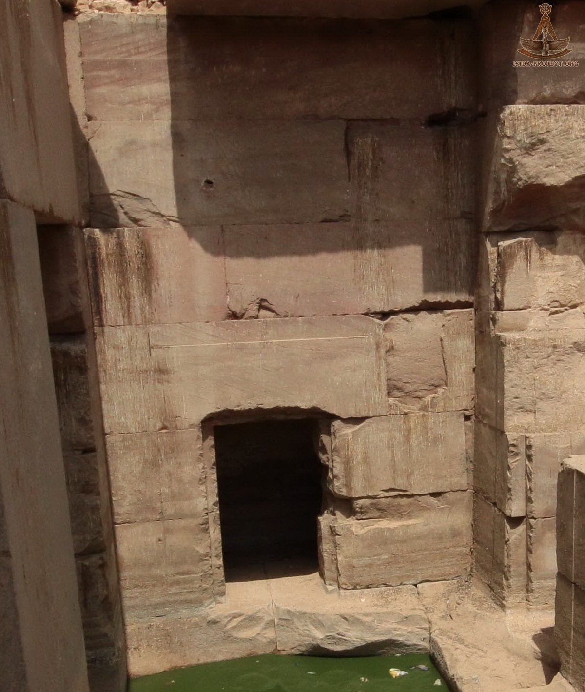
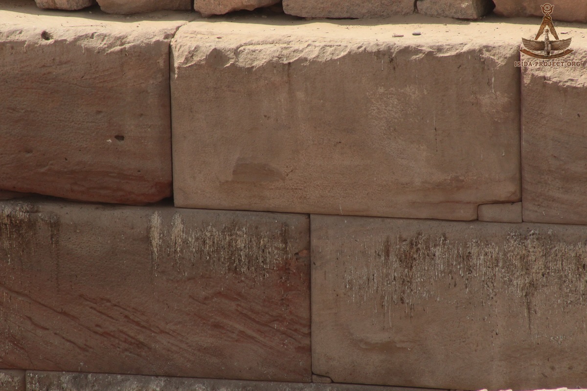
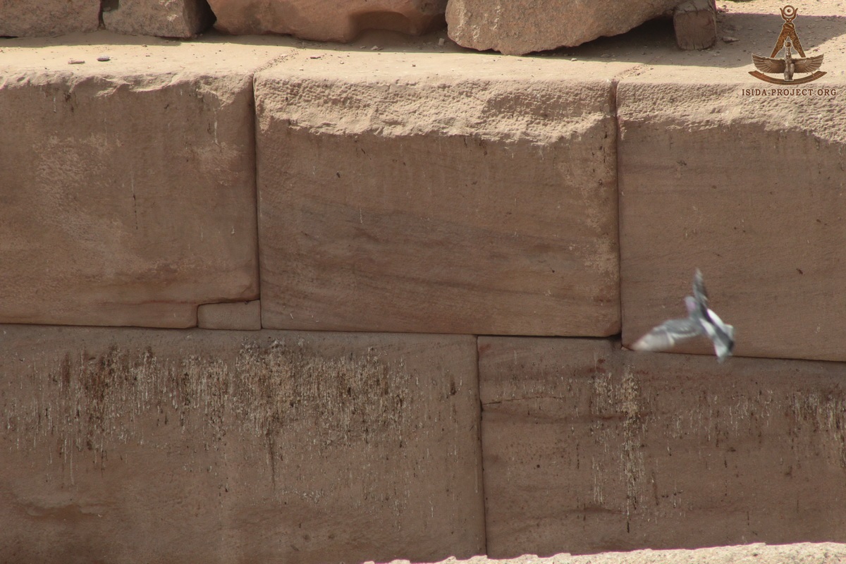
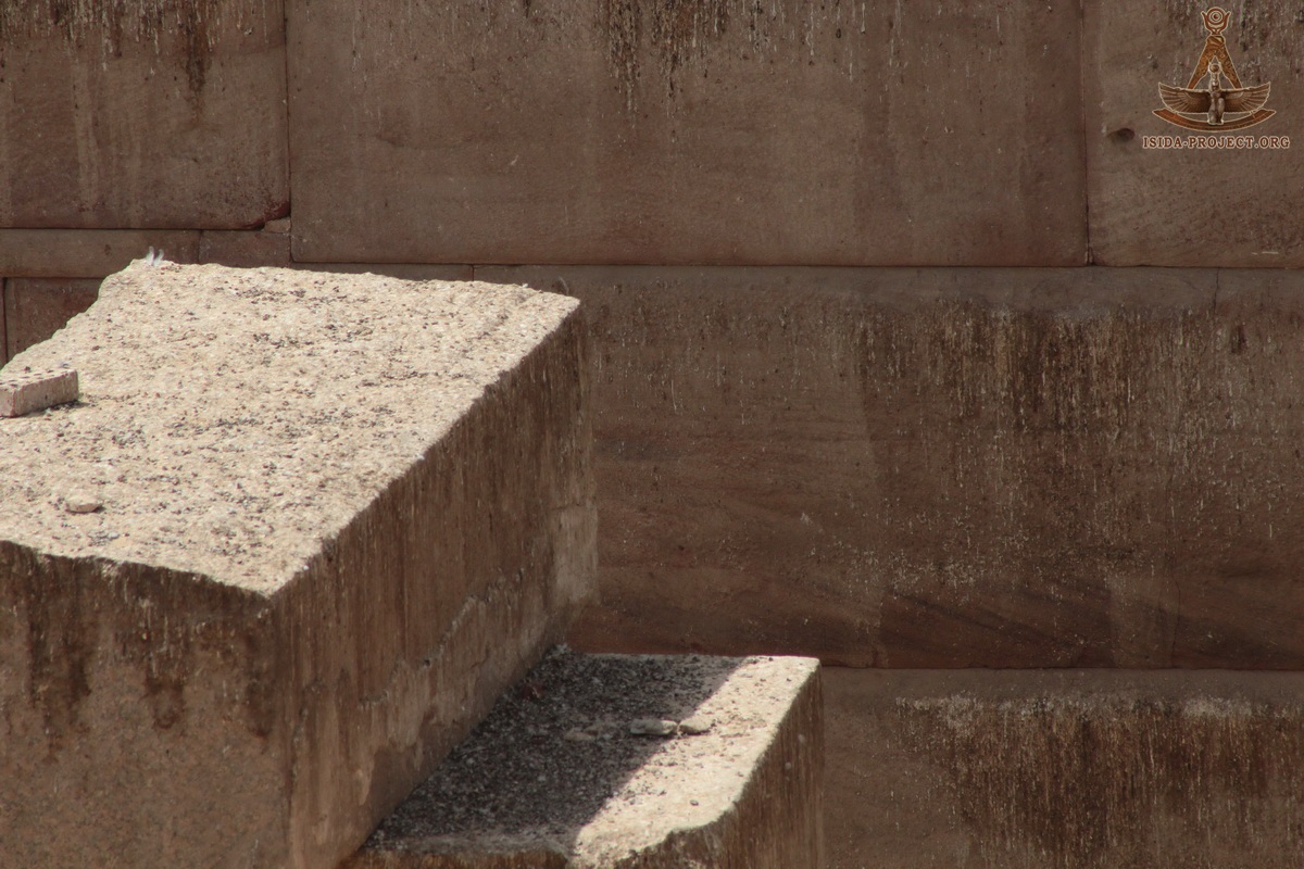
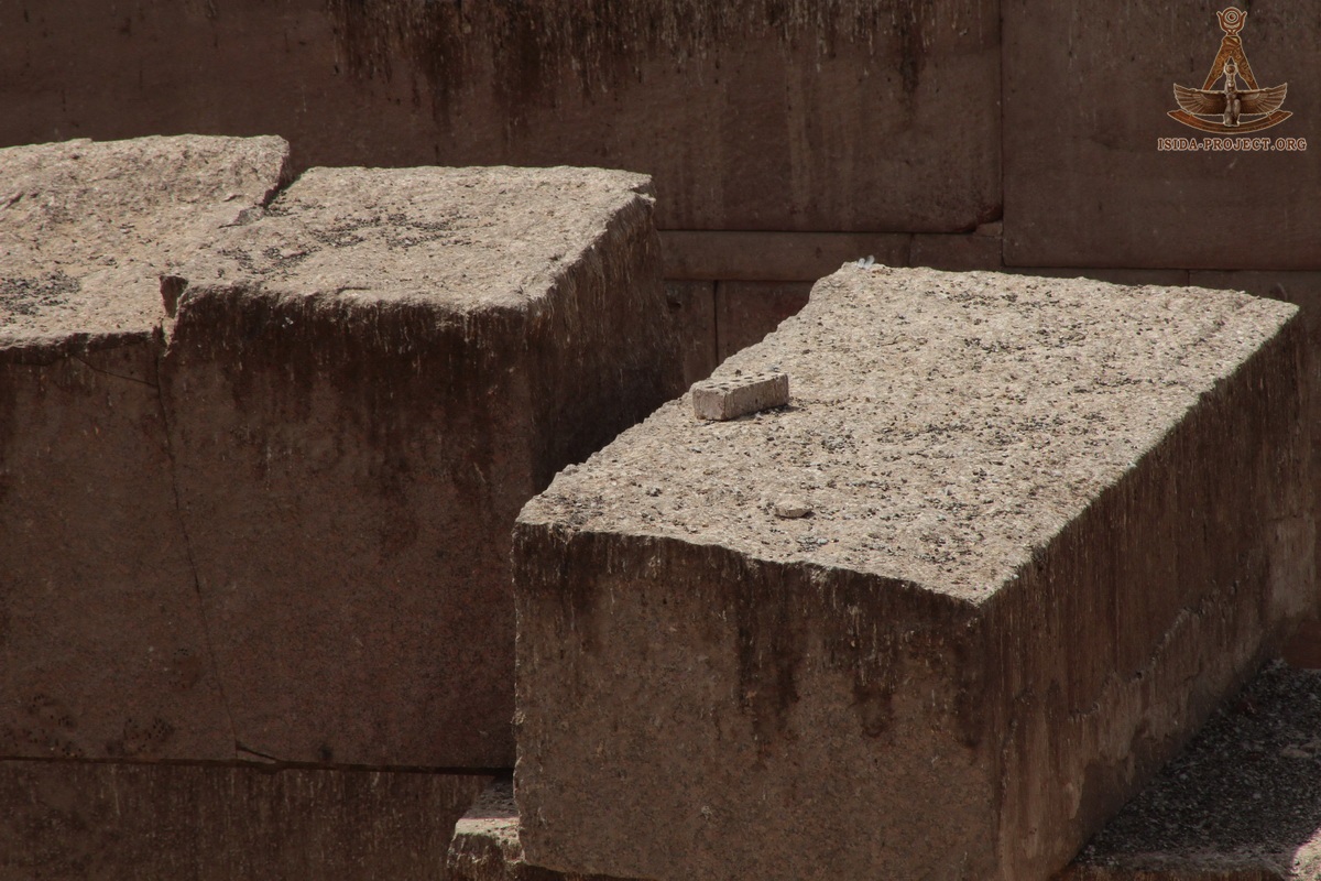
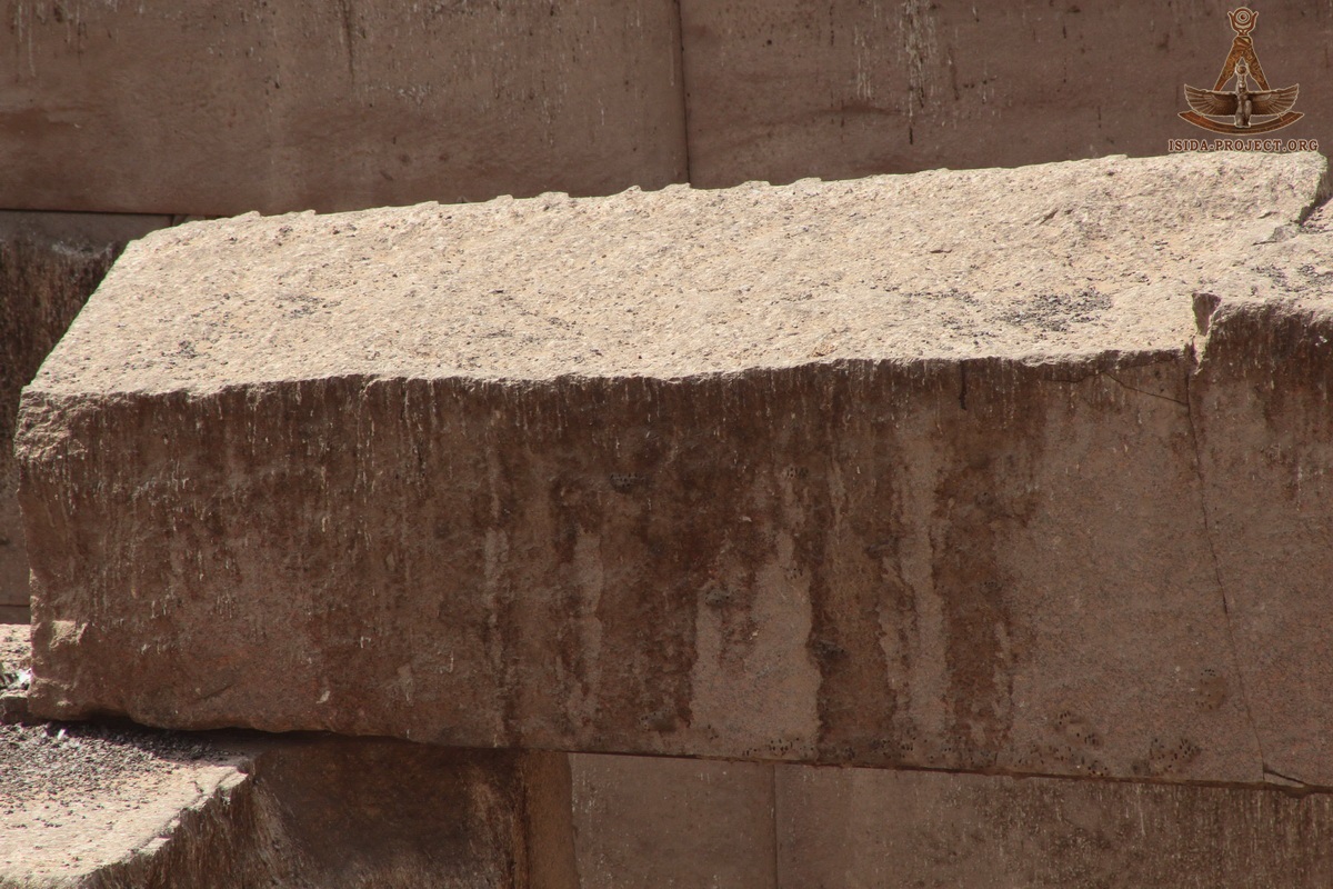
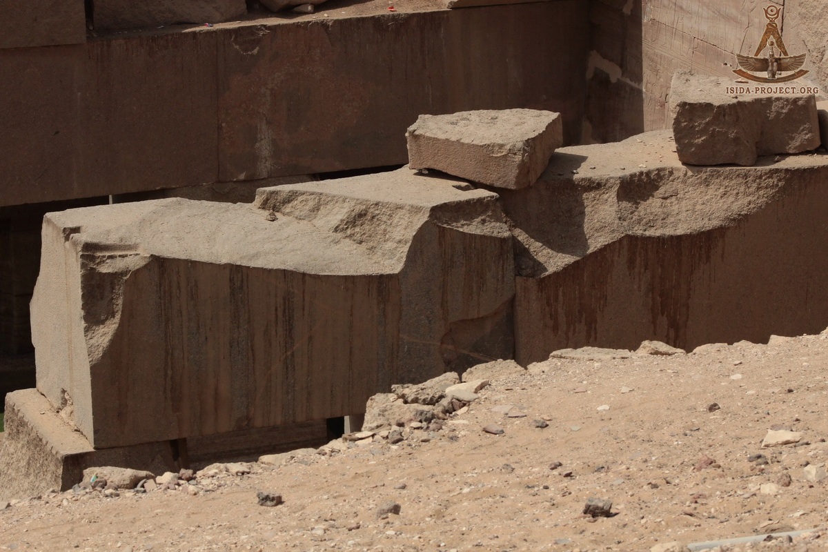
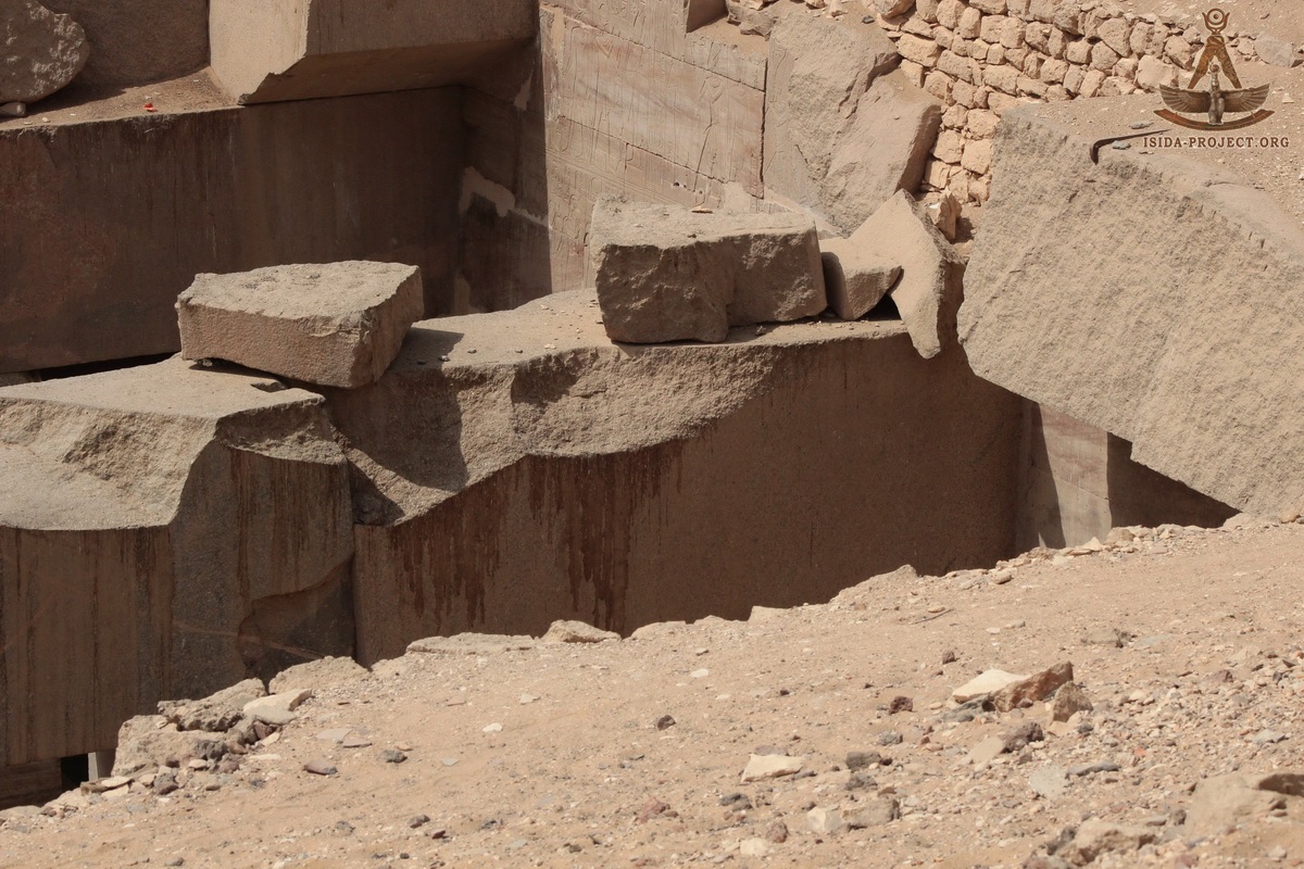
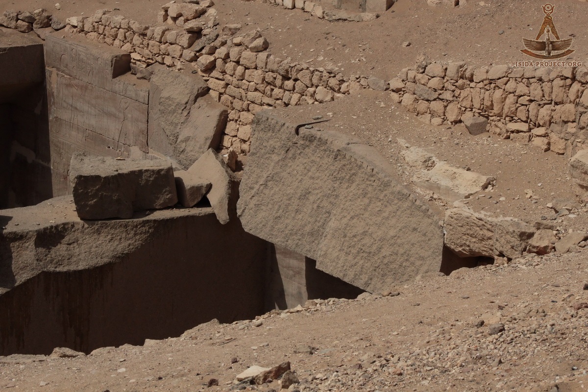
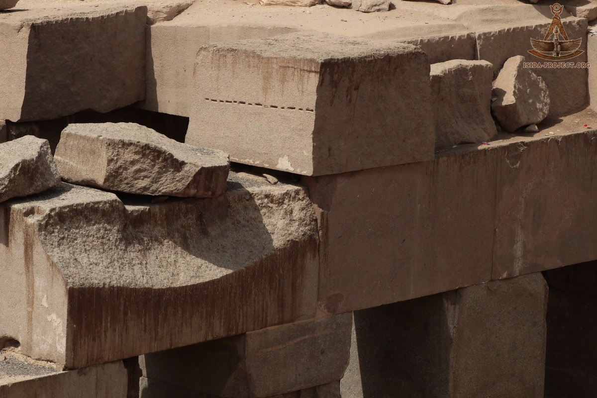
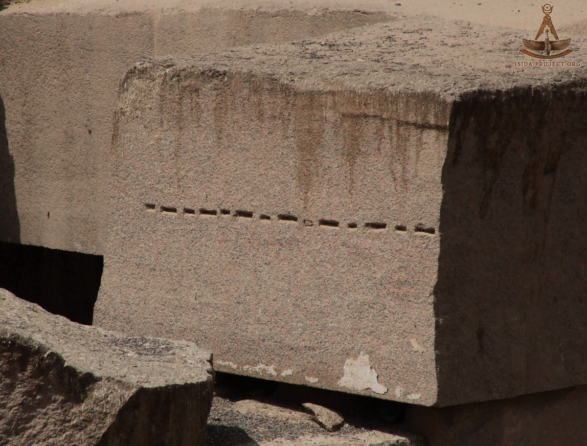
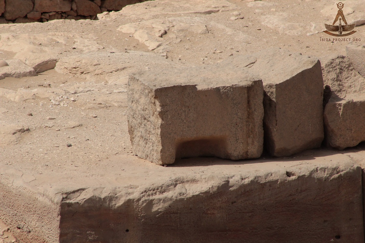
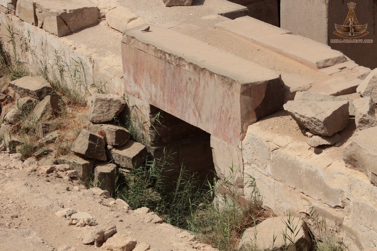
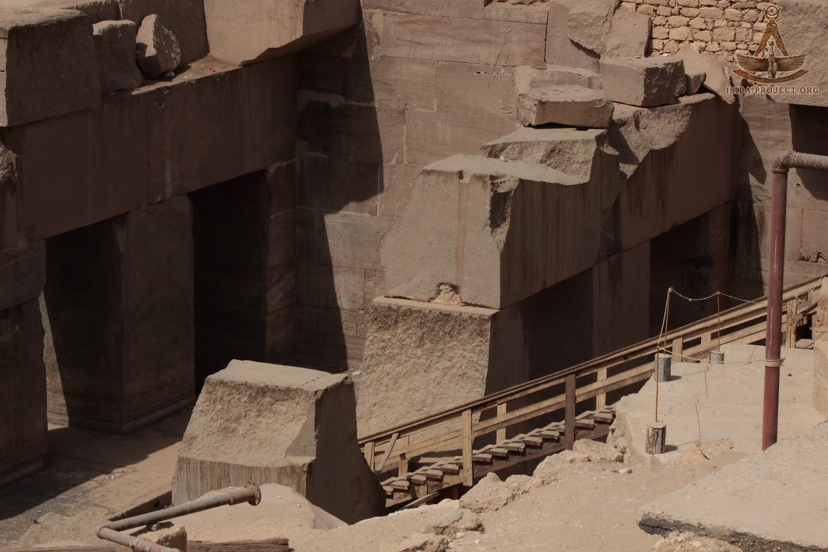
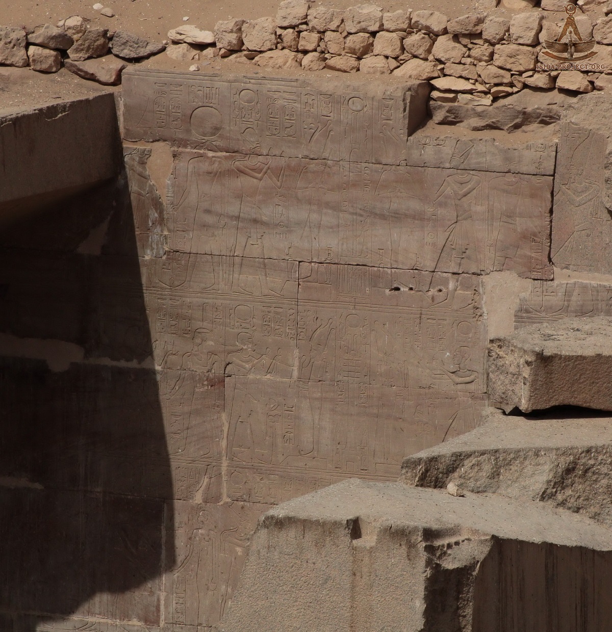
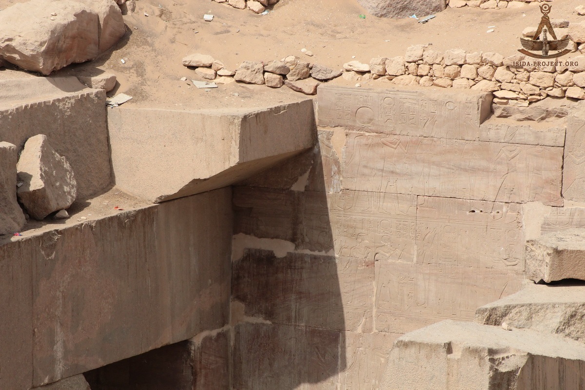
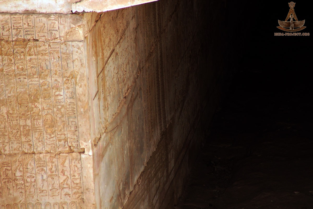
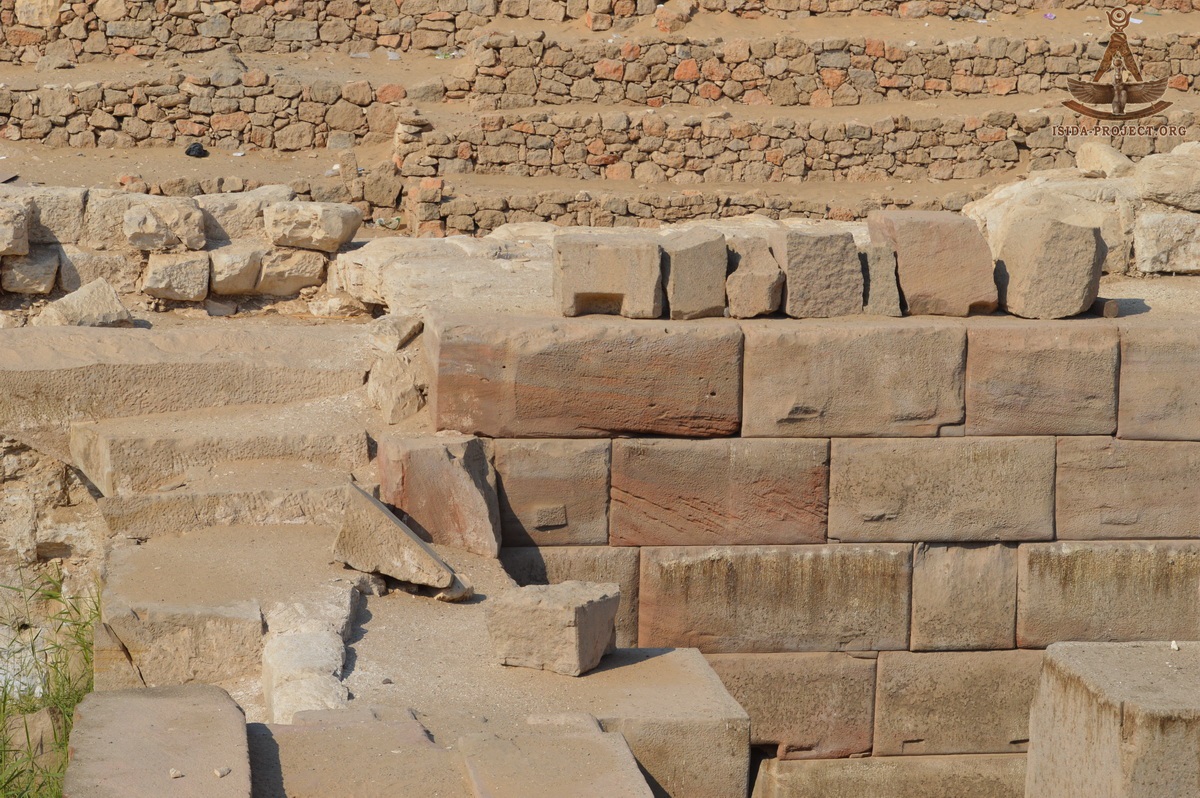
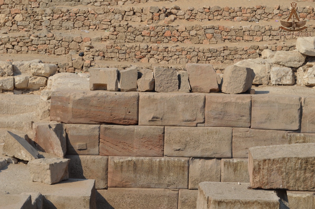
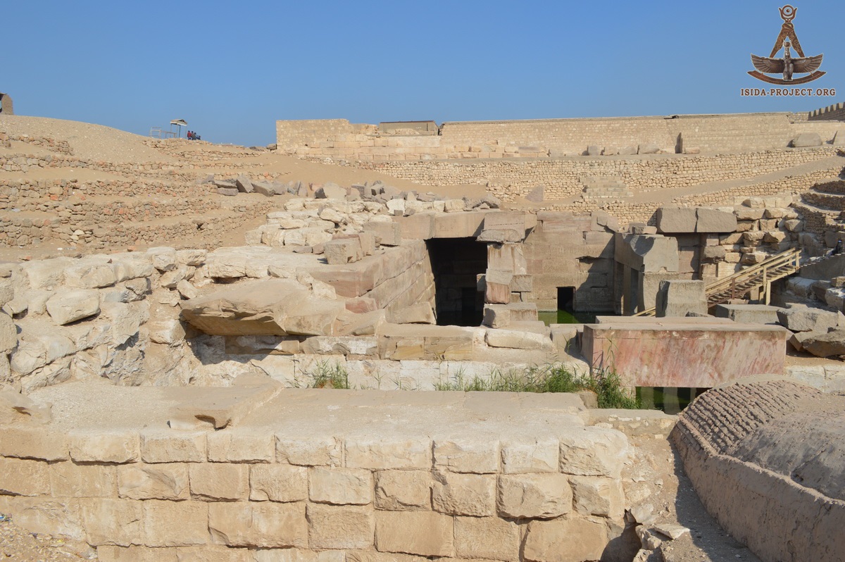
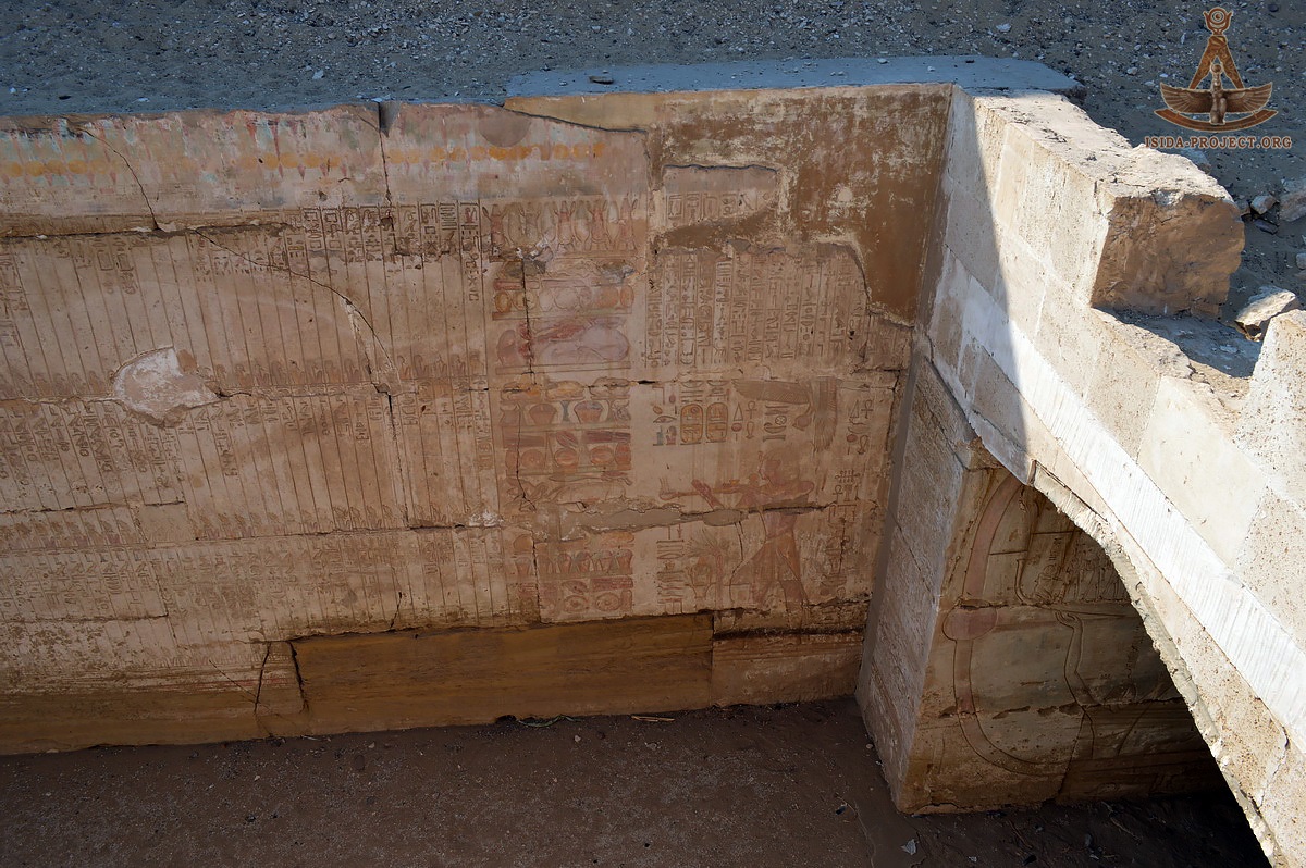
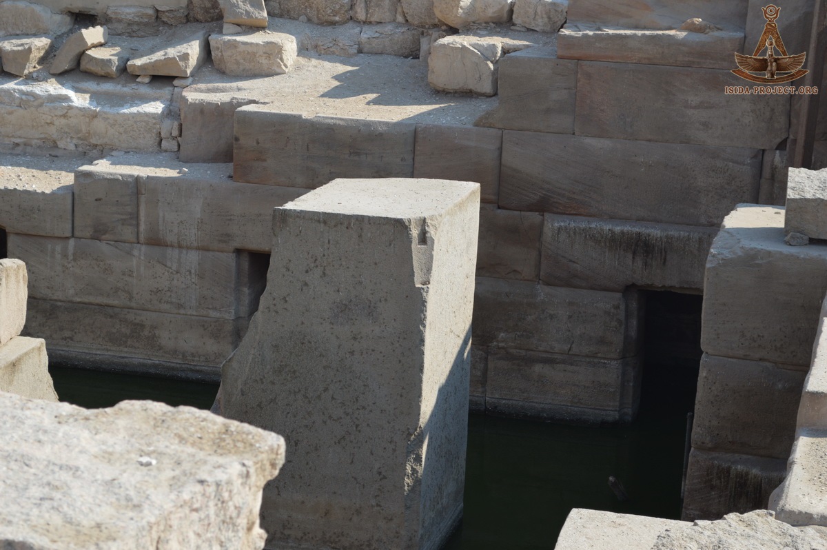
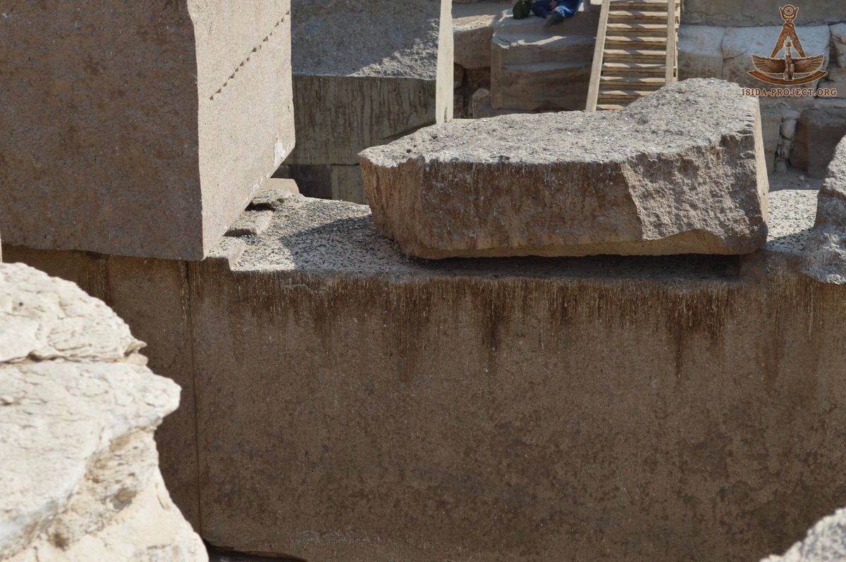
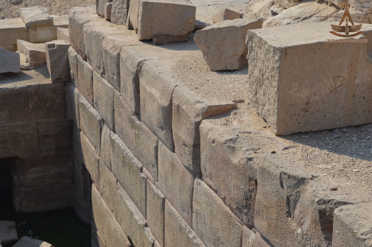
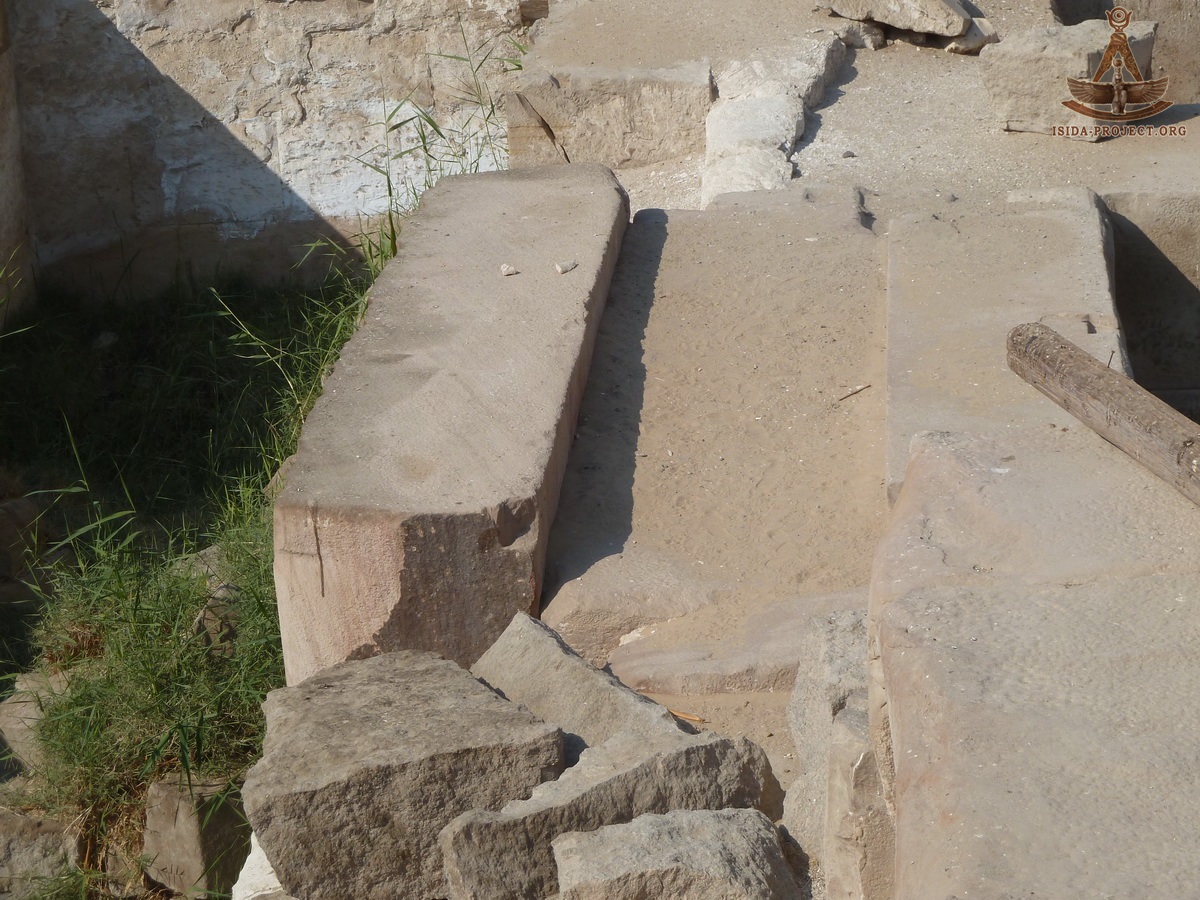
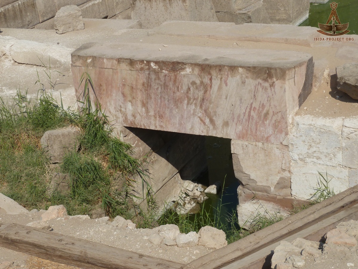
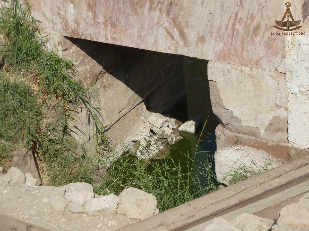
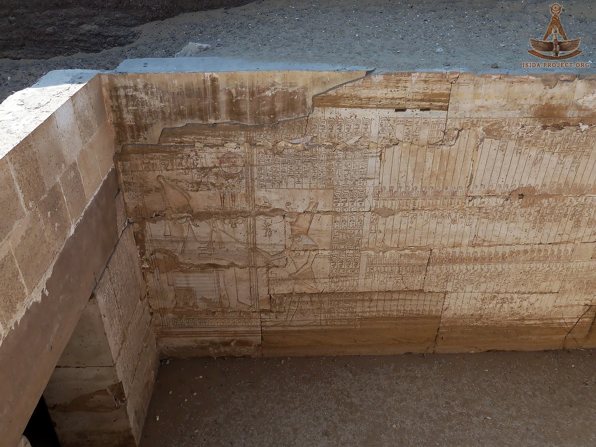
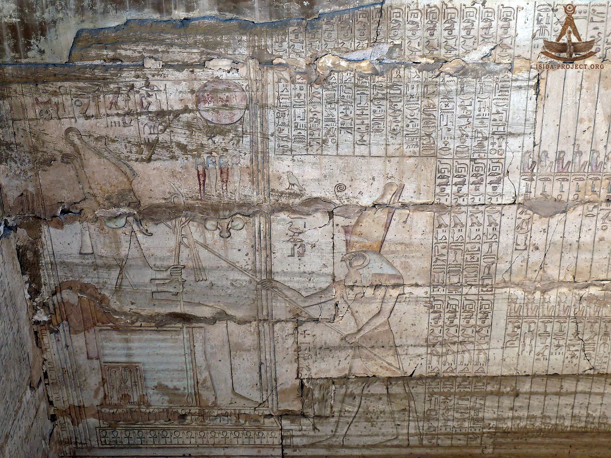
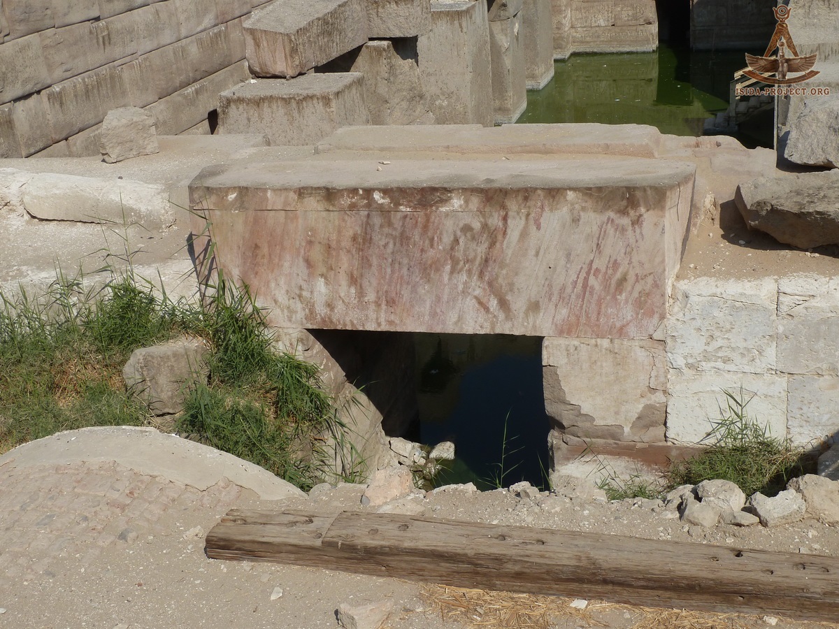
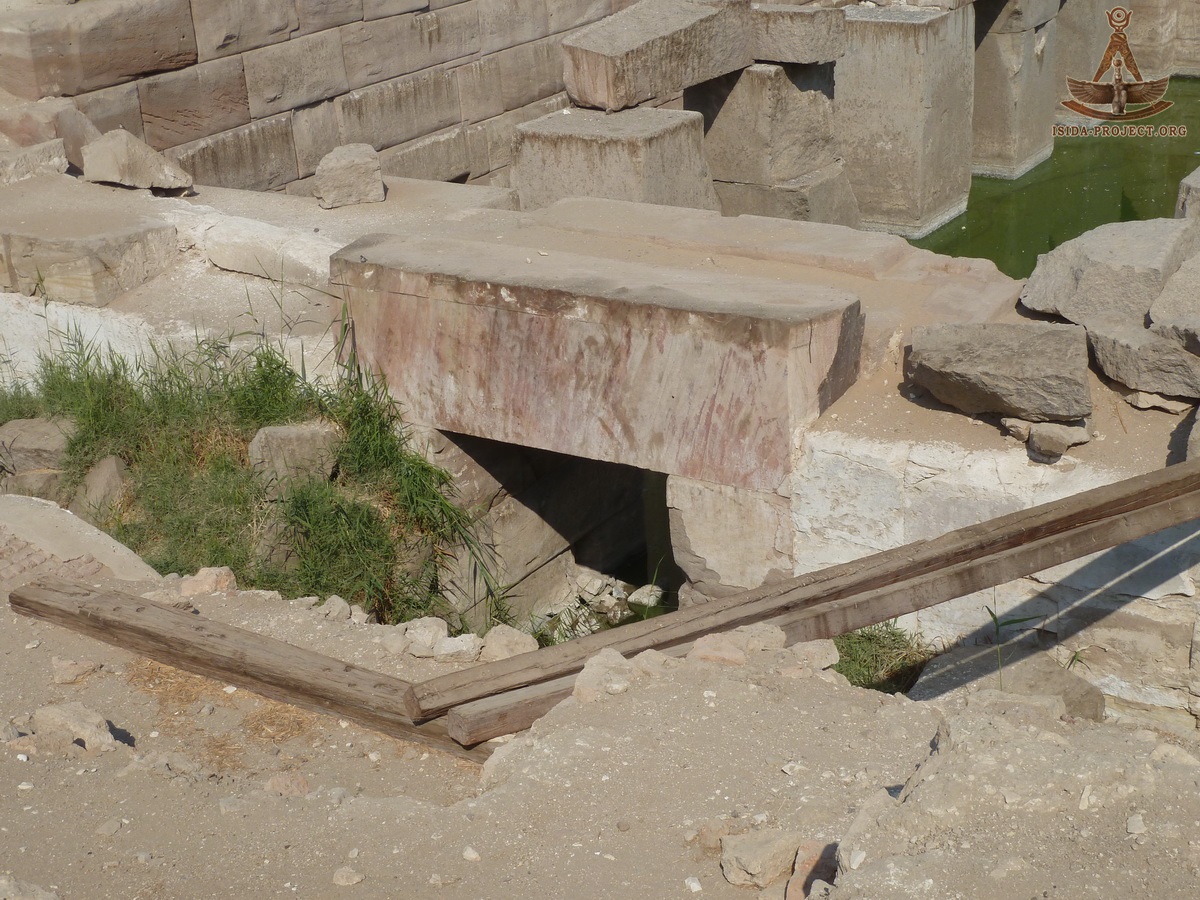
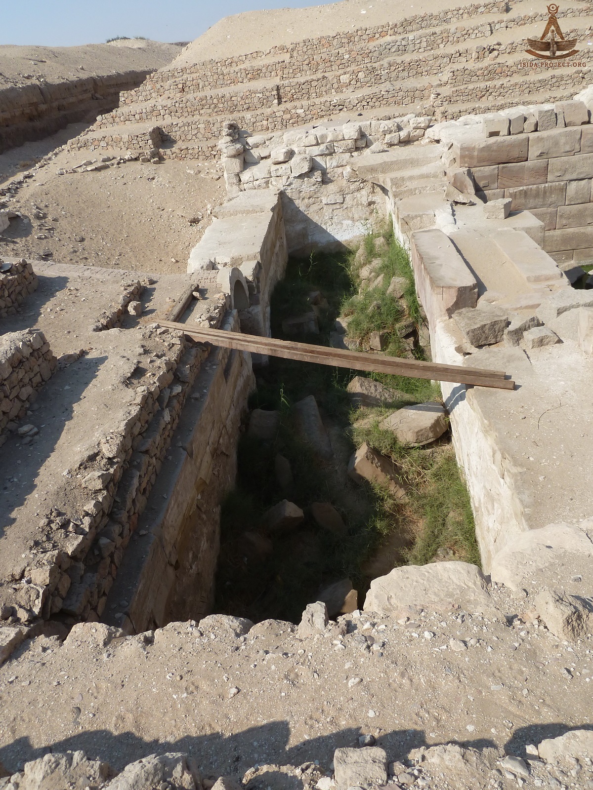
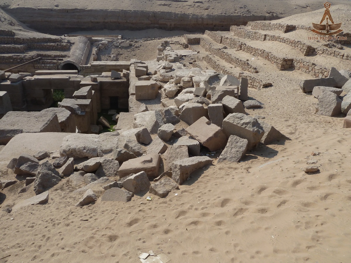
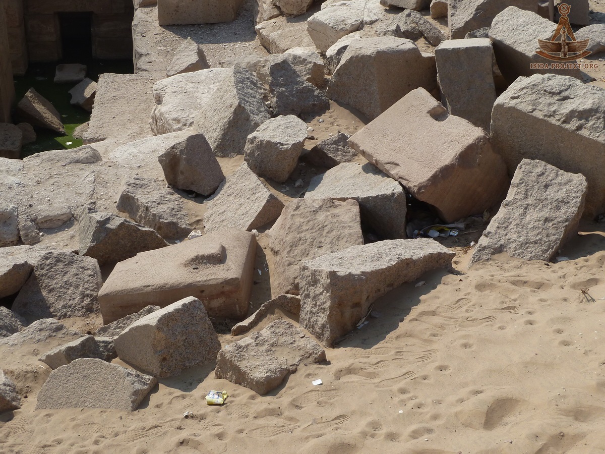
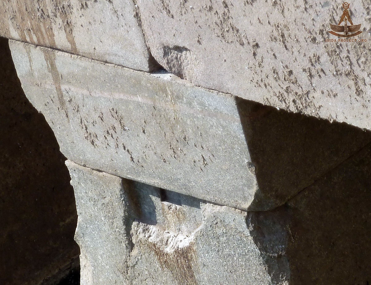
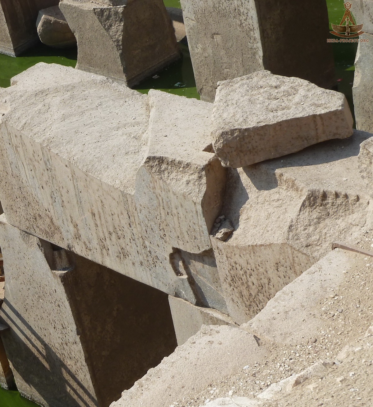
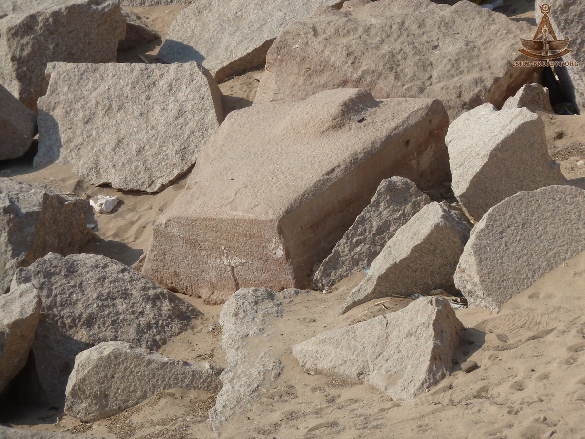
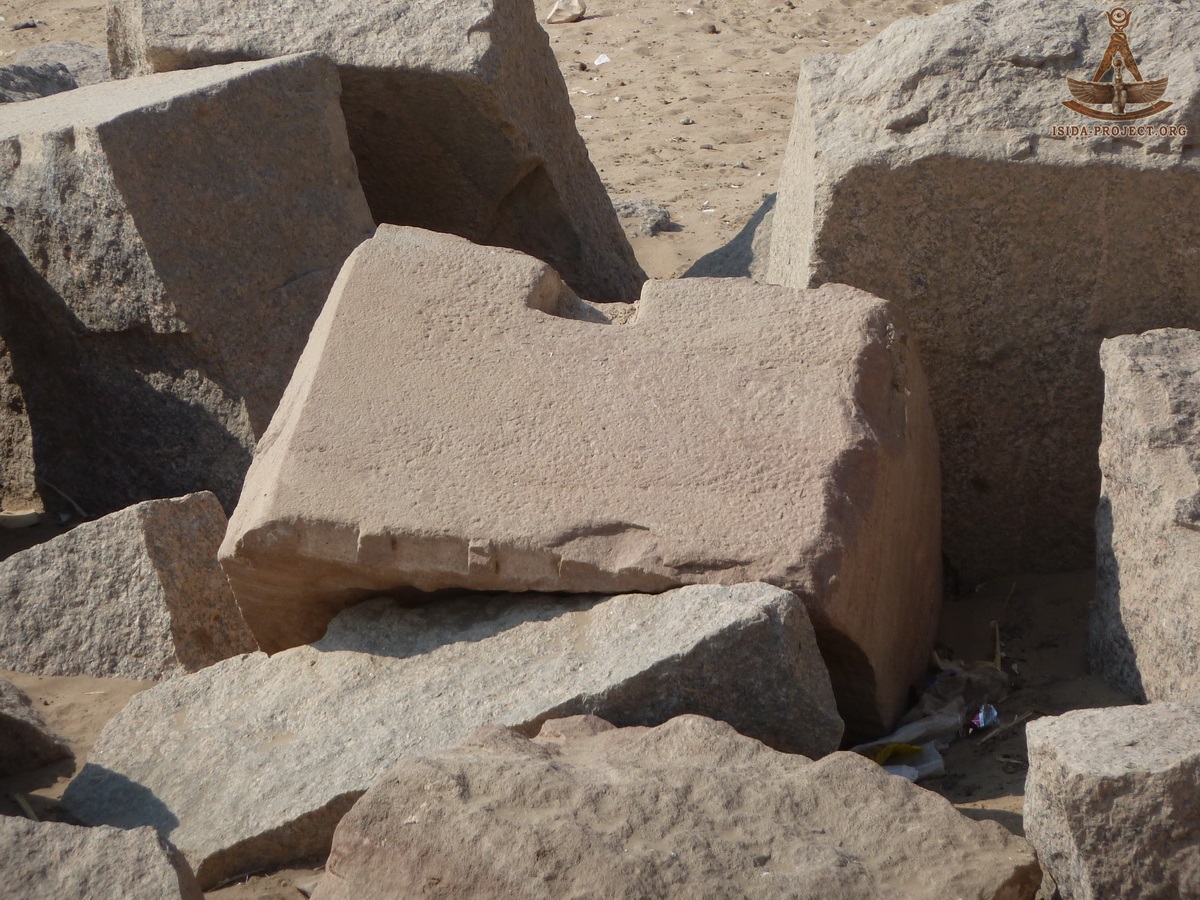
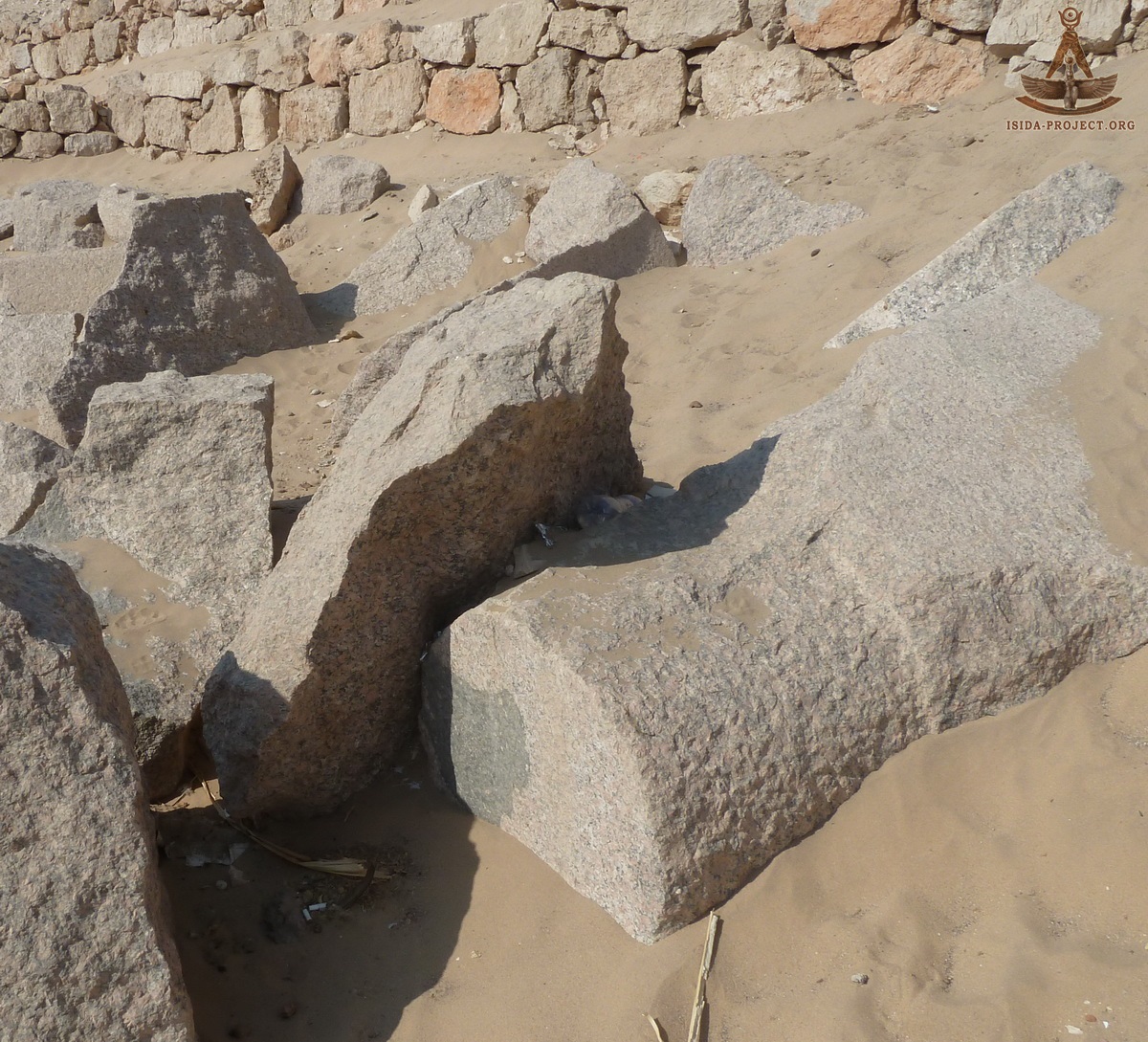
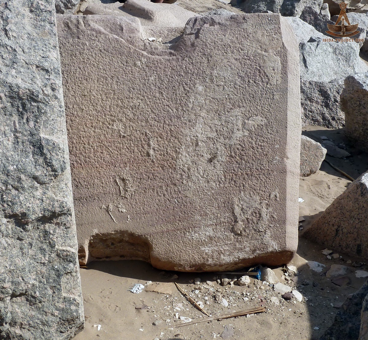
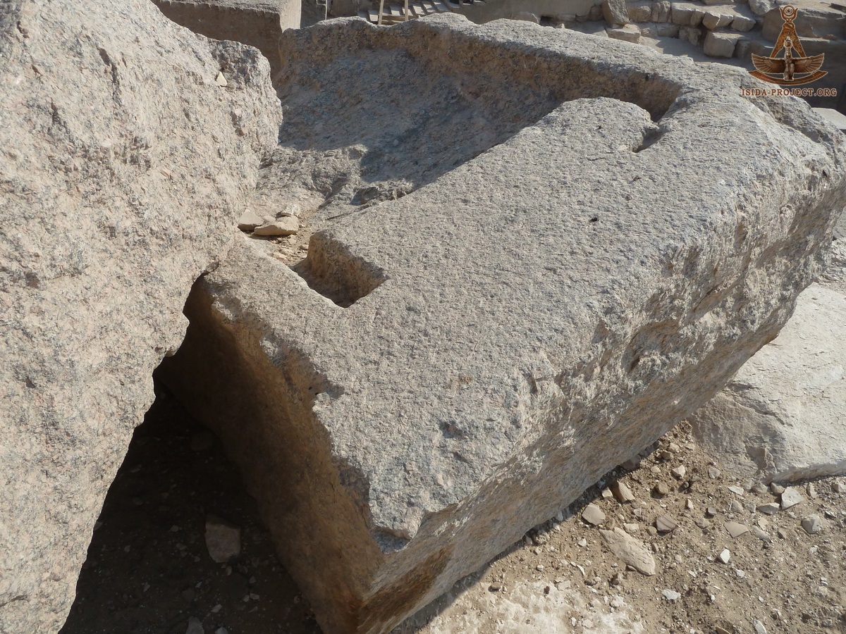
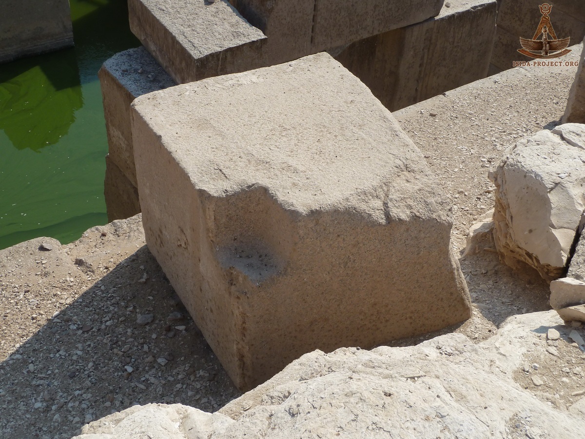
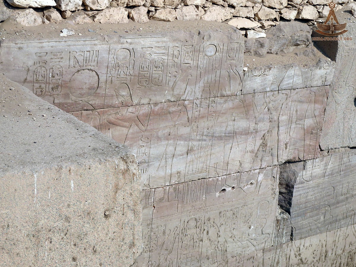
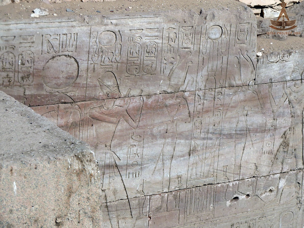
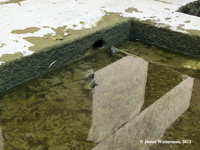
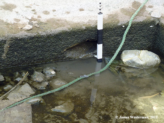
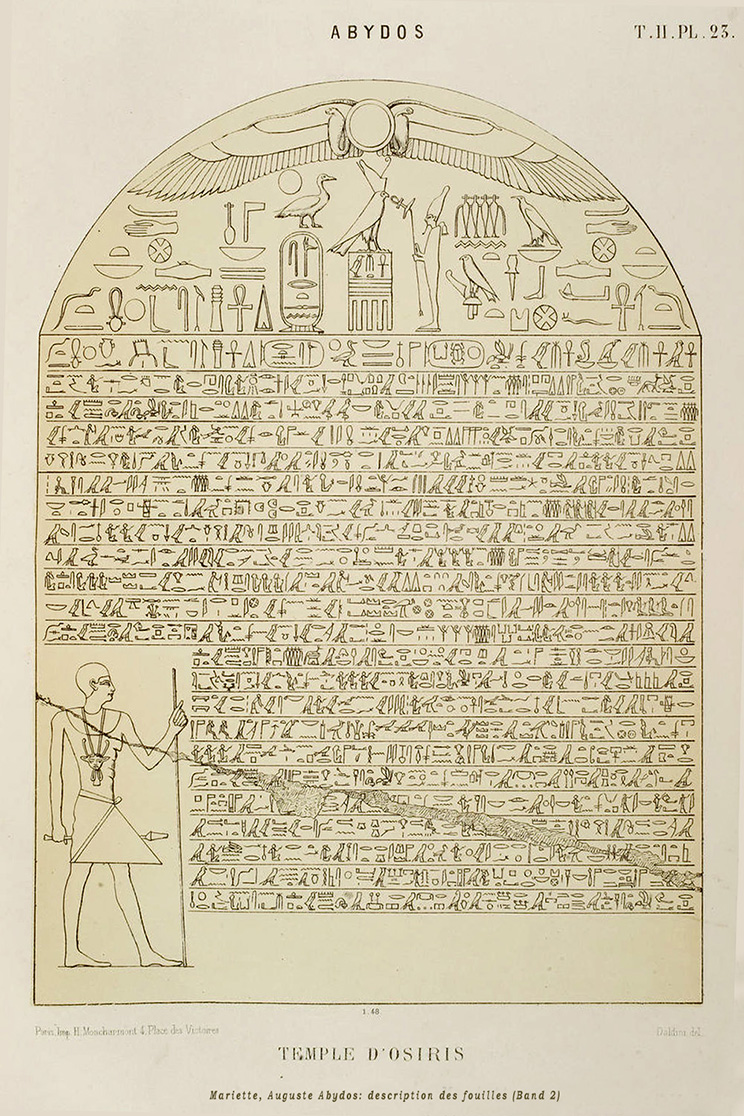
In the wall, located parallel to the temple wall of Seti I at a distance of 10 meters from it, there is an entrance, equal in size to the other 16 entrances, which are present in all the four walls of the Osirion. It leads to a long chamber of 20 x 5 meters with a vaulted roof. This location is marked as the Chamber "J" on the scheme of Edouard Naville and identified by him as well as by the other explorers of Osirion, as the actual Tomb of Osiris. This conclusion was made, basing on the ceiling bas-reliefs of ritual meaning. In particular, the engraving of the final scene of the Book of the Lower World, probably made, by the artists of Seti I while carrying out repair works in Osirion. This ritual scene is typical for the Tombs of the Ancient Egyptian rulers. "This room, perfectly preserved, is absolutely empty except for a heap of sand in the north-eastern corner. When this sand was cleared away we found that it came from a hole dug there (K), evidently by robbers, as is the case in many tombs in Egypt." Edouard Naville As for the hole (K), indicated on the Naville's scheme in the left corner of Chamber (J), we assumed its possible connection with sector (K) on the plan of the Temple of Seti I, published by Auguste Mariette in 1869. This hypotheses is described in our report "Egypt 2013. The Temple of Seti I". Perhaps the one who digged it was tempted by hopes to get into the Temple. But sandy layer 3m width, and a 10 meters height won this encounter. Below are the images, taken from the Chamber (J). The rest of the rooms of Osirion, masonry of its walls, columns and other architectural elements are shown below.
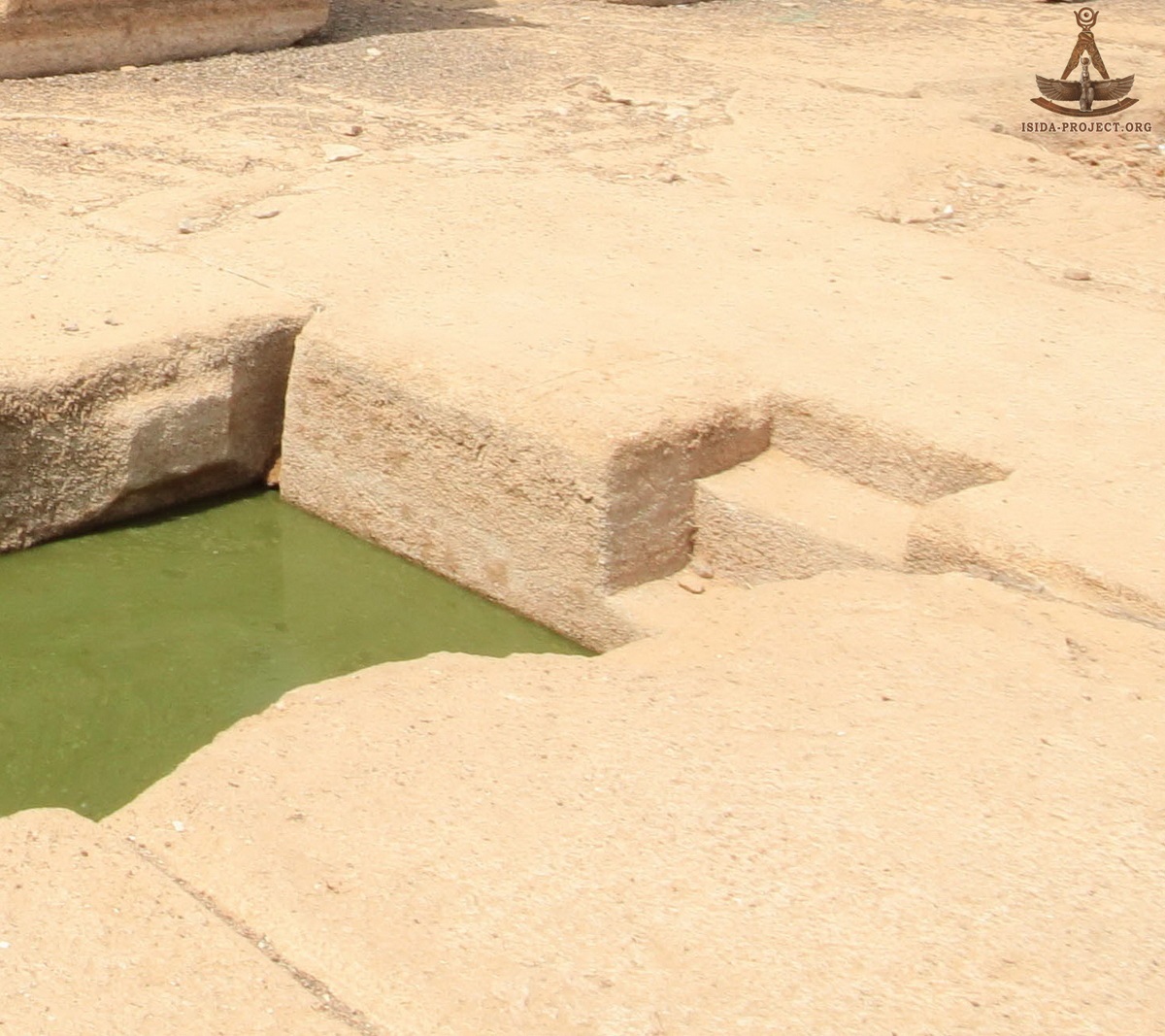
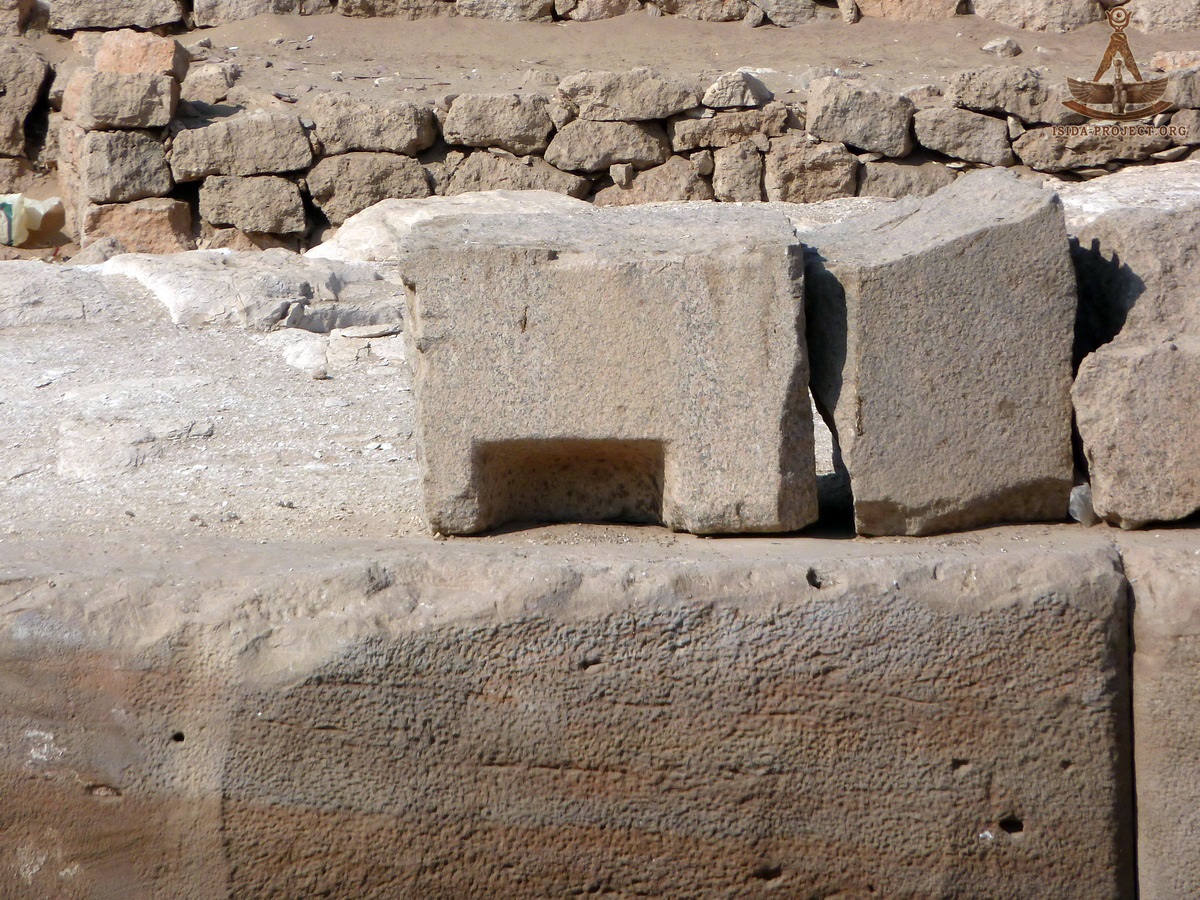
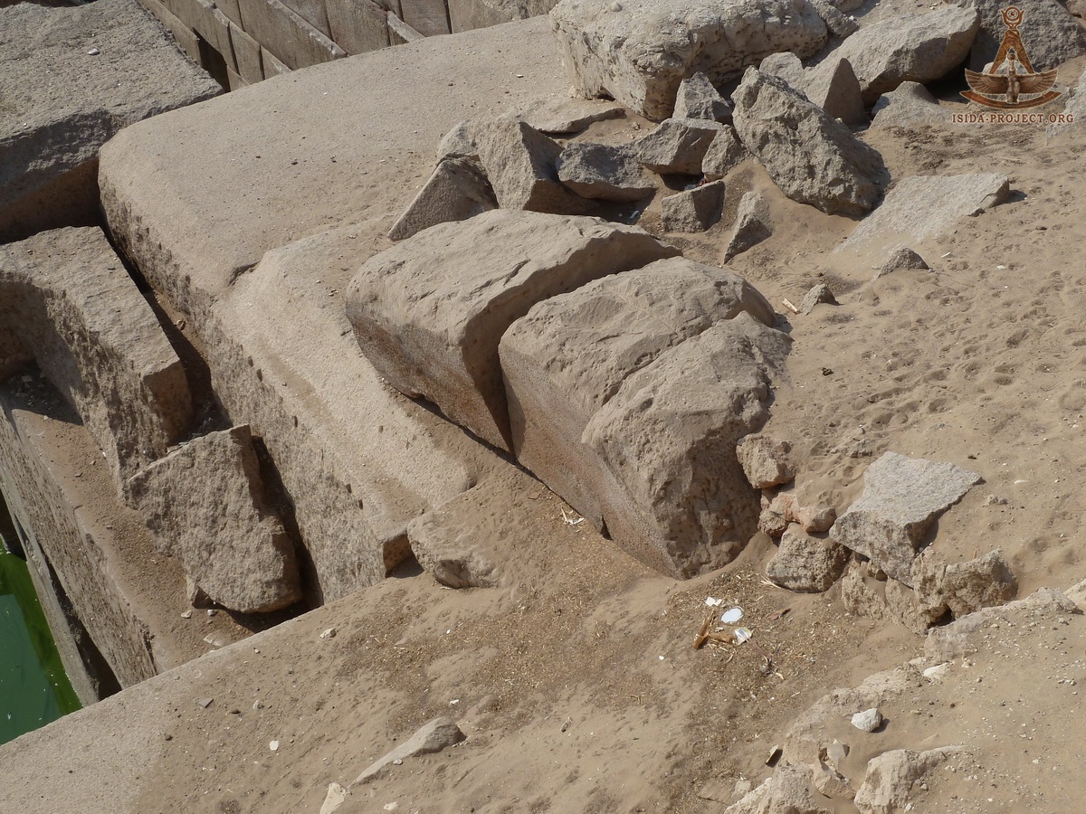
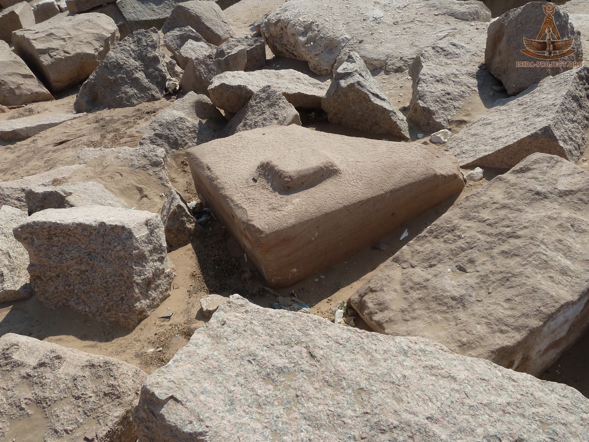
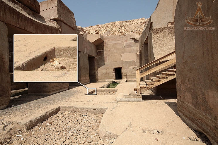
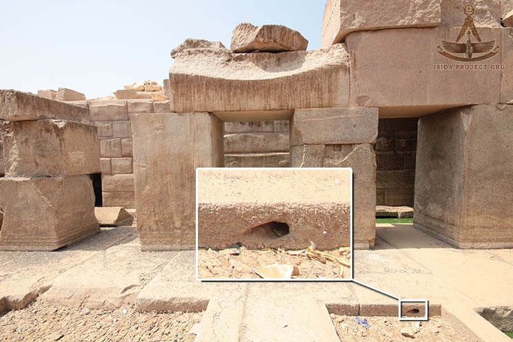
Lets note one small but interesting detail. Back in 2012, the expedition of James Westerman has found a cylindrical drilling hole, located in the north-eastern part of the square pit in the floor of the central "island". There is a number of different hypotheses on this subject, but the exact purpose of this hole has not been determined yet. The direction of the axis of the hole is oriented to the true North.
Further traces are leading to the Temple of Seti I - a magnificent building, with inextricable thread connected with the history of Osirion. The revealing of its secrets can open the veil, both above the personality of the Seti I, as well as on the problems of Osirion. Let's see if it is so...
* * * ... What exactly Antef II knew about Osirion, pursuing his campaign on expanding the southern Egyptian borders, as a result of which Heti III surrendered Abydos and the peace was established - remains unknown. Perhaps the rulers of the XI Dynasty still had access to the certain ancient sources of information, left from their ancient ancestors. The question remains open, but the facts remain facts, and researches does not stand still, thereby paying tribute to the Ancient Heritage of our great ancestors, which has initiated the World History.
|
||||||||||||||||||||||||||||
 |
 |
 |