|
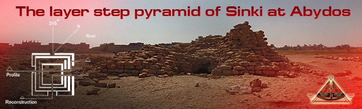
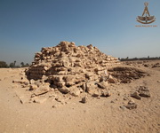
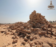
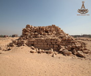
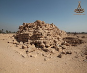
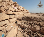
Layer Step Pyramid of Sinki
The minor step pyramids are largely a mystery,
there are many questions still to be answered, dates and functions to be investigated.
Nabil Swelim
(Professor, Egyptologist).
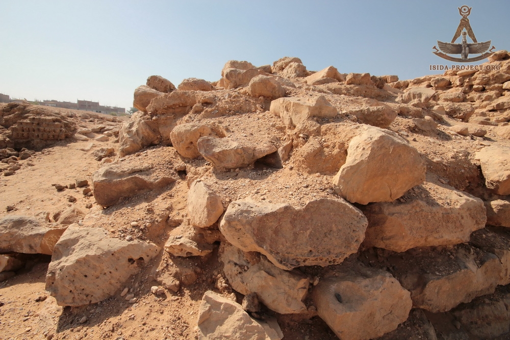
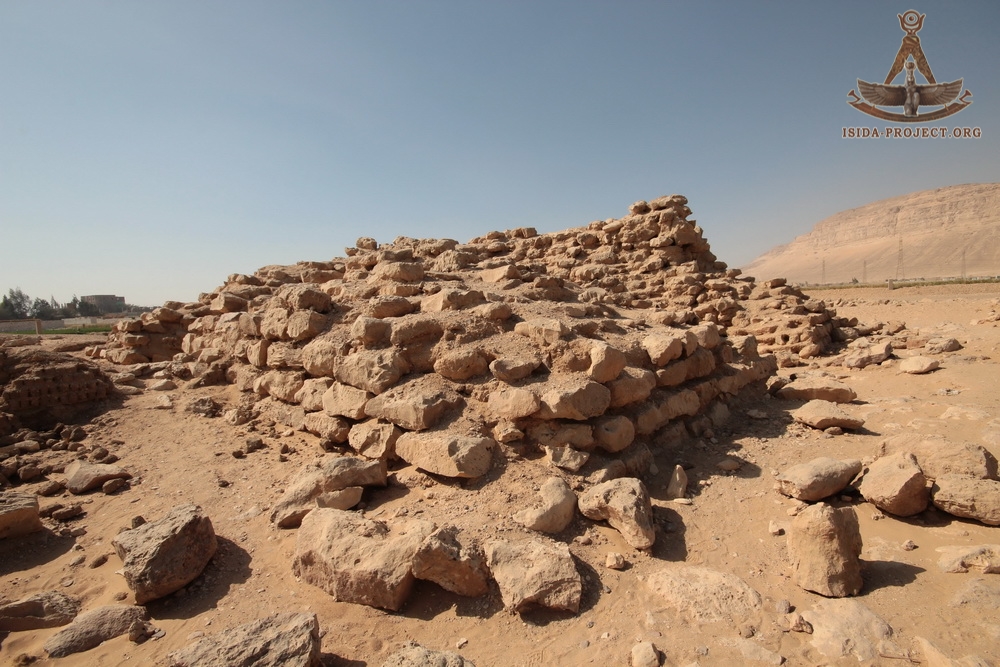
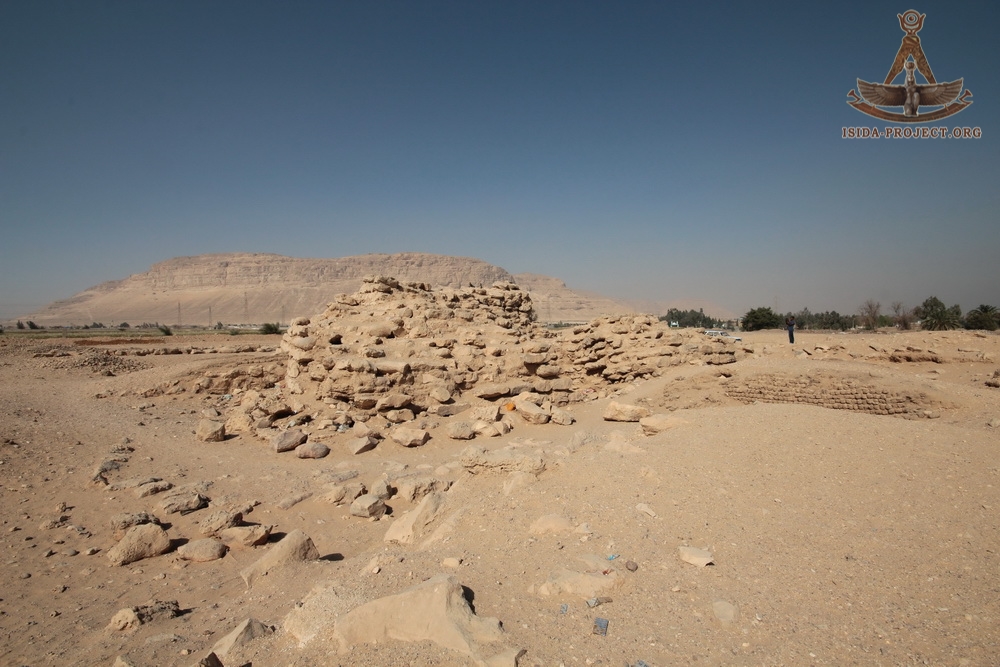
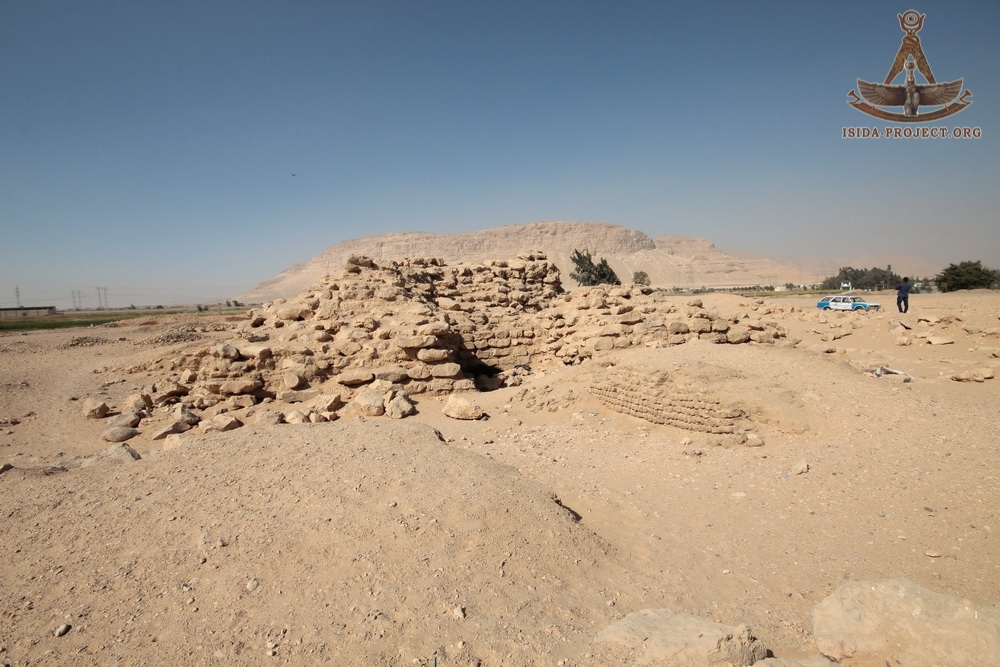
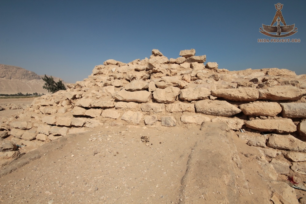
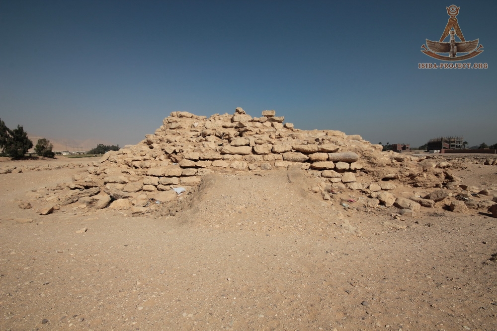
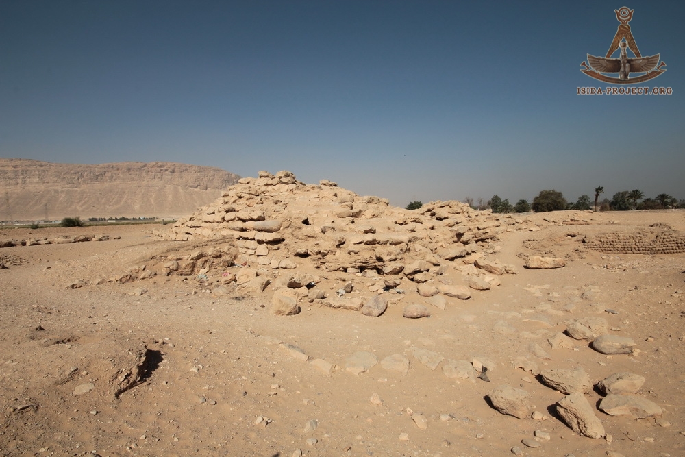
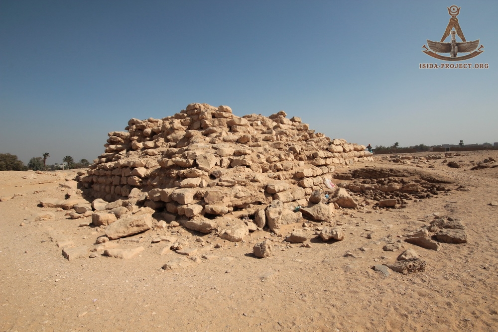
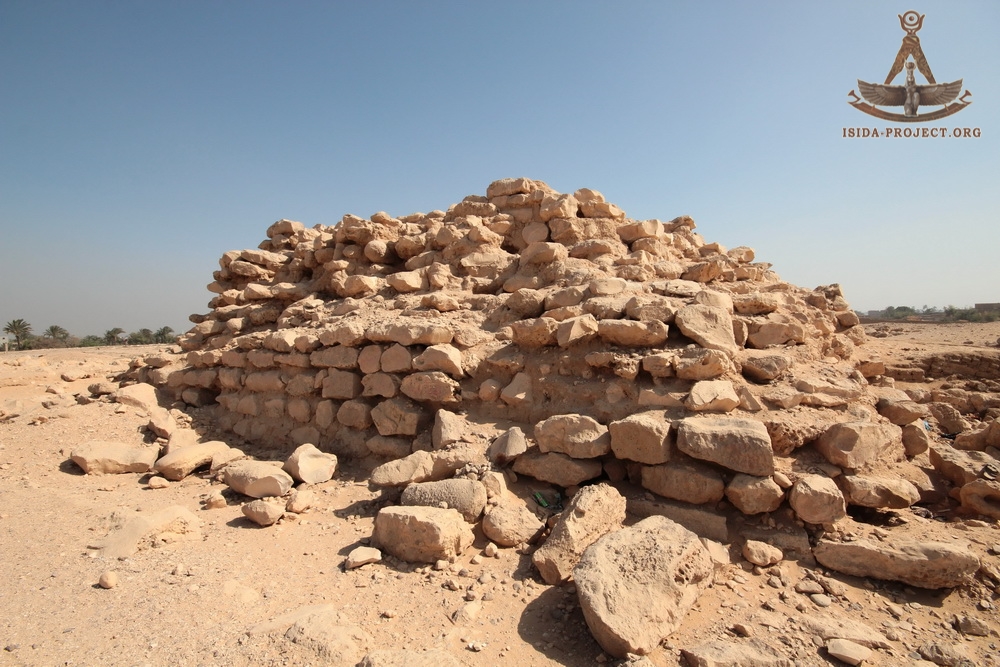
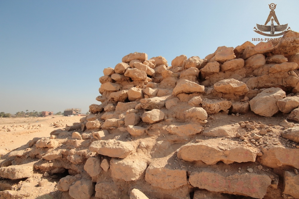
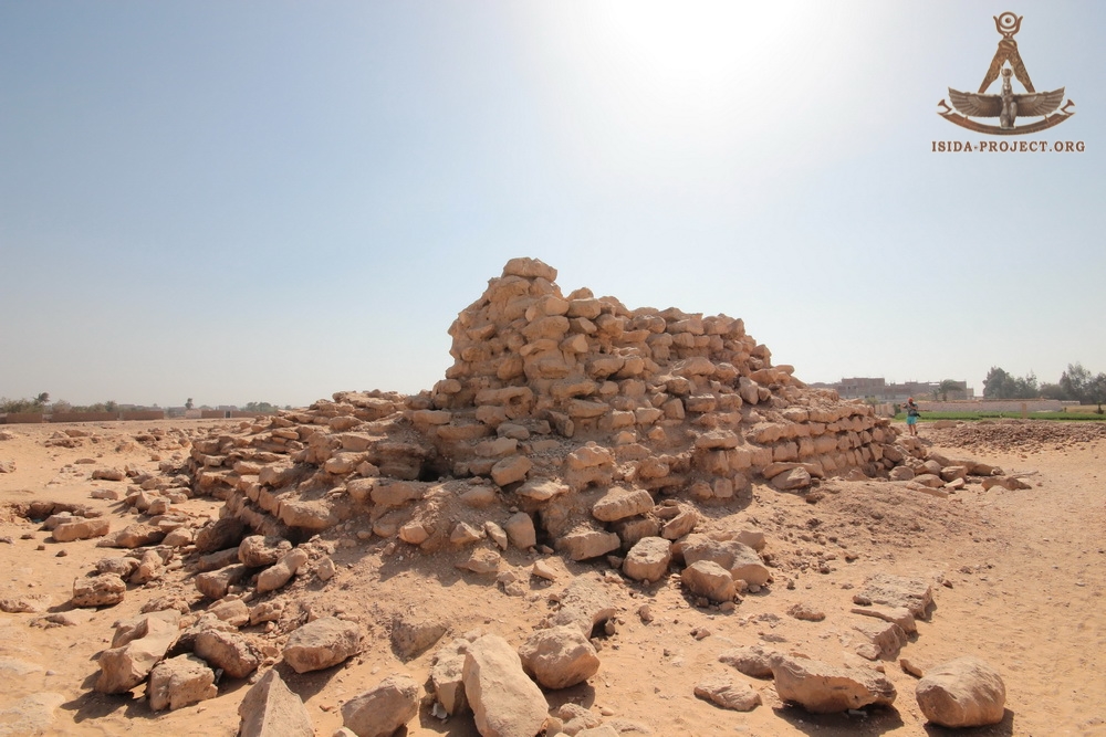
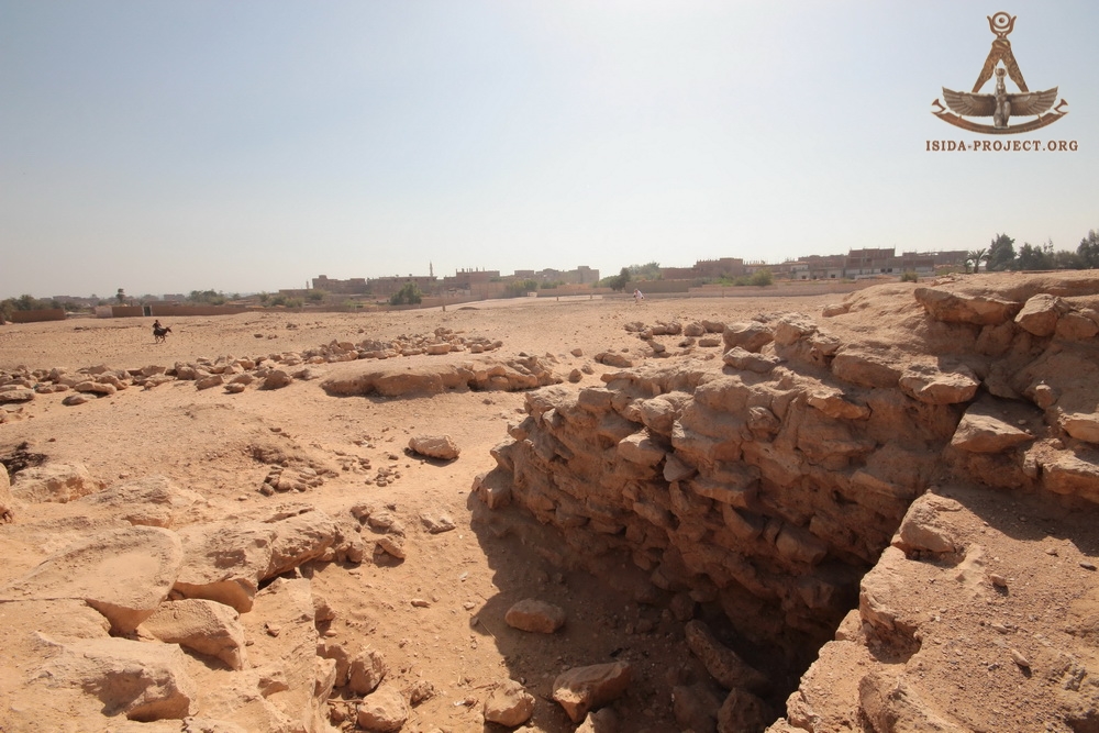
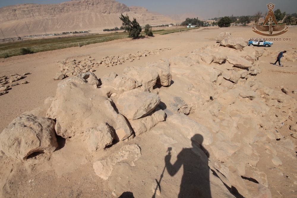
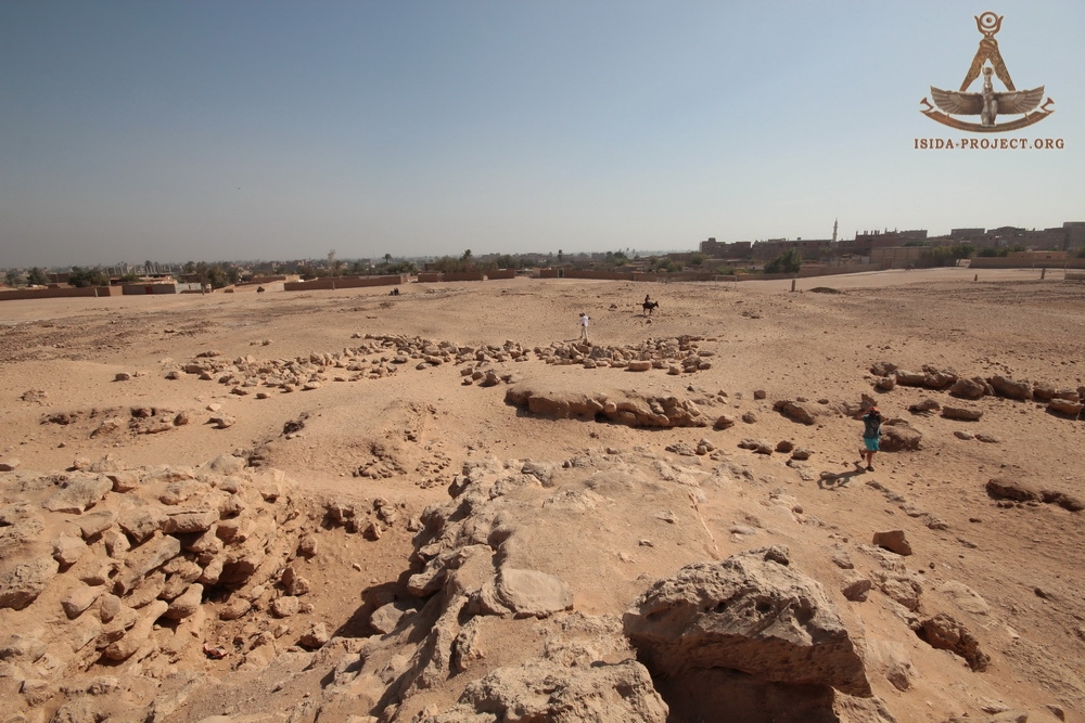
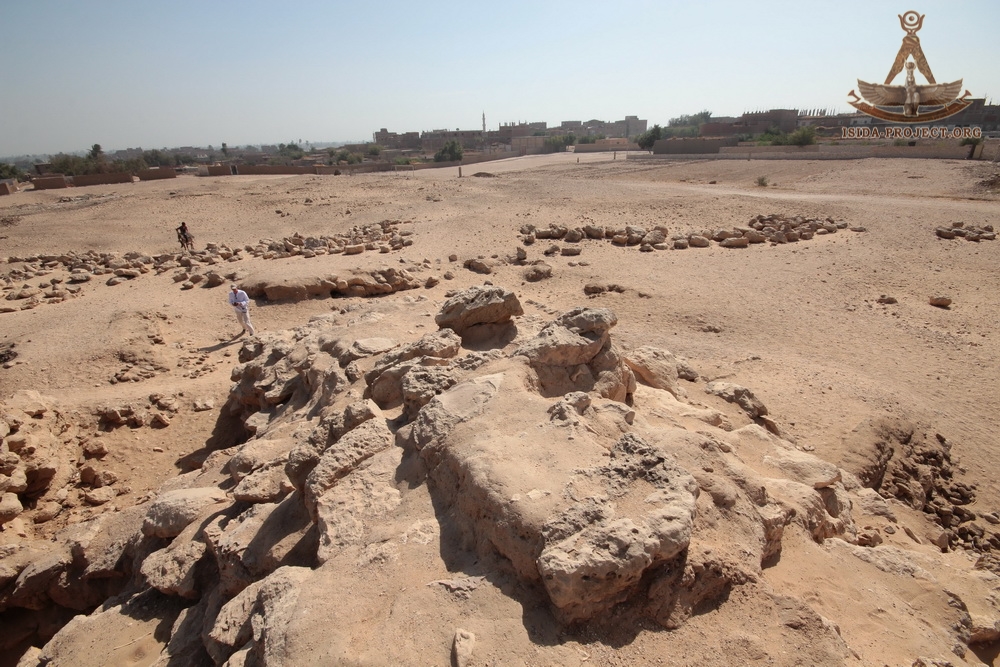
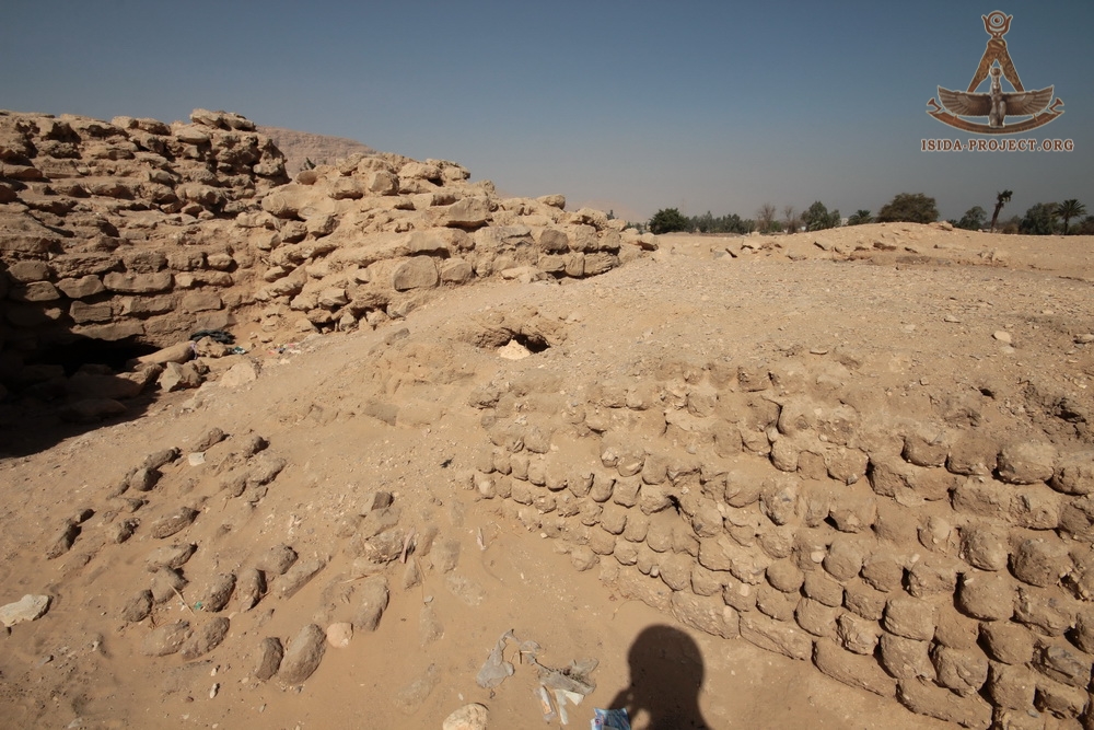
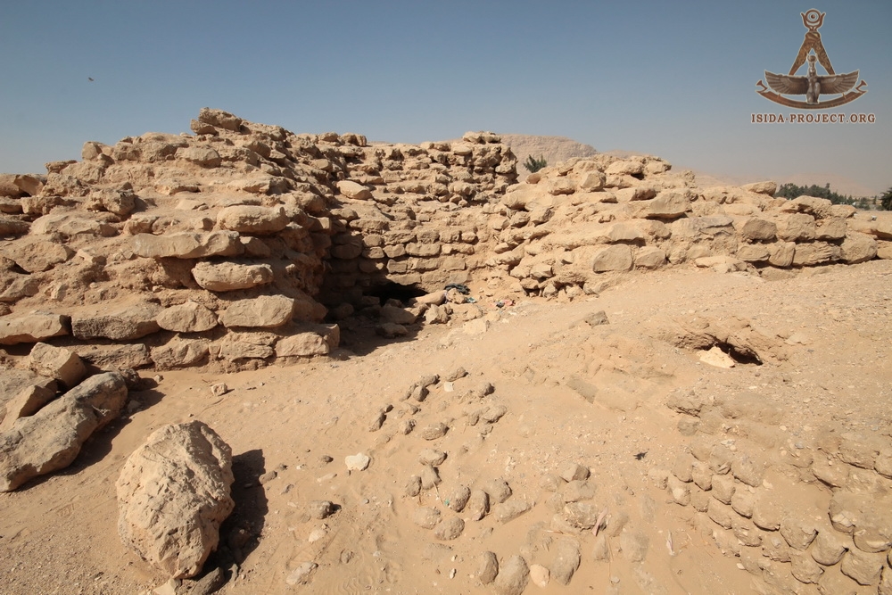
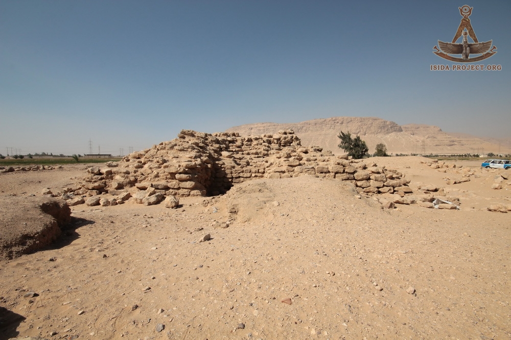
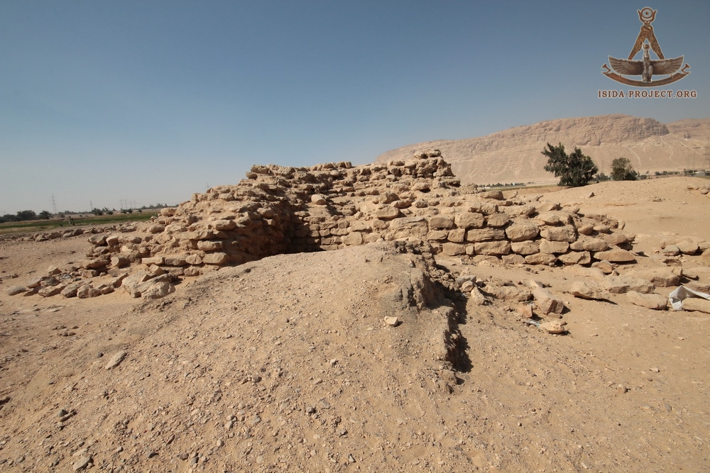
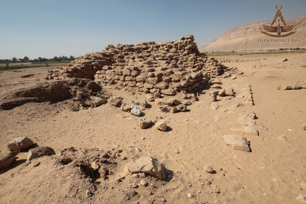
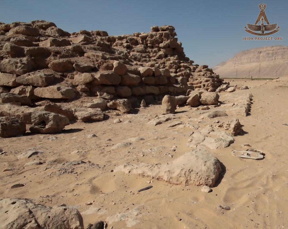
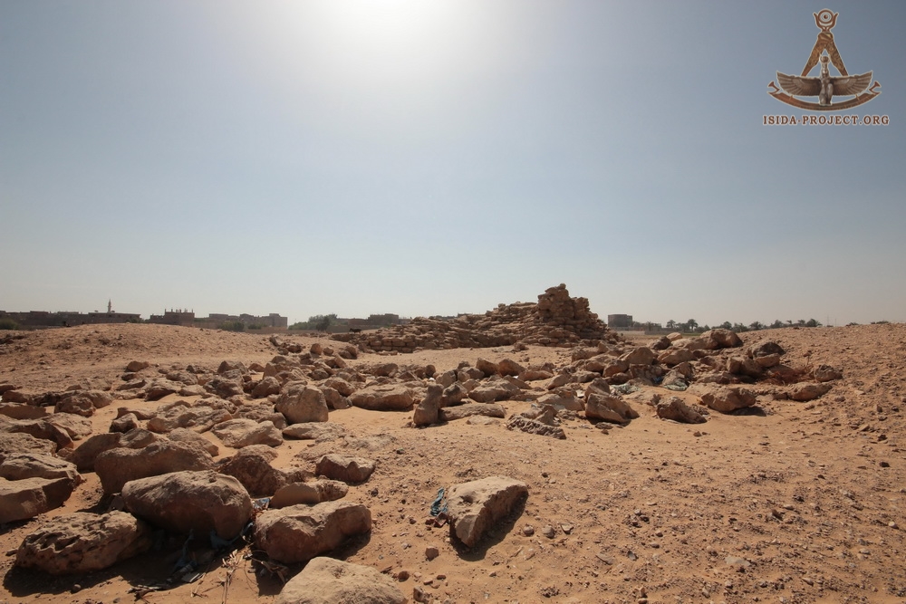
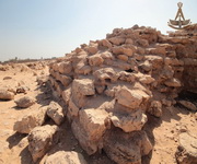
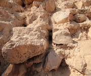
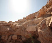
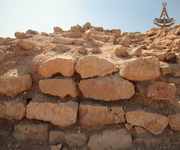
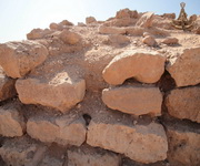
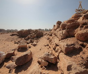
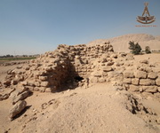
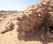
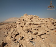
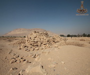
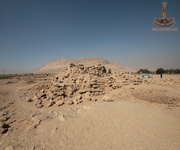
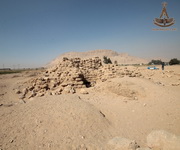
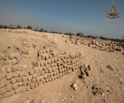
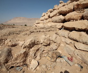
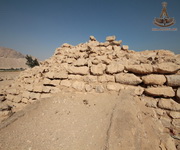
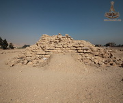
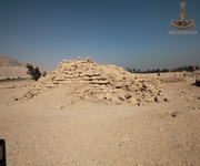
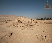
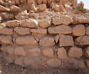
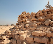
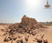
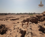
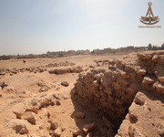
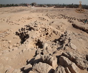
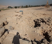
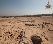
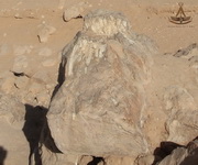
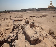
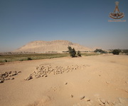
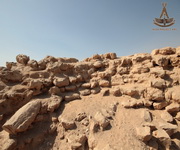
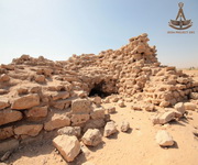
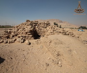
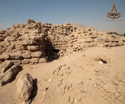
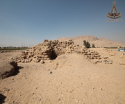
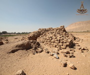
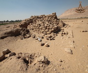
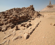
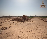
The ruins of a layer step pyramid, known as the Pyramid of Sinki (by the name of the area), is located in 5.5 km to the south-east from the Temple of Seti I, and in 1 kilometer from the Western Mountains of Abydos on the very edge of the cultivation.
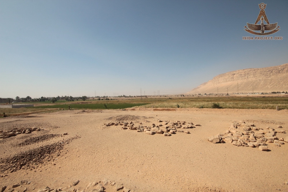
The shortest distance from the Pyramid of Sinki to the Nile makes 5.5 km in the north-west direction, where the riverbed has the shape of a semicircle. The pyramid is located to the west of the area where the river changes it's course from the south-west to north-west direction.
(Click to enlarge)
This historical monument was already noticed in 1880 - 1900s, due to such scientists as American Egyptologist and journalist Charles Willbour, British Egyptologist James Quibell and Flinders Petrieone - the founders of modern systematic Egyptology. They mentioned it as the Abydos pyramid and as the mastaba pyramid of el Amrah in their reports.
 |
"The Abydos Pyramid: The Pyramid which is just in front of the south horn of the mountain as seen from Abydos turned out to be a miniature edition of the little pyramid we paid so much attention last year, and like the Pyramid of Koolah its north side turns so far west as almost to lose its north ness--in fact, 42 degrees. The highest stones remaining are only sixteen feet (4.88 meters) above the level and it is about sixty Feet Square (18.29 meters) rising in four well-defined steps. They have dug into the centre and down to the rock and found nothing, as we did last year at Mohameereeyeh. Two little brick walls either side the north entrance are puzzling. Maspero suggests they indicate an attempt at a temple, but I have thus far seen Pyramid temples only on the east side."
Charles Edvin Wilbour, 1883
|
 |
In 1900, Quibell working on the Hieraconpolis temple at El Kom el Ahmar, describes the revetment, as follows: "Revetment of temple basement. -The sides of this excavation are of undisturbed earth not yet removed: the stick in the foreground is two metres in length. At the back is the revetment of rough stones, which retained the earth upon which the temple was built. This revetment ran round in a curved or almost circular form. It is similar in the style of its material and construction to the rough stone mastaba pyramids of El Kulah, Nubt, El Amrah etc. which are now known to belong almost certainly to the IInd Dynasty".
James Edward Quibell, 1900
|
 |
"It is probably, therefore, to the latter half of the Second Dynasty, 4350-4200 B.C., that a series of rough stone pyramids must be assigned which stand at El Amrah, Nubt, and El Qula. These are all built of unhewn blocks found loose on the desert cliffs (concretions). Each has successive faces of external finish, which have been coated over with added masonry. At Nubt the faces are still undressed, merely being selected for their flat fractures. At el Amrah (Sinki) the faces are moderately dressed. All of these are, however, built at the mastaba angle of four rises on one of base, and have and never had their successive coats covered with one uniform casing, like a pyramid."
William Matthew Flinders Petrie, 1901 |
The Belgian Egyptologist Jean Caparte, who published information about the Abydos pyramid at the beginning of the XXth century, mistakenly dated it as the Pyramid of the XVIII Dynasty (reign of Ahmose I). As the result the pyramid was forgotten and never considered in pyramid researches until October 26, 1977, when interest to it revived again and it became known under the local name of Sinki.
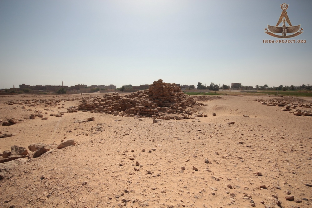
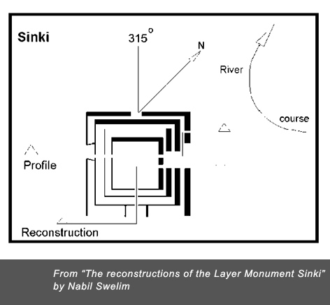
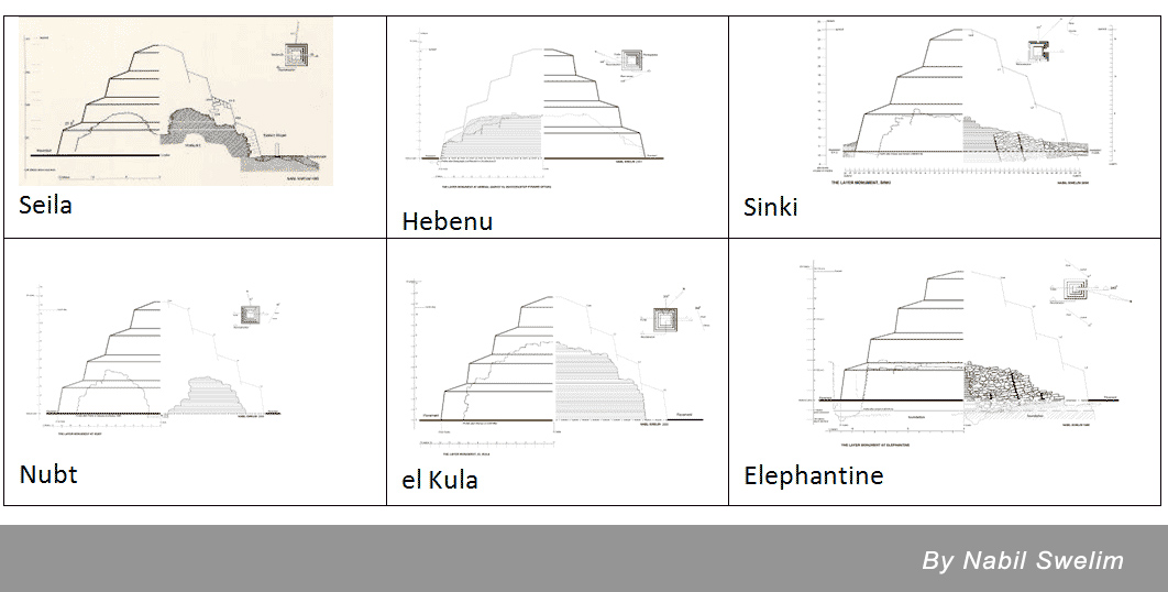
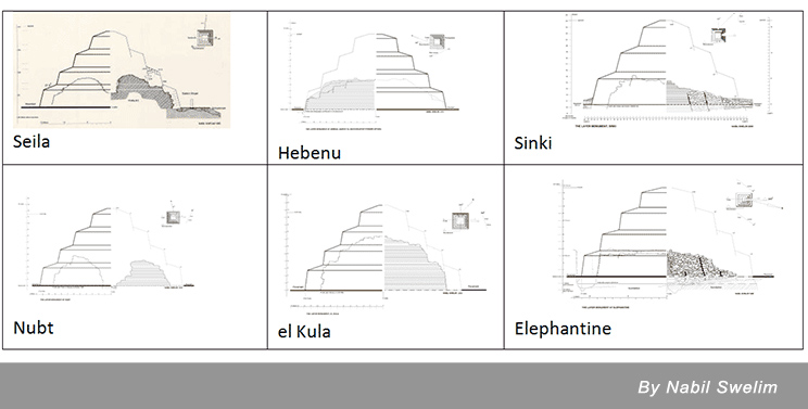
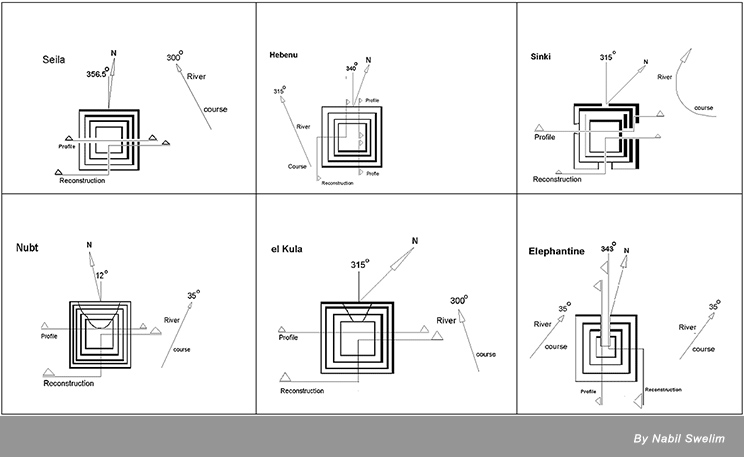
In the beginning of the 1970s, 4 layer monuments were classified by Egyptologists as the "Minor Step Pyramids". By that time, the four pyramids were known: in Seila (Fayum), Hebenu (Zawyet el Maiyiteen to the south of El-Minya), Nubt (Naqada) and El-Kula (Nag-el-Miamariya to the north of Hierakonpolis). Further discoveries of similar structures revealed three more pyramids: in Sinki, on the island of Elephantine and in El-Genimiya. Thus, already 7 "Minor Step Pyramids" marked the beginning of a new direction in the pyramid science in Egypt.
The schemes by Nabil Swelim, showing the 6 pyramids (except El-Genimiya) are represented below.
(Click to enlarge)
The schemes below are showing the orientation of the 6 pyramids (except El-Genimia) relative to the magnetic North and the Nile River, according to the research of the Egyptologist Nabil Selim.
(Click to enlarge)
In October 27, 1977 Nabil Swelim discovered the ruins of the layer step pyramid of Sinki, and in 1980, together with Gunter Dreyer, professor of the German Institute of Archeology in Cairo, provided the large-scale archaeological excavations of the ancient monument.

Professor Nabil Swelim
Egyptologist
|
In October 1977, I spent some memorable times with OMM SETI at Abydos and enjoyed the hospitality of Dr. HANI EL ZENI the director of the sugar refinery at Nag Hammadi. On the 26th of October 1977 he lent me a jeep, which took me on a desert track from Nag el Amrah to Abydos. Unexpectedly I noticed a few blocks of inclined masonry projecting out of the sand; these were the ruins of the layer monument Sinki. Shortly after that I announced the discovery of Sinki in a lectures arranged by the Hungarian Cultural Centre in Cairo and at the Archaeological Society of Alexandria. KAMAL EL MALLAKH, a journalist with interest in Egyptology, wrote about this discovery in the daily newspaper Al Ahram of The excavation In April 1979 on completing an excavation of the layer monument at Elephantine W. Kaiser and G. Dreyer, made their famous trip surveying the layer monuments. Kaiser and Dreyer drove from Aswan to Cairo and published their observations.9 Following that Kaiser realised the importance of excavating Sinki. Everything was set for a DIA (The German Institute of Archaeology in Cairo) excavation: starting on Nov. 12, 1980 until Feb. 5, 1981.
Nabil Swelim
|
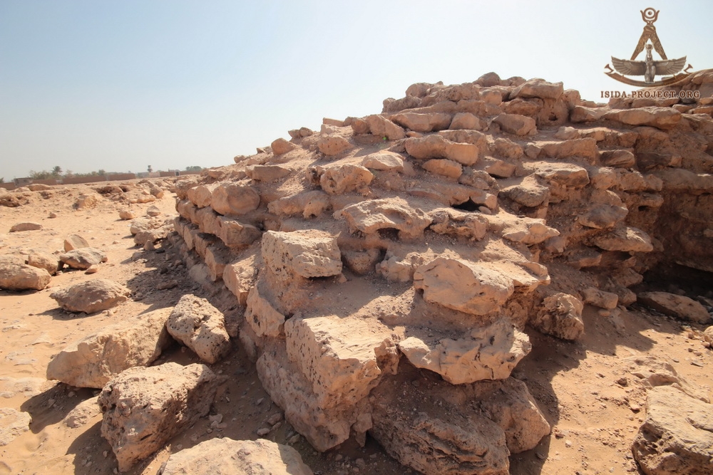
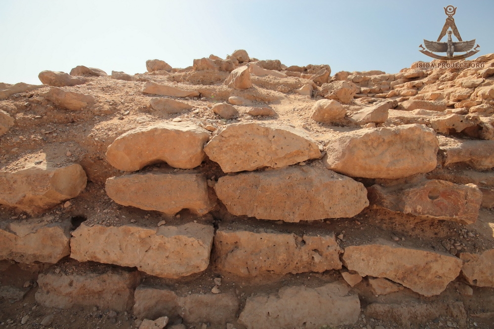
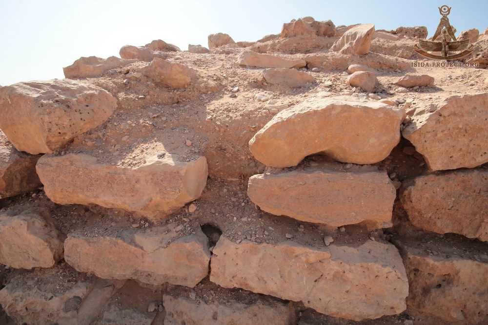
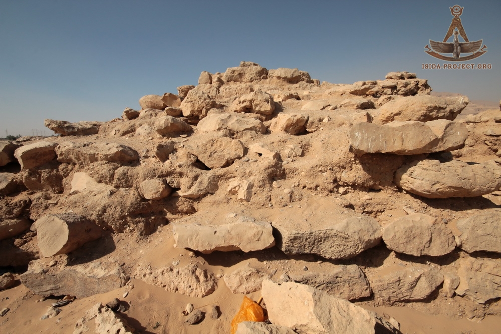
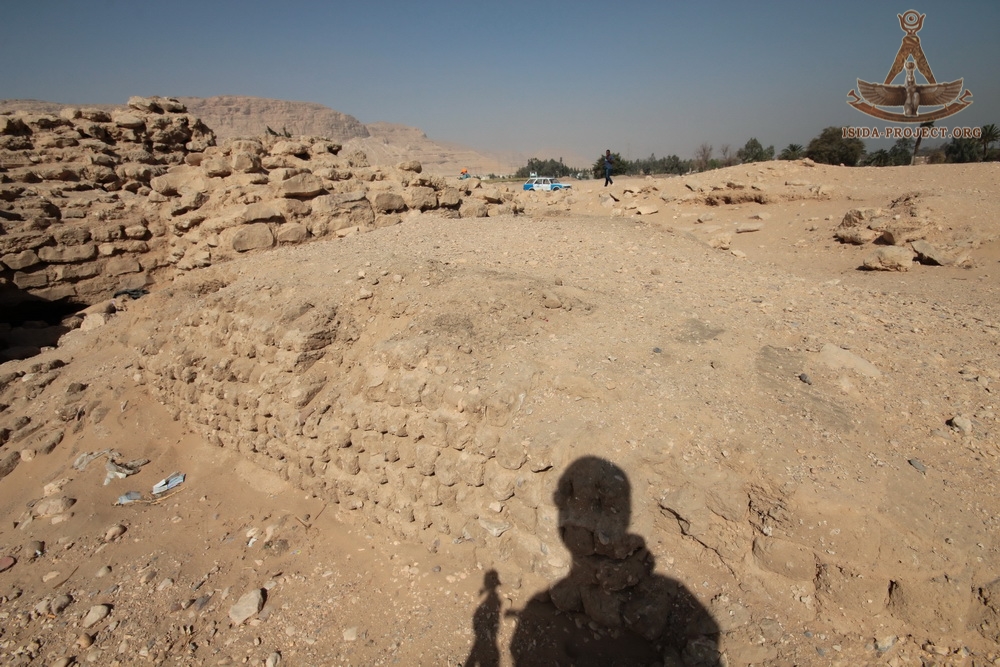
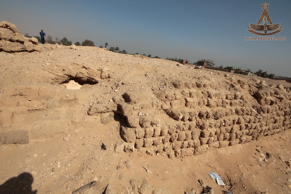
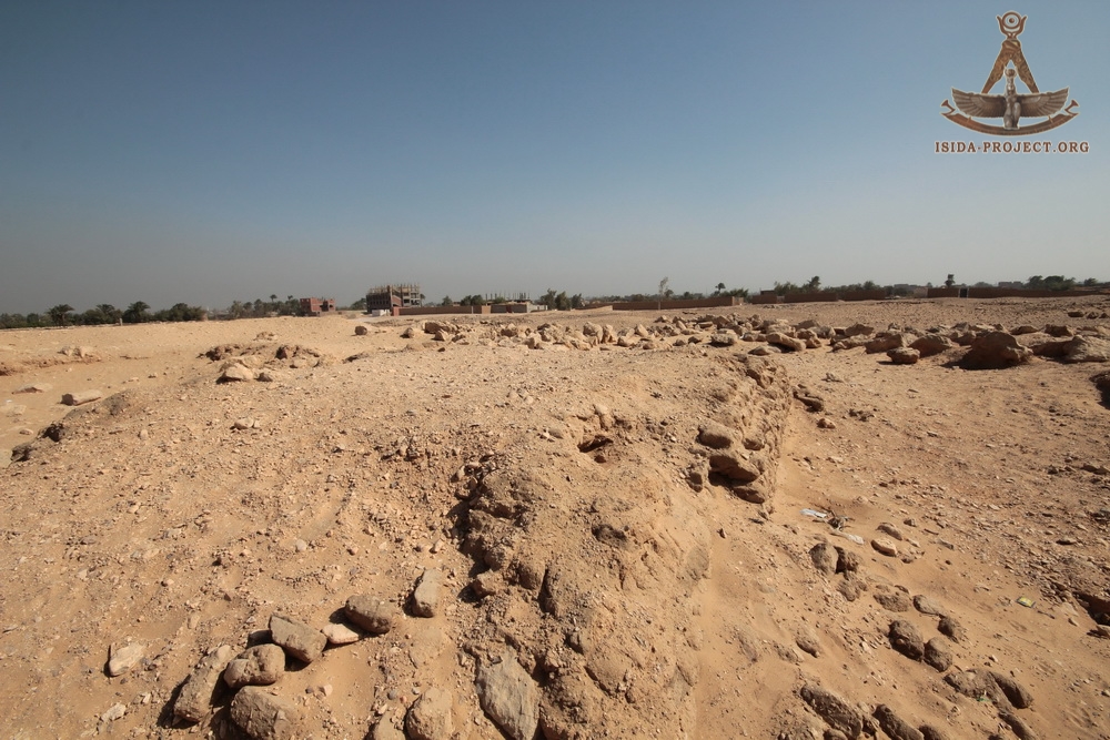
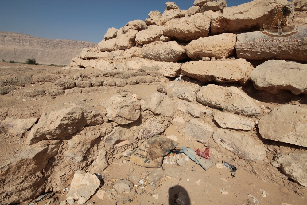
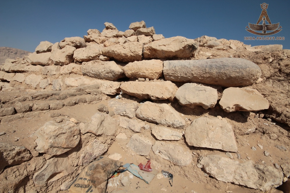
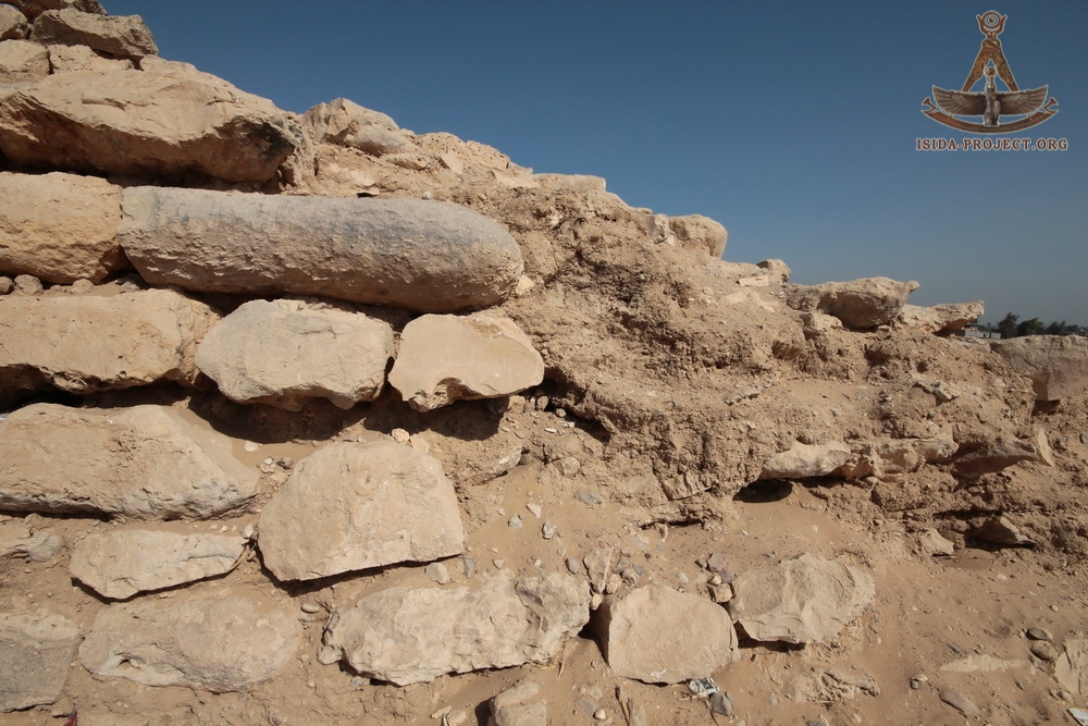
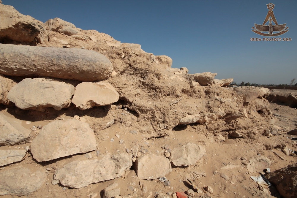
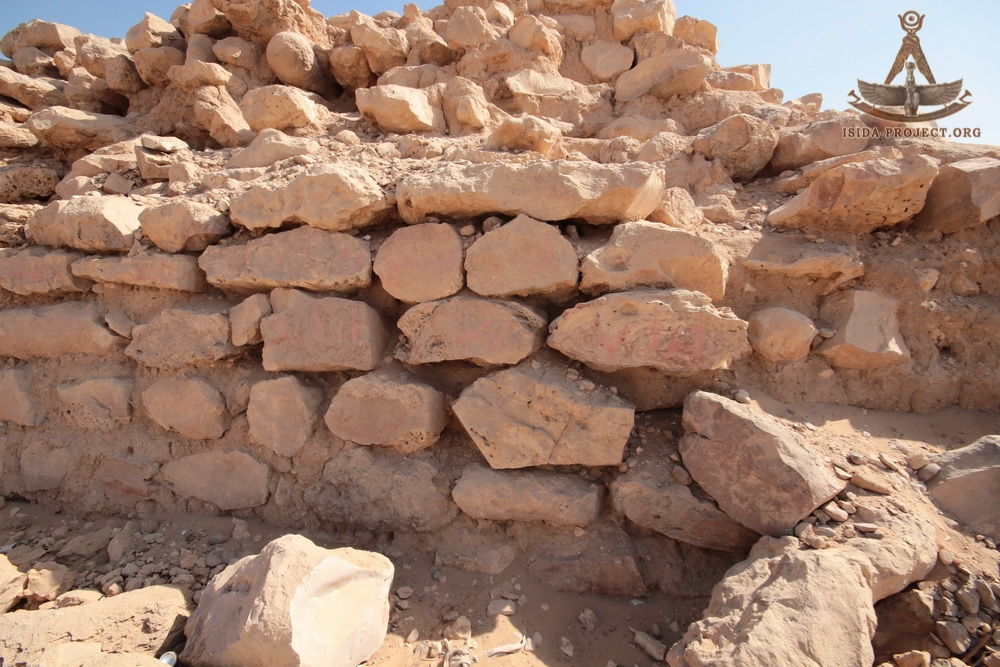
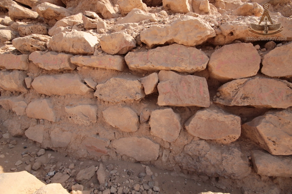
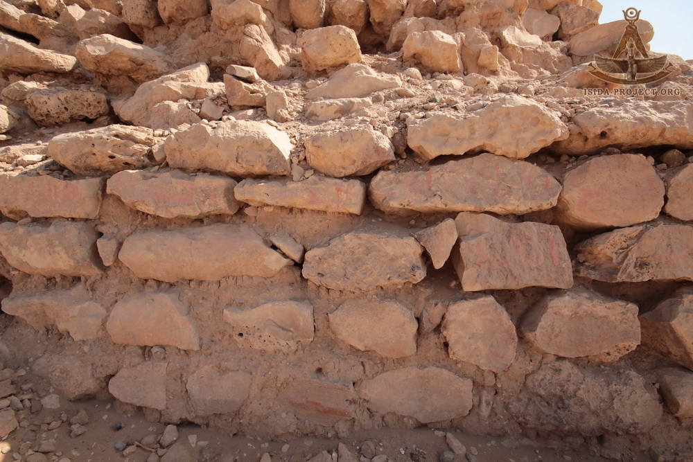
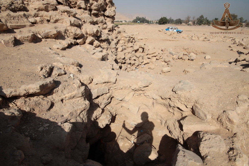
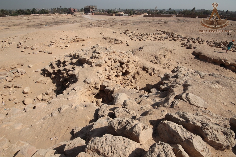
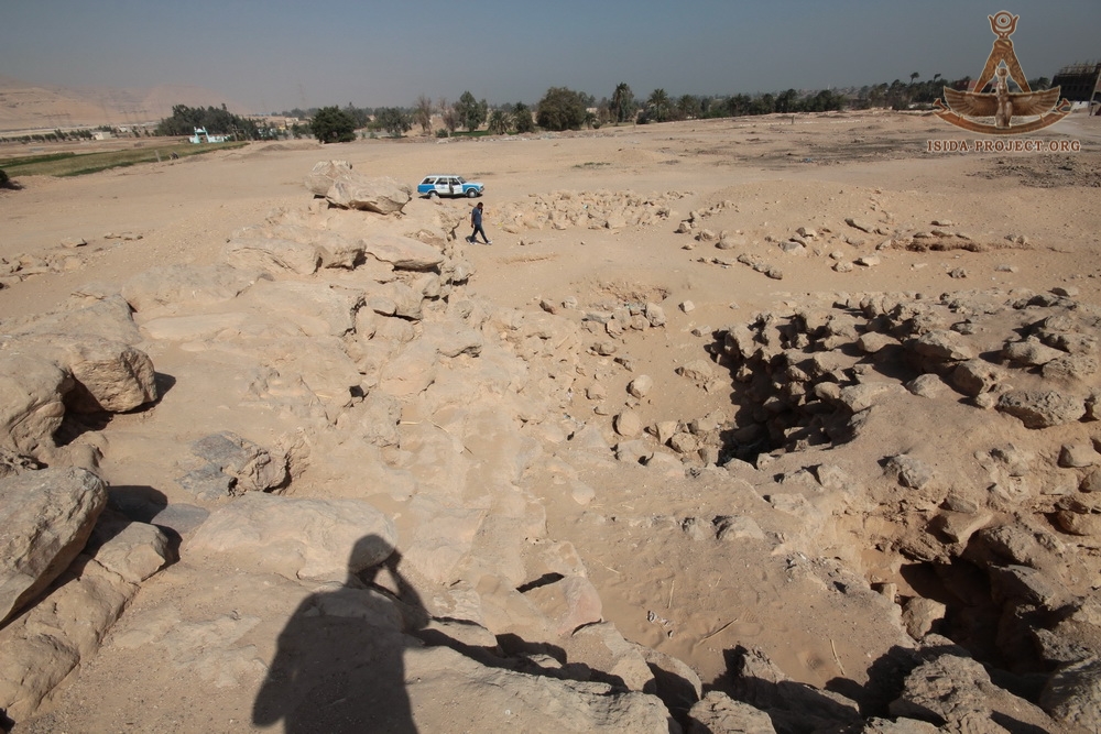
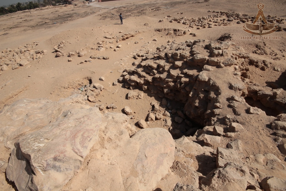
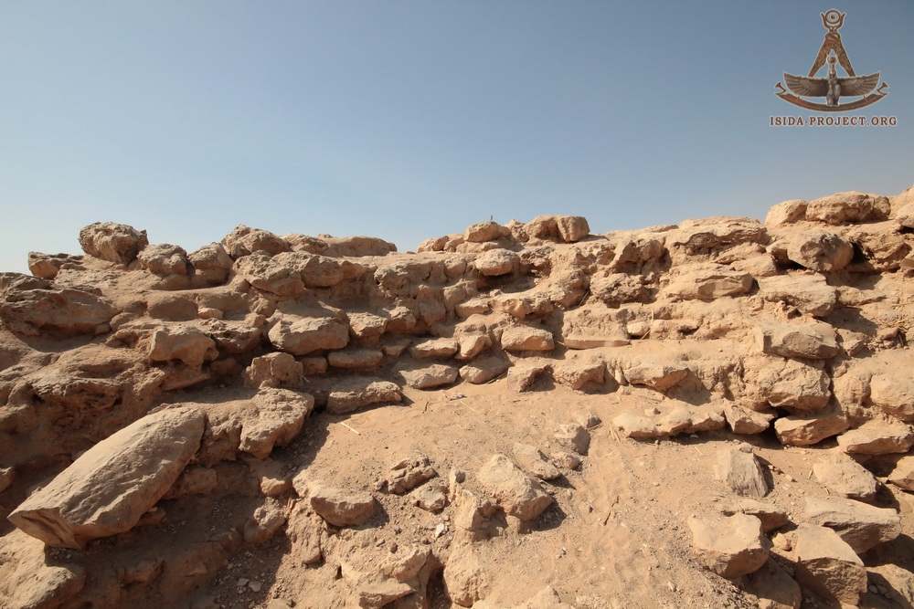
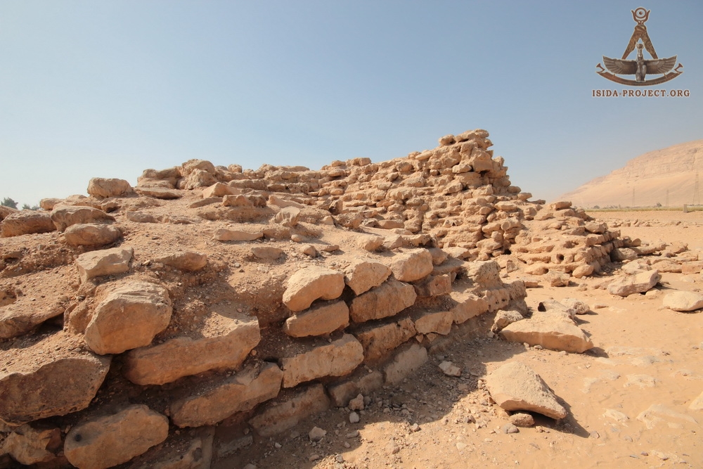
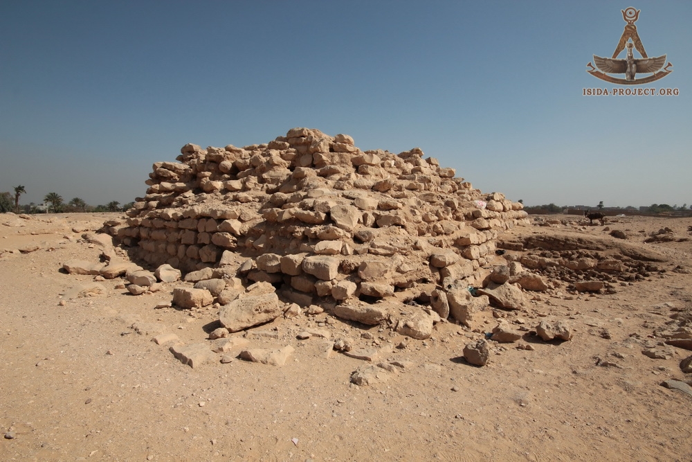
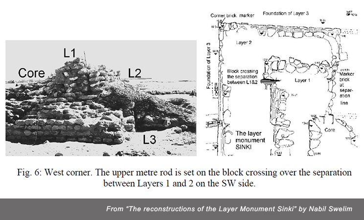
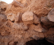
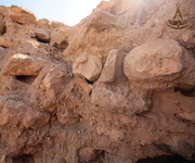
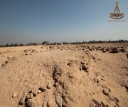
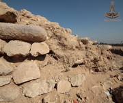
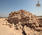
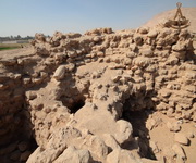
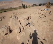
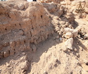
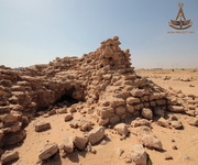
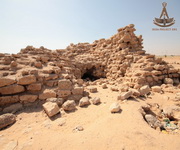
At the beginning of the excavation, nothing resembled a pyramid at all. The endless debris, consisting of fallen stones, pieces of mortar and blown sand, reached the uppermost layers of the masonry, except for the south-west side, which was covered with pebbles.

Source: Nabil Swelim, "The reconstructions of the Layer Monument Sinki "
Source: Nabil Swelim, "The reconstructions of the Layer Monument Sinki "
Source: Nabil Swelim, "The reconstructions of the Layer Monument Sinki "
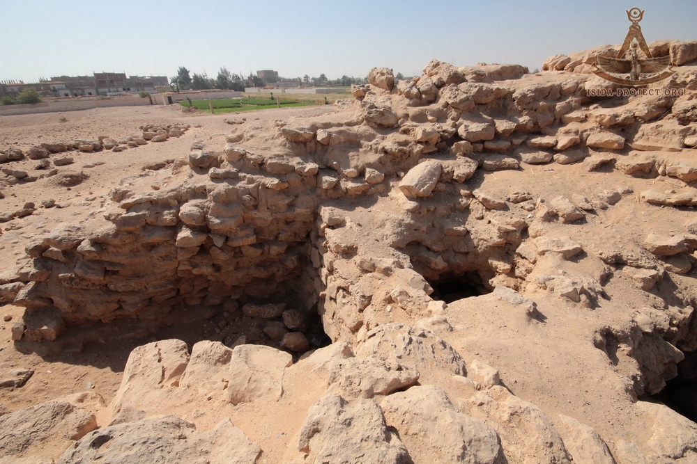
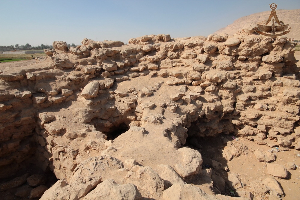
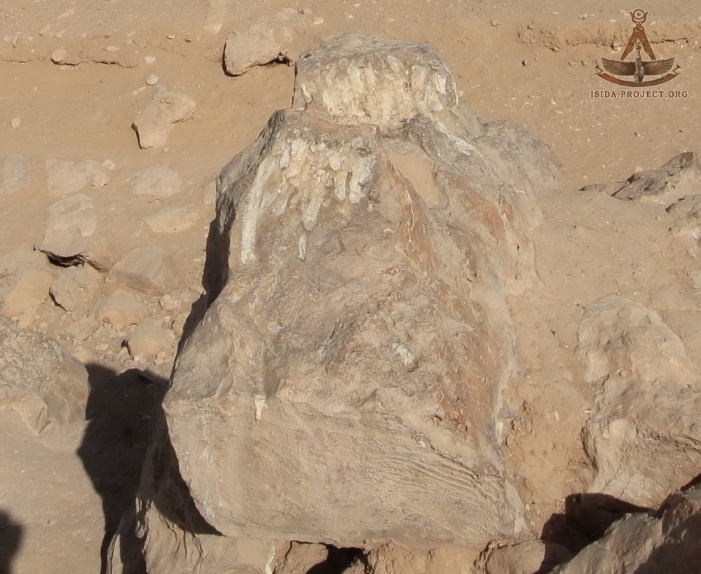
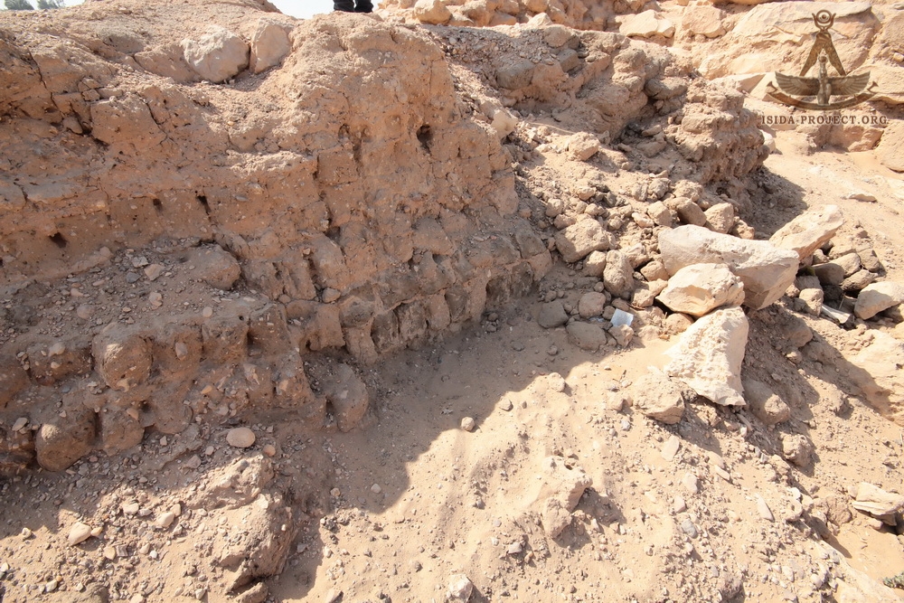
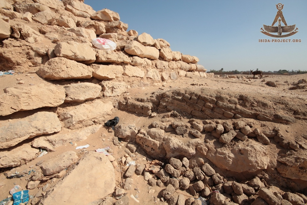
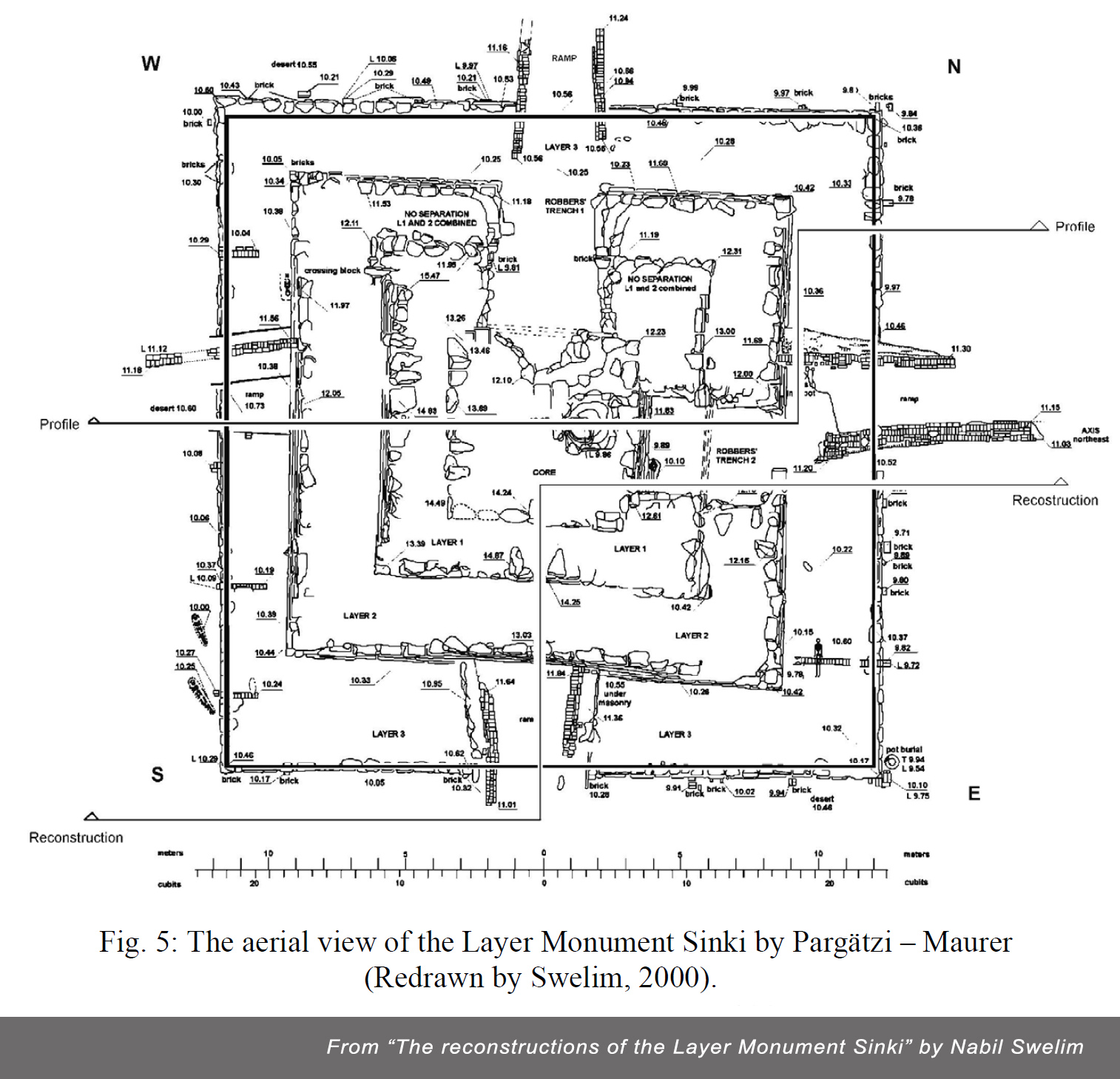
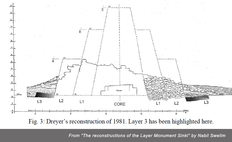
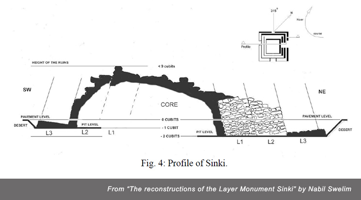
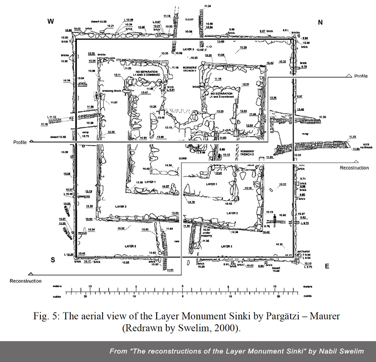
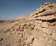
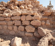
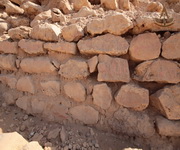
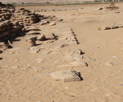
From the studying of the archeological site and the Pargätzi - Maurer plan, one can see that: Sinki was an accretion layer structure, built in a pit of about 0.60 meters deep over a thick layer of mortar spread on the gravel at the bottom of the pit. The plan of the core, layer 1 and 2 appear to be composed of faulty squares, which are disoriented from the cardinal points in a clockwise direction. Layer three, has a fairly square plan with corners oriented close to the cardinal points. The plan, orientation and alignments of the monument were set by means of control points marked with brick settings. The brick markers were placed over the mortar lining in the initial pit every time its area was enlarged. The core, layer 1 and 2 were successively built by manual lifting of building material to achieve a small stepped structure. (From the report of Nabil Swelim)
(Click to enlarge)
Source: Nabil Swelim, "The reconstructions of the Layer Monument Sinki "
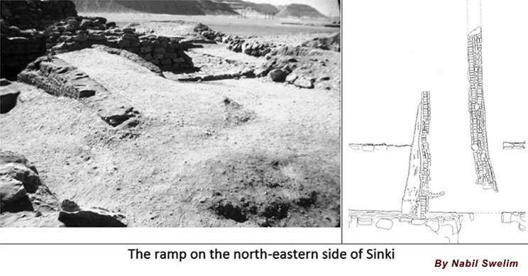
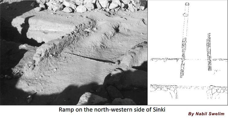
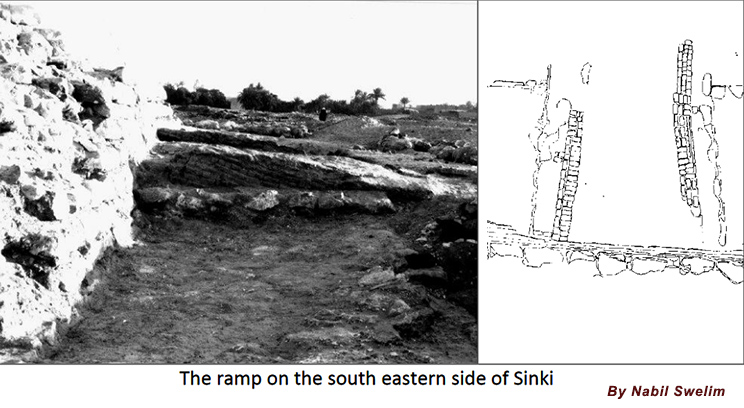
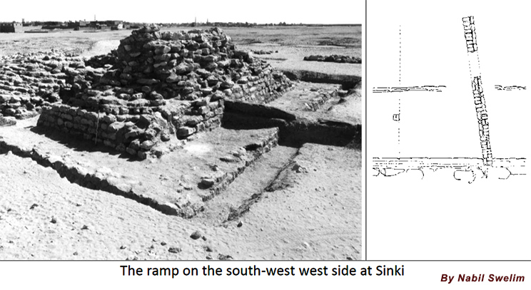
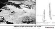
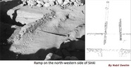
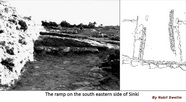
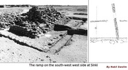
When the manual method of raising the building material ceased to be possible, 4 ramps were erected on each side of the pyramid.
 |
 |
 |
 |
| NE ramp |
NW ramp |
SE ramp |
SW ramp |
Source: Nabil Swelim, "The reconstructions of the Layer Monument Sinki ". "Planning and building".
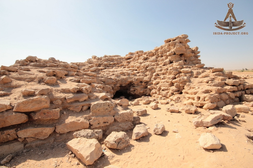
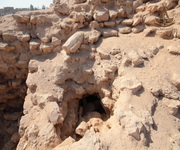
According to the archaeological research of Nabil Swelim, the Pyramid of Sinki was not totally finished. This conclusion was made for the following reasons: the construction ramps were found starting a few meters on the surrounding desert crossing over the foundation of layer 3 and reaching layer 2, which, by that time, was partly constructed and layer 2 must have reached some height above the present ramps.
Источник: Nabil Swelim, "The reconstructions of the Layer Monument Sinki ". "Planning and building".
Consequently neither a pavement nor an outer facing were built. To what extent was the nucleus completed is not known.
General information, according to Nabil Swelim:
- The axis is bearing: 315o
- The pavement would have surrounds the monument at the highest level of the foundation of layer 3 if the monument was completed with an unknown width.
- The final monument (step pyramid option) would have had 3 steps.
- At present the height is: 5.7 metres above the surrounding area.
- The base length is: 47.9 cubits, 25.9 metres.
- The layer thickness is not uniform approximately 5 cubits, 2.36 metres.
- A side angle of: Seked: 5 – 7, 10 - 14o off the vertical.
- Originally a height would have been: > 26 cubits, > 14 metres above the pavement level, in the reconstruction.
- Built on a rough desert surface.
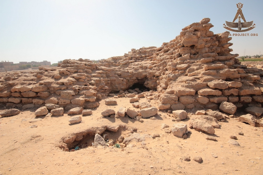
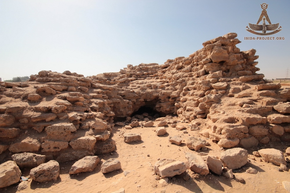
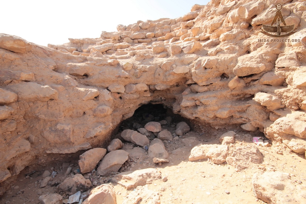
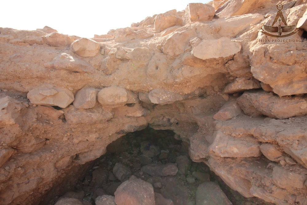
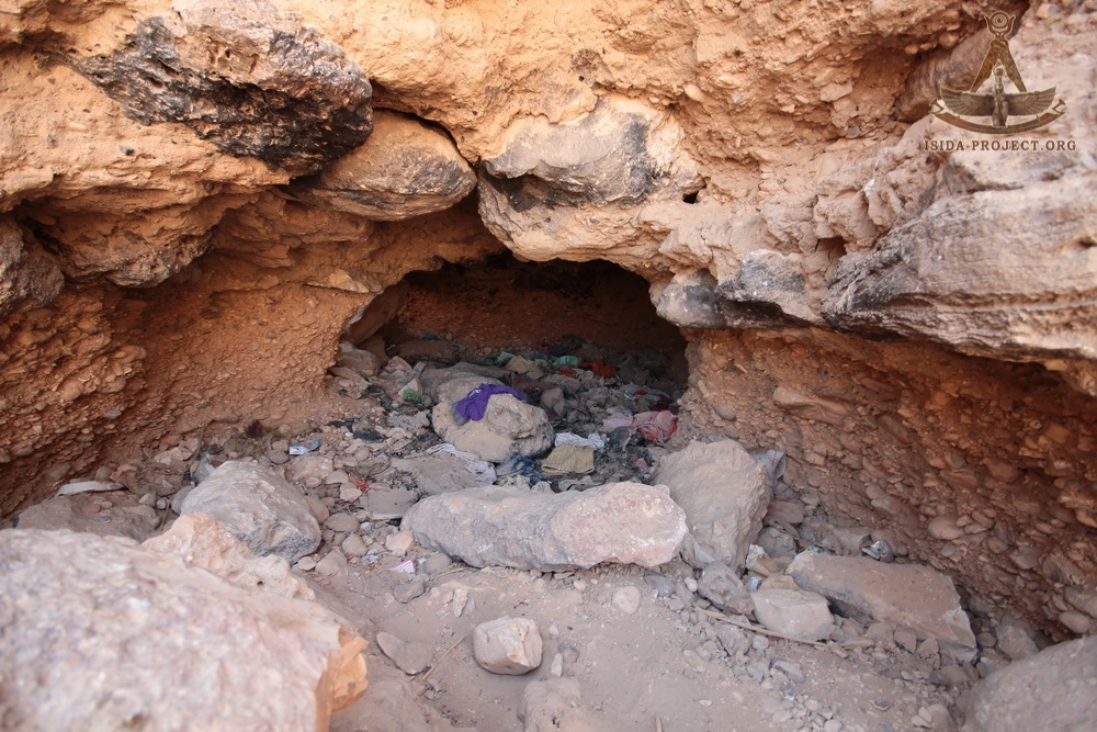
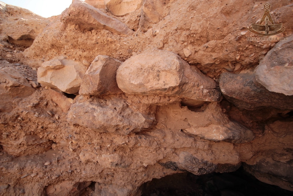
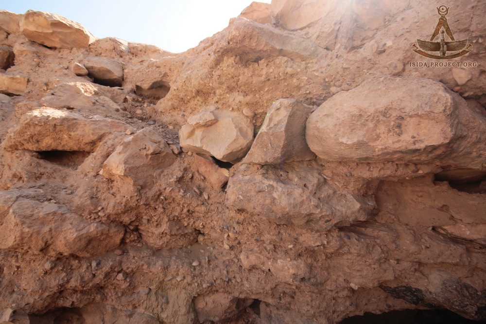
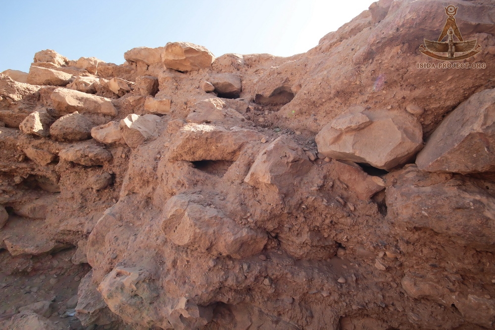
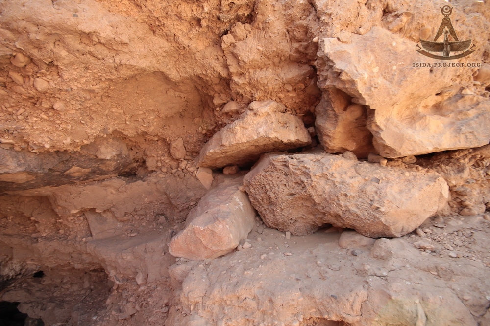
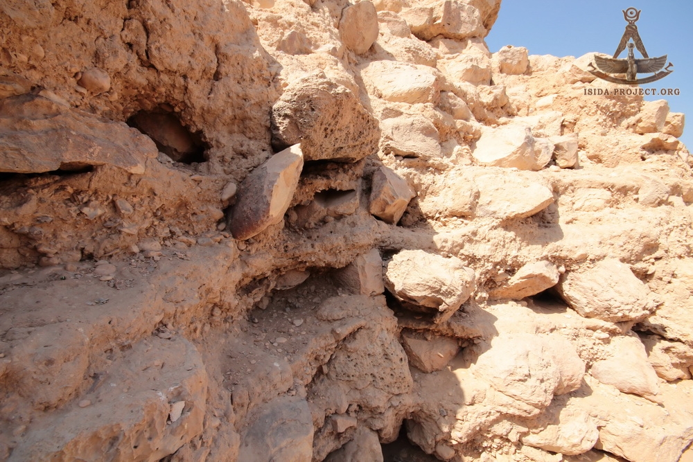
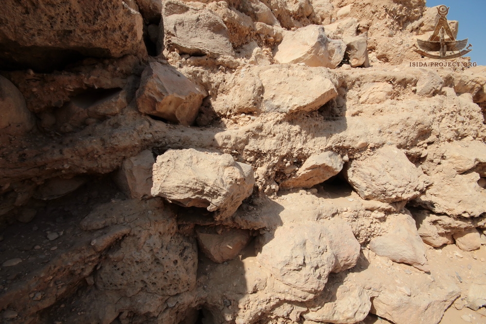
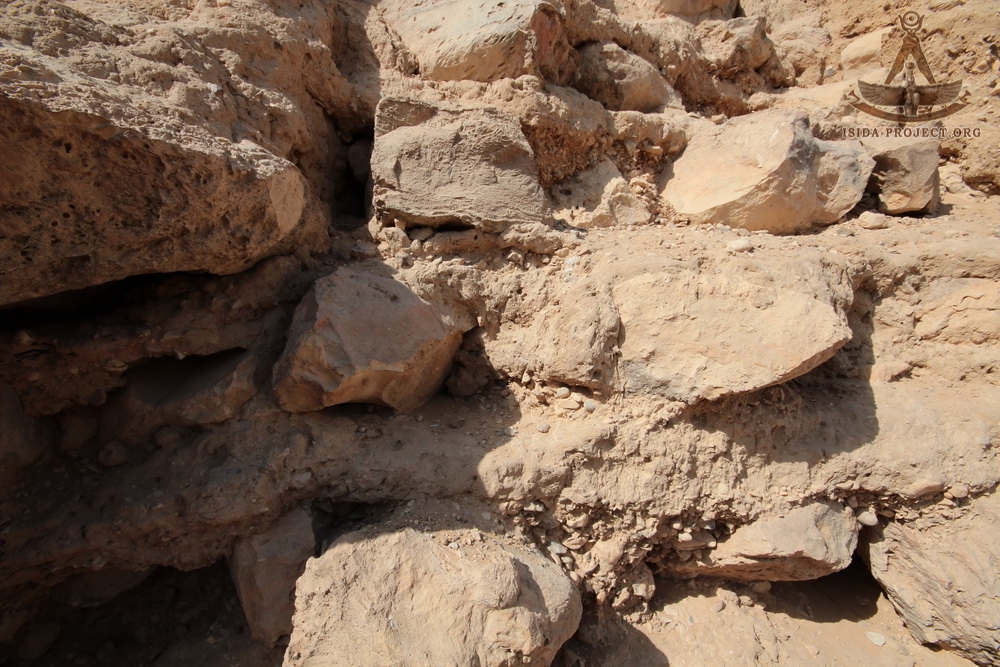
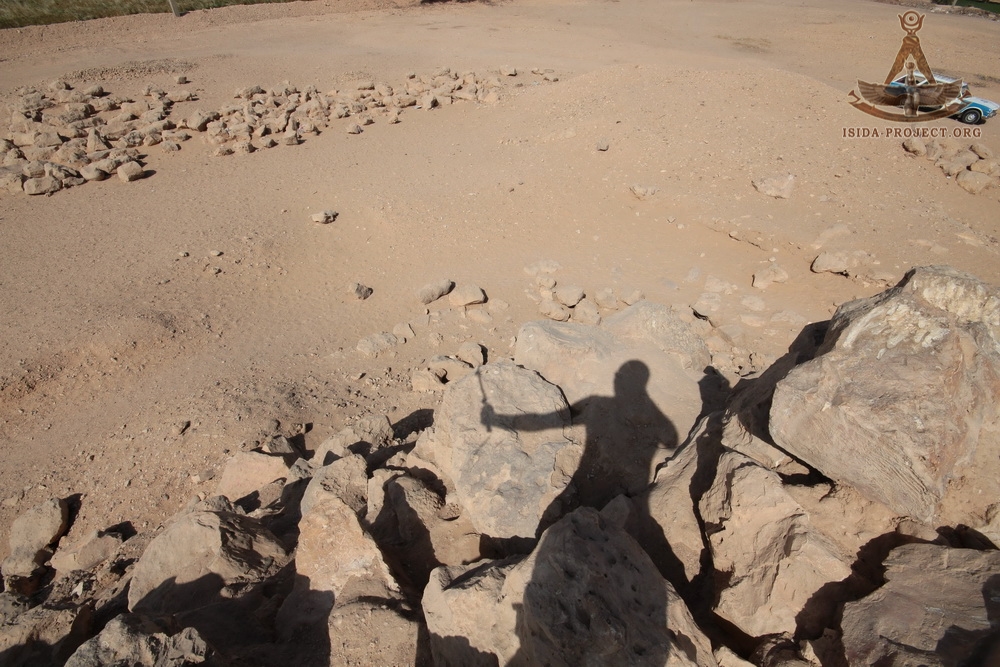
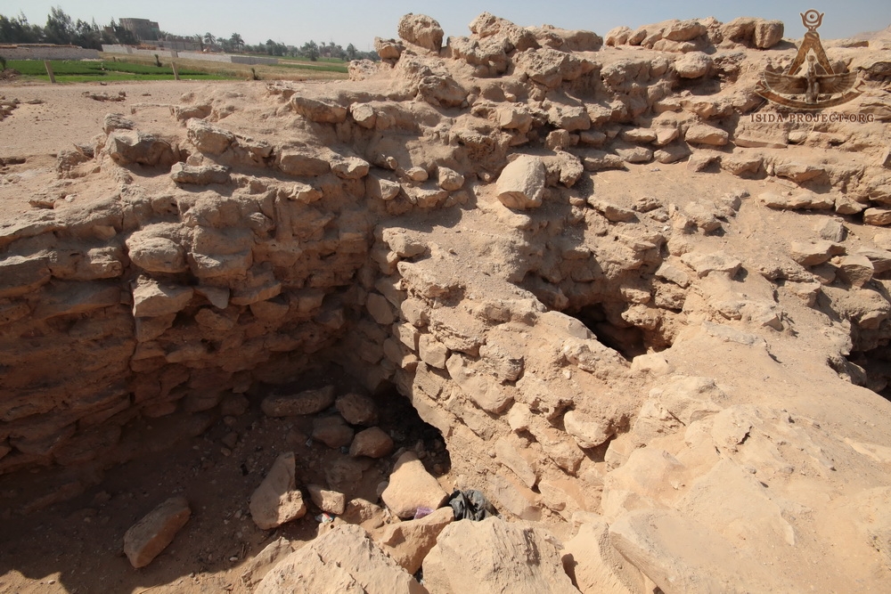
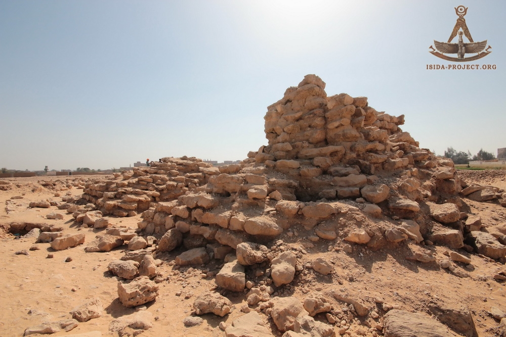
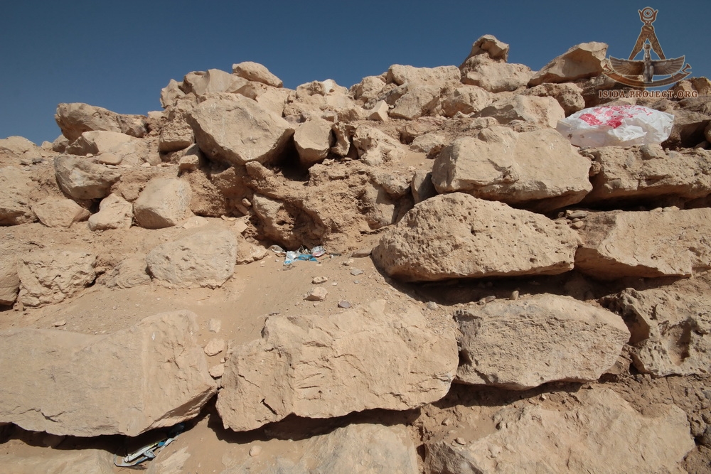
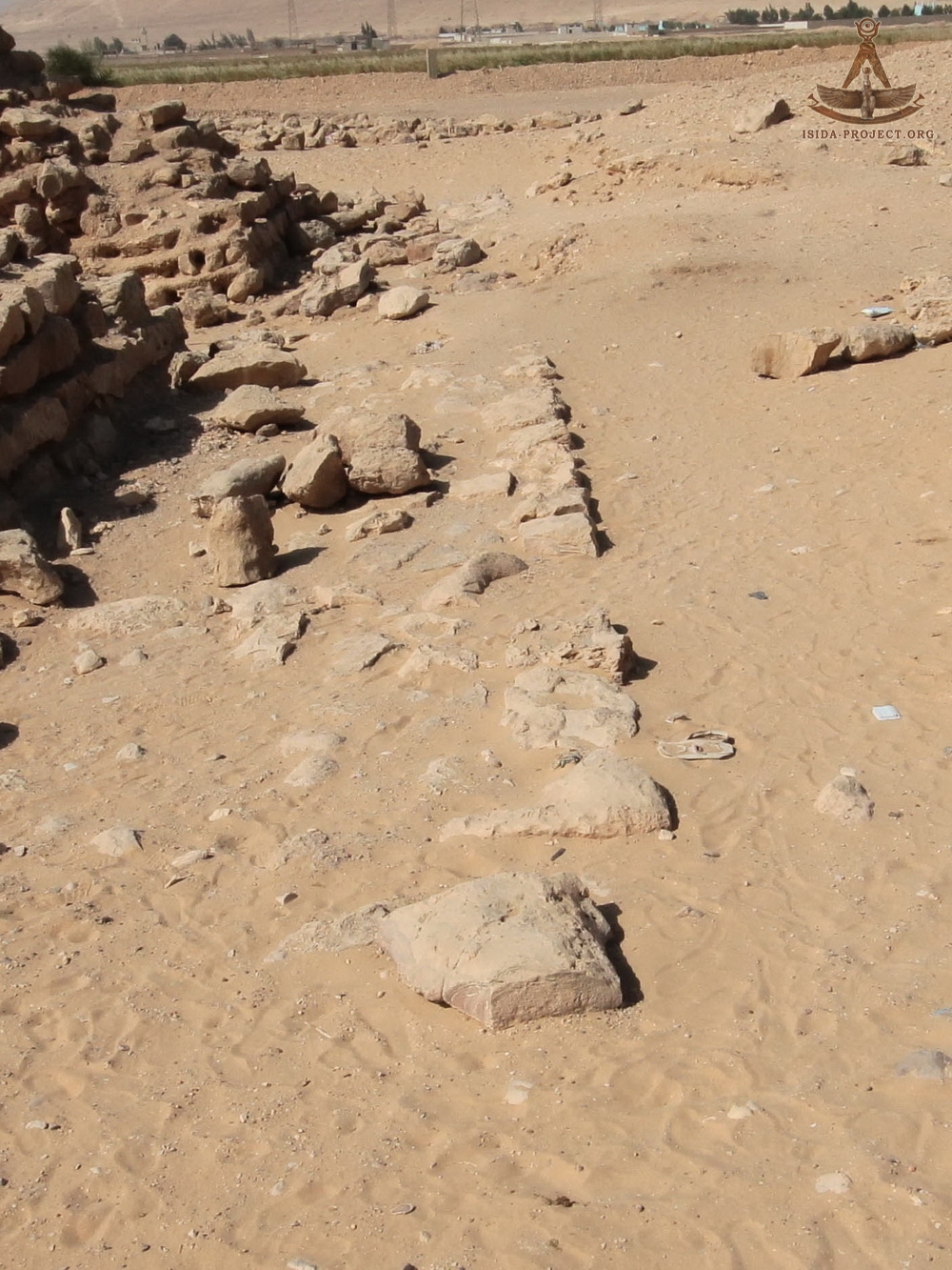
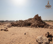
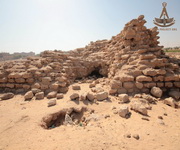
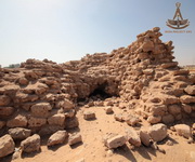
In April 2018, the members of the ISIDA Project research team have visited the Pyramid of Sinki in order to photograph the features of the masonry and the general architecture of the pyramid in every possible detail for further study.
 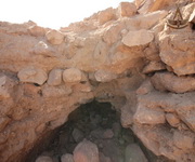  
  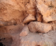 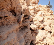
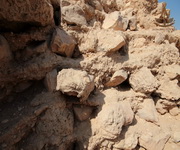 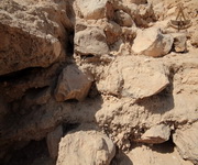  
  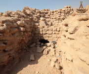 
   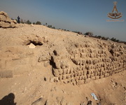
   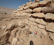
   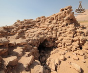
 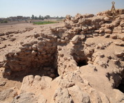  
 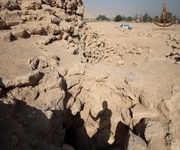 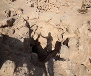 
   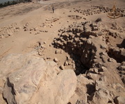
 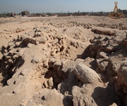 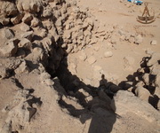 
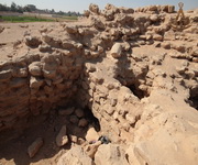 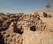  
  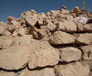 
   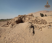
   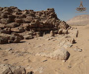
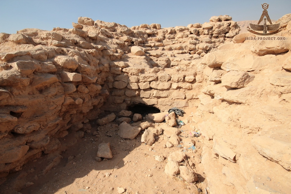
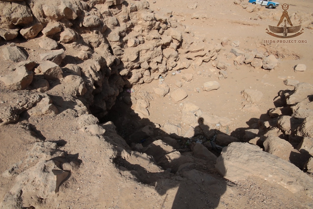
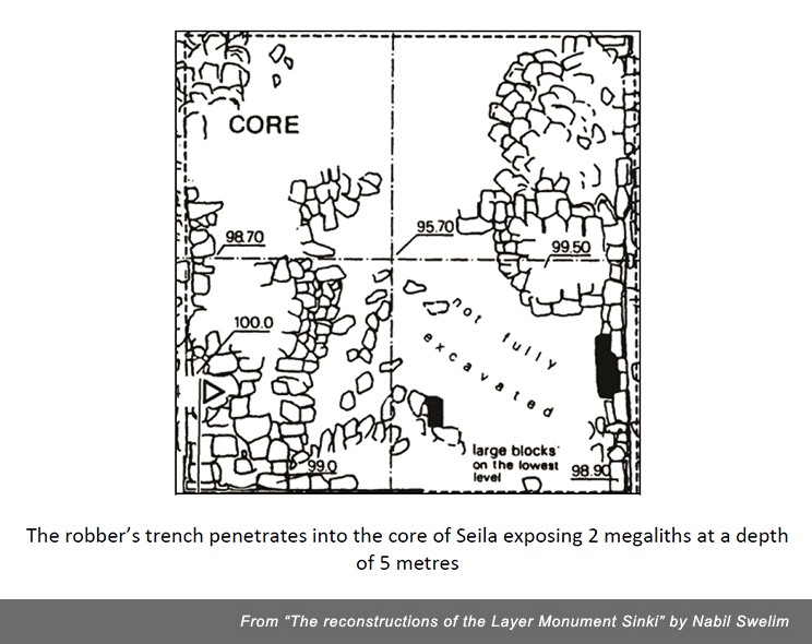
Returning to the report of Nabil Swelim, let's note that the robber's excavation in the center of the pyramid revealed 2 megalithic blocks at a depth of 5 meters. This fact gives grounds to assume that there are some underground enginering structures under the pyramid, the "top of the iceberg" of which is represented by the ruins of one of the oldest small pyramids, the Pyramid of Sinki, that can still be seen above the surface of the Abydos sands and needs much more studies and research.
SOURCES:


<< Back to the Map of Egypt
Discuss on Forum >>
© Copyright 2018 of ISIDA Project. All rights reserved.
|
|