|
|
 |
 |
 |
- England -
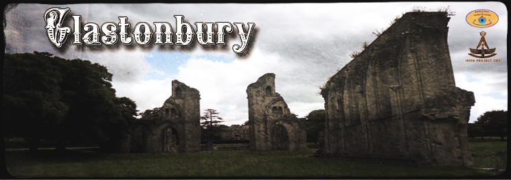
...But all is silent now! silent the bell, William Lisle Bowles (1762–1850) Glastonbury is a small town in Somerset, England, located 23 miles (37 km) south of Bristol. Glastonbury attracts people with its myths and legends, related to the Holy Grail and King Arthur. In some Arthurian literature Glastonbury is identified with the legendary island of Avalon. The origin of the name Glastonbury is unclear but when the settlement is first recorded in the 7th and the early 8th century, it was called Glestingaburg.
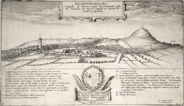
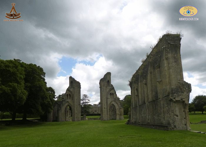
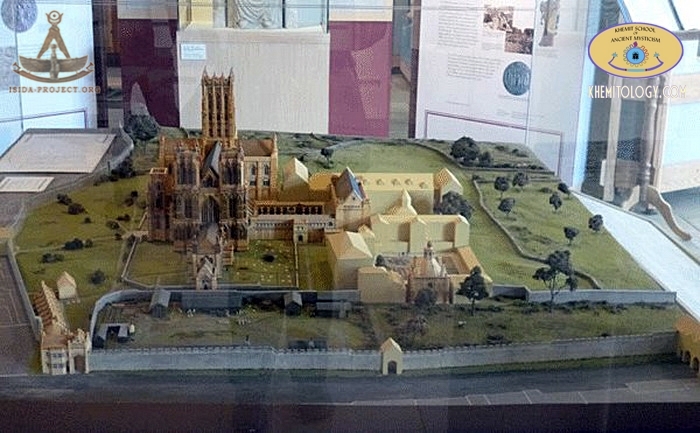
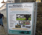
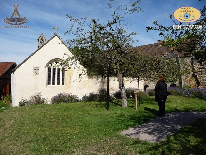
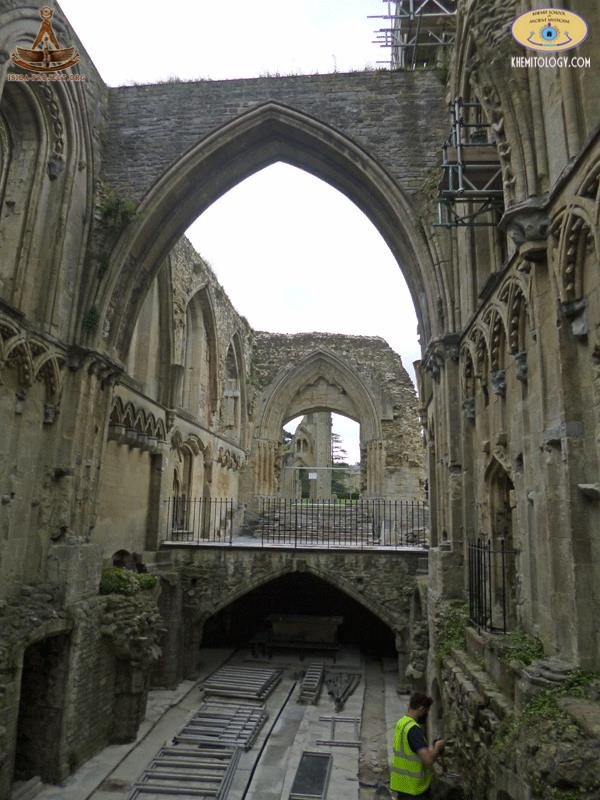
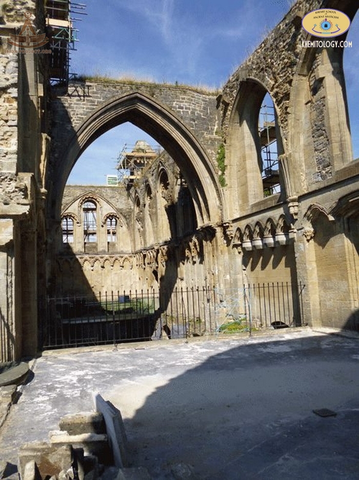
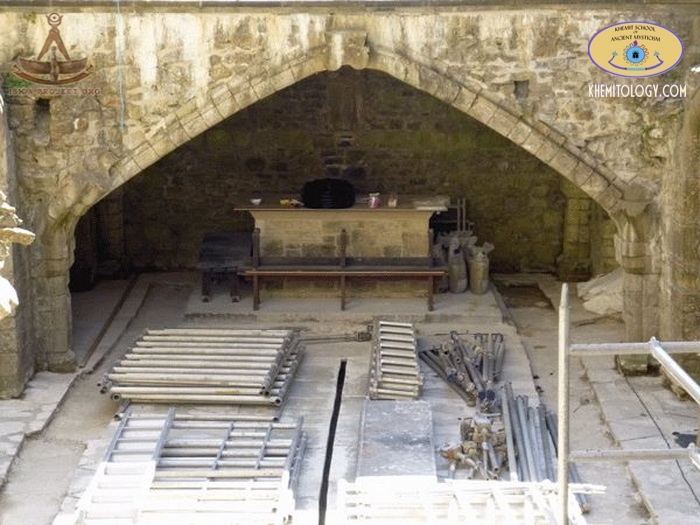
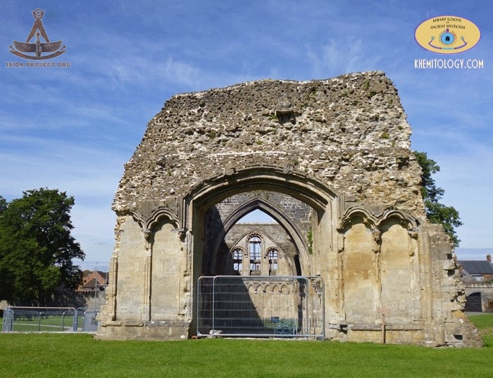
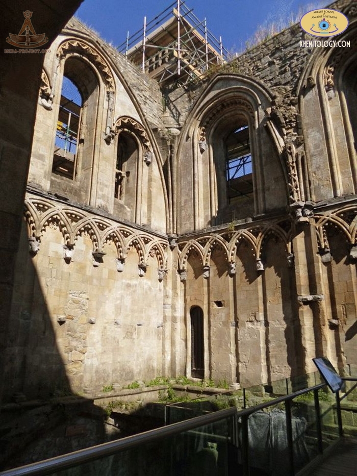
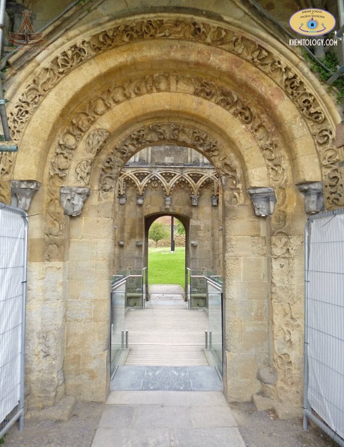
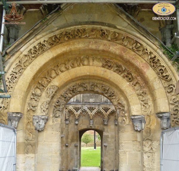
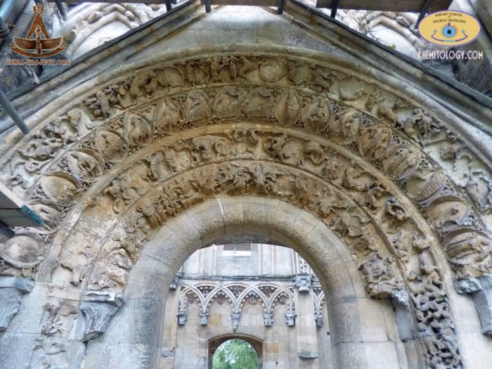
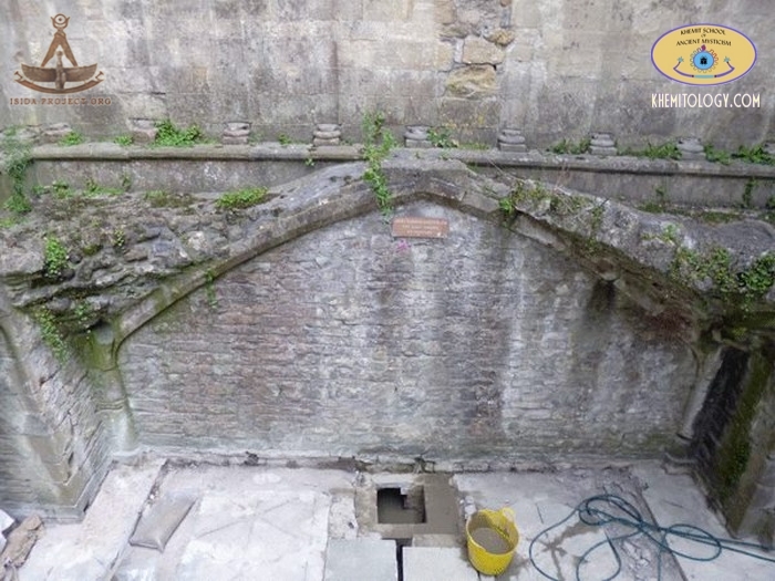
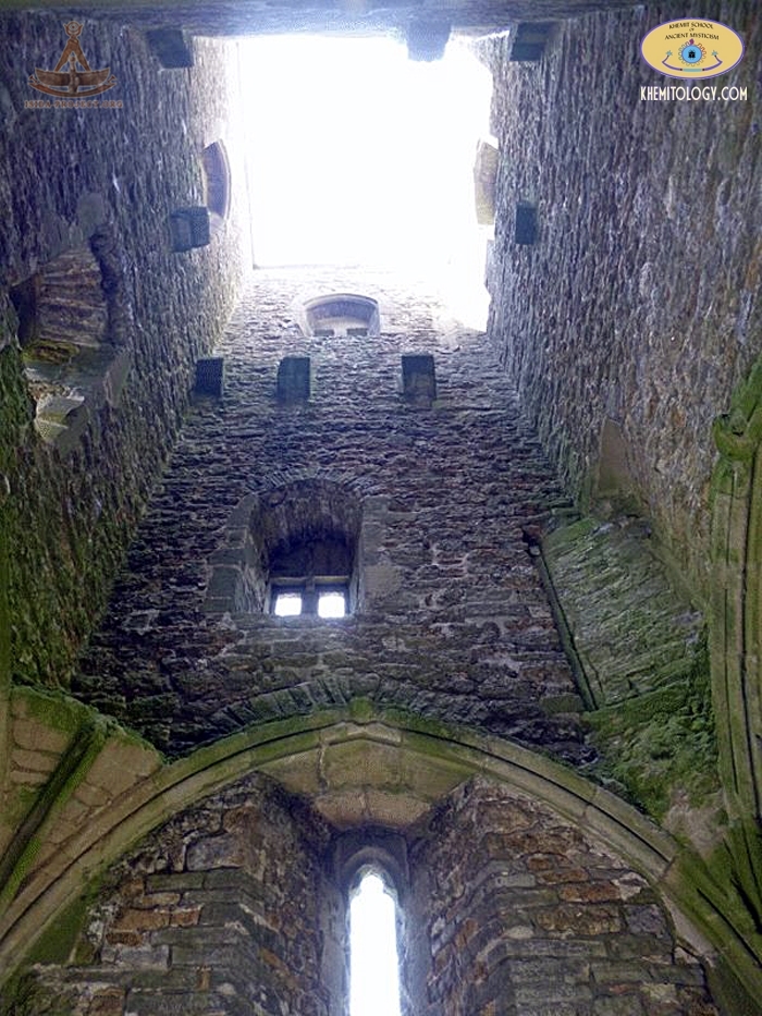
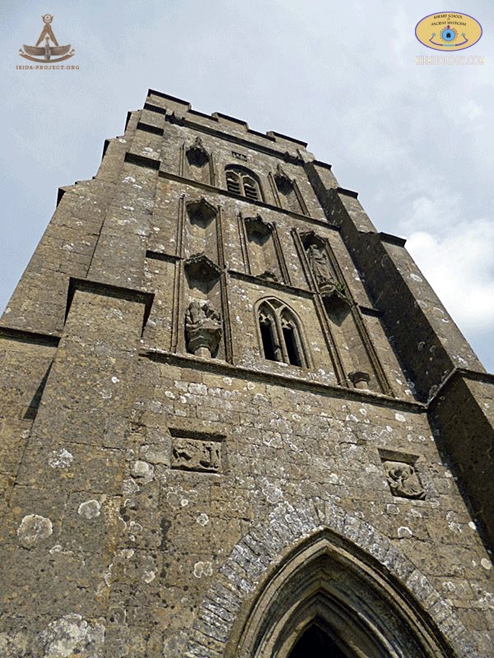
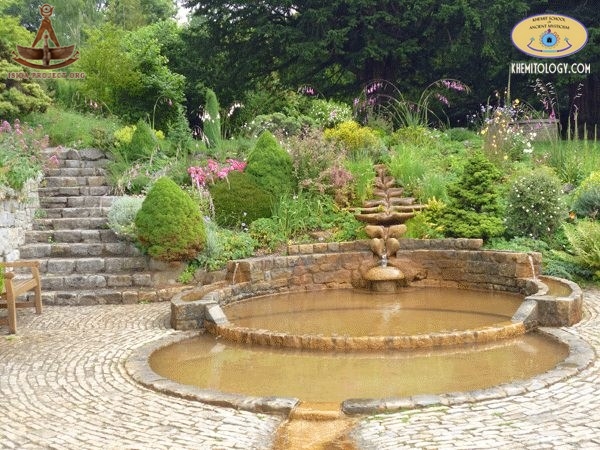
Glastonbury Abbey was a monastery in Glastonbury, Somerset, England. Its ruins are now a open for visitors.
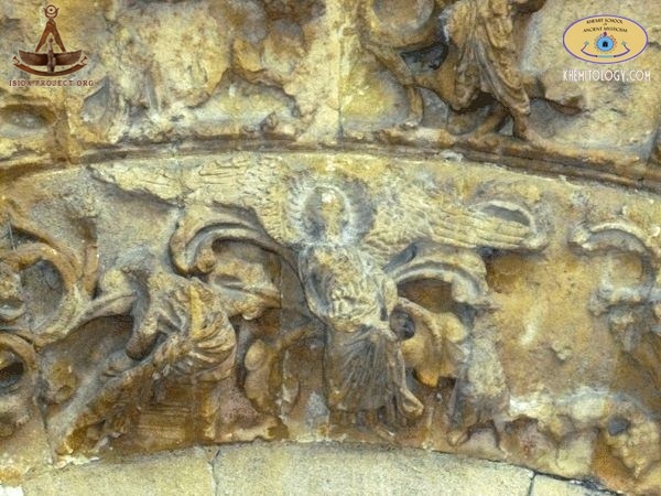
The abbey was founded in the 7th century and enlarged in the 10th. In 1184 the buildings were destroyed by the fire. It was restored only in the 14th century and became the one of the richest and most powerful monasteries in England. From at least the 12th century the Glastonbury area was frequently associated with the legend of King Arthur. This connection was promoted by medieval monks, who asserted that Glastonbury was the legendary Island of Avalon. Christian legends have also claimed that the abbey was founded by Joseph of Arimathea in the 1st century.
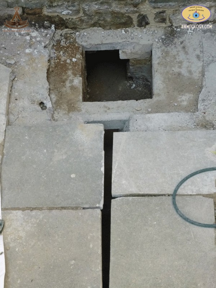
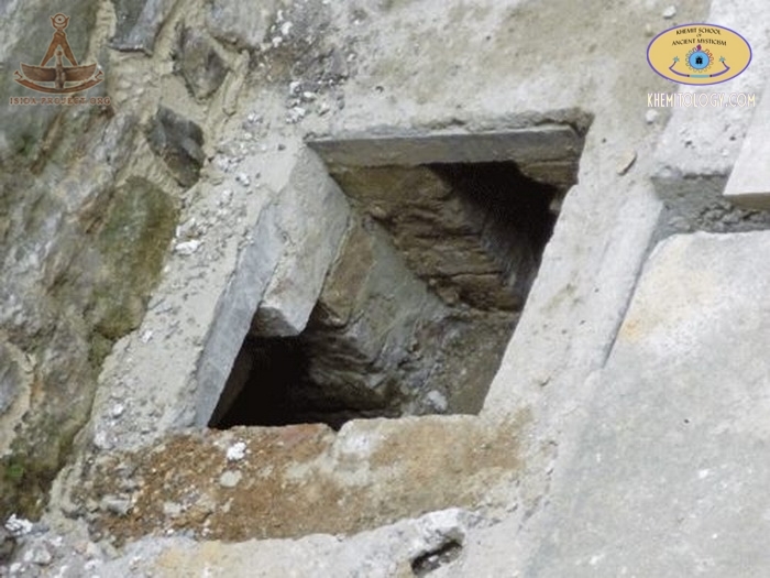
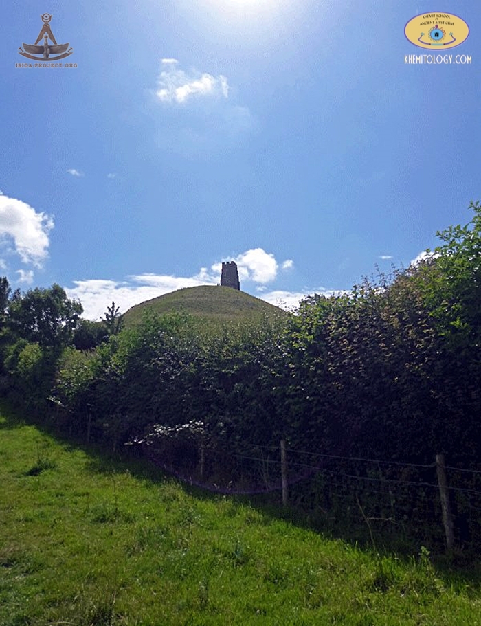
Glastonbury Tor. Glastonbury Tor is a hill, rising to an elevation of 158 metres (518 ft), with the St Michael's Tower on it's top. It is clearly visible for the miles around. Several buildings were constructed on the summit during the Saxon and early medieval periods; they have been interpreted as an early church and monks' hermitage. The original wooden church was destroyed by an earthquake in 1275, and the stone Church of St Michael built on the site in the 14th century. Its tower remains, although it has been restored and partially rebuilt several times.
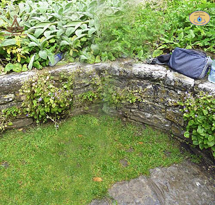
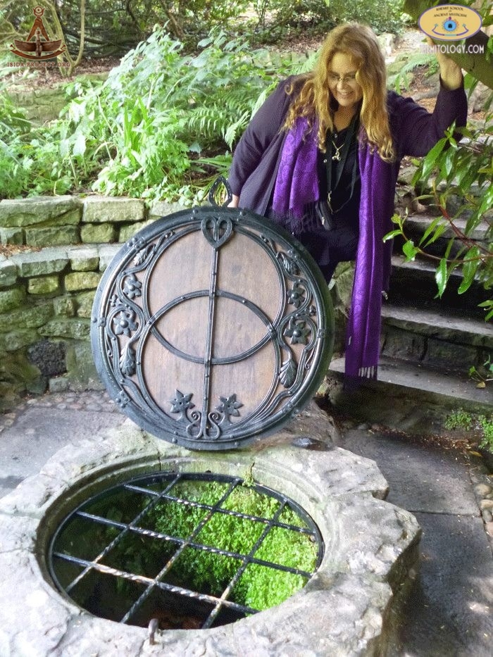
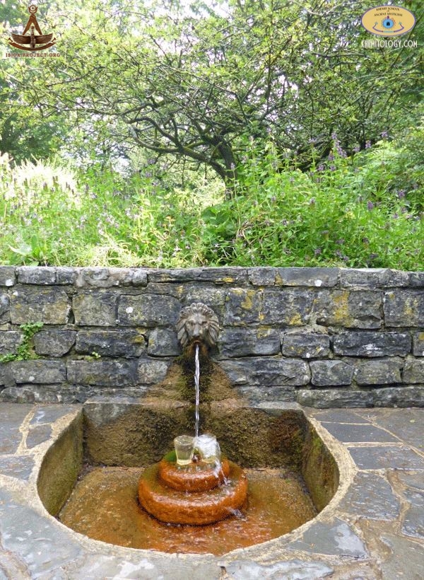
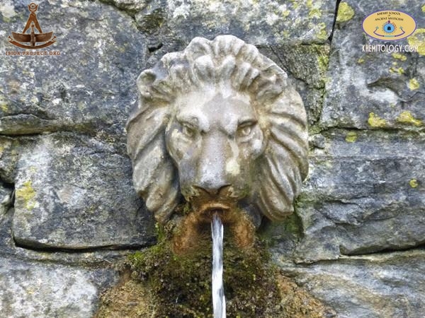
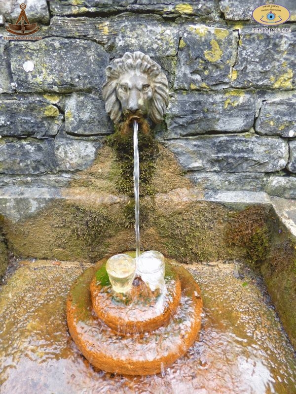
Archaeological excavations during the 20th century clarified the background of the monument and church, but some aspects of their history remain unexplained. The Tor is formed from rocks dating from the early Jurassic Period, namely varied layers of Lias Group strata. The uppermost of these, forming the Tor itself, are a succession of rocks assigned to the Bridport Sand Formation. These rocks sit upon strata forming the broader hill on which the Tor stands; the various layers of the Beacon Limestone Formation and the Dyrham Formation. The Bridport Sands have acted as a caprock protecting the lower layers from erosion. The iron-rich waters of Chalice Well, a spring at the base of the Tor, flow out as an artesian well impregnating the sandstone around it with iron oxides that have reinforced it to produce the caprock. The Chalice Well, located at the feet of the Glasonbury Tor, is regarded to be a "Holy Well". It is covered by a wooden well-cover with wrought-iron decoration, made in 1919. The natural water spring under it is used at least for two thousand years. Iron oxide deposits gives the water a reddish color. The well is about 9 feet (2.7 m) deep, with two underground chambers at its bottom.
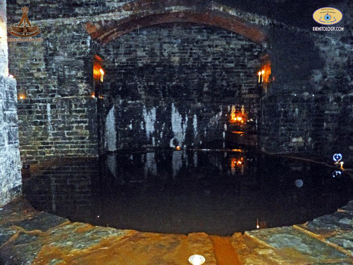
The White Spring - emerges just east of the Chalice Well. The water from this comes from a shallower aquifer from the Glastonbury Tor. A building, that was originally a waterworks, has been built over it. This building now serves as a place of worship and visitors are admitted at irregular opening times. The sides of the Tor have seven terraces. Their formation remains a mystery with many possible explanations. They may have been formed as a result of natural differentiation of the layers of Lias stone and clay used by farmers during the Middle Ages as terraced hills to make ploughing for crops easier. Author Nicholas Mann questions this theory. If agriculture had been the reason for the creation of the terraces, it would be expected that the effort would be concentrated on the south side, where the sunny conditions would provide a good yield, but the terraces are equally deep on the northern side, which would provide little benefit. Additionally, none of the other slopes of the island have been terraced, even though the more sheltered locations would provide a greater return on the labour involved.
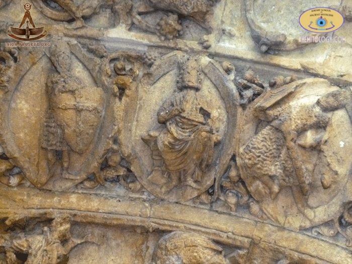
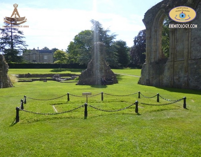
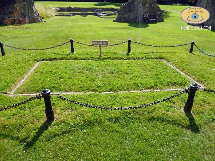
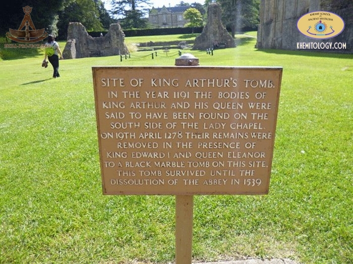
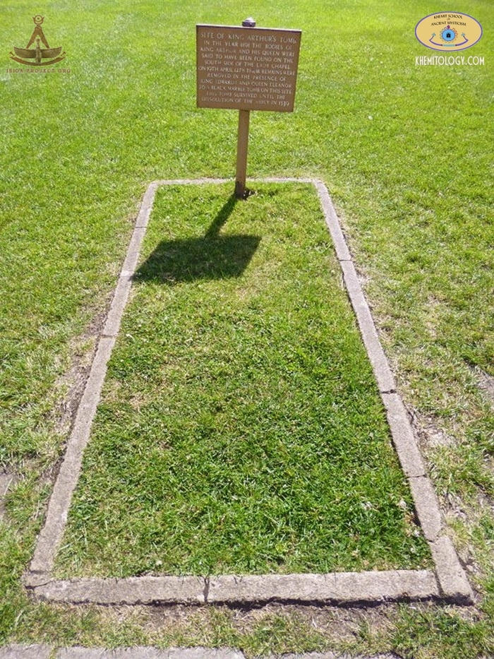
The 1970 excavation suggests the 12th century or later. The historian Ronald Hutton suggests that the terraces are the remains of a medieval "spiral walkway" created for pilgrims to reach the church on the summit, similar to that at Whitby Abbey. Another suggestion is that the terraces are the remains of a three-dimensional labyrinth, first proposed by Geoffrey Russell in 1968. He states that the classical labyrinth (Caerdroia), a design found all over the Neolithic world, can be easily transposed onto the Tor, so that by walking around the terraces a person eventually reaches the top in the same pattern. Evaluating this hypothesis is not easy. A labyrinth would very likely place the terraces in the Neolithic era, but given the amount of occupation since then, there may have been substantial modifications by farmers and/or monks and conclusive excavations have not been carried out. The Tor is mentioned in Celtic mythology, particularly in myths, connected with the story of King Arthur. It seems to have been called Ynys yr Afalon (meaning "The Isle of Avalon") by the Britons and is believed by some, including the 12th and 13th-century writer Gerald of Wales, to be the Island of Avalon of Arthurian legend. The Tor has been associated with the name Avalon, and identified with King Arthur, since the alleged discovery of his and Queen Guinevere's neatly labelled coffins in 1191, recounted by Gerald of Wales.
The King Arthur grave. "A particular relation of the discovery of the bodies or bones of this monarch and his queen,
between six and seven hundred years after the supposed and probable time of their deaths, has been, with due elaboration and prolixity brought forth by his countryman, Girald Barry, otherwise Giraldus Cambrensis, who died bishop of Menevia or Saint-Davids, in 1229, which,
however, it will not seem impertinent to give,
at length, from his own Latin, as follows : In these our days, at Glastonbury, between two pyramidal stones, formerly erected in the sacred burying-ground, hid very deep in the earth, in a hollow oak, and marked with wonderful, and, as it were, miraculous tokens, was found, and into the church, with honour, translated, and to a marble tomb decently commended : whence, also, a leaden cross, a stone being put under it, not infixed on the upper part, as it is wont, ought to "HIE JACET SEPULTUS INCLITUS REX ARTHURUS CUM WNNEVEREIA UXORE SUA SECUNDA IN INSULA AVALONIS" An extract by Leland, from a paper he met within the library of Glastonbury Abbey, says, " The bones of Arthur were raised from the sacred cemetery, in the year 1189, by Henry Sully, abbot of Glastonbury (Collectanea, III, 154). In other extracts, this discovery is dated 1191." Life of King Arthur . (From ancient historians and authentic
documents.)
© Copyright 2014 of ISIDA Project & Khemit School. All rights reserved. |
||
 |
 |
 |