|
|
 |
 |
 |
- England -
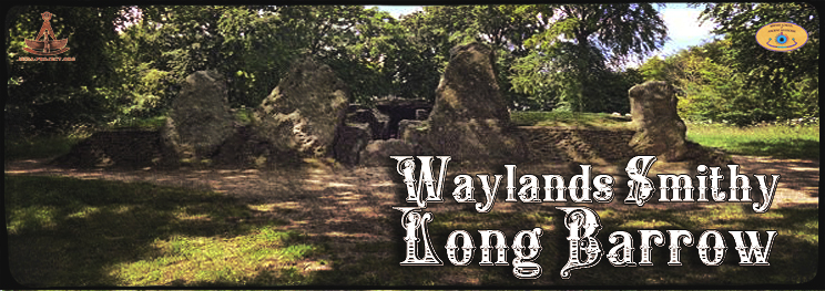
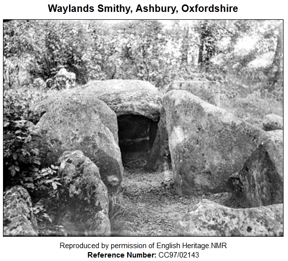
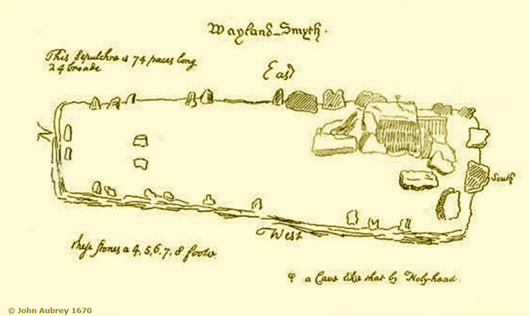
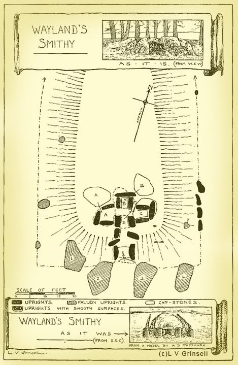
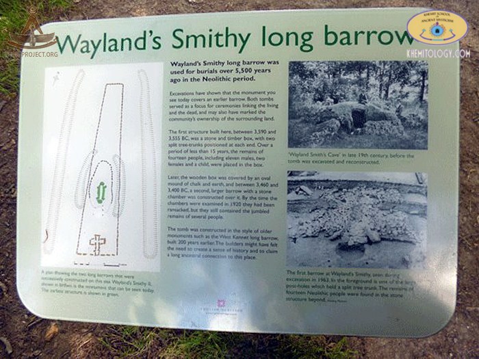
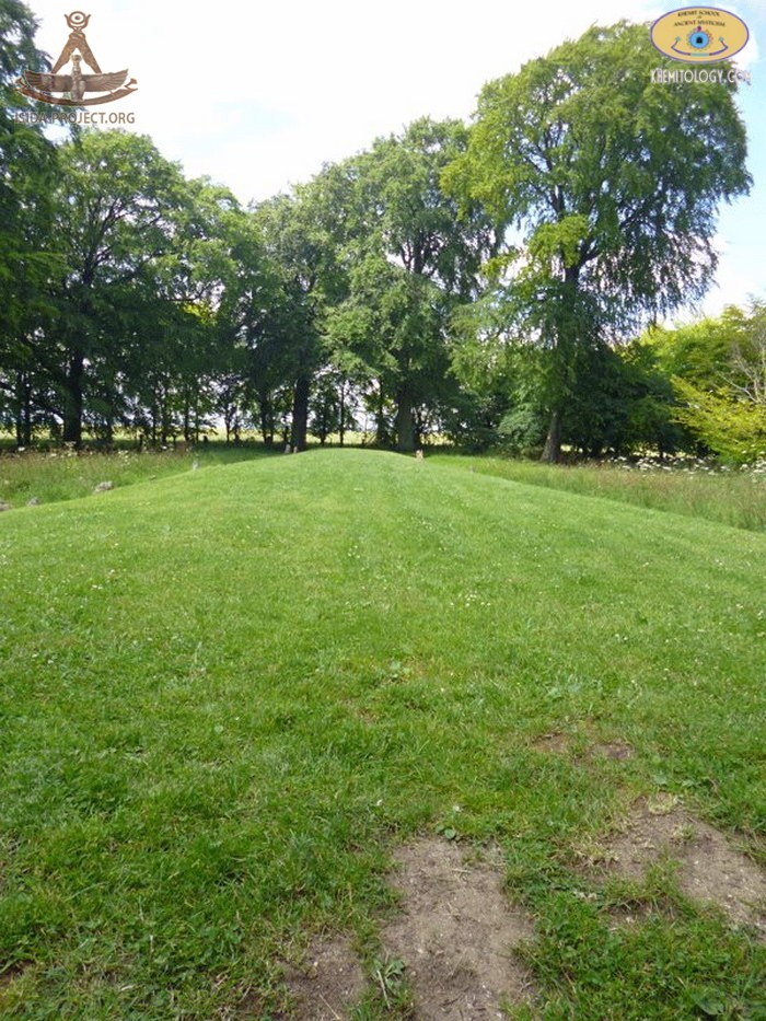
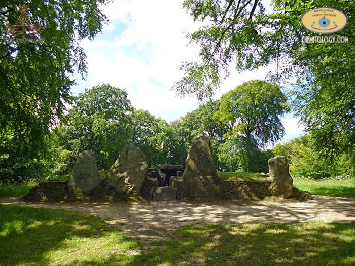
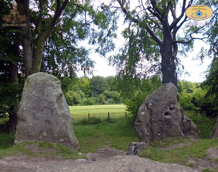
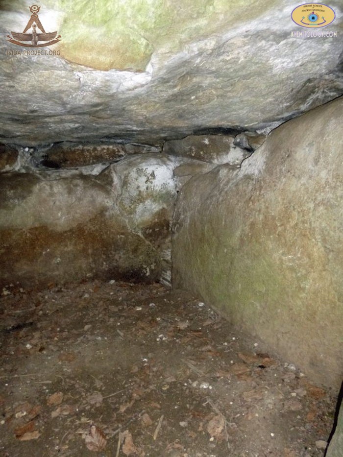
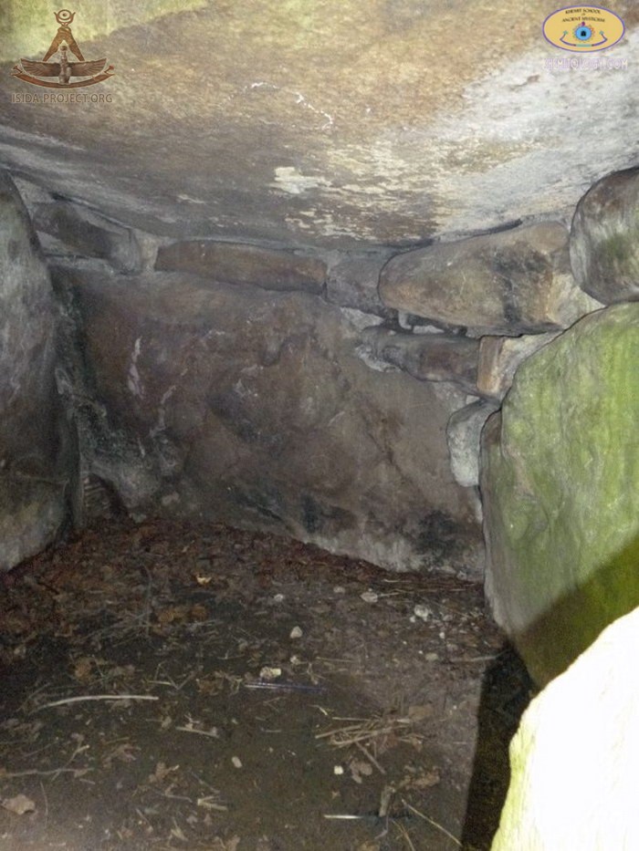
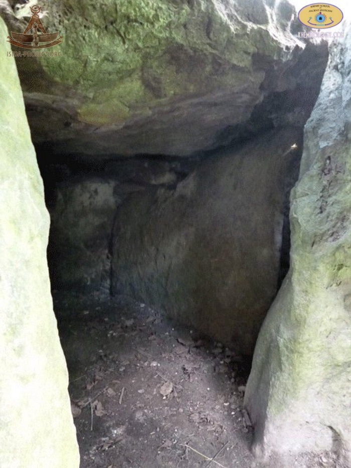
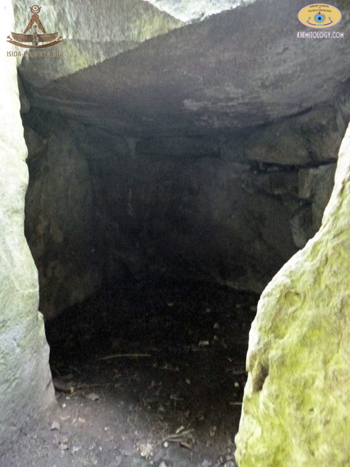
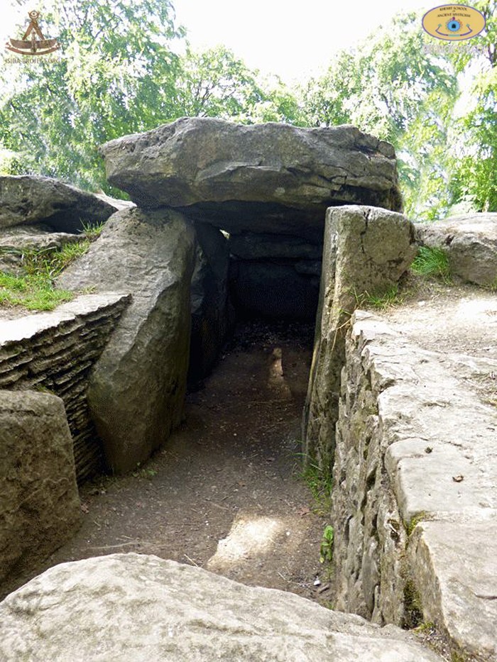
Wayland's Smithy is an atmospheric historic site situated approximately 2km along the Ridgeway from the Uffington White Horse. A Neolithic chambered long barrow, it was once believed to have been the habitation of the Saxon smith-god Wayland.
The perimeter of the site is 185 feet (56 m) long and 43 feet (13 m) wide at the south end. Its present appearance is the result of restoration following excavations undertaken by Stuart Piggott and Richard Atkinson in 1962–63.
© Copyright 2014 of ISIDA Project & Khemit School. All rights reserved. |
||
 |
 |
 |