|
|
 |
 |
 |
- England -
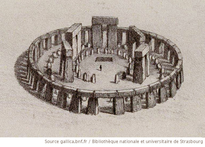
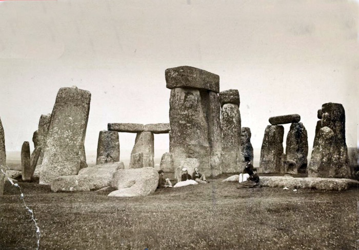
"That year Merlin, not by force but by art, brought and erected Stonehenge is an ancient monument, located in Wiltshire, England, about 2 miles (3 km) west of Amesbury and 8 miles (13 km) north of Salisbury. It is the one of the most famous sites in the world, designed as the ring of standing stones set within earthworks. According to the archeologists' researches it was built between 3000 BC - 2000 BC. According to James Morgan, Tim Darvill and Geoff Wainwright, the radiocarbon dating, suggested that the first stones were raised between 2400 and 2200 BC, while another theory, suggested by the archeologist Professor Mike Parker Pearson, suppose that bluestones may have been raised as early as 3000 BC. General view of Stonehenge reconstruction. 1872
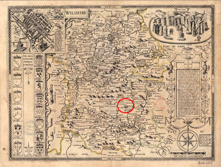
The map of Wilshire of 1610, depicting the Stonhenge megaliths and their location.
Today's satellite view of the Stonhenge.
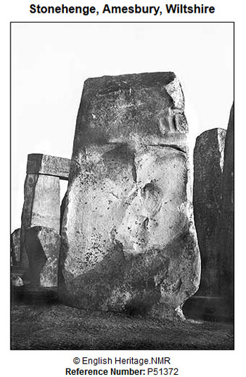
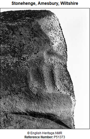
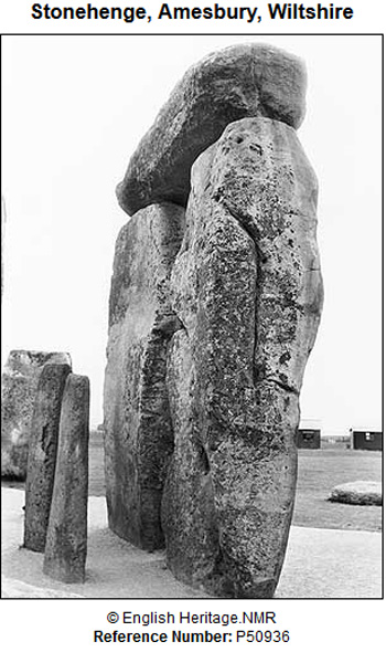
Archaeologists have found 4-5 large Mesolithic postholes (one may have been a natural tree throw), which date to around 8000 BC. These held pine posts around 0.75 metres (2 ft 6 in) in diameter which were erected and eventually rotted in situ. Stage I. 3100 BC The first monument consisted of a circular bank and ditch enclosure made of Late Cretaceous (Santonian Age) Seaford Chalk, measuring about 110 metres (360 ft) in diameter. The chalk dug from the ditch was piled up to form the bank. This first stage is dated to around 3100 BC, after which the ditch began to silt up naturally. Within the outer edge of the enclosed area is a circle, formed by 56 pits, each about a metre (3 ft 3 in) in diameter, known as the Aubrey holes after John Aubrey, the 17th-century antiquarian who was thought to have first identified them. Stage II. 3000BC: Evidence of the second phase is no longer visible. The number of postholes dating to the early 3rd millennium BC suggest that some form of timber structure was built within the enclosure during this period. The postholes are smaller than the Aubrey Holes, being only around 0.4 metres (16 in) in diameter, and are much less regularly spaced. Dating evidence is provided by the late Neolithic grooved ware pottery that has been found in connection with the features from this phase. Stage III (1). 2600 BC Archaeological excavation has indicated that around 2600 BC, the builders abandoned timber in favour of stone and dug two concentric arrays of holes in the centre of the site. The holes held up to 80 standing stones, only 43 of which can be traced today. The stones, which weighed about four tons, consisted mostly of spotted Ordovician dolerite but included examples of rhyolite, tuff and volcanic and calcareous ash; in total around 20 different rock types are represented. Each monolith measures around 2 metres (6.6 ft) in height, between 1 m and 1.5 m (3.3–4.9 ft) wide and around 0.8 metres (2.6 ft) thick. Stage III (2). 2600-2400 BC During the next major phase of activity, 30 enormous Oligocene-Miocene sarsen stones were brought to the site. The stones were dressed and fashioned with mortise and tenon joints before 30 were erected as a 33 metres (108 ft) diameter circle of standing stones, with a ring of 30 lintel stones resting on top. The lintels were fitted to one another using another woodworking method, the tongue and groove joint. Each standing stone was around 4.1 metres (13 ft) high, 2.1 metres (6 ft 11 in) wide and weighed around 25 tons. The average thickness of the stones is 1.1 metres (3 ft 7 in) and the average distance between them is 1 metre (3 ft 3 in). A total of 75 stones would have been needed to complete the circle (60 stones) and the trilithon horseshoe (15 stones). The lintel stones are each around 3.2 metres (10 ft), 1 metre (3 ft 3 in) wide and 0.8 metres (2 ft 7 in) thick. The tops of the lintels are 4.9 metres (16 ft) above the ground. Within this circle stood five trilithons of dressed sarsen stone arranged in a horseshoe shape 13.7 metres (45 ft) across with its open end facing north east. These huge stones, ten uprights and five lintels, weigh up to 50 tons each. They were linked using complex jointing. They are arranged symmetrically. The smallest pair of trilithons were around 6 metres (20 ft) tall, the next pair a little higher and the largest, single trilithon in the south west corner would have been 7.3 metres (24 ft) tall. Only one upright from the Great Trilithon still stands, of which 6.7 metres (22 ft) is visible and a further 2.4 metres (7 ft 10 in) is below ground. Stage III (3). 2400-2280 BC Later in the Bronze Age, the bluestones appear to have been re-erected. They were placed within the outer sarsen circle and may have been trimmed in some way. Like the sarsens, a few have timber-working style cuts in them suggesting that, during this phase, they may have been linked with lintels and were part of a larger structure. Stage III (4). 2280-1930 BC This phase saw further rearrangement of the bluestones. They were arranged in a circle between the two rings of sarsens and in an oval at the centre of the inner ring. Stage III (5). 1930-1600 BC Soon afterwards, the north eastern section of the Phase 3 IV bluestone circle was removed, creating a horseshoe-shaped setting (the Bluestone Horseshoe) which mirrored the shape of the central sarsen Trilithons.
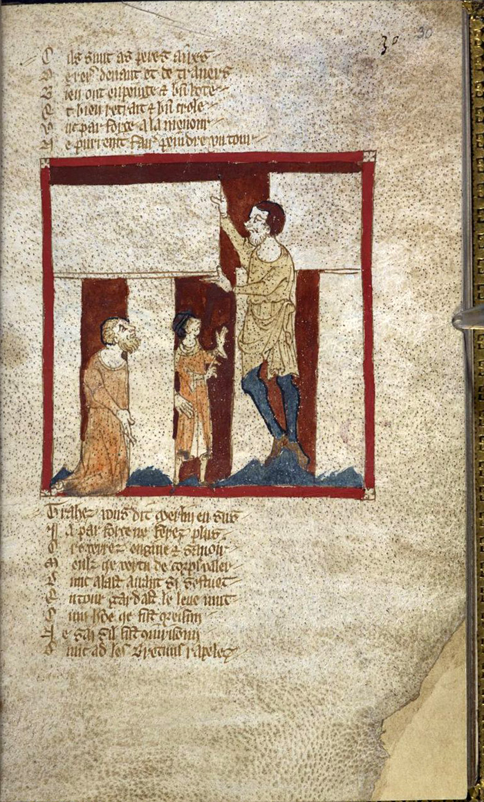
History. There are a lot of drawings and schemes, created by different artists and researches, since the times, people begun to pay attention to this ancient mysterious megalithic structure. Here, we would like to stop only on some of them. 1136 The oldest surviving story of the building of Stonehenge was written about 1136 by Geoffrey of Monmouth (d.1154/5). He described how a monument called the ‘Giant‘s Round‘ was supposedly brought from Ireland by the wizard Merlin and set up on Salisbury Plain as a memorial to the British who were killed in a battle with the invading Saxons. The Wace's Norman verse edition "Roman de Brut", which dates from about 1480, is illustrated with Merlin dismantling or raising a trilithon.
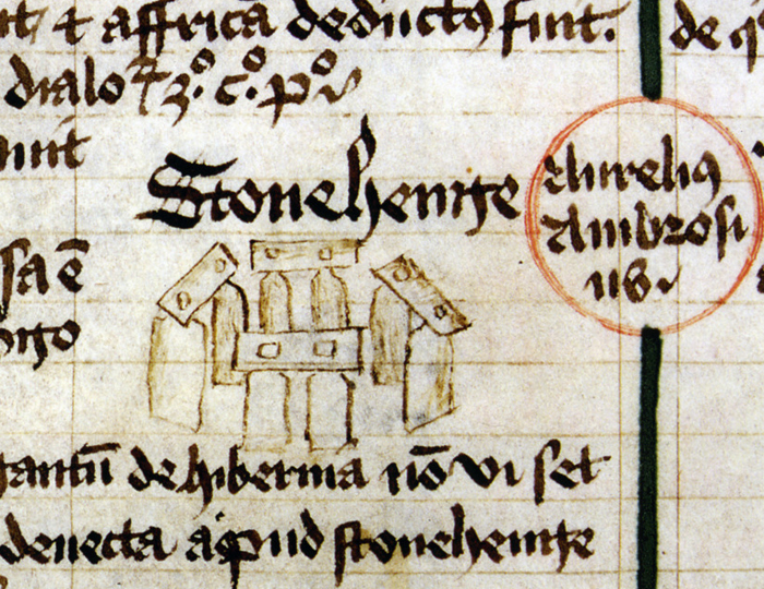
1440 The detailed drawing of Stonehenge, found in a 1440 manuscript "the Scala Mundi".
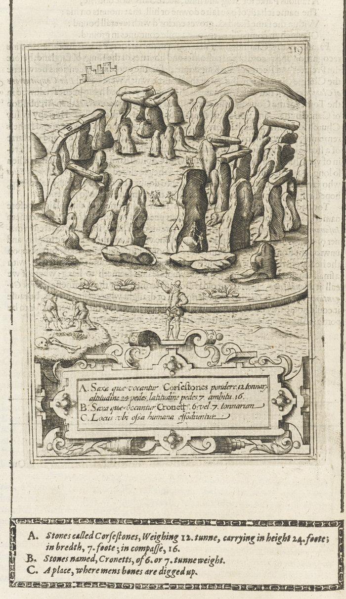
1610 Below is the illustration of Stonehenge and the measurements of its main stones, documented in the the Early printed book "Britain, or a chorographicall description of the most flourishing kingdomes, England, Scotland, and Ireland, and the ilands adioyning, out of the depth of antiqvitie : beavtified with mappes of the severall Shires of England" by William Camden.
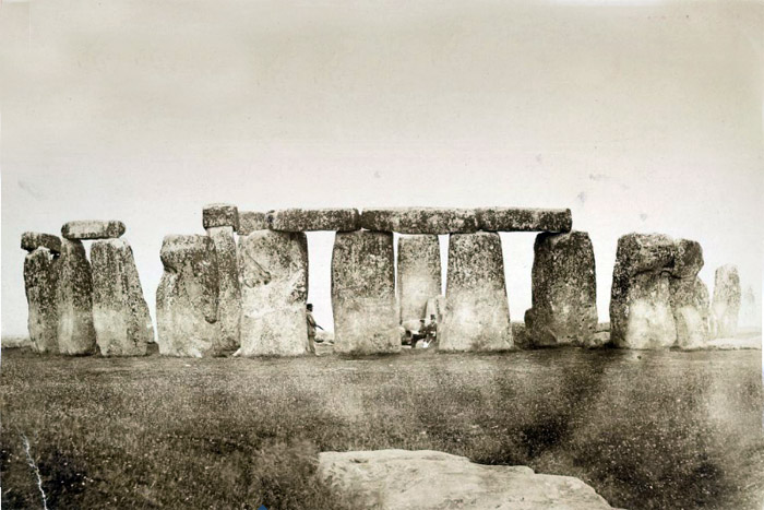
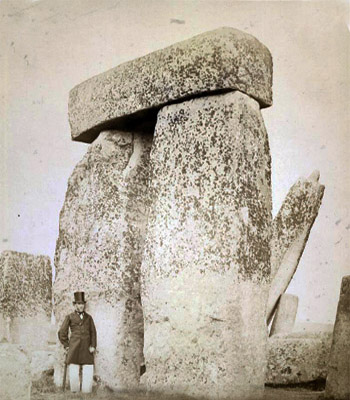
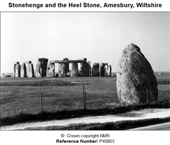
1867 View of Stonehenge in Wiltshire, taken by the Ordnance Survey under the supervision of Colonel Sir Henry James. The images are taken from the Colonel James' 1867 book 'Stonehenge, Turusachan and Cromlechs'. Stonehenge was built on Salisbury Plain during three phases of construction between c. 3200 and c.1600 BC. Its design incorporates astronomical alignments and it was first used as a temple to the moon, only later transformed into a temple to the sun. An entrance causeway runs from the north-east and originally marked the most northerly rising of the midwinter full moon. It was later widened so that another megalith placed at its edge, the Heel Stone, became a marker for the summer solstice." Source: British Library
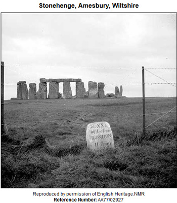
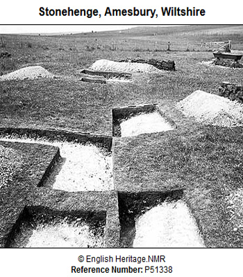
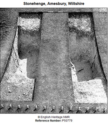
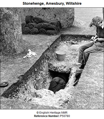
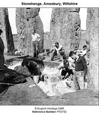
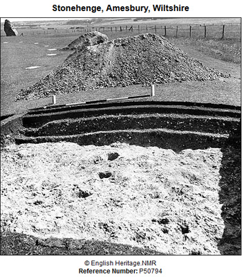
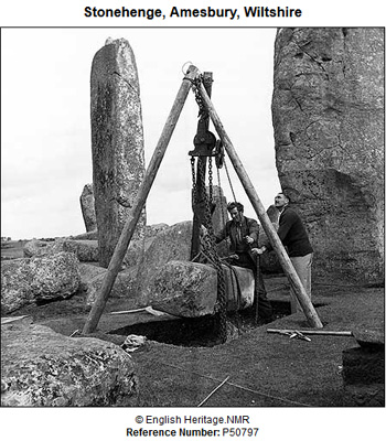
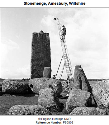
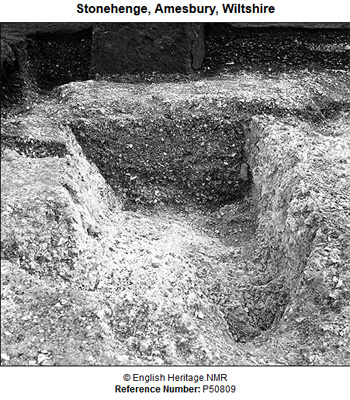
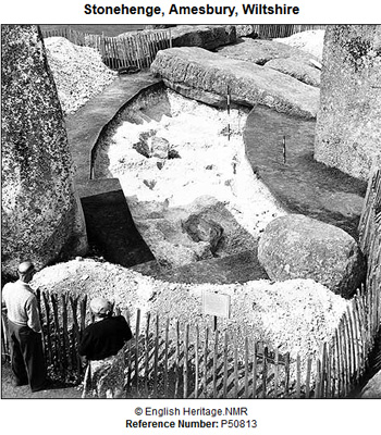
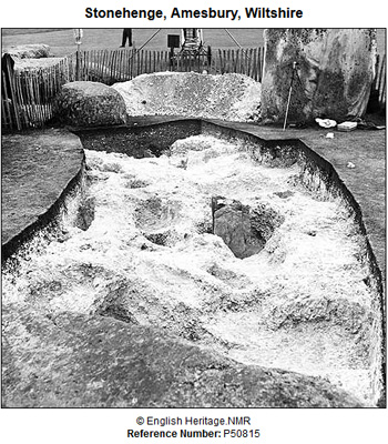
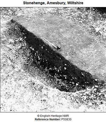
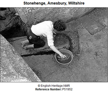
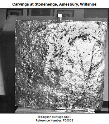
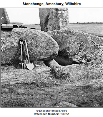
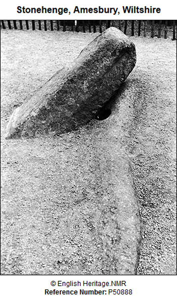
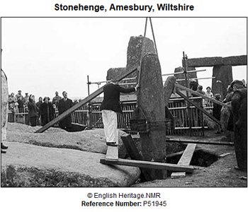
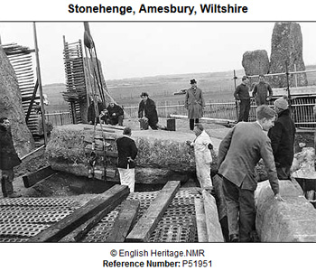
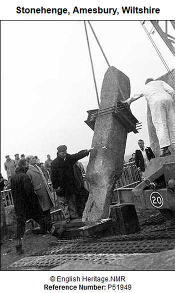
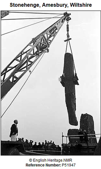
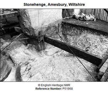
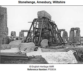
Archeological works. Below are the photos of archeological and restoration works, made during the period of 1953-1964. (The first photo, showing the general view of the site and a milestone, was taken in 1930.) Source:
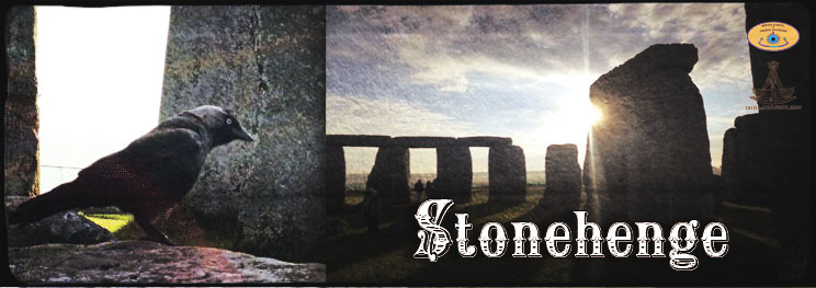
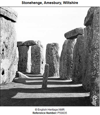
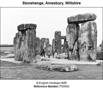
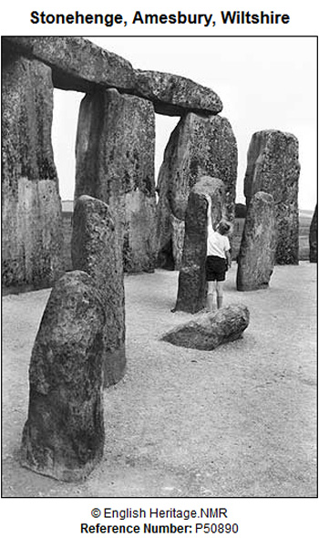
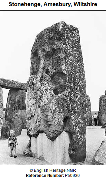
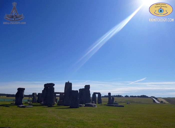
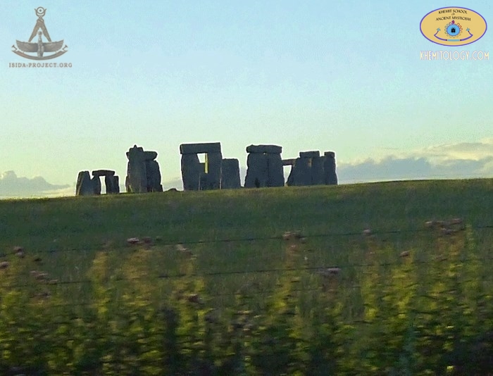
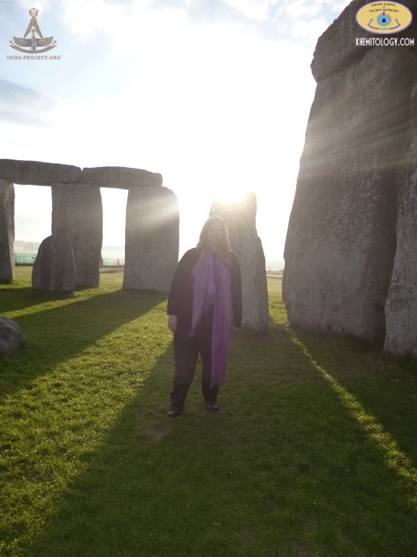
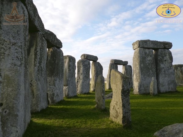
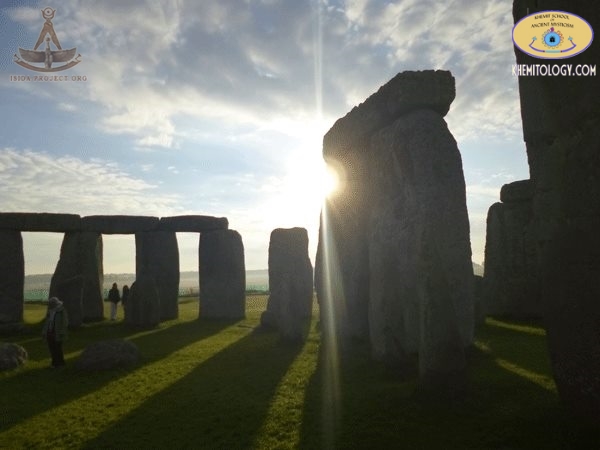
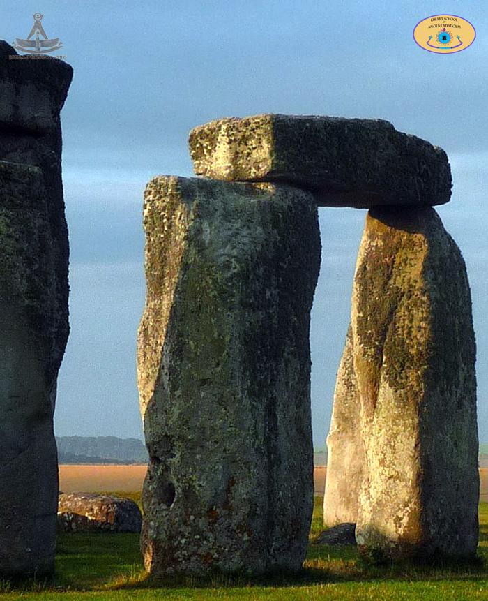
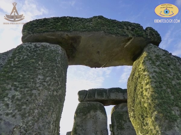
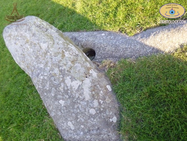
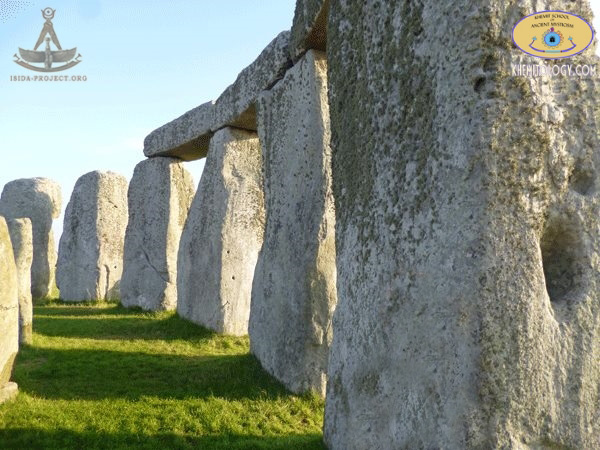
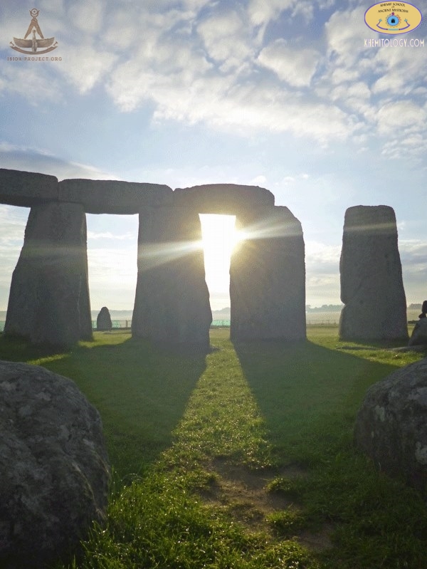
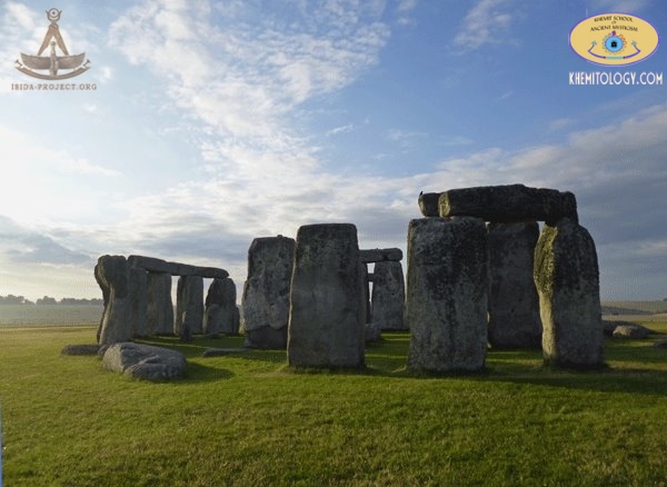
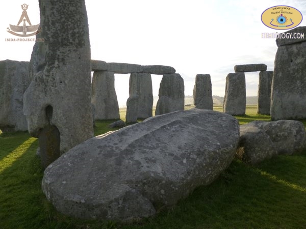
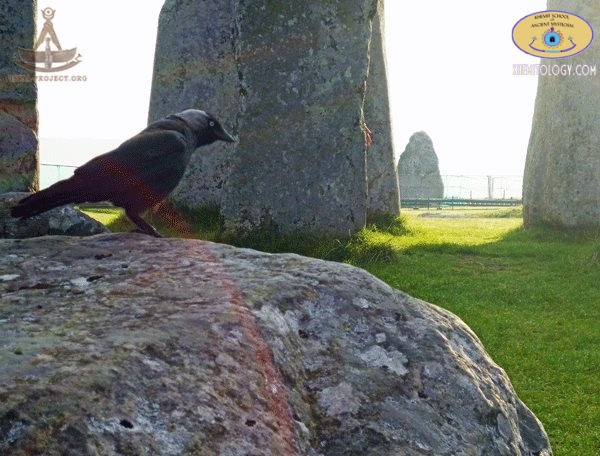
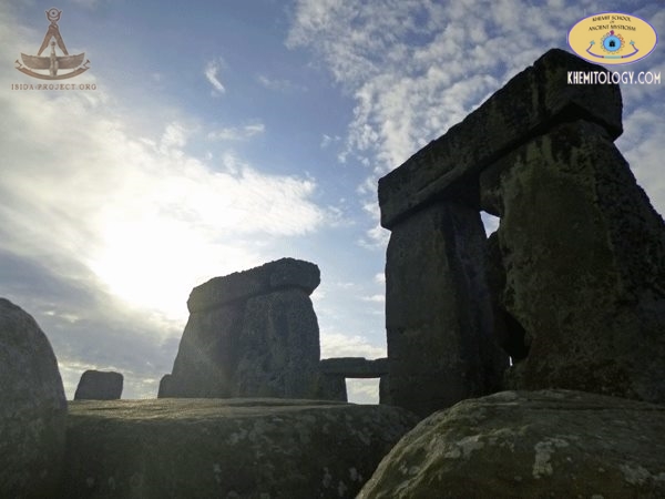
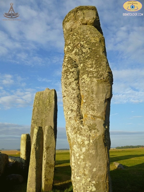
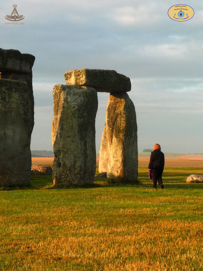
Stonehenge now The members of our research group has visited the site in 2014 with the preliminary mission. "The truth is out there..." The site and its surroundings were added to the UNESCO's list of World Heritage Sites in 1986.
© Copyright 2014 of ISIDA Project & Khemit School. All rights reserved. |
||
 |
 |
 |